Warton Crag from Silverdale

8.7 miles | 14.0 km | 452 m Ascent | 10.9 Naismith miles | Rick Clapham
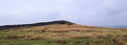
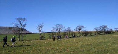
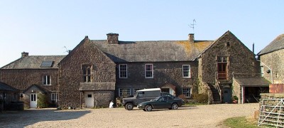
Another Silverdale walk from the Bentham Footpath Group – but this one takes us over to Warton Crag and the Beacon, with great views over Morecambe Bay at many points.
We pass a Victorian folly, a number of interesting sites of industrial archaeology, a failed attempt to reclaim land from the sea, and an iron-age hill fort.
The walk is classed as moderate mainly because it’s quite long, and although there is some climbing, the paths are generally good – at least in the weather that favoured us in April 2022.
Be aware that parts of the walk are on the edge of the bay so can be muddy in wet weather and/or during high tides.

Warton Crag from Silverdale Read More »

Staveley

7.4 miles | 11.9km | 290 m Ascent | 8.8 Naismith miles | Kate Rowe
Staveley is a lovely village sitting on the River Kent upstream of Kendal.
Less busy than the Lakes, Staveley has many attractions -as well as excellent walks such as this one, we find a brewery visitor centre, a chocolatier, craft bakery, pubs, cafes and other shops.
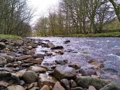
This easy walk tracks down the banks of the River Kent, through pretty woodland. If your timing is good – and this is best as a spring walk – expect to see the traditional host of golden daffodils.
The return journey first heads toward Bell Hill before returning to Staveley through pleasant and gentle farmland with excellent views of the Lakeland fells.

Staveley Read More »

Rydal Water

7.7 miles | 12.5 km | 756 m Ascent | 11.5 Naismith miles | David & Sheila Longton
Rydal Water is one of the smaller lakes in the Lake district at just 3/4 mile long and 1/4 mile wide.
We start at the lane next to the White Moss car park, then head up to White Moss Common, before tracking around the hillside below Alcock Tarn. We cross the A591 and take a low level path into Grasmere before re-joining the road and taking the pavement along the edge of the lake for a while.
We pick up a pleasant path down into the woods and follow the River Rothay to the western end of Rydal water then head uphill to Rydal Cave, before following the path down to Rydal Mount and Rydal Hall. From there we take the Coffin Route west toward Nab Scar, and White Moss Common, which leads us back to our start

Rydal Water Read More »

Airton to Malham Circular

9.1 miles | 14.7 km | 541 m Ascent | 11.8 Naismith miles | Graham Cooper
Malham is one of the “honeypot” destinations in the Yorkshire Dales, so parking can be problematic and crowds can be an issue. This walk cleverly manages to pass through Malham and some of its many attractions whilst starting and finishing in the much more secluded village of Airton.
The walk starts with a long and steady trek up onto Calton Moor climbing more than 500m before merging with The Dales Highway which we follow down to the bottom of Gordale Scar. From there we walk down past Janet’s Foss into Malham where after a short break we head along the Pennine way and the River Aire back down to Airton via Hanlith.

Airton to Malham Circular Read More »

Silverdale

8.2 miles | 13.1 km | 351 m Ascent | 9.9 Naismith miles | Alan Parker
Silverdale is a popular walking area, offering fine views in clear weather, and the area is one that the Bentham Footpath Group often explores.
The route is . . .
• Via the golf course to Hagg Wood
• To the edge of Silverdale village
• To The Cove, then up to Eaves Wood
• Behind Challan Hall to Hawes Water and Yealand Hall Allotment
• Finally across Leighton Moss to return to the RSPB centre.

Silverdale Read More »

Barley to Twiston and Rimington Moors

7.7 miles | 12.3 km | 486 m Ascent | 10.1 Naismith miles | George Sheridan
This circular walk from the lovely village of Barley offers fantistic views of three fundamentally different areas: Pendle Hill, the Yorkshire Dales, and the Colne Valley. Just in our “moderate” challenge category, this is a good walk for a crisp clear winter day.
If you want a longer version – add in the sculpture park at Aitken Wood

Barley to Twiston and Rimington Moors Read More »

Preston Patrick

7.5 miles | 12.0 km | 451 m Ascent | 9.7 Naismith miles | Robert Baines
A really good walk through less well walked areas: Although classed as moderate walk, this is because the distance is marginally over 12 km. The surfaces are easy, and the inclines gentle, so dont dismiss this walk as too harsh.
Good views over Hutton Roof and Farleton Fell can be had an a clear day, and sections of canal always add interest.

Preston Patrick Read More »

Holmepark Fell

7.1 miles | 11.4 km | 383 m Ascent | 9.0 Naismith miles | Don Cartledge
We start in Holme village and pick up the Lancaster Canal heading north and passing Farleton.
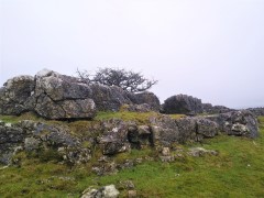
We then take minor lanes around the back of Farleton Fell, before taking paths over fields to Puddlemire lane and then from Town End Farm up onto the base of Newbiggin Crags at Whin Yeats. The landscape here is dominated by limestone outcrops and spectacular pavements with atmospheric isolated trees that attract many an amateur photographer.
We briefly return to a minor lane before cutting through Holmepark Fell, next to the huge Holme Park Quarry, before meeting the A6070 at Holme Park Farm. A short section on the verge of the road returns us to Holme.

Holmepark Fell Read More »

Lower Garsdale

6.4 miles | 10.3 km | 295 m Ascent | 7.9 Naismith miles | Alison Kinder & Colin Stroud
Garsdale is one of the less-visited Dales in the Yorkshire Dales National Park, and that’s something of a shame, because it’s particularly attractive. It runs East / West between Baugh Fell to the North, and Rise Hill to the South.
This walk starts at a large car park on the A684 with great views of the Howgills, and then heads up the dale on a small and very quiet road following the lower slopes of the imposing Baugh Fell.
We return on the other side of the dale following the Clough River past New Bridge before picking up the Sedgwick Geological trail on our way back to the car park.

Lower Garsdale Read More »