Dentdale circular

5.7 miles | 9.2 km | 248 m Ascent | 6.9 Naismith miles | Peter Lennard
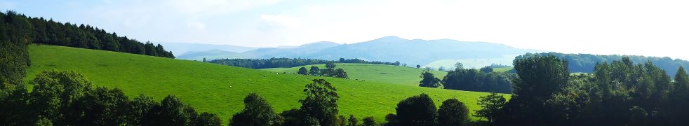
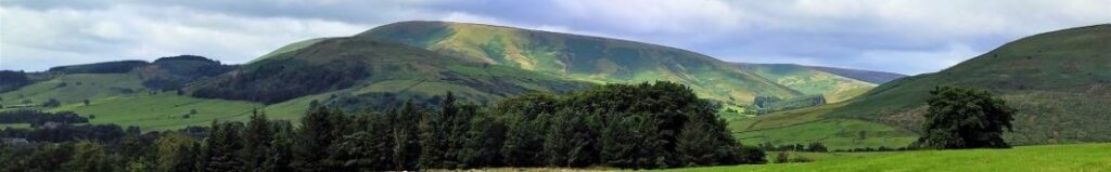
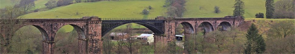
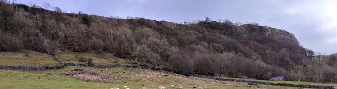
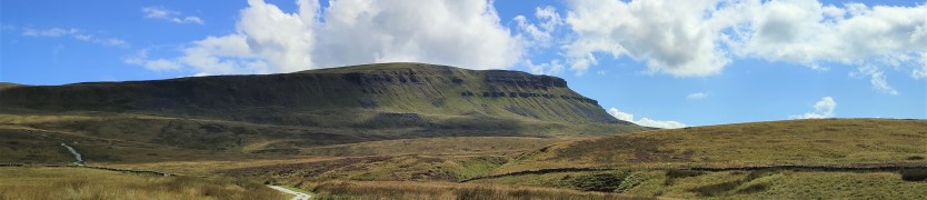
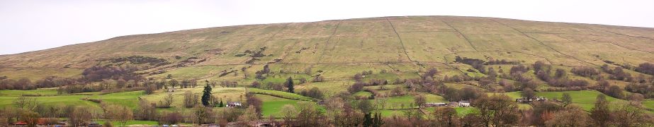
We start by Church Bridge, and then loop up onto the fell at South Lord’s Land before walking behind the village, with great views across the valley, and then over to Gawthrop, before crossing meadows to get to Barth Bridge. From there we pick up the Dales Highway long distance path and follow it up to Lunds where we walk on an ancient green lane for a while. We soon head right and onto North Lord’s Land looking across the valley with views of where we walked in the morning. Finally, we return to Barth Bridge via High Barth and then take a very quiet road walk on the North of the Dee before one more section through fields back to Church Bridge.

Dentdale circular Read More »

Gargrave and Eshton

6.3 miles | 10.2 km | 170 m Ascent | 7.2 Naismith miles | Peter Lennard
It’s easy to overlook Gargrave as you drive through on the A65, and it would be a mistake to do so: Gargrave is a great place to start a walk, with the added advantage that there are pubs, cafes, and an interesting variety of shops to enjoy. Parking is free and there are good quality public toilets.
Still not convinced, then add a walk that includes the Leeds Liverpool canal, parts of the Pennine Way, Country houses, enchanting wells, great views of Sharp Haw, a peaceful memorial garden, a curiously ornate lime kiln, and weather station. Where else other than the Yorkshire Dales would you find so much interest in just six miles?

Gargrave and Eshton Read More »

Brock Bottom and Beacon Fell

6.8 miles | 11.0 km | 215 m Ascent | 7.9 Naismith miles | Peter Lennard
Of the areas that Bentham Footpath Group walk, the Forest of Bowland is generally the quietest. That’s not to say it doesn’t have its hot spots though, and it’s at one of these – the Beacon Fell Country Park that we start this easy walk.
The Country Park has a number of attractions all within a well defined and quite small boundary, so you could easily augment the walk by adding one or more of . . . a sculpture trail, orienteering challenges, waymarked walks around the site, a barbecue site, viewing points, and a visitor centre with café and toilets. The whole site is a Biological Heritage Site, so you may also see interesting and rare flora and fauna.
Although we start at the Visitor Centre, we soon leave the site and head down to Brock Bottom, where we pick up the River Brock and head upstream passing Brockmill on the way to Gill Barn Wood. We then enjoy great views of Parlick and Fair Snape Fell before climbing back up to the Beacon Fell site where we wander around the Beacon.

Brock Bottom and Beacon Fell Read More »

Dunsop Bridge

7.6 miles | 12.3 km | 234 m Ascent | 8.8 Naismith miles | Peter Lennard
Within the Bentham Footpath Group, we tend to think of ourselves as living “up North”, and indeed we do – but only by a few miles: It turns out that the geographic centre of Great Britain is (according to the Ordnance Survey) in Dunsop Bridge. Given this curious fact, how can we decline the temptation to start a walk right from the centre of the country?
That curiosity aside, Dunsop Bridge is a great place to walk, and is often described as being at the heart of the Forest of Bowland. This gentle walk heads out from the village up the banks of the Dunsop before striking out to the isolated farms at Beatrix. From there, we cross Rough Syke at the bottom of Oxenhurst Clough and then after a brief but steep climb, follow green lanes and a very minor road to the lovely village of Newton where we pick up the Hodder, to follow it downstream back to Dunsop Bridge.
En route, we follow the Ribble Valley Jubilee Trail over Giddy Bridge, and then past Knowlmere Manor, and Thorneyholme Hall where we see the confluence of the Dunsop and the Hodder. The walk ends back at Dunsop Bridge where ice cream beckons.
We recommend that you take waterproofs on this walk – be aware that Dunsop Bridge holds the record for the most intense rainfall in the UK with 117mm (4.6 in) falling in just 90 minutes on 8th August 1967.

Dunsop Bridge Read More »

Sedbergh Riverside and the Lune Viaduct

6.3 miles | 10.1 km | 248 m Ascent | 7.5 Naismith miles | Peter Lennard
The Dent Foot walk that we completed on 17/03/23, connected with two of the three rivers in and around Sedbergh – the Rawthey and the Dee. This walk completes the set by adding the Lune.
We start by heading out onto the fells at the base of Winder, with great views over to the Lune Valley and the disused railway viaduct. We then cross farmland to pick up the Dales Way and have a close look at the spectacular viaduct.
From there we follow the Lune downstream before cutting back to Ingmire Hall. Next, we head down to the beautiful Friends Meeting House at Brigflatts, and finish by following the Rawthey upstream back to Sedbergh. The walk is classified as easy – althtough there is a bit of a climb at the start.

Sedbergh Riverside and the Lune Viaduct Read More »

Langcliffe to Stainforth Circular

4.7 miles | 7.6 km | 192m Ascent | 5.7 Naismith miles | Peter Lennard
The Bentham Footpath Group has a tradition of making the walk between Christmas and New Year an easier and shorter walk than usual, so that we can combine it with a meal at a local venue. Our aim is to make the walk accessible to all our members and to ensure that we can be at our venue by lunchtime.
Does that mean the route needs to be dull? Absolutely not – as this walk shows. We start from Langcliffe and then take the path up the western side of the river Ribble as far as Stainforth Force and the historic pack horse bridge. From there we cross the river and take the bridleway into Stainforth village and then over fields to the fascinating Hoffmann Kilns at the old Craven Lime Works. Finally, another short section of field crossings brings us back to Langcliffe.

Langcliffe to Stainforth Circular Read More »

Pen-y-ghent

6.8 miles | 11.0 km | 617 m Ascent | 9.9 Naismith miles | Peter Lennard
Pen-y-ghent is the smallest of the “three peaks” at 694m (2277ft).
This circular walk goes anticlockwise so that we tackle the steep ascent at the South end of the hill first followed by a gentler downhill return with views over to Horton, Ingleborough, and Hull Pot.
BFG walks are rated based on a combination of distance and ascent, and this one is quite short and so is classified as “easy”. Be aware through, that the climb to the peak is steep and rocky, so care is needed.

Pen-y-ghent Read More »