March 2023

Sedbergh Riverside and the Lune Viaduct

6.3 miles | 10.1 km | 248 m Ascent | 7.5 Naismith miles | Peter Lennard
The Dent Foot walk that we completed on 17/03/23, connected with two of the three rivers in and around Sedbergh – the Rawthey and the Dee. This walk completes the set by adding the Lune.
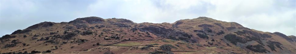
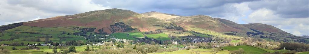
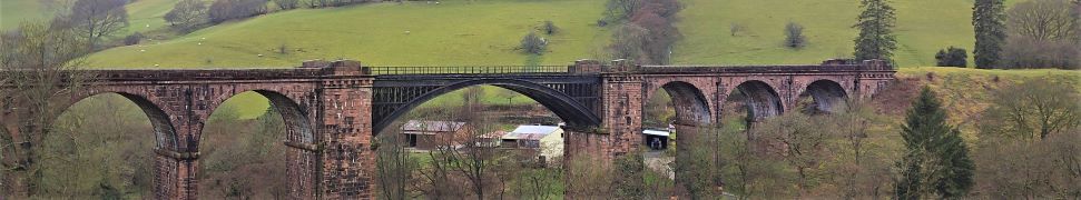
We start by heading out onto the fells at the base of Winder, with great views over to the Lune Valley and the disused railway viaduct. We then cross farmland to pick up the Dales Way and have a close look at the spectacular viaduct.
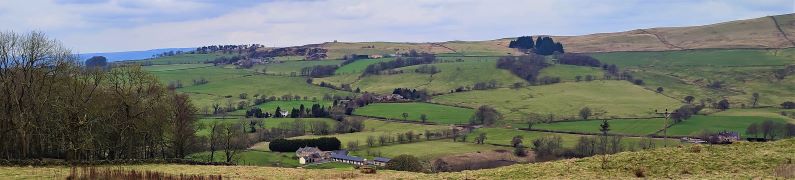
From there we follow the Lune downstream before cutting back to Ingmire Hall. Next, we head down to the beautiful Friends Meeting House at Brigflatts, and finish by following the Rawthey upstream back to Sedbergh. The walk is classified as easy – althtough there is a bit of a climb at the start.

Sedbergh Riverside and the Lune Viaduct Read More »

The Two Langdales

8.8 miles | 14.2 km |462 m Ascent | 11.1 Naismith miles | Alison Kinder & Colin Stroud
The two Langdales referred to in the title are Great Langdale and Little Langdale – in effect two parallel valleys separated by Lingmoor Fell.
Starting from Elterwater, we head up the valley along the gentle woodland paths of Great Langdale with Lingmoor Fell on our left and Chapel Stile on the right across a surprisingly flat valley with very steep sides. We then follow the direction of the beck upstream to Oak Howe where we pick up the Cumbria Way enjoying fantastic views of Dungeon Ghyll Force as we follow the path round the back of Side Pike to cross over a short but steep ridge into Little Langdale.
Pausing at the top of the ridge we have great views up Langdale and Oxendale, before we follow the path round and descend into Little Langdale, passing Blea Tarn on the way. A short road section on the Wrynose Pass road takes us down to Fell Foot Bridge where we head across fields to Slater Bridge and Little Langdale Tarn before we pick up a track back to Elterwater.

The Two Langdales Read More »

Dent Foot

8.1 miles | 13.0 km | 234 m Ascent | 9.3 Naismith miles | David Longton
Sedbergh is a favourite location for The Bentham Footpath Group, as is Dent, so surely there’s a walk based between the two that captures the best of both? There is – and this is it -typical Yorkshire Dales walking but with views of the Howgills.
We start next to the River Rawthey, just north of where it merges with the Lune, and track upstream toward Sedbergh, passing the confluence with the Dee, but staying with the Rawthey at first. We then cross the river and head to Millthrop, to pick up the Dales Way path which takes us down to Gate Manor in Dentdale. We then cross the Dee to return along the other side of Dentdale via Rash and Dent Foot, before skirting Holme Fell to arrive at Middleton Bridge via a Roman road. A short stroll back along the Rawthey concludes the walk.

Dent Foot Read More »

Sabden Valley

7.8miles | 12.6 km | 325m Ascent | 9.4 Naismith miles | George Sheridan
Bentham Footpath Group is lucky enough to have easy access to The Yorkshire Dales, The Lake District, and as for this walk, the Forest of Bowland. This 803km2 Area of Outstanding Natural Beauty (AONB) features a southern section known as the Forest of Pendle, which includes Pendle Hill, and the Sabden Valley. Pendle Hill is a great walk, and one that the Footpath Group have walked before, so this time we explore the Sabden Valley.
We start at the Nick of Pendle, taking a South-westerly route down one side of the valley before crossing the Sabden Brook, and returning to Sabden Village on the opposite side. The second half of the walk takes us out to the East as far as Dean Farm from where we return via Churn Clough Reservoir.

Sabden Valley Read More »

Sharp Haw and Flasby Fell

7.1 miles | 11.5 km | 374 m Ascent | 9.0 Naismith miles | Sandra Craggs
Living in and around the Dales means that we often drive through Gargrave, and as we exit the town on the Skipton side, we see an attractive fell ahead of us with a wooded side and a ridge that looks inviting as a walking area.
That’s our destination for this walk: The woods are Crag Wood, and the peak behind them is Sharp Haw and Flasby Fell. Rather than approaching them from Gargrave though, we head over to the B6265 Grassington Road so that we approach Sharp Haw from the Southeast on the Dales High Way. This route keeps more of the spectacular view over the Ribble and Aire Valleys hidden until a big reveal at the peak of Sharp Haw. We then continue round Flasby Fell to Flasby Village and return via forestry tracks through High Wood and Crag Wood, enjoying excellent views over Gargrave toward Clitheroe.

Sharp Haw and Flasby Fell Read More »