May 2024

School Knott and Orrest Head

7.2 miles | 11.6 km | 368 m Ascent | 9.0 Naismith miles | Susan Badley
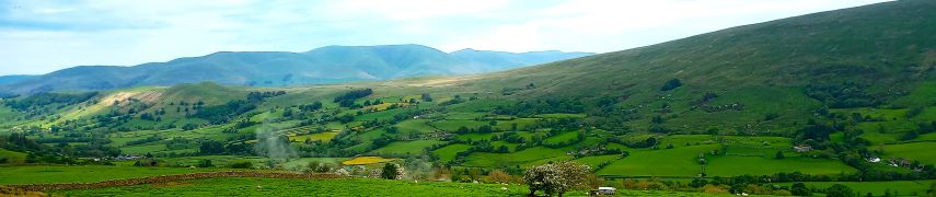
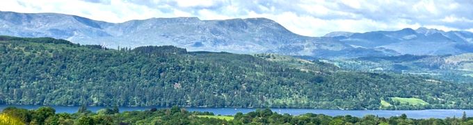
A quick glance at our website shows how much we like the fells to the East of Windermere – not only are they easy to get to from Bentham, but they are less crowded than some other Lake District destinations and offer some stunning views. This walk adds to our portfolio and starts from Ings where there is convenient parking.
We head toward Windermere via the viewpoint at School Knott, and then re-cross the railway and the A591 to find a route up Orrest Head via Common Wood.
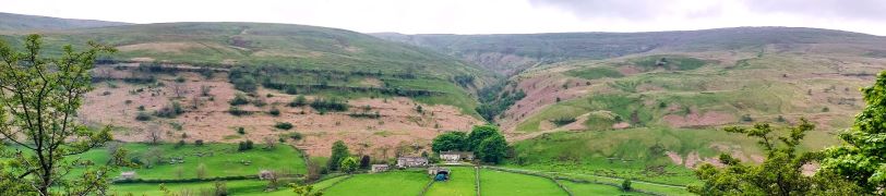
We carry on heading north until we get to Far Orrest, then on to Town End via footbridges over Trout Beck. Finally, we return to the A591 near the Brockhole visitor centre, where we catch a bus back to Ings.

School Knott and Orrest Head Read More »

Dentdale

5.6 miles | 9.1 km | 302 m Ascent | 7.1 Naismith miles | Rick Clapham
Dentdale is one of the more popular gems of the Yorkshire Dales, and so not surprisingly, Bentham Footpath Group visit regularly. Every time we come here there is something different to see, and this time we start from the Church Bridge and take a riverside path downstream for a short distance before coming back to the centre of the village via the picnic area. We then head up the enchanting Flintergill, visiting an open air museum and enjoying a viewpoint, before climbing to the Occupation Road overlooked by the Megger Stones.
After following the Occupation Road for about a mile we head back downhill along a green lane to High Nun House, then cross the minor road and head down to Deepdale Beck which we follow downstream back to the Dee, which we then follow back to our starting point.

Dentdale Read More »

Buckden to Yockenthwaite

8.3miles | 13.3 km | 262 m Ascent | 9.6 Naismith miles | Sandra Craggs
In February 2024, Bentham Footpath Group visited Kettlewell and walked up to Starbotton – where we crossed the river Wharfe. It occurred to us at the time that just a few miles further upstream was Buckden, another great starting point for walks in the Upper Wharfe valley. So, this time we drive just a little further and base ourselves at the convenient Yorkshire Dales National Park car park in the village and head out on the Pennine Journey path through Rakes Wood, along Buckden Rake, and on to Cray High Bridge where we enjoy the waterfalls. From there we head to the opposite side of the valley and walk down to Cray where we pick up a path that contours around the steep sides of Langstrothdale Chase above Hubberholme before falling to Yockenthwaite.
We then head back down the riverside path, now on the Dales Way, and soon arrive at Hubberholme and its beautiful church before finishing with a gentle stroll back to Buckden. As well as waterfalls, this walk offers great views, limestone pavements, ancient woodlands, and locations that you may well recognise from the TV series “All Creatures Great and Small”. Why do we start with a picture of a mouse? . . . read on.

Buckden to Yockenthwaite Read More »

Ingleborough from Clapham

9.6 miles | 15.4 km | 751 m Ascent | 13.3 Naismith miles | Bernie & Sheila Garrett
One of the (many) advantages of living in Bentham is easy access to the Yorkshire Three Peaks. The group has taken various routes up each, and in this excellent walk we tackle Ingleborough again. Why? – because it’s still there as Mallory might say.
Most walkers start at Ingleton, but we take the slightly less common starting point at Clapham and approach the peak via a route that passes Clapdale Wood and Ingleborough Cave. We then take an optional short diversion to look at Trow Gill, before continuing slightly further north to find an easier route uphill across Clapham Bottoms and on to the famous Gaping Gill. After that there’s a steep climb up Little Ingleborough before we finally reach the peak, where we enjoy fine views and note bronze age remains and a demolished hospice. The diversions just tipped us over the 15km limit that we use to mark a walk as challenging but leave those out and it would be moderate – though still steep.

Ingleborough from Clapham Read More »

Bardsea and Urswick

7.4 miles | 11.8 km | 250 m Ascent | 8.6 Naismith miles | Terri Kwiecinska
In March 2024, Bentham Footpath Group walked at Flookburgh, and enjoyed views over the Cartmel sands to Bardsea. This time we are on the other side of the estuary for a great walk starting from Bardsea then heading inland to visit Urswick and its tranquil tarn. On the way we have the corresponding views back toward Flookburgh and the whole of Morecambe Bay. We also see a beautiful church, a curious three sided folly, get more than one ice cream opportunity, and pass the site of an ancient hill fort, before noting alpacas, highland cattle and a stone circle. We end by walking on the beach with opportunities to see and hear all the birdlife teeming at the margins. All this with free parking and public toilets.

Bardsea and Urswick Read More »