August 2022

Barbon Low Fell

7.6 miles | 12.2 km | 553 m Ascent | 10.4 Naismith miles | Alison Kinder & Colin Stroud
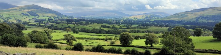
Several Bentham Footpath Group walks start in or pass through Barbon – a reflection of the fact that this pretty village is accessible, and a good base for walks up onto the surrounding fells.
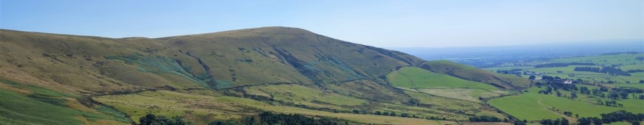
This one explores Barbon Low Fell: We start at the Community Hall in Barbon, and then take the riverside path through Barbon Park until we find the footbridge over Barbon Beck. From there we take the Footpath up toward Bull Beck, but before we get that far we strike out over access land to Hoggs Hills where we enjoy great coastal views.
Finally, we head down to Fell Garth, and strike out North through fields back to Barbon.

Barbon Low Fell Read More »

Killington

7.2 miles | 11.6 km | 435 m Ascent | 9.4 Naismith miles | Robert Baines
Many people associate Killington with the reservoir and the services on the M6.
In fact, the pretty 14th century village that the reservoir is named after is some way to the east of there in the Lune Valley with impressive views over to the Howgills at Sedbergh.
This relatively easy walk takes the shape of a figure eight on the OS map – and there are paths to enable either loop of the figure 8 to be walked independently, so two shorter walks can also be found here.
Apart from some boggy ground at Tarn Moss, the walking is easy though, so we recommend the walk as published here.

Killington Read More »

Bleasdale Fells, Fair Snape Fell and Parlick

8.8 miles | 14.2 km | 594 m Ascent | 11.8 Naismith miles | Mary & Kate Taylor
One of the many advantages of living in Bentham is easy access to the Forest of Bowland.
We start with a steep climb up the imposing Parlick Hill, rewarding ourselves with a break at the summit where we enjoy westerly views over Lancashire toward the coast and easterly across the Forest of Bowland. From there, we walk the ridge of Blindhurst Fell over to the summit of Fair Snape Fell, where a convenient stone shelter hosts a lunch break.
We then back track a little to take a zig-zag path down the side of the fell to Higher Fair Snape, before striking out across fields toward Holme House. Just before we get that far though, we divert left to Bleasdale with an optional visit to the circle before taking a gentle low level path through pastures back to fell foot and the start of the walk.

Bleasdale Fells, Fair Snape Fell and Parlick Read More »

Gunnerside and Old Gang Smelt Mill

10.4 miles | 16.7 km | 927 m Ascent | 15.0 Naismith miles | Sandra Craggs
We tend to think of the Yorkshire Dales as a rural idyll, but there is also a great deal of industrial heritage to be found. This walk starts in the lovely village of Gunnerside in Swaledale and then heads up Gunnerside Gill into an area that from the 15th to 19th centuries was the centre of a vast lead mining industry.
We explore remains of the lead mining sites – now mostly reclaimed by nature, before taking the steep scramble to cross Melbecks moor where we find an altogether bleaker and more damaged landscape –the result of lead smelting. This is where we find the Old Gang Smelt Mill, a much larger and toxic operation than the remains we saw at Gunnerside.
From there we walk down to Surrender bridge and then take a return route along the side of Swaledale with fantastic views up the valley to Muker and beyond or down toward Reeth and the North Yorks Moors.

Gunnerside and Old Gang Smelt Mill Read More »