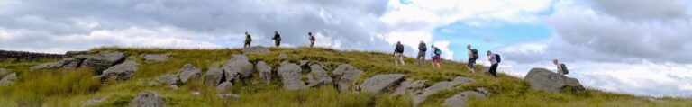
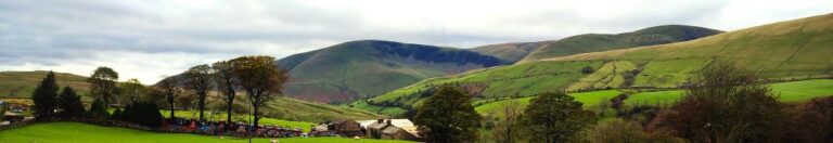
7.9 miles | 12.7 km | 307m Ascent | 9.4 Naismith miles | David Longton
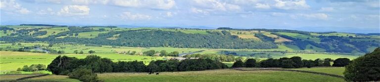
One of the benefits of living in Bentham is easy access to the Yorkshire Dales, the South Lakes, and the Forest of Bowland. That means great scenery - but at times, significant numbers of visitors. As this walk demonstrates though, think beyond the obvious honeypot locations, and it’s still easy to find a great walk which can be enjoyed in solitude, or with your favourite walking group.
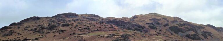
From the easily accessed village of Rathmell, we head out on minor roads to Higher Lumb Gill Wood then stay on lanes to the oddly named Ragged Hall, before arriving at Whelpstone Lodge. From there we climb to the Trig point at Whelp Stone Crag – where we have our passports ready for a brief entry into Lancashire, before returning via Brayshaw, Boostagill and Cappleside. There are great views along the way, and because much of this route is on minor roads, the going is generally easy.
8.3miles | 13.3 km | 262 m Ascent | 9.6 Naismith miles | Sandra Craggs
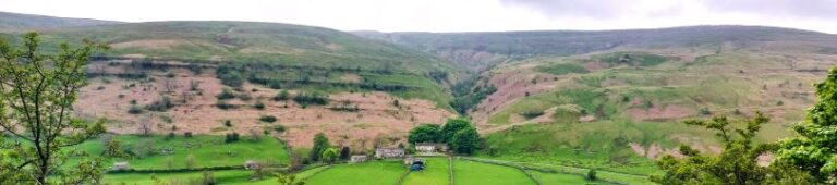
In February 2024, Bentham Footpath Group visited Kettlewell and walked up to Starbotton – where we crossed the river Wharfe. It occurred to us at the time that just a few miles further upstream was Buckden, another great starting point for walks in the Upper Wharfe valley. So, this time we drive just a little further and base ourselves at the convenient Yorkshire Dales National Park car park in the village and head out on the Pennine Journey path through Rakes Wood, along Buckden Rake, and on to Cray High Bridge where we enjoy the waterfalls. From there we head to the opposite side of the valley and walk down to Cray where we pick up a path that contours around the steep sides of Langstrothdale Chase above Hubberholme before falling to Yockenthwaite.
We then head back down the riverside path, now on the Dales Way, and soon arrive at Hubberholme and its beautiful church before finishing with a gentle stroll back to Buckden. As well as waterfalls, this walk offers great views, limestone pavements, ancient woodlands, and locations that you may well recognise from the TV series “All Creatures Great and Small”. Why do we start with a picture of a mouse? . . . read on.
7.8 miles | 12.6 km | 190m Ascent | 8.7 Naismith miles | Valerie Eccles and Mary Pickstone
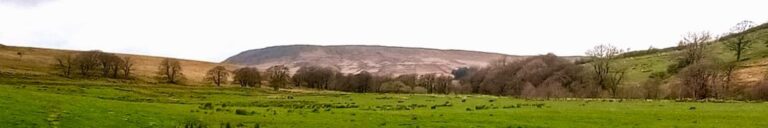
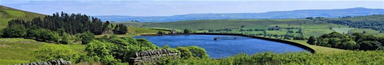
Bentham Footpath Group members are lucky enough to have the Yorkshire Dales and the South Lakes within easy reach. But our good fortune is not limited to that – we are also on the edge of the Forest of Bowland, which of course includes Gisburn Forest and Stocks Reservoir – which we explore today.
This walk starts from a car park next to the remains of a church that was relocated to enable the reservoir to be built, and then loops anticlockwise around the water – meaning that there is not much climbing.
We have been here before (September 2022) and at that time the water levels were deliberately very low – as part of engineering works to increase capacity in the long term. This time we get to see the levels replenished and the works complete – the contrast is striking. On the way round, we see signs of the buildings that were abandoned to enable construction, traces of the railway that enabled materials to be imported, and foundations for the village that temporarily housed the army of builders, as well as a more recent and very poignant woodland memorial site.
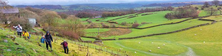
8.3 miles | 13.3 km | 391 m Ascent | 10.2 Naismith miles | Kate Rowe
Spring is such an optimistic time of the year, and getting out and about on a walk with friends is a great way to experience it. So the Bentham Footpath Group have developed an informal habit of taking a walk each year that celebrates the season by picking a route that features the best of the new daffodils or bluebells.
So, here is a “daffodil walk”, and as all Wordsworth fans will appreciate, it really has to be in the Lake District to be authentic – which means of course that as well as the spring flowers we get great views of the fells, tranquil tarns and on this walk, links to Arthur Ransome.
Although our focus was the daffodils, this is a great walk at any time of the year. We rate it as “moderate” based on distance and elevation change but you should be aware that it can feel challenging under wetter conditions.

8.3 miles | 13.4 km | 138 m Ascent | 9.0 Naismith miles | David & Sheila Longton
A number of Bentham Footpath Group walks feature views of Morecambe Bay – usually with the Kent or Levens estuaries as the backdrop to higher level walks such as those at Cartmel or Silverdale. This time we do the full seaside experience: Starting at Flookburgh, we walk along the coast getting sand on our boots for a while, before heading inland to Cark, on to Low Bank Side, then across the valley to Templand before returning on a route running through trees below Boarbank Hall. On the way we pass old airbases from both world wars, atmospheric salt marshes, bridleways across the bay, signs of the old shrimping industries, grand Italianate houses, and the odd lime kiln.
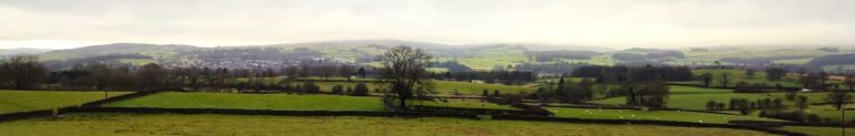
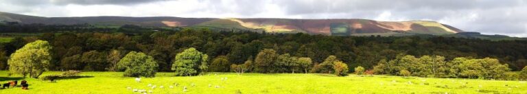
7.8 miles | 12.6km | 297 m Ascent | 9.3 Naismith miles | Sandra Craggs
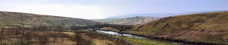
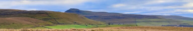
Horton in Ribblesdale is a great place to start a walk, and the “three peaks” are the big draw with Pen-y-Ghent an obvious choice, as is the Sulber Nick route over to Ingleborough.
Both are good walks, but there is much else to see in this area, as we show with a route including a tarn, the stunning Far Moor Bridge, disappearing rivers, atmospheric lime kilns, a National Nature Reserve, extensive limestone pavement, and vast quarries, all of which is accessible via the Settle to Carlisle railway. What more could you want? A blue lagoon? – well there was one until recently, and we can offer pictorial evidence.
7.9 miles | 12.7 km | 233 m Ascent | 9.0 Naismith miles | Valerie Eccles & Mary Pickstone
Limestone pavement is one of the defining features of the Yorkshire Dales, and when asked to think of an example, most people mention Malham: that pavement and the Cove are indeed spectacular, and Bentham Footpath Group have enjoyed a number of good walks there.
This walk however visits the much larger (15 square miles) and rather more secluded Great Asby Scar National Nature reserve. Malham famously has a tarn, so we throw one of those in and start at Sunbiggin tarn before taking a gentle climb to the scar using the Dales Highway path. We then head west along the top of the scar and visit Castle Folds, the remains of a Romano-British walled settlement. From there we pick up the path coming up from Asby Winderwath Common and circle round the scar to head down to the Gamelands stone circle, before taking the Coast to Coast path back to the tarn.
7.7 miles | 12.3 km | 279 m Ascent | 9.0 Naismith miles |Ed Badley
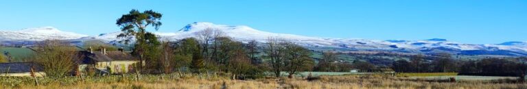
A quick glance at the pictures associated with this walk will show you that we undertook this route on a beautifully crisp icy day - but the date was not as originally intended: our plan had been to walk at Ribblesdale, but the risk of black ice on the journey over prompted this last minute swap.
The walk showcases the best of the local area – with views of the Three Peaks dusted in snow, horses running on the moorland, an exciting clamber down to the delightfully named Burbles Gill using steps installed by BFG many years ago, a view of the Big Stone, and then a walk across the moorland at Bents where we have great views of the Lakeland Fells. We then go to Low Bentham and head up the riverside path back to High Bentham. We love it when a plan comes together.
8.0 miles | 12.8 km | 337 m Ascent | 9.6 Naismith miles | Mary & Kate Taylor
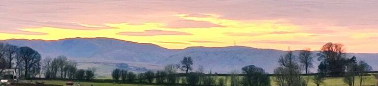
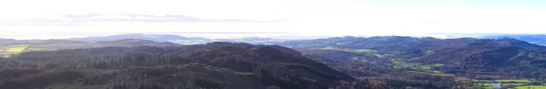
Walks for the Bentham Footpath Group are planned in four month programmes – which means that the date of this walk was fixed in September 2023. It could easily have been the case then that we encountered miserable rain with poor visibility whilst sliding around in ankle deep mud.
But we were lucky - we could not have had a better day for the start of 2024 – bright sunshine and clear air on the tops and atmospheric inversion clouds in the valley bottoms were even more beautiful than the pictures convey. Add potholes, caves, natural fountains, ancient monuments, and informed guides, to make for a perfect start to the new year.
8.2 miles | 13.3 km | 385 m Ascent | 10.2 Naismith miles | Rick Clapham
Barbon is great place to start and end a walk. Not only is there convenient parking - either at the layby at Hodge Bridge, or at the Village Hall - but there is a great deli and a highly rated pub, the remains of a Roman Road, the course of a disused railway, grand houses, ancient stone circles, and a motor sport venue.
This moderately challenging walk offers all that, plus artworks by Andy Goldsworthy, great views down the Lune Valley, an invigorating climb up Brownthwaite, a very attractive waterfall, and then an easy finish along the banks of Barbon Beck in the grounds of Barbon Manor.
8.9 miles | 14.3km | 467 m Ascent | 11.2 Naismith miles | Susan Badley
The Bentham Footpath Group typically undertakes about 50 walks each year. Given where we live, many of these will be in the rain or have poor visibility. Sometimes though we are spectacularly lucky with the weather and get to enjoy simply stunning views, and this walk was just such an occasion.
If you follow this route, you may or may not be so lucky, but whatever the weather, this will always be a great walk: We start from a free and convenient parking spot, climb up to one of the best views of Windermere, sharing the How with Luing cattle. We then head over to Sow How Tarn, clip the edge of Middle Tarn, and then go via Heights Cottage onto Ravens Barrow, and a curious monument. From there we visit a lovely ancient church and old schoolhouse, and through fungi-rich woodland to Thorphinsty Hall, through Crag Wood and up to an atmospheric derelict farmhouse en-route to Simpson Ground. We round the day off with a tranquil reservoir, and more woodland with lovely gnarled old trees. A perfect day.
8.8 miles | 14.1km | 212 m Ascent | 9.8 Naismith miles |David & Sheila Longton
The Bentham Footpath Group have completed a number of great walks in and around Kendal – search on the website for Staveley, Levens or the Lancaster Canal to see some of them. This walk adds to that library and because it intersects with earlier offerings, creates a great opportunity to build our mental map of the area.
We start from a layby on the “old road” – once the main route from Kendal to Windermere – and then walk through woodland on Rather Heath passing the edge of Ratherheath Tarn before striking out to Plumgarths where we visit the Cumbria Wildlife Trust’s gardens. We then head parallel to the A591 before crossing onto Kendal Fell at Helsfell Nab. Unusually for a BFG walk, we then go into the outskirts of a town (Kendal), for lunch in the park, before we head out to Burneside. We have a good look at the Church and the paper mills before heading upstream along the Kent to Bowston on a section of the Dales Way. A final section over the railway, then under the main road brings us back to our starting point.
8.7 miles | 14 km | 115 m Ascent | 9.2 Naismith miles | Ed Badley
Most of the walks that Bentham Footpath Group offer are circular – we need to end where we started because that’s where our cars are.
That’s not a problem in itself, but sometimes there is an attractive route that’s well worth walking, but which offers no route back - without simply turning round.
So, here’s a solution: This walk is linear – we park at Holme and get the bus to Levens Bridge, then walk through Levens Hall Deer park to pick up the disused Lancaster Canal which we follow all the way back to Holme. Not only do we get to see more of the canal and its industrial archaeology than would otherwise have been possible, but we can include the deer park, which is simply stunning in autumn, as well as enjoying great views of the Kent estuary from the top deck of the bus.
9.0 miles | 14.5 km | 431 m Ascent | 11.1 Naismith miles | Sandra Craggs
The Howgills are always a great place to walk, and autumn can be particularly beautiful with the bracken turning orange, hawthorn berries bright red, the grass still green, and the trees showing hints of purple as they start to drop their leaves. Add to this the many glorious becks and waterfalls, and the relatively secluded paths, and we have a recipe for a perfect day out.
This walk starts at Rawthey Bridge on the A683 then takes woodland paths to Narthwaite. From there, we contour around Wandale Hill using an old Pack horse route to Adamthwaite. We cross Wandale Beck and Stonely Gill and then head back toward Murthwaite, turning just before we get that far, to come back round the eastern side of Harter Fell on a public by-way. We cross the A583 at Fell End and then head up to the waterfalls at Uldale before returning to the start over moorlands at Bluecaster.
8.8 miles | 14.1 km | 300 m Ascent | 10.3 Naismith miles | Mary & Kate Taylor
We recently enjoyed a great walk on the Tolkein Trail, visiting the far end of the Hodder where it meets the Ribble, and we also spent time on the Hodder as part of our equally enjoyable Dunsop Bridge walk. This walk is also based around the Hodder and explores the region between our other two offerings.
We start from Whitewell, and head downstream to Stakes, but as there are no rights of way directly along the banks of the Hodder, we find a route along the side of Seed Hill, before crossing the road and clipping the edge of Ing Wood where we enjoy a view which includes ostriches. From there we head across fields, over a ford and on to Stakes, where there is an option to cross the river via stepping stones. When the Hodder is in full flow this route can be difficult, so we took a diversion to Doeford Bridge and Loud Mytham bridges to safely cross the river.
The return leg of the walk brings us via Knot Hill to New Laund Farm where we again have the option of a route back over stepping stones. We took the safer, but slightly longer route back via Burholme Bridge, and then a permissive path close to the Hodder. The extensions to cope with the high water levels make this long enough to be classed as a moderate walk, but there are no hard climbs.
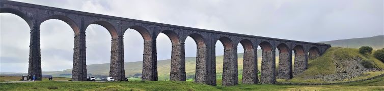
7.8 miles | 12.5 km | 206 m Ascent | 8.8 Naismith miles | Valerie Eccles & Mary Pickstone
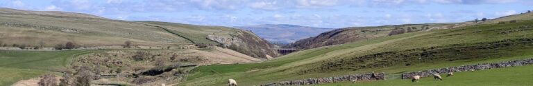
The Ribblehead Viaduct is probably the most photographed railway bridge in the UK, and an icon of the Yorkshire Dales. It’s more than just a bridge though; surrounded by stunning countryside, and with traces of industrial archaeology dating back to its construction, there’s lots to see. So where better to start a walk?
From Ribblehead, we head under the viaduct and over to Gunnerfleet before following Winterscales Beck down to the intriguing Haws Gill Wheel where the river disappears and then reappears. After a very short section of road walk, we pause at the lovely St Leonards Church, before heading up to Ellerbeck, passing a sculpture as we go, and from there take the Dales Highway back to the railway. After a brief look at the Signal Box at Blea Moor, we return via the Viaduct with views over to Ingleborough and Simon Fell.
The Dales’ favourite railway, that bridge, a disappearing river, a beautiful church, art, and great views.
7.6 miles | 12.3 km | 234 m Ascent | 8.8 Naismith miles | Peter Lennard
Within the Bentham Footpath Group, we tend to think of ourselves as living “up North”, and indeed we do – but only by a few miles: It turns out that the geographic centre of Great Britain is (according to the Ordnance Survey) in Dunsop Bridge. Given this curious fact, how can we decline the temptation to start a walk right from the centre of the country?
That curiosity aside, Dunsop Bridge is a great place to walk, and is often described as being at the heart of the Forest of Bowland. This gentle walk heads out from the village up the banks of the Dunsop before striking out to the isolated farms at Beatrix. From there, we cross Rough Syke at the bottom of Oxenhurst Clough and then after a brief but steep climb, follow green lanes and a very minor road to the lovely village of Newton where we pick up the Hodder, to follow it downstream back to Dunsop Bridge.
En route, we follow the Ribble Valley Jubilee Trail over Giddy Bridge, and then past Knowlmere Manor, and Thorneyholme Hall where we see the confluence of the Dunsop and the Hodder. The walk ends back at Dunsop Bridge where ice cream beckons.
We recommend that you take waterproofs on this walk – be aware that Dunsop Bridge holds the record for the most intense rainfall in the UK with 117mm (4.6 in) falling in just 90 minutes on 8th August 1967.
7.5 miles | 12.1 km | 274 m Ascent | 8.9 Naismith miles | Alison Kinder & Colin Stroud
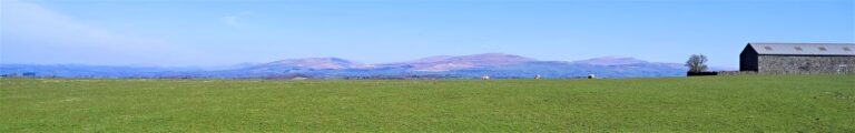
The road journey form Bentham to Lancaster is relatively mundane, making it easy to forget that that there are good walks on either side of the main road – as this excellent route shows. We start from the Bull Beck parking area on the A683 just east of Caton, then walk over fields to Brookhouse. A quiet country road takes us up to the wind farm at Caton Moor, with fantastic views across the valley and Morecambe Bay, before we head back down to the main road passing the quarries that feed the Claughton Brick works. We then cross the road and pass more evidence of the area’s railway history before coming through fields at the back of the brickworks to follow the banks of the Lune back to Bull Beck.
We list this walk as a “moderate” challenge, simply because it’s just over our 12km threshold. The route is generally quite easy and there are relatively few stiles, so if you normally prefer “easy” walks, don’t discount this one.
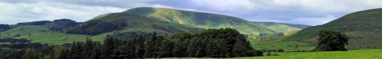
8.4 miles | 13.5 km | 479 m Ascent | 10.8 Naismith miles | Ed Badley
Infamous for its links to the witch trials of 1612, Pendle Hill and the surrounding villages are a lovely part of the Forest of Bowland Area of Outstanding Natural Beauty (AONB). Bentham Footpath Group explored the Sabden Valley in an earlier walk (https://benthamfootpathgroup.co.uk/sabden-valley/) and have climbed Pendle hill before – though prior to logging our walks on our website.
For this walk we climb Pendle Hill again, starting from the Nick of Pendle on the Clitheroe Road. Rather than walking on the road to start the climb, we cross and head west to pick up the Ribble Valley Jubilee Trail at Parsley Barn, and then cross the road higher up, to head up Pendleton Moor. Instead of taking the direct route up Pendle Hill though, we veer left and circle round it via Mearley Moor and Pendle Moor before reaching the peak. Our return route is via Boar Clough then Ogden Clough, before climbing Black Hill to gain great views over Churn Clough reservoir. From there it’s an easy walk back to the Nick. Although classed as “moderate”, be aware that this walk can be challenging in poor weather.
7.8miles | 12.6 km | 328 m Ascent | 9.5 Naismith miles | Jim Shuttleworth
Bentham Footpath Group has enjoyed many good walks in the Howgills. This time we go just a little bit further North and explore Ravenstonedale, Smardale and the fantastic Smardale Gill Viaduct.
The viaduct alone is worth the trip, but this walk offers much more: a thriving nature reserve, great views back to the Howgills and Wild Boar Fell or across to Brough Castle and Warcop Fell, industrial archaeology, and free parking within walking distance of two award winning pubs.
Much of the route is on accessible paths so although the walk is long enough to be classed as moderate, it’s not too challenging and there are some potential shortcuts.
8.5 miles | 13.6 km | 361 m Ascent | 10.3 Naismith miles | Susan Badley
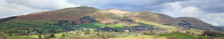
Bentham Footpath Group Walks generally start within an hour’s drive of Bentham – there is so much wonderful walking country within that radius that we are always spoiled for choice. This excellent walk – aided by near perfect weather - highlights the fact that Bentham itself is a great place to start a walk.
We start in low Bentham and cross the Wenning at the pedestrian bridge were the Silk Mills once stood, and then head up Mill Lane as far as Kirkbeck where we take paths across fields to Mewith lane and then across to Spens Farm.
We cross the Hindburn for the first time at Furnessford Bridge, and then head over to Cragg Hall, before descending back to the river to cross at Hindburn Bridge. From there we head up to Mealbank and take paths across fields to follow the Wenning Valley upstream with great views across to Ingleborough and Whernside along the way. Passing Robert Hall, we head down Eskew Lane and back to Low Bentham.
8.8 miles | 14.2 km |462 m Ascent | 11.1 Naismith miles | Alison Kinder & Colin Stroud
The two Langdales referred to in the title are Great Langdale and Little Langdale – in effect two parallel valleys separated by Lingmoor Fell.
Starting from Elterwater, we head up the valley along the gentle woodland paths of Great Langdale with Lingmoor Fell on our left and Chapel Stile on the right across a surprisingly flat valley with very steep sides. We then follow the direction of the beck upstream to Oak Howe where we pick up the Cumbria Way enjoying fantastic views of Dungeon Ghyll Force as we follow the path round the back of Side Pike to cross over a short but steep ridge into Little Langdale.
Pausing at the top of the ridge we have great views up Langdale and Oxendale, before we follow the path round and descend into Little Langdale, passing Blea Tarn on the way. A short road section on the Wrynose Pass road takes us down to Fell Foot Bridge where we head across fields to Slater Bridge and Little Langdale Tarn before we pick up a track back to Elterwater.
8.1 miles | 13.0 km | 234 m Ascent | 9.3 Naismith miles | David Longton
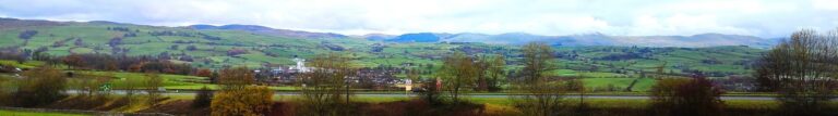
Sedbergh is a favourite location for The Bentham Footpath Group, as is Dent, so surely there’s a walk based between the two that captures the best of both? There is - and this is it -typical Yorkshire Dales walking but with views of the Howgills.
We start next to the River Rawthey, just north of where it merges with the Lune, and track upstream toward Sedbergh, passing the confluence with the Dee, but staying with the Rawthey at first. We then cross the river and head to Millthrop, to pick up the Dales Way path which takes us down to Gate Manor in Dentdale. We then cross the Dee to return along the other side of Dentdale via Rash and Dent Foot, before skirting Holme Fell to arrive at Middleton Bridge via a Roman road. A short stroll back along the Rawthey concludes the walk.
7.8miles | 12.6 km | 325m Ascent | 9.4 Naismith miles | George Sheridan
Bentham Footpath Group is lucky enough to have easy access to The Yorkshire Dales, The Lake District, and as for this walk, the Forest of Bowland. This 803km2 Area of Outstanding Natural Beauty (AONB) features a southern section known as the Forest of Pendle, which includes Pendle Hill, and the Sabden Valley. Pendle Hill is a great walk, and one that the Footpath Group have walked before, so this time we explore the Sabden Valley.
We start at the Nick of Pendle, taking a South-westerly route down one side of the valley before crossing the Sabden Brook, and returning to Sabden Village on the opposite side. The second half of the walk takes us out to the East as far as Dean Farm from where we return via Churn Clough Reservoir.