6.3miles | 10.2 km | 217 m Ascent | 7.4 Naismith miles | Terri Kwiecinska
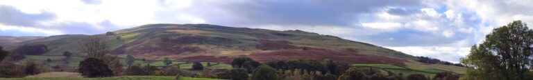
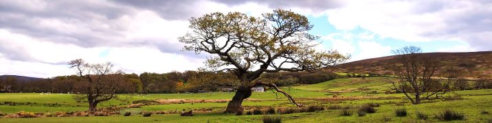
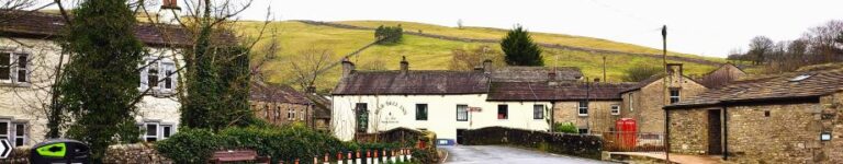
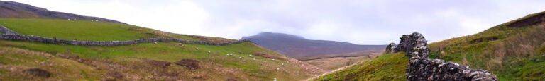
People often associate Sedbergh with the Howgills and steep climbs such as Cautley Spout, Winder or The Calf. These are indeed great options, but there are gentler walks from Sedbergh, and that’s what we offer here.
We start in the town centre and then take a route past the parish church to Birks, then walk over flat fields to the historic Friends Meeting House at Brigflatts. We backtrack slightly and take a disused railway line to the river Rawthey which we follow upstream to a footbridge at Birks. We cross this and then head across a golf course to the rather lovely Abbot Holme Bridge, then follow the Dee upstream to Dent Foot Chapel and Rash Bridge. From there we cross and at Rash climb through a couple of fields to pick up the Dales Way into Millthrop, before crossing the Rawthey again and returning to Sedbergh. Overall then we get to see lots of the Howgills in their autumnal colours without needing to actually climb them.
7.1 miles | 11.4 km | 247 m Ascent | 8.3 Naismith miles | Alison Kinder & Colin Stroud
During last week’s Chapel-le-Dale and Ingleborough environs walk we took a path down the side of the Ribblehead viaduct and enjoyed great views down the Ribble valley toward Pen-y-Ghent and Horton in Ribblesdale. This week we start from Horton and get a much closer look, this time with the viaduct in the far distance.
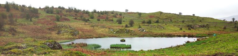
On a route that is a figure of eight – giving an opportunity to opt for a short version should the weather change - we get to see the two entrances to the Sell Gill Holes cave system before taking the Ribble Way path along the side of the valley as far as Old Ing. From there we cross Birkwith Moor to pick up the Pennine Way to bring us back toward Horton at a higher level. Once we get back to Sell Gill Holes, we opt to take a path across to New Houses rather than repeat the outbound route and end with a stroll along the banks of the Ribble.
6.9 miles | 11.1 km | 257 m Ascent | 8.1 Naismith miles | Peter Lennard
There are a number of walking groups that you could choose to join. The Ramblers alone have 500 groups, whilst also in our area there are independent groups in Settle and Lancaster. But surely none of them offer the same level of care to their members as the Bentham Footpath Group. We saw that last week when a last minute change of route was required to avoid flooding, and we see it again this week: When this walk was planned, our leader noticed that part of the route was obstructed by thistles and nettles. Rather than risk inconvenience to group members, he set about organising a clearance party, ensuring a safe and comfortable walk on the day.
This easy route is one we have walked a number of times – and there is no apology for that. It offers a convenient start, great views, enough of climb to get the pulse racing, and an opportunity to visit Settle town centre.

7.2 miles | 11.5 km | 298 m Ascent | 8.6 Naismith miles | George Sheridan
A quick glance at an OS map centred on Kendal shows a viewpoint just to the west of the town – not far from Underbarrow. This walk gave us the chance to see that view – and much more besides.
We start at a convenient free car park on the Underbarrow road, and head out along the top of Cunswick scar, with great views across Cunswick Fell to Kendal and beyond. We then drop down through Scar Wood, to skirt the edge of Cunswick Tarn and stroll past Cunswick Hall before taking a variety of woodland paths to Underbarrow.
From here we see Scout Scar looming ahead before climbing it at Barrowfield. Once at the top, we enjoy views across to the Lakeland fells, and Morecambe Bay before heading along the top of the scar to the viewpoint where we find an historic shelter and helpful graphics to identify the numerous hills we can see. A brief stroll downhill returns us to the car park.

6.9 miles | 11.1 km | 199 m Ascent | 7.9 Naismith miles | Alison Kinder & Colin Stroud
In a recent group trip to Kirkby Stephen, we enjoyed a great walk along a disused railway line. A quick glance at the map shows that the fantastic Smardale viaduct which we visit today is not far from there – and unsurprisingly it’s on the same disused line, so if you wanted to join the two routes you could.
The viaduct alone is worth the trip, but this walk offers much more: Great views back to the Howgills and Wild Boar Fell, industrial archaeology, wildflowers, lizards, and free parking within walking distance of two award winning pubs.
Much of the route is on accessible paths so although it’s close to our 12km threshold for an easy walk, this one is well worth considering for those wanting a gentler stroll.
6.9 miles | 11.1 km | 291 m Ascent | 8.4 Naismith miles | Don Cartledge
Staveley and the River Kent have long been a favourite of the Bentham Footpath Group – it’s an easy place for us to get to and there are some wonderful walks in the area. This time though, we go through Staveley and venture further up the valley.
Starting at Green Quarter, we stroll down to Kentmere, and then follow the river upstream past the imposing Rainsborrow Crag and as far as the reservoir that was built to control the flow to the mills downstream. We then cross to the east of the river and come back on a route tht gives us great views of old quarrying works.
The last part of the route back to the parking is a steep climb, so although this is an easy route overall, expect to be out of breath at the end.
3.9 miles | 6.3 km | 175 m Ascent | 4.8 Naismith miles | Valerie Eccles & Mary Pickstone
Bentham Footpath Group try to hold a few evening walks each year – typically during the summer months. Evening walks are accessible to those who have commitments during the day, and because they are typically shorter in length, they are suitable for those unable to join us for our more challenging offerings. Summer evenings can also provide great clear skies with pink sunsets, making for stunning views, although as our pictures show, that can be something of a lottery.
Even in the rain and mist though, this is a great walk – Hutton Roof is a favourite place to start a walk and is a location that we have used before. This time we start in the village centre and take a path up the edge of Hutton Roof Crags heading toward Newbiggin Crags, before heading back past Whin Yeats, and then taking quiet backroads to St John’s church, where we see the memorial stone for Bentham’s best known war hero.
6.9 miles | 11.1 km | 199 m Ascent | 7.9 Naismith miles |Terri Kwiecinska
In April 2023, Bentham Footpath Group enjoyed a great walk in Ravenstonedale and Smardale, where we explored a disused railway line and crossed the magnificent Smardale Gill viaduct. At the time, we made a mental note to come back and explore other parts of this line, and so when one of our group members suggested a walk at the poetry stones in Kirkby Stephen, we grasped the opportunity to combine the two. This walk visits the poetry stones on a route that includes parts of that disused railway line, and two more viaducts. We add interesting geology, a lovely riverside section, and Kirkby Stephen town centre - all crammed into a relatively short and easy walk.
4.4 miles | 7.0 km | 143 m Ascent | 5.1 Naismith miles | Kate Rowe
Being able to take a walk on a balmy summer evening is one of life’s treats, and its one that the Bentham Footpath Group try to enjoy a few times each year.
The weather is beyond our control of course, as our August 2023 evening walk from the same starting location showed. This time we were lucky and got good light with excellent views.
The later starting time means that a shorter walk is appropriate, so this walk falls well into our easy category. Easy does not mean dull though -there’s plenty to see with hay meadows in full flower and some great views across the valley to Ingleborough.
7.4 miles | 11.9 km | 206 m Ascent | 8.4 Naismith miles | Mary Taylor
Living in Bentham gives us easy access to the Yorkshire Three Peaks, and many BFG walks have featured them as their main attraction. This walk however takes a route between two of them without climbing either. Does that mean we miss out on points of interest? Not at all – the best views of the peaks are often not from the top.
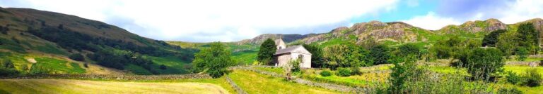
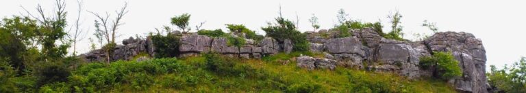
We start at Chapel-le-Dale, using the car park for the lovely St Leonard’s Church, and then head up toward Ellerbeck, passing the interesting Statue of a Warrior by Charles I'Anson. From there we head left onto Scales Moor – in effect the southern slopes of Whernside, seeing some of the best limestone pavement anywhere. Once at Twisleton Scar End, we take a path down to Twisleton Hall, and then on to Oddies Lane – a metalled road, built over the route of a Roman Road, which sees very little traffic. This takes us back to Chapel-le-Dale, with great views of Ingleborough along the way.
6.0 miles | 9.6 km | 67 m Ascent | 6.3 Naismith miles | Alison Kinder & Colin Stroud
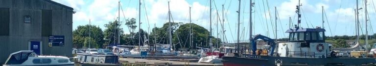
The Lancaster Canal features in a number of Bentham Footpath Group Walks – not entirely surprising given that Bentham has a Lancaster postcode, and canals generally offer scenic walking opportunities. This time, we explore Glasson Dock and the Glasson Branch – one of the last parts of the UK canal network to be built, before the railways largely replaced water transport.
From convenient parking at Conder Green, we first head inland first through farms and up to the Lancaster Canal at Galgate. We then go south along the towpath until we get to the junction with the Glasson Arm, which we follow all the way down to Glasson Dock – one of the few places where our canal network connects to the sea.
The return from the Marina and Dock is via a disused railway line offering great views of the estuary, and there are several opportunities along the route to combine this easy and generally flat walk with pub lunches.
7.2 miles | 11.6 km | 368 m Ascent | 9.0 Naismith miles | Susan Badley
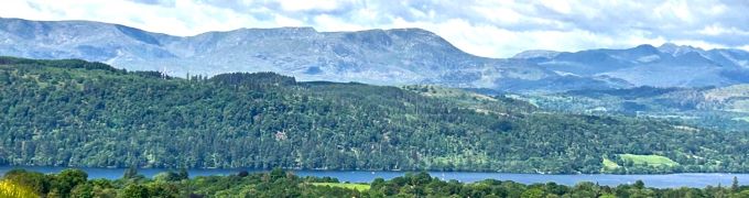
A quick glance at our website shows how much we like the fells to the East of Windermere – not only are they easy to get to from Bentham, but they are less crowded than some other Lake District destinations and offer some stunning views. This walk adds to our portfolio and starts from Ings where there is convenient parking.
We head toward Windermere via the viewpoint at School Knott, and then re-cross the railway and the A591 to find a route up Orrest Head via Common Wood.
We carry on heading north until we get to Far Orrest, then on to Town End via footbridges over Trout Beck. Finally, we return to the A591 near the Brockhole visitor centre, where we catch a bus back to Ings.
5.6 miles | 9.1 km | 302 m Ascent | 7.1 Naismith miles | Rick Clapham
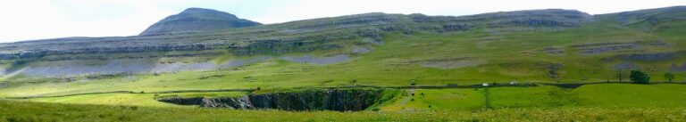
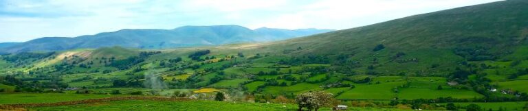
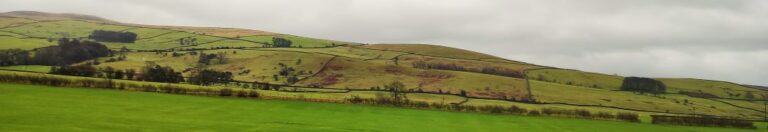
Dentdale is one of the more popular gems of the Yorkshire Dales, and so not surprisingly, Bentham Footpath Group visit regularly. Every time we come here there is something different to see, and this time we start from the Church Bridge and take a riverside path downstream for a short distance before coming back to the centre of the village via the picnic area. We then head up the enchanting Flintergill, visiting an open air museum and enjoying a viewpoint, before climbing to the Occupation Road overlooked by the Megger Stones.
After following the Occupation Road for about a mile we head back downhill along a green lane to High Nun House, then cross the minor road and head down to Deepdale Beck which we follow downstream back to the Dee, which we then follow back to our starting point.
7.4 miles | 11.8 km | 250 m Ascent | 8.6 Naismith miles | Terri Kwiecinska
In March 2024, Bentham Footpath Group walked at Flookburgh, and enjoyed views over the Cartmel sands to Bardsea. This time we are on the other side of the estuary for a great walk starting from Bardsea then heading inland to visit Urswick and its tranquil tarn. On the way we have the corresponding views back toward Flookburgh and the whole of Morecambe Bay. We also see a beautiful church, a curious three sided folly, get more than one ice cream opportunity, and pass the site of an ancient hill fort, before noting alpacas, highland cattle and a stone circle. We end by walking on the beach with opportunities to see and hear all the birdlife teeming at the margins. All this with free parking and public toilets.
6.2miles | 10.0 km | 100m Ascent | 6.7 Naismith miles | Mary & Kate Taylor
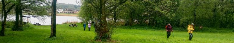
For this walk we head southwest into Lancashire and park at the convenient Scorton Picnic site adjacent to the river Wyre, before we explore the riverside, the adjacent lakes, and the farmland in the Wyre valley as they come back to life as spring takes hold.
This is a walk without a great deal of change in elevation, and is quite short, so we class it as easy. However, it may be worth considering that in common with most riverside and valley bottom walks, how easy it feels may well change with the weather - heavy rain makes the paths muddy and slippery so if you are picking this walk for ease of use, make sure you pick a suitable day.
6.3 miles | 10.2 km | 393 m Ascent | 8.3 Naismith miles | Alison Kinder & Colin Stroud
Sometimes our program works out such that we are in the same area for two consecutive walks – and that’s the case this time. This walk is at times no more than 200m from our recent Winster Valley walk, and at first we though that must be why a couple of locations looked familiar – we later realised that it is becase our equally excellent route at Lord’s Lot used a short section of the same paths from Spigot House to Bow Mabble Breast.
What does separate this walk from the earlier Lords Lot walk is the weather – we were rather unlucky this time. Despite that, there is much to recommend this walk – easy parking, rivers and tarns, woodland, working farms and some great views. Even in the rain it’s well worth the effort.
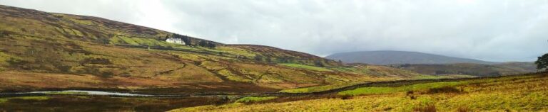
7.1 miles | 11.5 km | 371 m Ascent | 9.0 Naismith miles | George Sheridan
Walking is a somewhat weather-dependant hobby, and this route demonstrates that clearly: When we completed our Grisedale and Garsdale walk in this area in June 2022, we enjoyed bright sunshine, walked over dry fields, and asked ourselves why bridges had been provided to cross mere trickles of streams. Fast forward to the wettest start to year that anyone can remember, and we see why the bridges are there – those same streams are now small rivers in full flow.
So, does the rain spoil the experience? Not at all, it just gives us a different perspective: Wonderful waterfalls roar into life, mosses and lichens proliferate, and we get extra exercise jumping over streams and fighting to stay upright on muddy descents. Whatever the weather, this walk offers a great deal – we rate it as easy based on the distance and ascent but be aware that there are steep sections and in the event of poor conditions, extra care is needed.
5.7 miles | 9.2 km | 248 m Ascent | 6.9 Naismith miles | Peter Lennard
We start by Church Bridge, and then loop up onto the fell at South Lord’s Land before walking behind the village, with great views across the valley, and then over to Gawthrop, before crossing meadows to get to Barth Bridge. From there we pick up the Dales Highway long distance path and follow it up to Lunds where we walk on an ancient green lane for a while. We soon head right and onto North Lord’s Land looking across the valley with views of where we walked in the morning. Finally, we return to Barth Bridge via High Barth and then take a very quiet road walk on the North of the Dee before one more section through fields back to Church Bridge.
6.4 miles | 10.3 km | 335 m Ascent | 8.1 Naismith miles | Sandra Craggs
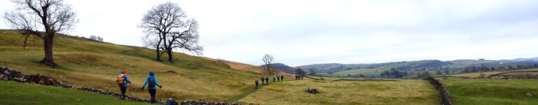
Kettlewell is one of the “Honey pot” villages in the Yorkshire Dales, and so during the peak of the tourist season, it gets rather crowded - and justifiably so – it’s a lovely place.
However, if you pick a glowering day during February when the weather forecast is gloomy, not only will you have the pick of the parking places, but all the paths will be deserted and if the weather proves to be better than expected you will still get some great views.
This walk takes us from Kettlewell up the Top Mere Road to Cam Head and then down Starbotton Cam Road into Starbotton. We then return along a riverside path enjoying typical Upper Wharfedale views. Although we class this walk as easy, based on the distance and total ascent, be aware that the first section is steep, though there are a couple of benches to take a rest.
5.0 miles | 8.1km | 164 m Ascent | 5.9 Naismith miles | Don Cartledge
This is one of our shorter walks – partly because we revised part of the route on the day to avoid flooding, and partly because sometimes it’s just nice to offer an easier route that can be used to fill a Sunday afternoon or a spare couple of hours on a balmy summer evening.
Despite being quite compact, this walk packs a lot in – we get to see the dismantled railway line that once linked Ingleton and Sedbergh, via Barbon, we walk on a Roman road, pass a number of Andy Goldsworthy art installations, catch a distant glimpse of a stone circle, visit the beautiful Holy Trinity Church in Casterton, walk on the access road to coal mines that can be traced back to the reign of Charles I, and all still have time left to get some shopping in Kirkby.
7.2 miles | 11.6 km | 271 m Ascent | 8.6Naismith miles | Alison Kinder & Colin Stroud
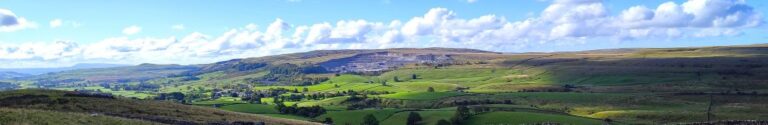
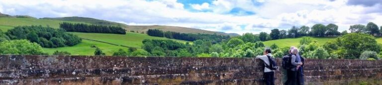
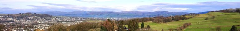
Kendal styles itself as “The gateway to the Lakes”, and it is indeed a good base for those wishing to explore the southern end of the Lake District. The surrounding countryside also has much to offer in its own right– as we see in this walk.
From convenient parking close to Oxenholme station, we start by climbing the Helm, gaining great views of the Lakeland Fells, the Howgills, and Morecambe Bay. From there we descend past an ancient fort, and a curious folly to pick up St Sunday’s Beck which we follow upstream to the delightful Bleasehall Wood. We note a syphon well before taking an isolated green lane to St Sunday’s Bridge and from there we head to Hawkrigg. The return leg involves a brief but quite steep climb up the aptly named Windy Hill, and then it’s a steady descent to the finish. We show this as an easy walk because it is (just) less than 12 km – but the consensus from the group was that it “feels more like a medium”.
6.9 miles | 11.0 km | 249 m Ascent | 8.1 Naismith miles | Mary Taylor
Bentham Footpath Group travel up to an hour or so to get to the start of our walks. This generally works well, but given that we already live in paradise, we sometimes find ourselves thinking – why not just stop here and just walk our own patch? So that’s exactly what we do on this walk.
The Norber erratics are well known, and one of the “tick list” attractions in the Yorkshire Dales. The usual starting point would be Austwick – and we have in the past walked from there, but this route extends the day and gives us a chance to take in Clapham and Wharfe, as well as Austwick.

6.0 miles | 9.6 km | 205 m Ascent | 7.0 Naismith miles | Don Cartledge
A quick glance at our website shows that Levens is a firm favourite of the Bentham Footpath Group, and this easy walk demonstrates exactly why – it’s convenient to get to, offers easy walking, is packed with interesting locations, landscaped parks and industrial heritage, as well as offering stunning views back to the Yorkshire Dales, of the Kent estuary, and over to the Lake District fells.
The route we present here overlaps in places with a number of our other walks – the great advantage of this is that you can use this as the basis for longer or more challenging days out by adding sections from the connecting routes.
4.1 miles | 6.6 km | 197 m Ascent | 5.1 Naismith miles |Alison Kinder & Colin Stroud
This walk was designed to be brief such that as a group we could meet as usual yet be finished in time to reconvene with friends and family at the Old Sawmill in Clapham for a convivial meal.
Don’t go thinking that this walk is any the lesser for being short and sweet though – it goes far enough up Fell Lane (one of the routes up Ingleborough) to give good views of the peak, and we have Ingleton and the Lune Valley to enjoy too.
A brief look at the OS map will show that this walk intersects with many other footpaths so there are ample opportunities to extend or modify the route – or simply enjoy it as it is: An easy but enjoyable walk that can be slotted into the day with minimal planning.