Sedbergh is a favourite location for The Bentham Footpath Group, as is Dent, so surely there’s a walk based between the two that captures the best of both? There is – and this is it -typical Yorkshire Dales walking but with views of the Howgills.
We start next to the River Rawthey, just north of where it merges with the Lune, and track upstream toward Sedbergh, passing the confluence with the Dee, but staying with the Rawthey at first. We then cross the river and head to Millthrop, to pick up the Dales Way path which takes us down to Gate Manor in Dentdale. We then cross the Dee to return along the other side of Dentdale via Rash and Dent Foot, before skirting Holme Fell to arrive at Middleton Bridge via a Roman road. A short stroll back along the Rawthey concludes the walk.
We had intended to start this walk at Middleton Bridge where the A683 from Kirkby Lonsdale to Sedbergh crosses the Rawthey – there is generally parking for three or so cars on the Kirkby side of the bridge, but that proved impossible on the day, so we carried on to a layby further along the main road at Beckside. Parking for 4 or 5 cars is available on the right, at the location shown on the OS map as a milestone. The Grid reference there is SD6299 9082. If you are using Satnav to get to this location, then the postcode LA10 5ES covers the area, and you can use what-3-words tag racing.sunbeam.scare to pinpoint the layby. If you prefer the Middleton Bridge starting point, then the same postcode applies, but the what-3-words tag is snappy.engages.unsigned, and the OS reference is SD6303 8973.
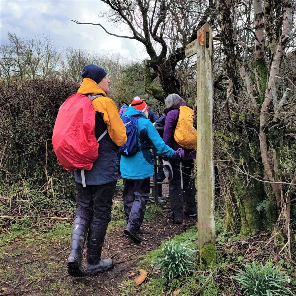
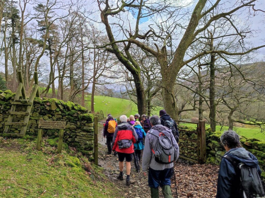
The walk starts by heading along the A683 in the direction of Sedbergh for a short while. This is a busy road, so take care here. Fortunately the distance on the road is short, and we soon see a waymarked path – (FP Birks Mill 1 ¼, Dales way) – on the right taking us down to the banks of the Rawthey.
We spend quite a lot of this walk close to a river, and it’s tempting to assume that it’s always the same one. In fact, there was debate amongst the group as to which rivers we were seeing: A glance at the OS map indicates that we start on the River Rawthey – it merges with the Lune a short distance to the South of Middleton Bridge. We also get to see the River Dee – initially when it merges with the Rawthey just a short way into the walk, and then again as we walk along the banks in Dentdale.
We head up the Rawthey for a little while now. The path has been eroded a little in places; much of it has been repaired recently, but care is still needed if the river is in spate. As we follow the river round to the left, a rather fine railway bridge comes into view. The railway for which this cast iron bridge was built was the Lancaster and Carlisle Railway’s Ingleton branch line running from Ingleton Station up to Low Gill. By the time the branch was completed in 1861, the Lancaster and Carlisle Railway had already become part of the London and North Western Railway (LNWR).
After formal closure the line was still on occasions used for weekend excursions and to transport pupils to and from local boarding schools. Goods traffic continued until 1 October 1964, and the line was maintained as a possible relief route until April 1967 when the tracks were lifted.
Our path crosses the railway track bed and then continues on the far side, still along the river. The railway bed is not an official path, but desire lines show that many people use it as such, so make sure you stay on the correct (riverside) path. As we continue along the left bank of the Rawthey, we have excellent views to Winder – the peak to the North of Sedbergh, and before long we see the River Dee merging with the Rawthey – so in effect we have arrived at the bottom end of Dentdale.
The Rawthey now bends round to the left, passing a waste water treatment works, and ahead of we see a rough road and then a footbridge over the river. Our walk crosses the bridge, but it’s worth noting that that the current structure is fairly new – the original bridge was destroyed by flooding in December 2015 – a short video clip of the aftermath can be seen here
The buildings that we pass on the left just before the bridge are now used as light industrial / storage units but were once the Birks Mill referenced on the way marker at the start of the walk. Built in 1796, this water-powered mill was originally designed for spinning cotton. A fire in 1822 destroyed everything so the current 3 storey mill, house and garden are a rebuild dating from then. Records show that the mill was lit by gas, heated with steam via a coal boiler, and had a waterwheel measuring 18ft by 12ft producing 30hp. After the rebuild, Birks Mill was used for spinning worsted yarn for local trade, for snuff manufacturing and bobbin turning: Textile production stopped in 1909.
On the far side of the footbridge the path goes right and approaches a gate where the path splits in two. There is an option to continue along the course of the river, but we take a sharp left and head East toward Millthrop. We are walking along flat meadows here and to the far side of the river (our left) we can see Birks House, a whitewashed country house.
The path continues round and after a steel gate becomes a track and as we continue to follow the Rawthey upstream we soon find ourselves looking over the river toward the “Pepperpot” within the grounds of Sedbergh School.
A number of stories have been suggested to explain the curious location and appearance of this structure: It is commonly thought to have been built as an isolation house for a local land owner’s daughter who had Tuberculosis. The last known use of Pepperpot was in 1936 when it was rented by a school master from the Preparatory School of Sedbergh after that it fell into disuse and was for many years just a ruin.
In spring 2015 the Heritage Lottery Fund awarded Sedbergh School Foundation a grant to rebuild the Pepperpot.
A more detailed history of the structure can be found here:
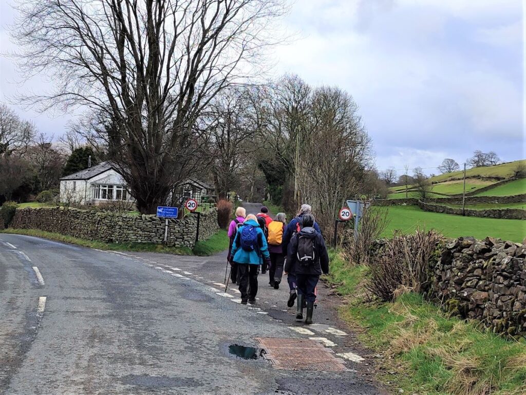
Our walk continues round to the right and after taking a wide track between drystone wall, we come to a minor road where we turn left and walk down into Millthrop. As we approach the hamlet, we see a fork in the road, and we take the smaller road on the right.
We now need to look for a well signed track on the right (BW Frostrow Fell)– just before the older part of the hamlet. This takes us steeply uphill along a rough track.
We are now on the Dales Way, and will stay on this long distance path for a while. We gain height steadily now, and as we do so the views over Sedbergh to the Howgills open up behind us – so take a few moments to look back, as well as enjoying the forward views to the Frostrow Fells (on the left), and Dentdale (on the right).
We pass a tempting sign for a path to Highside – this might be worth coming back to another day as there is a waterfall on the way to Highside, and a number of routes from there back to Sedbergh.
The track continues, and not far beyond here splits into two. We need to take the left hand fork heading uphill. The track on the right goes down to the minor road at the base of Dentdale.
We continue with the bridleway for a while now – the route remains clear – if somewhat muddy in places -and we soon see a way marker for a footpath down to Rash. We continue with the bridleway, but if a shortcut is required, that path goes down to Rash Bridge and Dent Foot Chapel which we pass later in the walk.
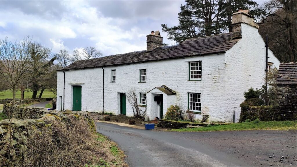
The path becomes a green lane between drystone walls after a while and skirts the edge of Gap Wood – care is needed here as there are fallen trees. After the woodland we enter a more open landscape and see an attractive whitewashed farmhouse ahead of us. This building has all the hallmarks of an interesting history, but appears not to be listed.
Beyond the farm the track continues down to the minor road at the bottom of the valley, as it does so, but hidden from view, we are passing Gate Manor on the right. The only real signs we get of this large house are a pair of curious oak doors set in the perimeter wall.
As we arrive at the road, we take a very slight left-then-right dog-leg to continue the Dales way as it heads down to a ford / footbridge combination in the base of the valley. The river was deep and strong on the day of our walk, but one of the curious features of the Dee is that the flow almost disappears during dry spells, so the ford will often be a viable option.
We cross the footbridge and continue up to meet a road on the South side of the Dee – where we turn right. To our left is dense woodland at Brackengill Woods – we were lucky enough to see a deer here.
We stay on the minor road for a while now – heading down the Dee Valley with views of all the locations we passed a short while ago from the opposite side of the valley – including Gate Manor.
Eventually we arrive at Rash Bridge – on our right, and somewhat hidden by trees – and just beyond this is the Methodist Chapel at Dent Foot.
This is currently disused, and at the time of our walk was being offered for sale by auction, so may well be a dwelling or holiday let when we next do this walk.
Just before the chapel it is worth noting that there is a weir in the river – weirs are often built to manage a head of water to drive a water wheel, and sure enough, we see a mill race running behind the chapel to an old mill building – this is Rash Mill – a grade II listed building.
Rash Mill is a 16th Century water-powered Manorial Corn Mill – a corn mill associated with a manor house and supplying flour to the manor and surrounding villages. It was rebuilt in the early 18th century as a cotton carding and spinning mill and later reverted back to corn milling and is now used as a joinery works.
We continue along the road – expect little traffic – we are initially following the Dee, but the road soon heads left and we leave the river following the contours around the base of Holme Fell. From here the views over the Dee and Rawthey Valleys to Sedbergh and The Howgills are wonderful, and lunch at a convenient memorial bench at the roadside gives an opportunity to enjoy them.
Our next destination is Jordan Lane – part of the Roman Road from what is now Kirby Lonsdale to Sedbergh. In a short while we see a sign for a footpath to Jordan Lane. This is a viable route, but involves some climbing up boggy terrain, so we prefer to press on along the road until we see a way marker for the bridleway to Jordan Lane. In practice, it does not really matter which route you take – they come together before we reach Jordan Lane. However, the ancient green lane that the Bridleway takes is so attractive that it must be our recommendation.
The bridleway and the footpath merge, and head down hill toward the route of the railway that we saw at the start of the walk, and we see a bridge where the railway passed over Jordan Lane.
From here we follow Jordan Lane Southwest (i.e. not under the railway bridge). The lane is perfectly straight here in that Roman Road kind of way, and we need to look for a path on the right taking us down, over another railway bridge through woodland to the Middleton Bridge we had intended to use as the start of the walk.
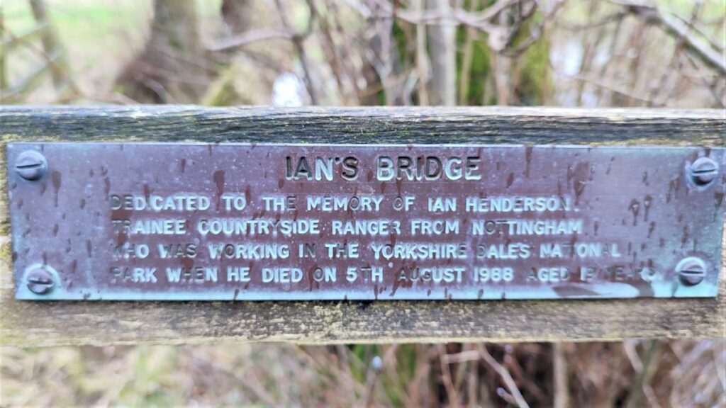
We cross the road bridge with care and take a footpath on the right immediately after the bridge. This takes us over fields and back toward the A683 and our starting point. On the way we cross a footbridge over a small back and note the memorial to plaque to a countryside ranger.
We arrive back at the A road at a gate and turn right to walk down the road for a short distance back to the cars.