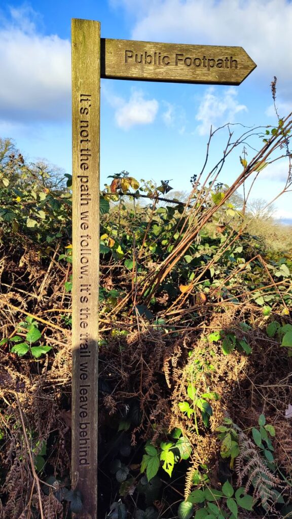
Jump to . . .Step by Step | OS Map | Downloads | Gallery | Fly through
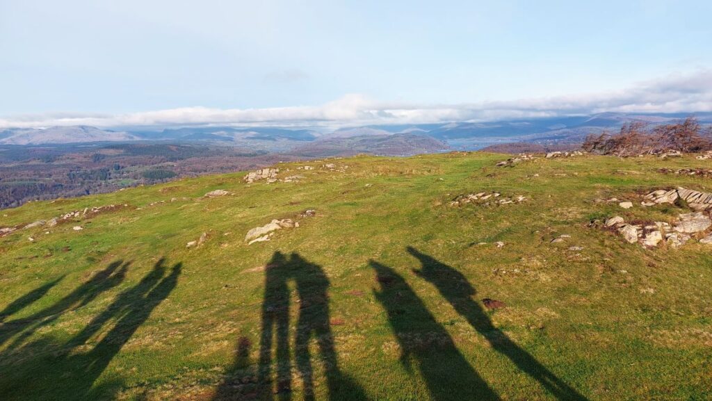
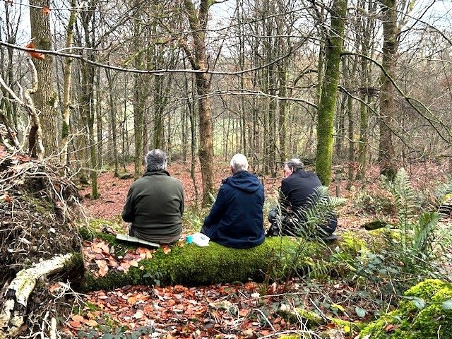
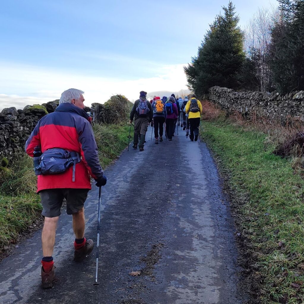
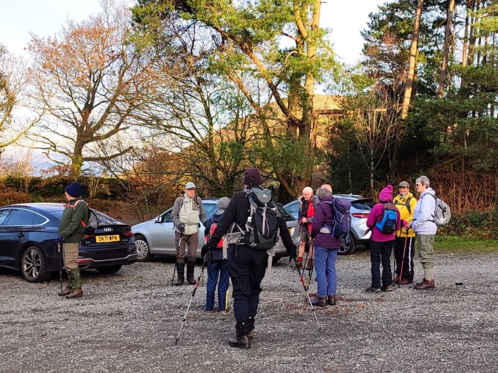
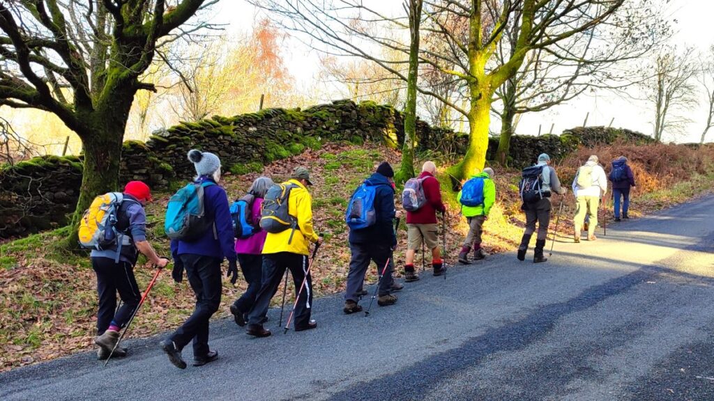
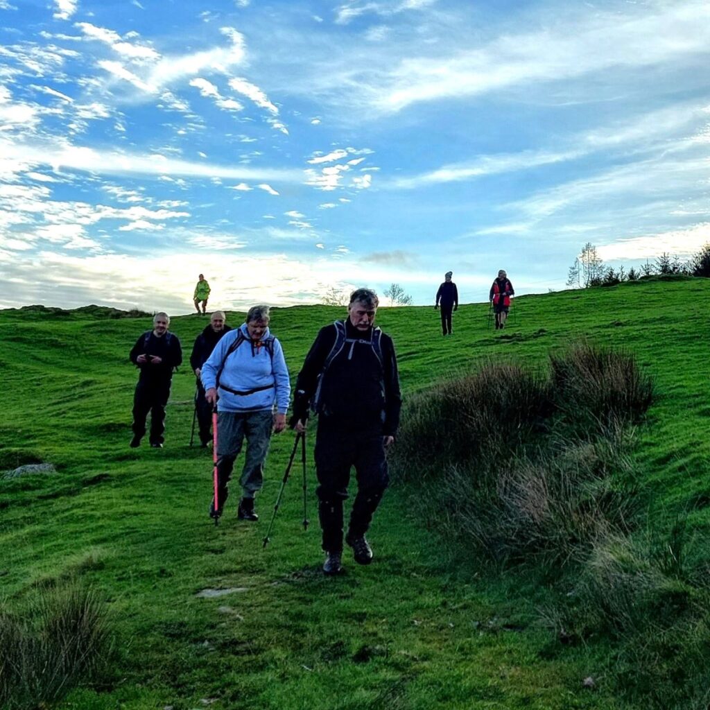
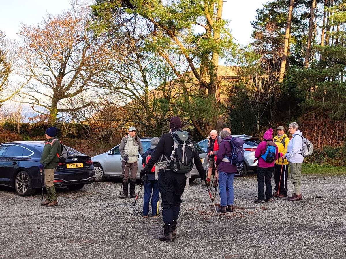
The Bentham Footpath Group typically undertakes about 50 walks each year. Given where we live, many of these will be in the rain or have poor visibility. Sometimes though we are spectacularly lucky with the weather and get to enjoy simply stunning views, and this walk was just such an occasion.
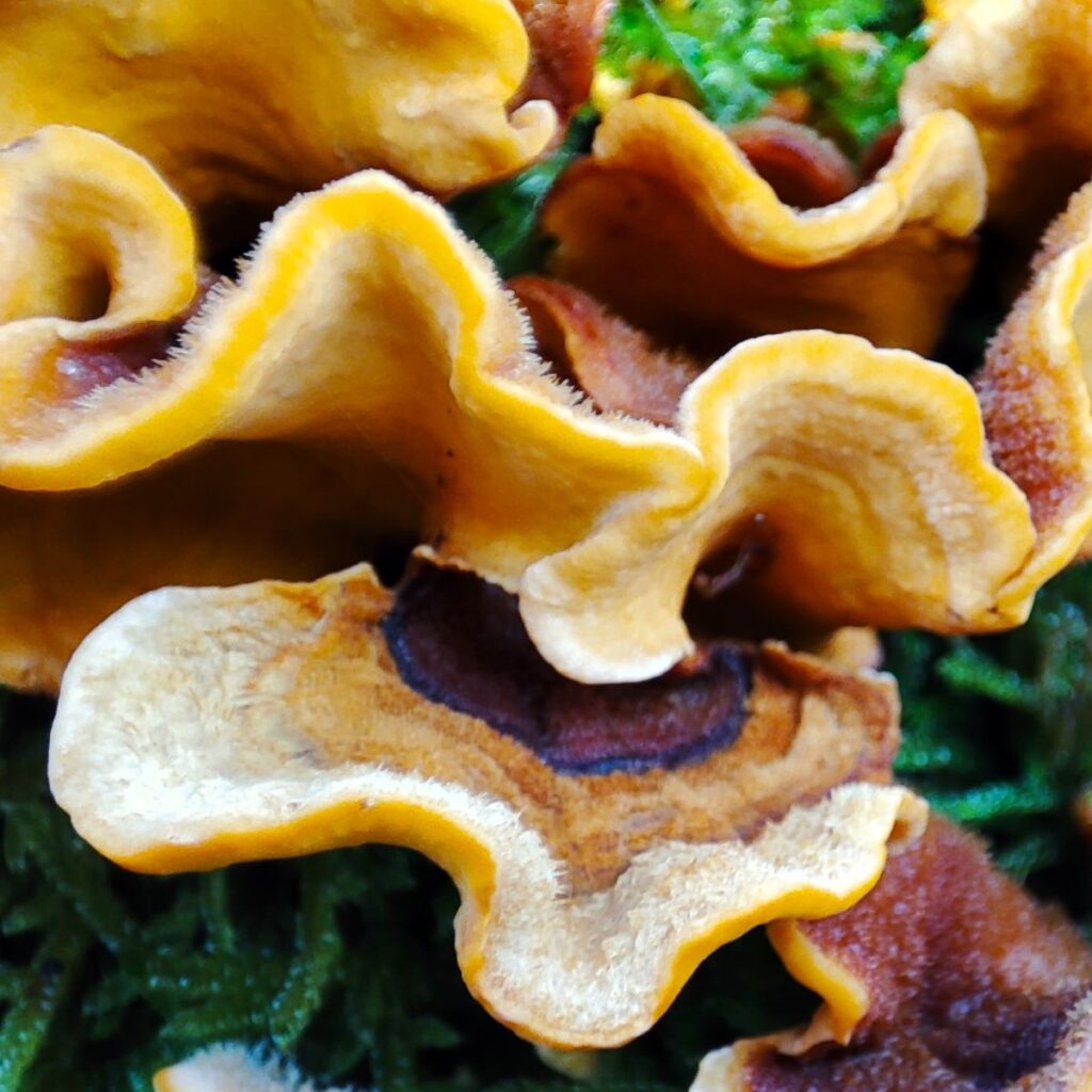
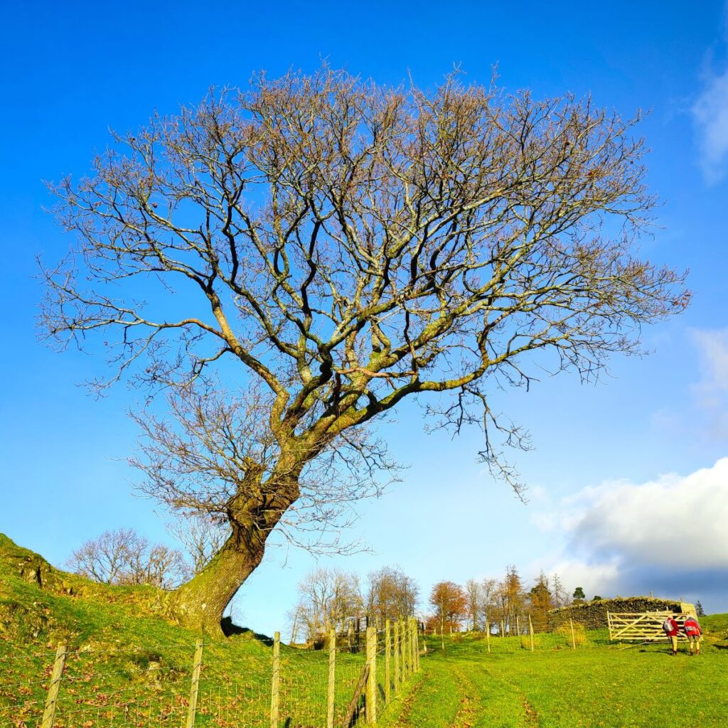
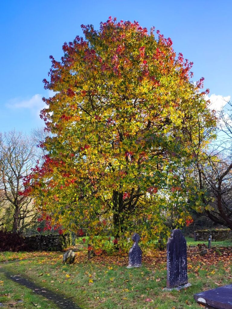
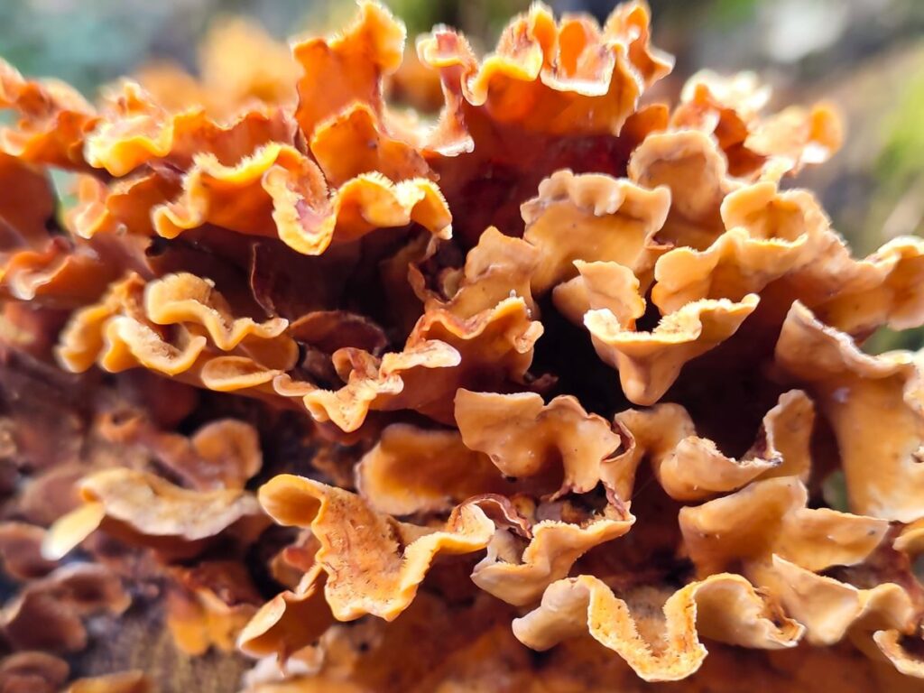
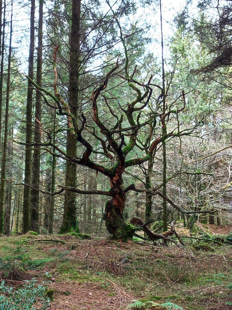
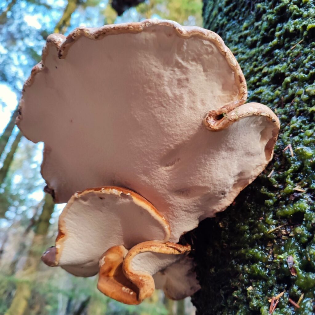
If you follow this route, you may or may not be so lucky, but whatever the weather, this will always be a great walk: We start from a free and convenient parking spot, climb up to one of the best views of Windermere, sharing the How with Luing cattle. We then head over to Sow How Tarn, clip the edge of Middle Tarn, and then go via Heights Cottage onto Ravens Barrow, and a curious monument. From there we visit a lovely ancient church and old schoolhouse, and through fungi-rich woodland to Thorphinsty Hall, through Crag Wood and up to an atmospheric derelict farmhouse en-route to Simpson Ground. We round the day off with a tranquil reservoir, and more woodland with lovely gnarled old trees. A perfect day.
- Total distance 14.3 km (8.9 miles)
- Total ascent 467 m
- Moderate walk
Step-by-Step
We start from a free car park on land owned by Forestry England on Fell Foot Brow. To find the right road, take the A590 to Newby Bridge and then at the roundabout take the A592 toward Bowness on Windermere. After 1km look for Fell Foot Brow on the right – the car park is about 500m up the road sited on the right. If the car park is full, don’t worry return to the road and use a layby. The OS grid reference for the car park is SD38958763, and the corresponding what-3-words tag is nothing.scuba.galloping. If you are using Satnav to get there then Fell Foot Brow, Staveley-in-Cartmel, Ulverston LA11 6NX should work.
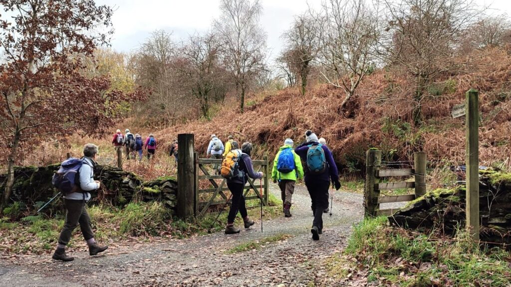
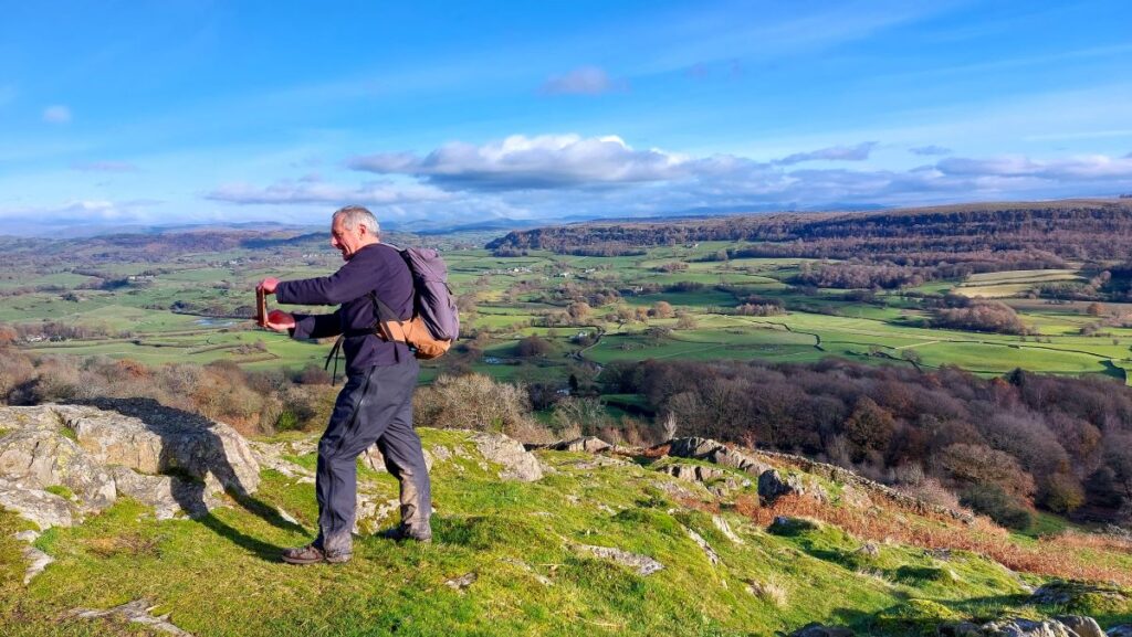
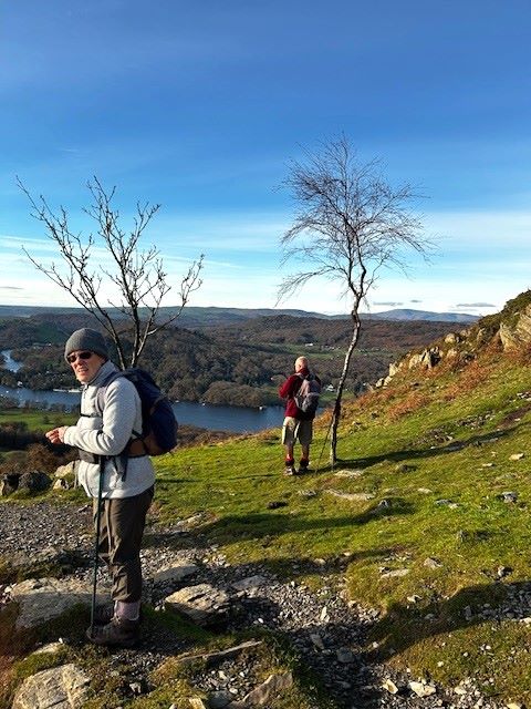
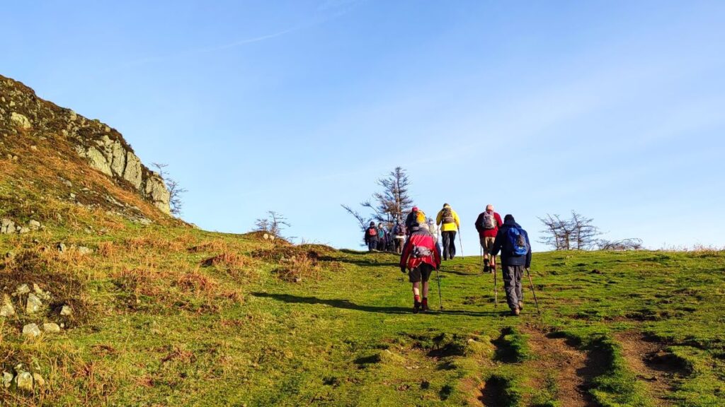
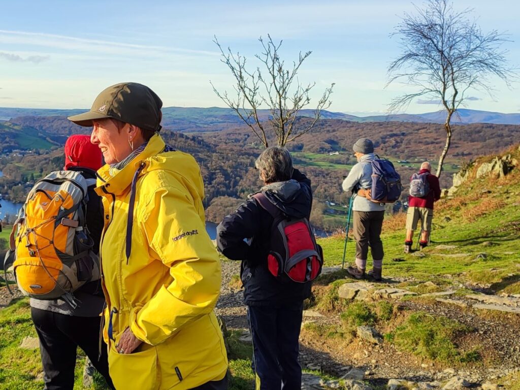
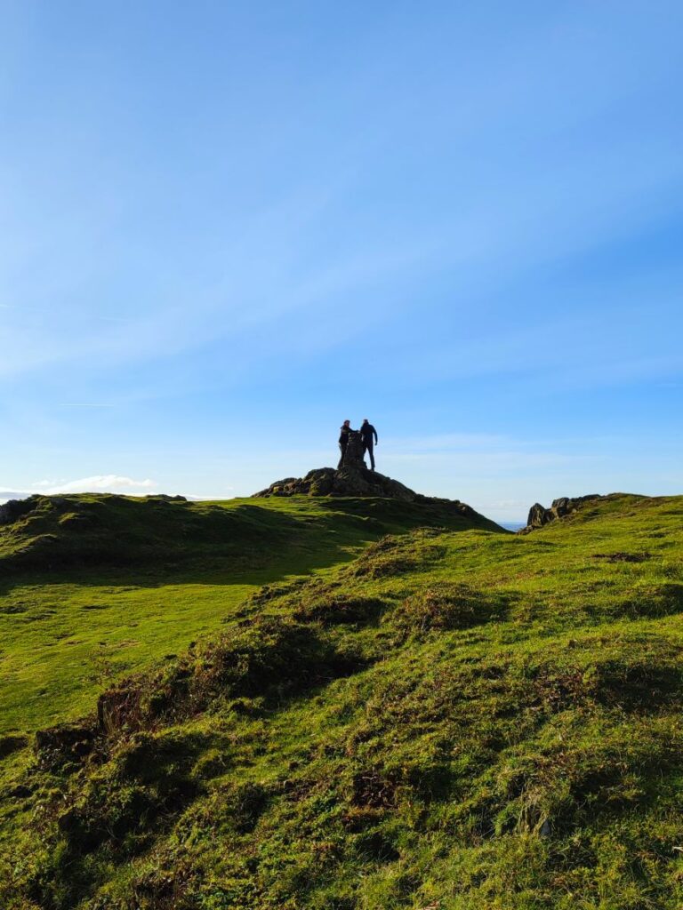
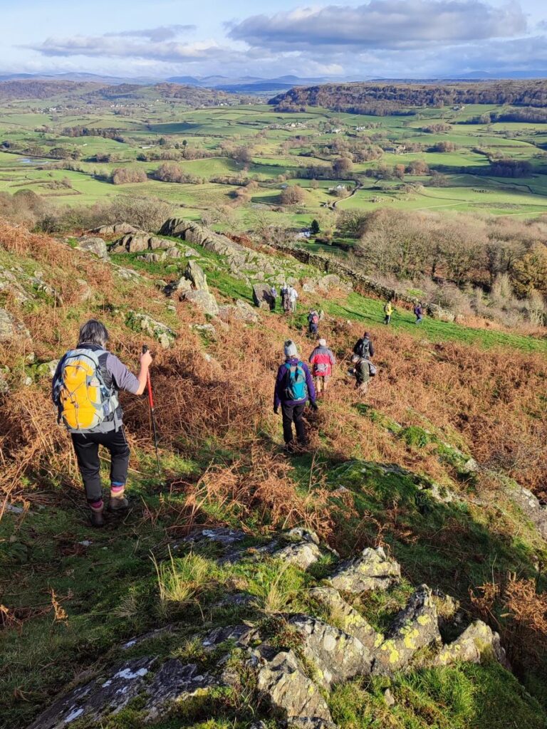
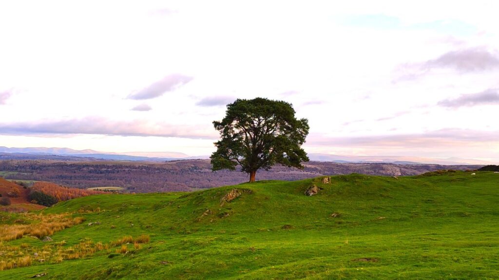
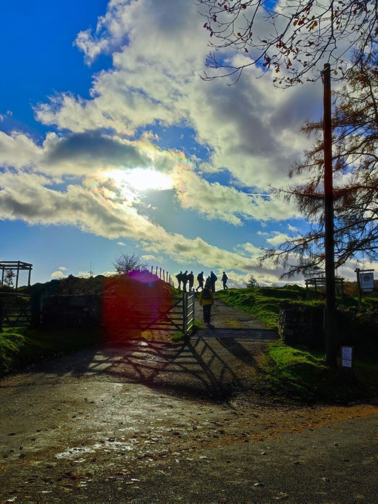
Once at the car park, head away from the road and look for the path on the left hand side of the car park. This leads through woodland and back to Fell Foot Brow at a wooden gate. We cross the road and continue with a path directly to the viewpoint at Gummer’s How: The term How is quite common in the Lakes and is derived from the Old Norse word haugr – a common local term for a hill or mound.
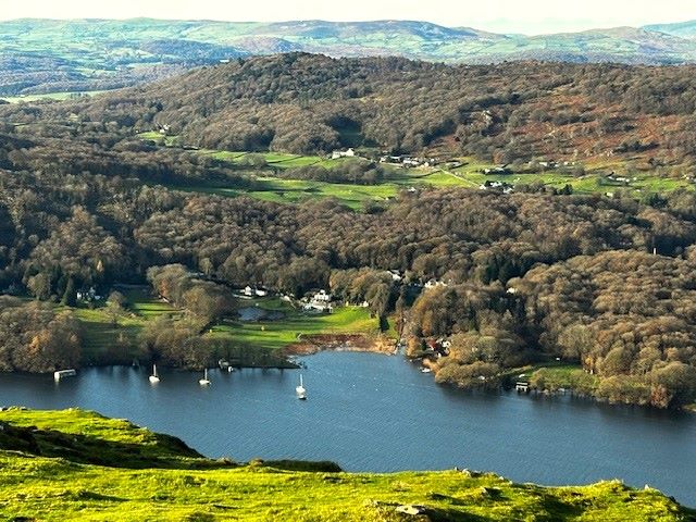
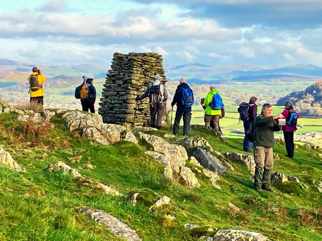
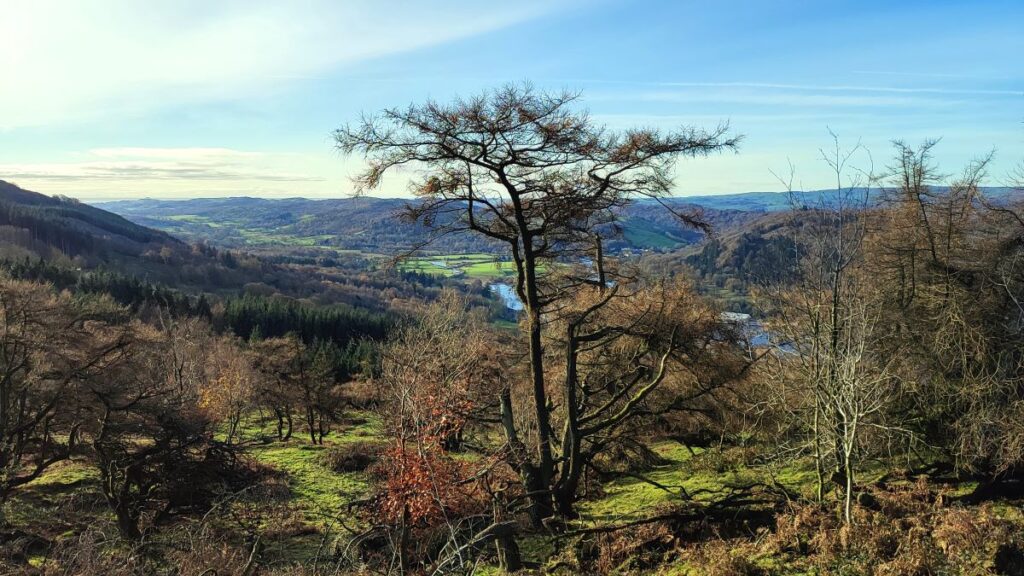
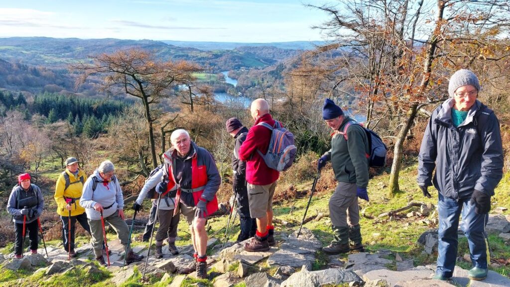
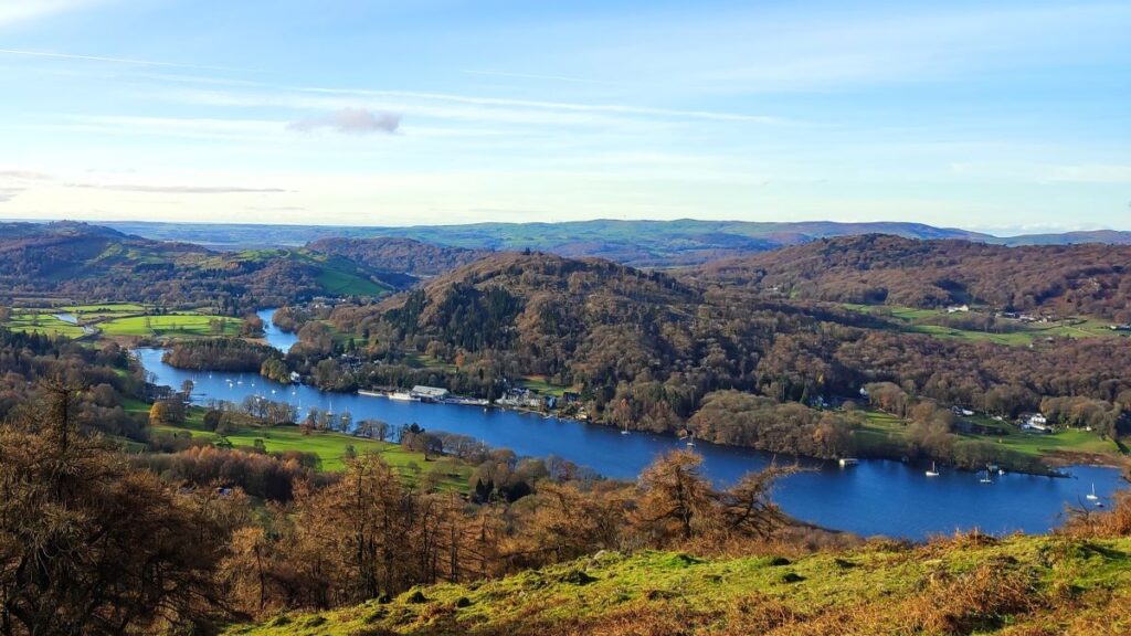
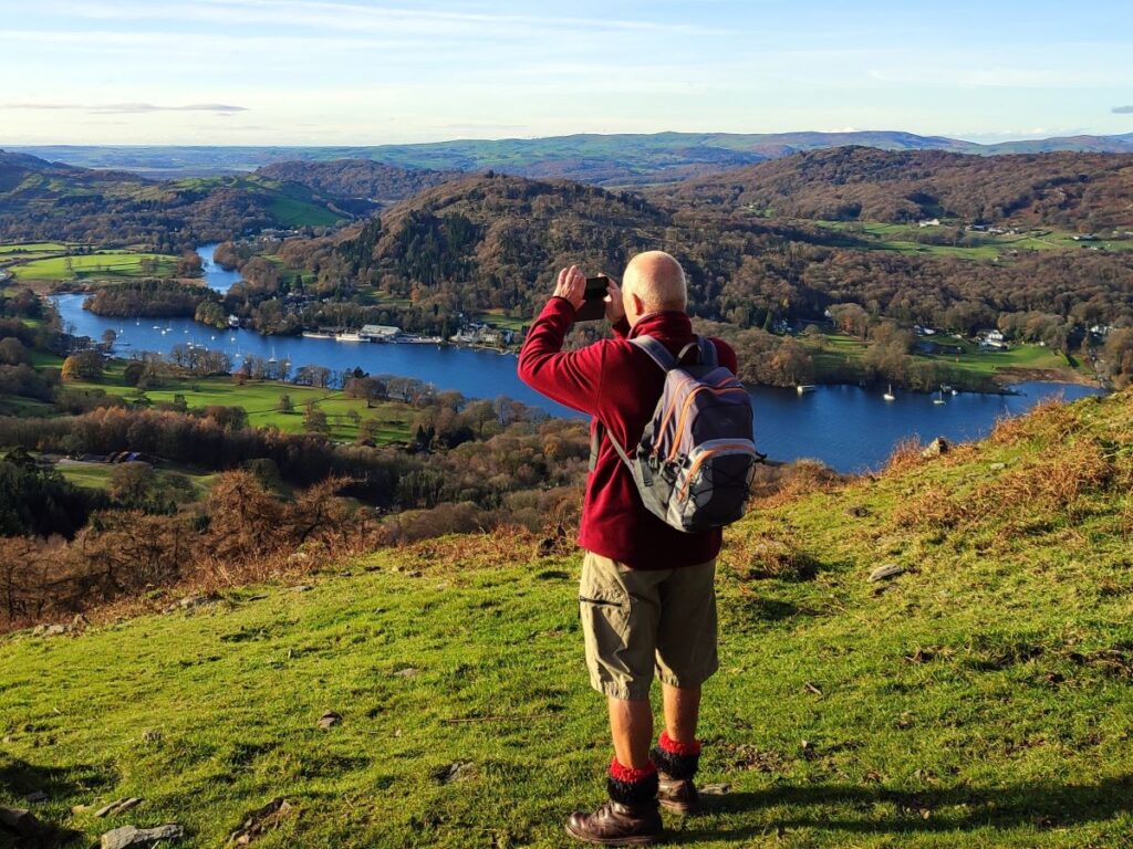
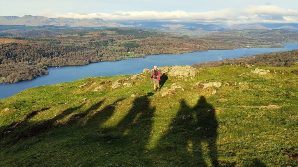
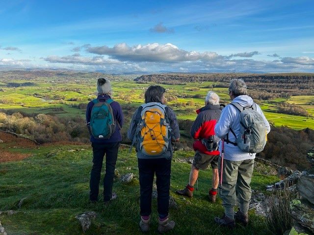
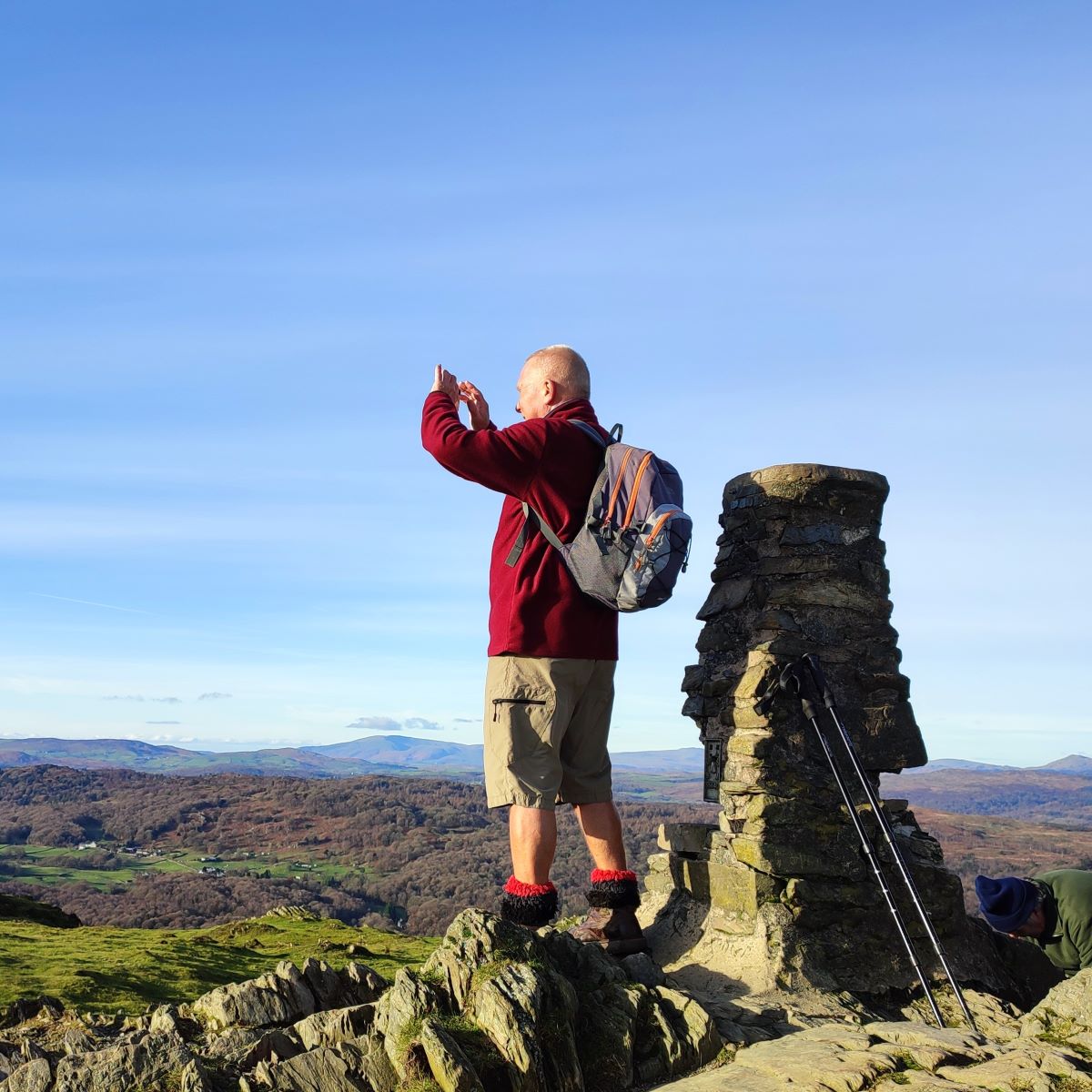
At 321 m above sea level, and only 131m higher than the car park, Gummer’s How is a small hill by the standards of the Lake District, but it is the highest of the foothills in the area and commands excellent views, particularly along Windermere – the cairn looks over the magnificent Town Head House estate towards the lake. We also have view across to the Coniston Fells and the broad panorama of Morecambe Bay.
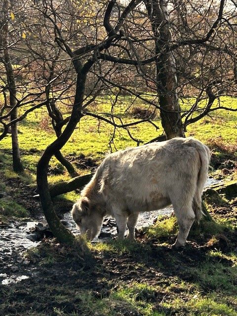
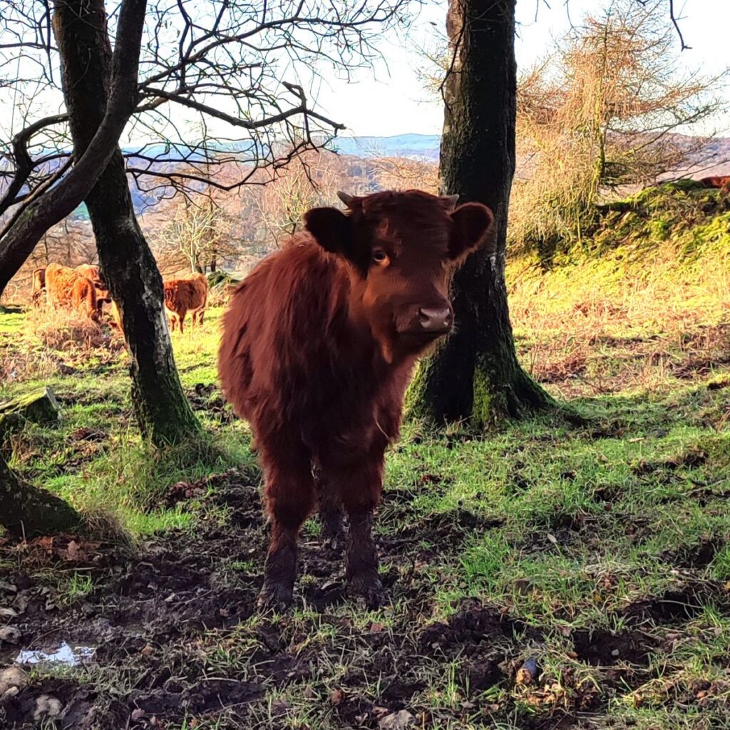
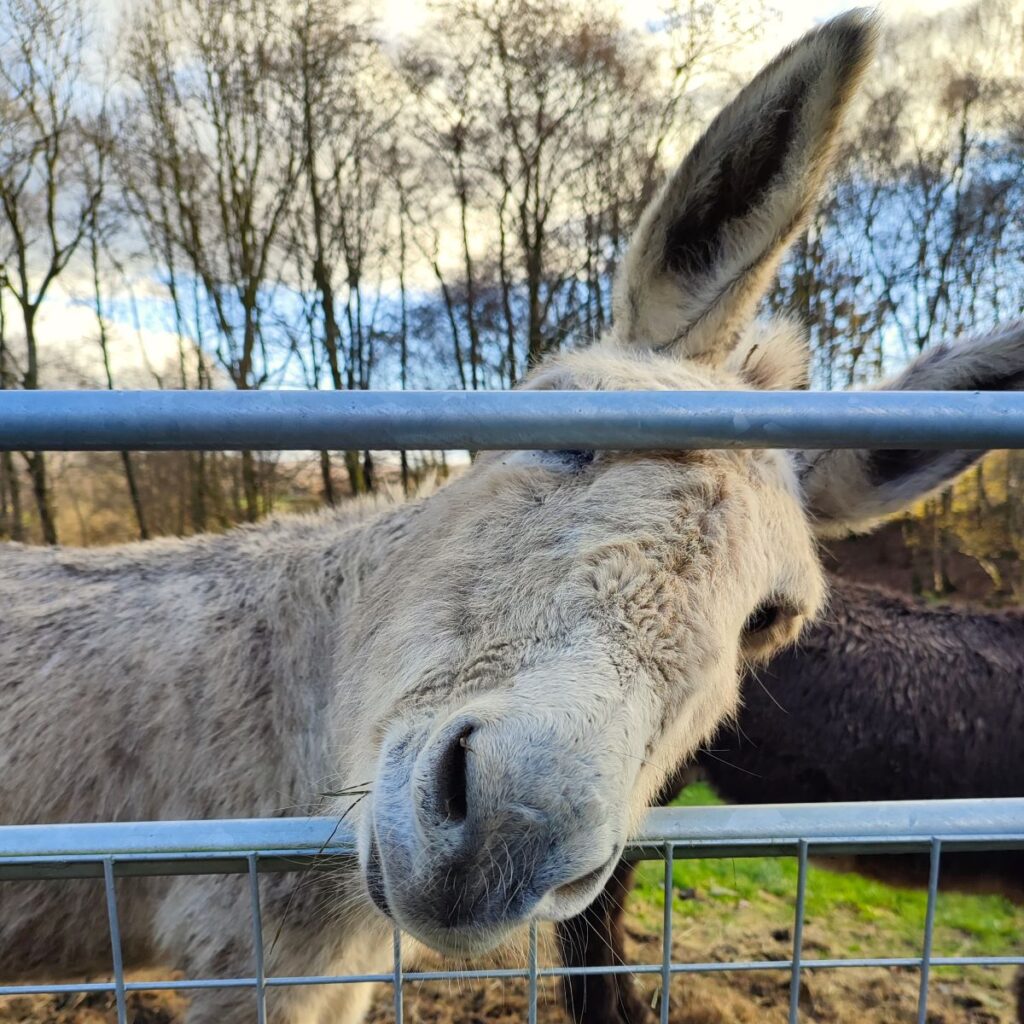
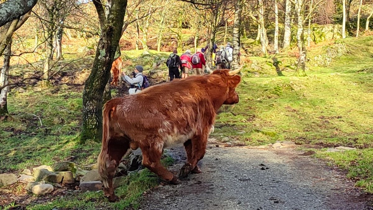
The route to the summit is clear and easy to navigate – initially it’s through an area where Natural England and Defra are cooperating to implement a higher level environmental stewardship scheme to stabilise and support the unique ecology of this exposed upland. Part of this involves grazing cattle in the area, and they have selected a specific hardy breed known as Luing.
The Luing breed was created on the Isle of Luing in Argyll, and they are a cross between Highland Cattle and Shorthorns. Although these are big animals – as evidenced by this bull – they are quite docile and well used to visitors – as ever though dogs should be well controlled.

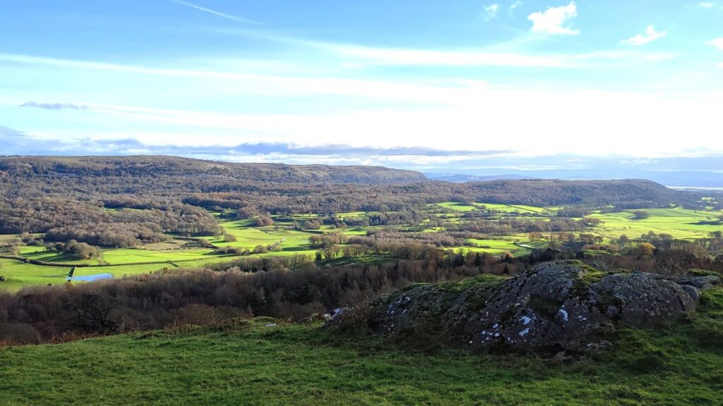
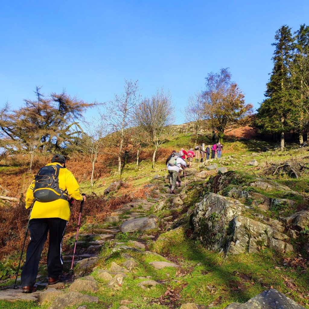
As we progress further toward the How, the path becomes steeper and quite rocky – it is possible to take a very direct route to the cairn at the top of the hill, but we recommend the gentler path round the easter flank – not only is it easier, but it gives good views over to reservoir in Birch Fell plantation and Whitbarrow Scar over to the East.
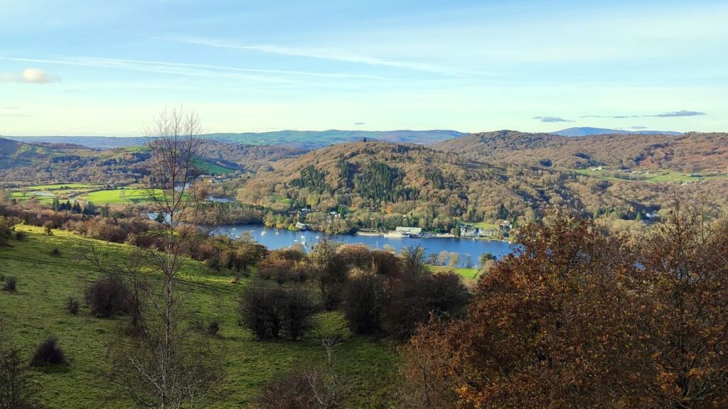
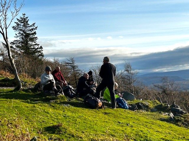
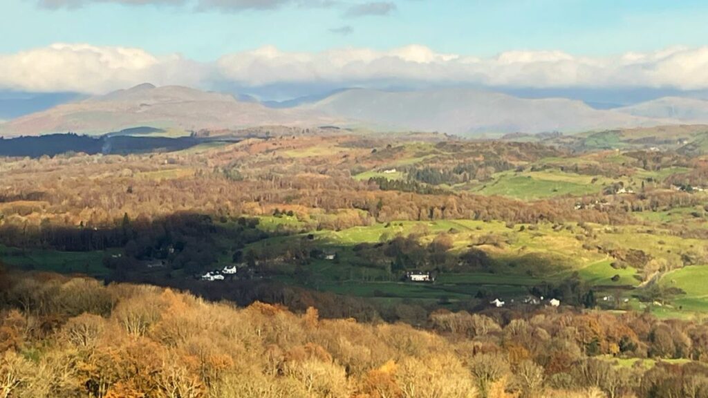
Once at the top, we get a great view of Windermere and we are reminded just how long the lake is – we can see the southern end clearly, but the northern tip is more than ten miles away.
Gummer’s How is the subject of a chapter of Wainwright’s book The Outlying Fells of Lakeland. He describes it as “an old man’s mountain”, which given that the Bentham Footpath Group is composed mostly of retirees is appropriate, but possibly sexist. Wainwright says of it: “And when ancient legs can no longer climb it know ye that the sad day has come to hung up the boots for ever and take to slippers”.
In order to prove that we are not yet ready for our slippers, we head back down to Fell Foot Brow, and start the loop out toward Cartmel Fell.
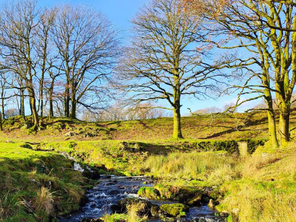
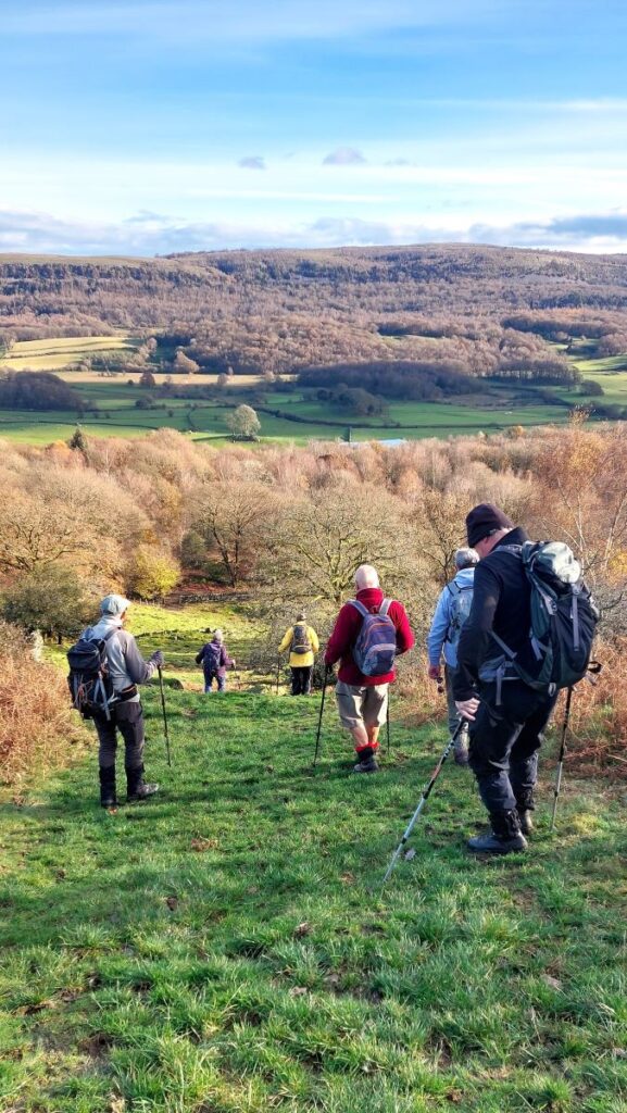
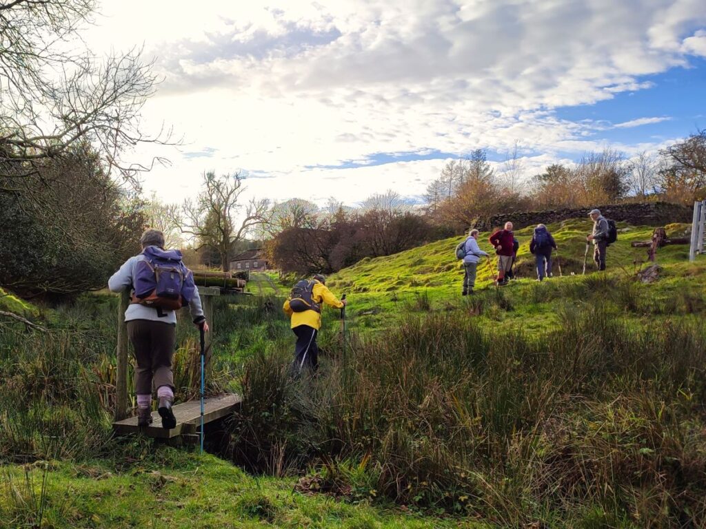
Initially we head up the brow at the roadside – if you prefer to be off the road there is a route through Astley’s plantation – in fact we use it for our return journey at the end of the walk, but we found the road to be quiet and safe. We follow the road for just 400m and then look for a lane on the right – this heads down toward a farm at Sow How: We have Astley’s Plantation on the right and great views over toward the Heights on our left – you may spot one or more of the four tarns in this area if the weather is clear.
As we follow the lane down between the drystone walls there are a number of paths and tracks into the plantation on the right – we ignore these for now and continue down to the farm, taking the roadway between the farmhouse and barns and continuing Southeast until just 50m past the buildings we take a left turn onto a track heading northeast and to Sow How Tarn. The track soon veers left, but we carry straight on and through a gate as we climb toward the tarn.


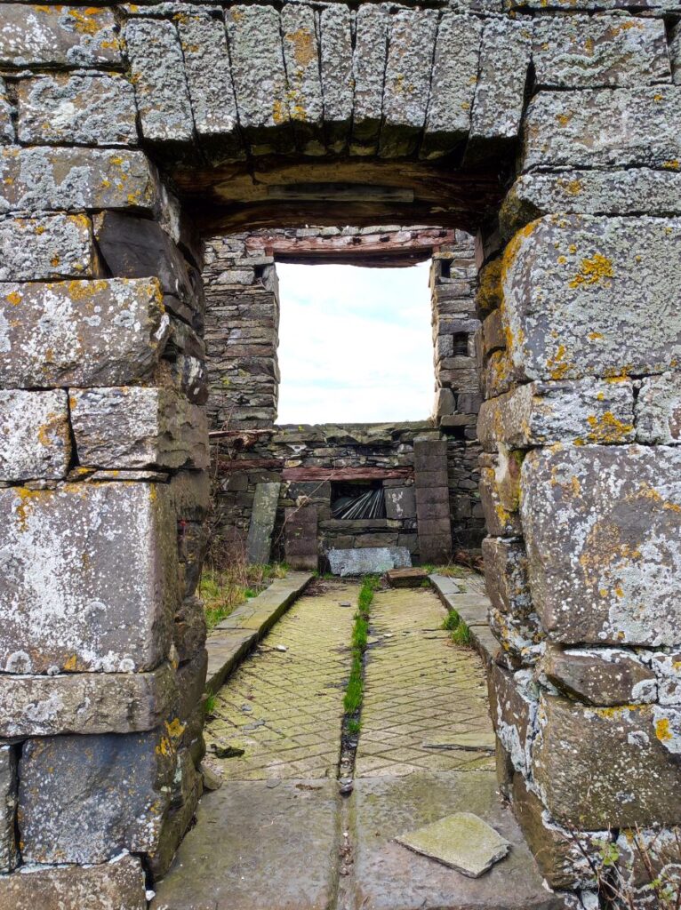
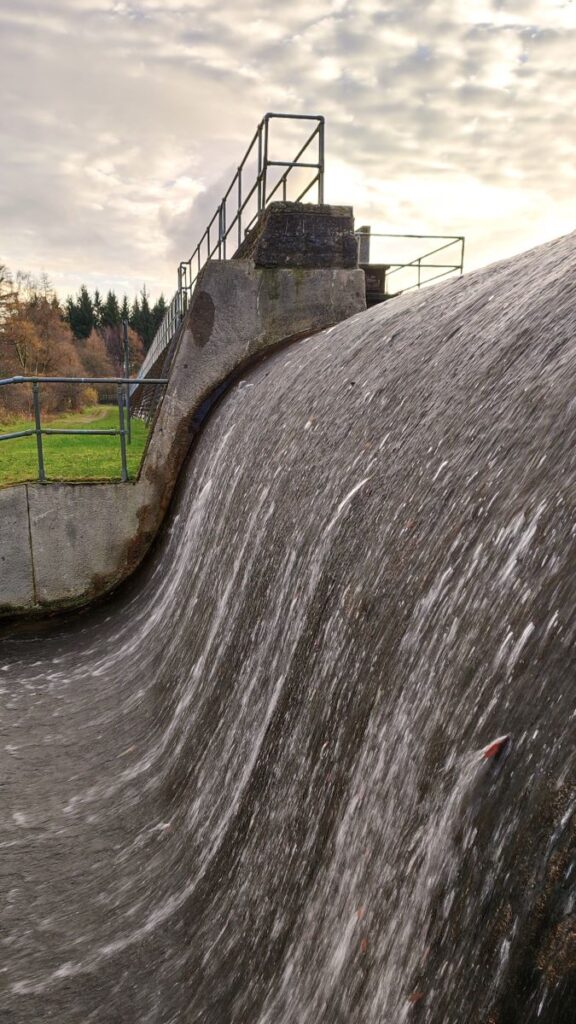
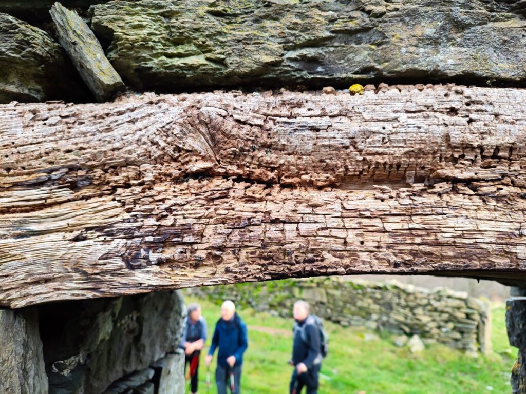
Sow How Tarn is not in fact a natural tarn – it is a man made fishing lake with an attractive boat house that features in many lake district calendars, and a deep retaining embankment wall that the path passes in front of – embedded in the right hand end of this embankment is a curious doorway, which presumably houses control gear for the spillway.
Beyond the embankment, the path heads Northeast and up to a gate, to continue through the next field and on toward the woodland, which we enter on the track that leads to Heights Cottage. Not quite on the track, and so not immediately visible, there is another tarn to our left as we head through the woods – this is Middle Tarn, and there is a footpath up to it should you wish to make a short detour.
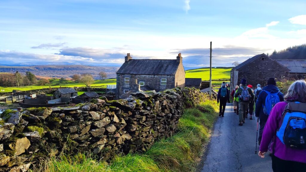
The track soon leaves the woodland and continues with a drystone wall to our right, until we arrive at a large farmhouse and barn – no longer occupied. This is Heights Cottage. The lane goes past the back of the building, and we then head sharply to the right and follow the route down the side of the barn and down toward a gate adjacent to a stand of trees.
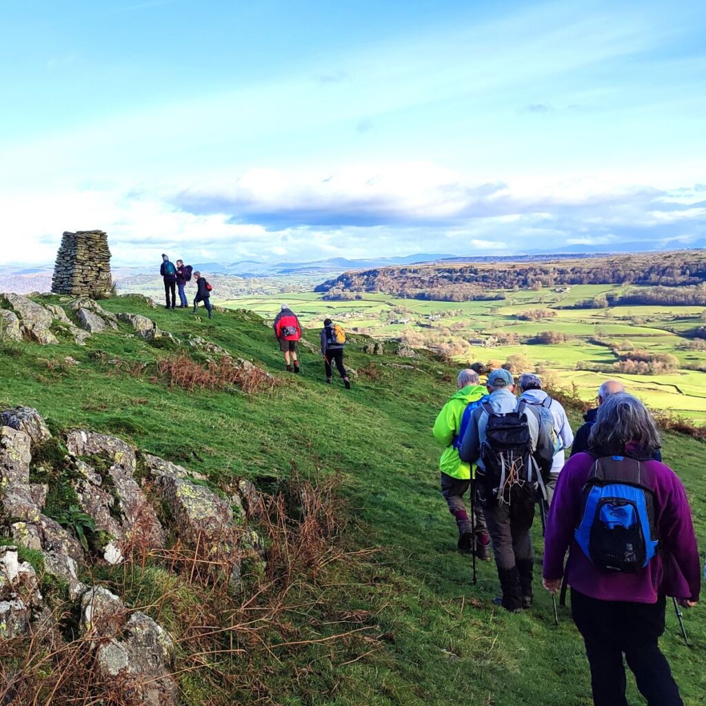
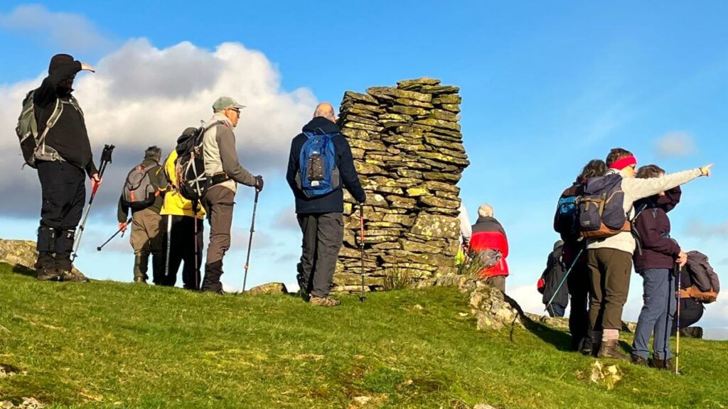
Beyond the gate we are on Raven’s Barrow. There are designated footpaths on the Barrow, but the area is also Open Access Land, so we can pick our own route, and we take a route that is not specifically marked as a path on the OS map. If you are concerned about navigation here, don’t be – take our GPX with you on your phone to check the route, or if that’s not possible, simply head westward from the stile and when the path forks keep right. You will climb a little and then see a cairn described on the OS map as a monument.
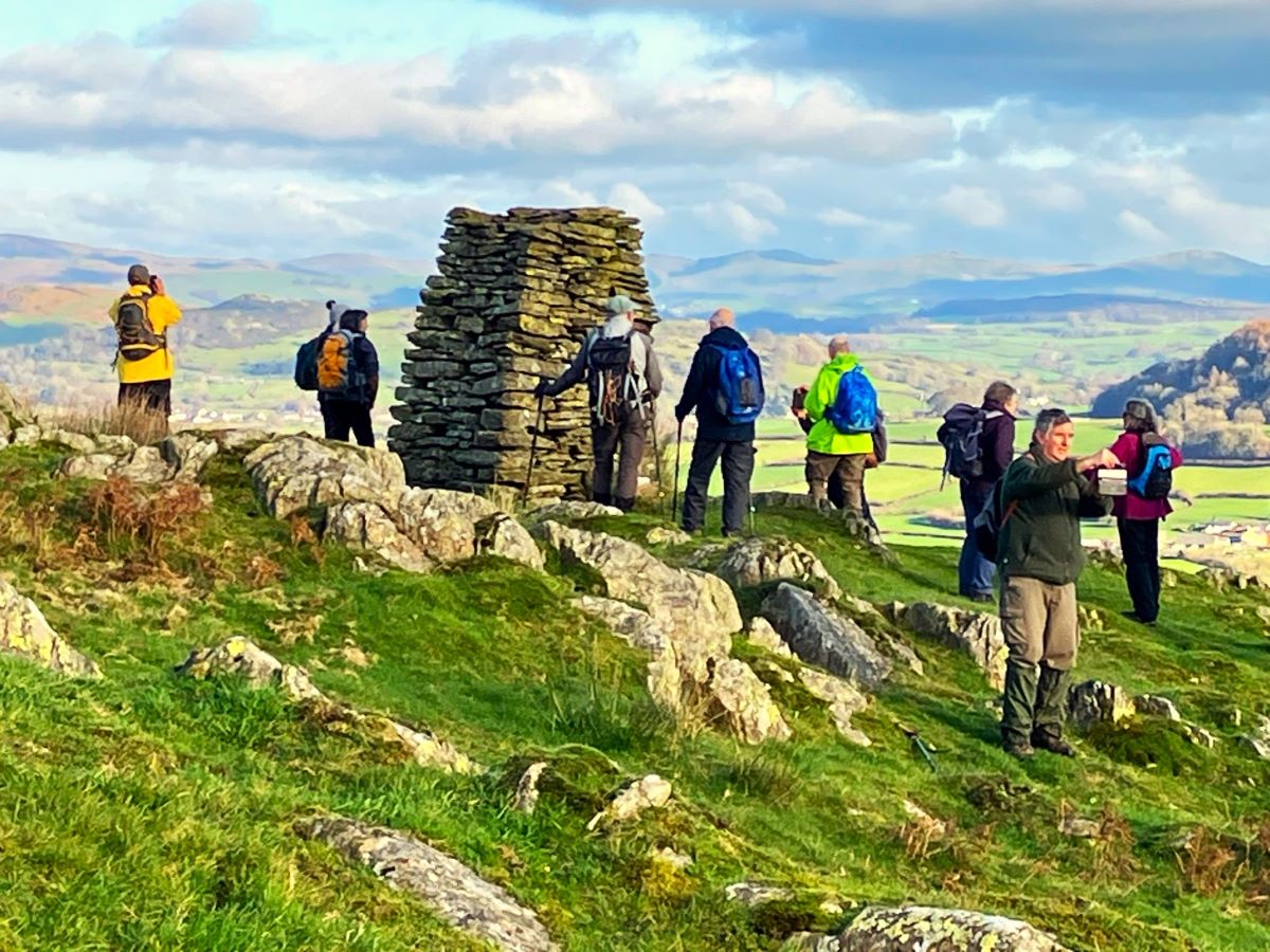
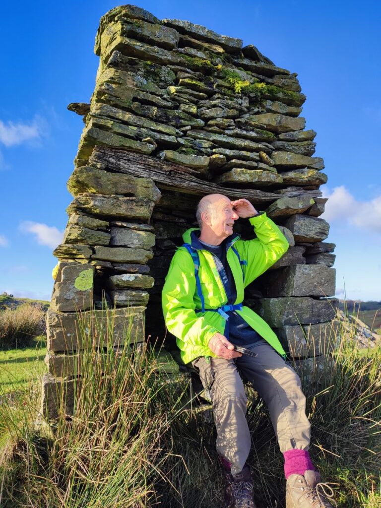
There is significant debate as to what this structure really is, and why was placed here. The quality of construction, the inclusion of a seat within one of the four faces along with the siting somewhat below the high point of the hill suggest that it is much more than a cairn, but there is nothing to suggest any specific reason for the structure – no inscriptions or memorial stones for example.
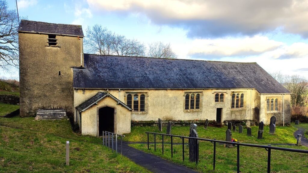
Having pondered the monument, we continue west and see a church in the distance, and well below us. This is St Anthony’s at Cartmel Fell – and that’s where we head next. The path down the hill is quite steep and needs some care when wet – as does the stile over the drystone wall that we encounter halfway down. From here we are back on marked paths – in fact there are two paths as we come over the stile – we need to bear right and head down to road.
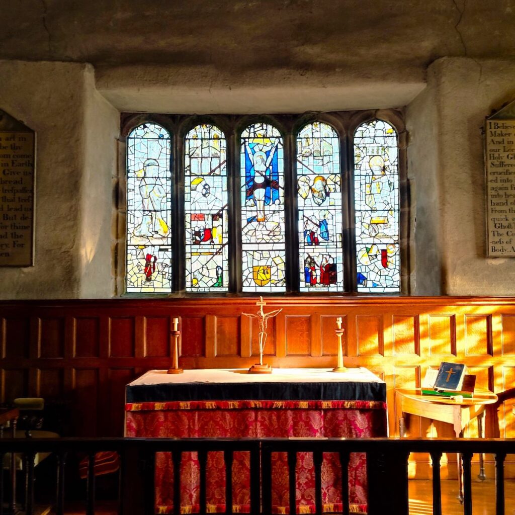
At the road we notice an interesting, inscribed signpost opposite and take the indicated route down to the church, which is just 100m down the track – we enter the church grounds via a stile into the well-kept graveyard.
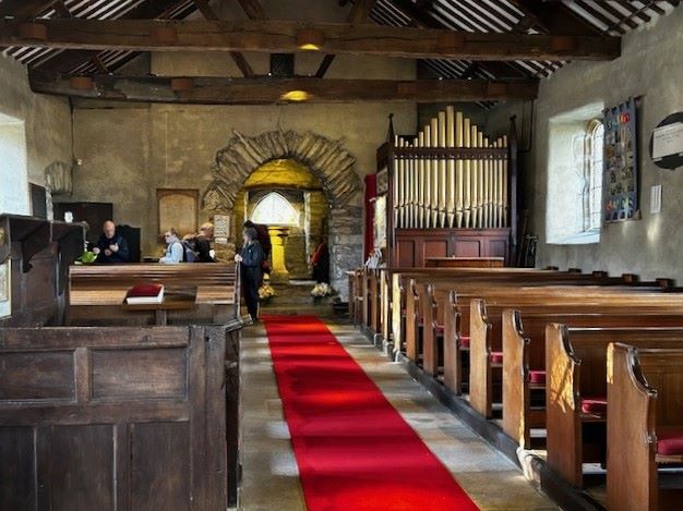
St Anthony’s was founded in 1504 and is a Grade I listed building. It is open to visitors, and is well worth seeing, boasting unusual box pews, a triple decker pulpit, ancient stained glass at the altar and contemporary designs at the font.
It was originally a chapel of ease – a church building other than the parish church, built within the bounds of a parish for the attendance of those who cannot reach the parish church conveniently, generally within a sparsely populated larger parish. It served (and of course still serves) the residents of Cartmel Fell in 1504 as an alternative to travelling to Cartmel Priory each Sunday.
The boxed pew on the North side is known as the Cowmire Hall pew and is thought to have been made from the chancel screen in 1571. The box pews on the South side also date from the 17th Century. (Cowmire Hall itself about a mile Northeast of here, and is a large house based on an early 16th Century pele tower). The three decker pulpit of 1698 is a rarity. The lower deck is where the clerk sat, the middle was for the reader and the top was where the sermon was, and still is, preached. According to Wikipedia, this is the only church in the north of England dedicated to St Anthony.
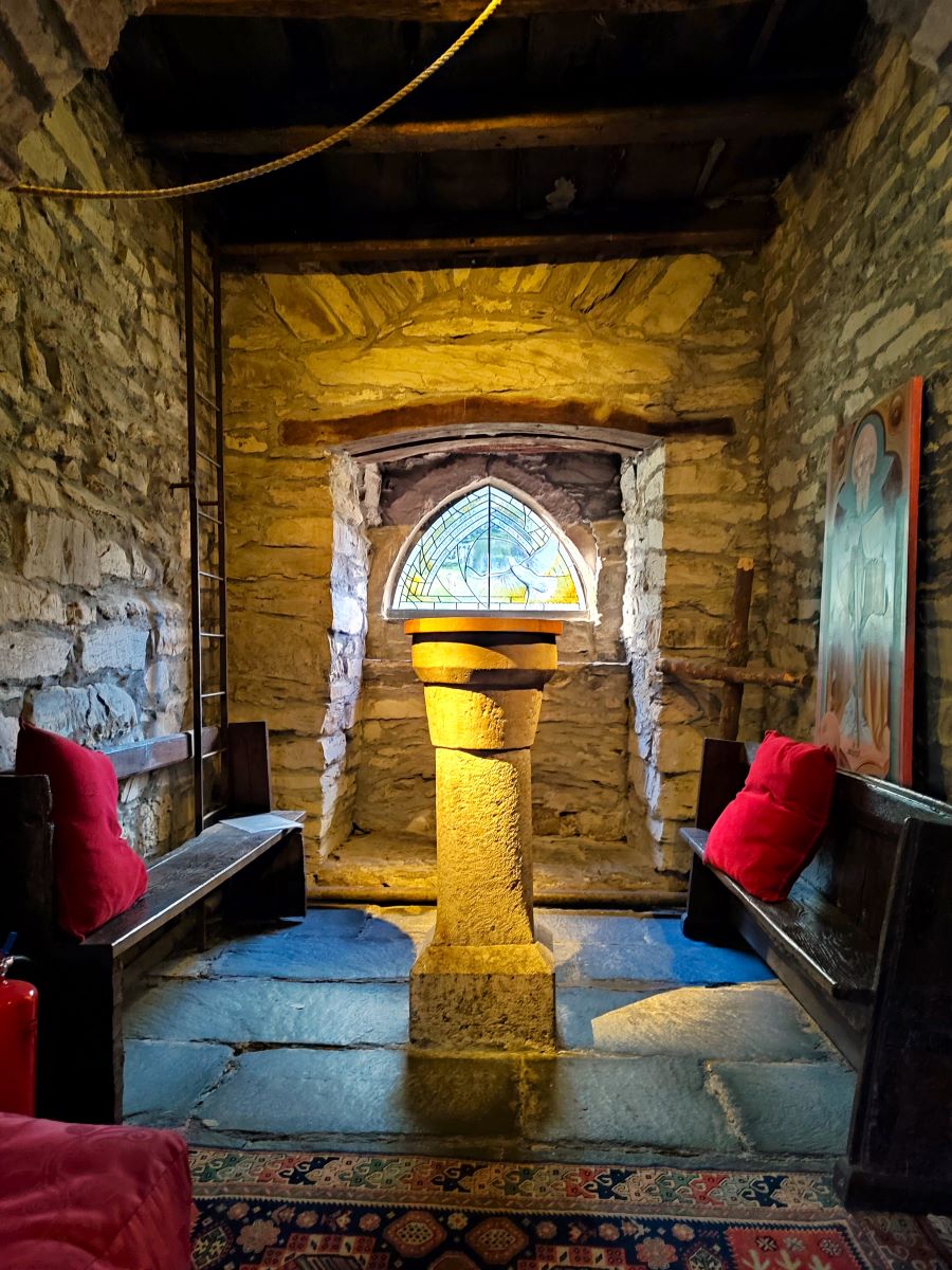

The majority of the stained glass at the altar is 15th Century, and it is thought that it came from Cartmel Priory. The East window shows Christ, St Anthony, St Leonard and small groups of the Seven Sacraments linked by streams of blood from the wounds of the crucified Lord.
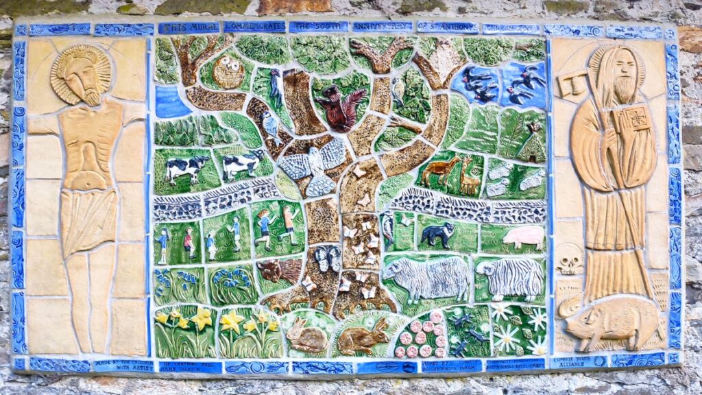
As we leave the church and head up toward the Lychgate, we pass a war memorial that remembers thirteen local men lost in the two world wars, and then arrive at the village hall – once the schoolhouse. An interesting ceramic frieze and an interpretation board are worth taking the time to read before we head South away from the church and down to a small road.
If you visit the church, please repay their hospitality by leaving a donation, and to visit their website – click here
We cross the road and continue in the same direction on the far side, heading through woodland until we arrive at a minor road where we head left for a while. We follow this road down to a staggered crossroads. The road we are crossing is the larger of the two and we need to make sure we carry straight on, on the smaller track ahead.
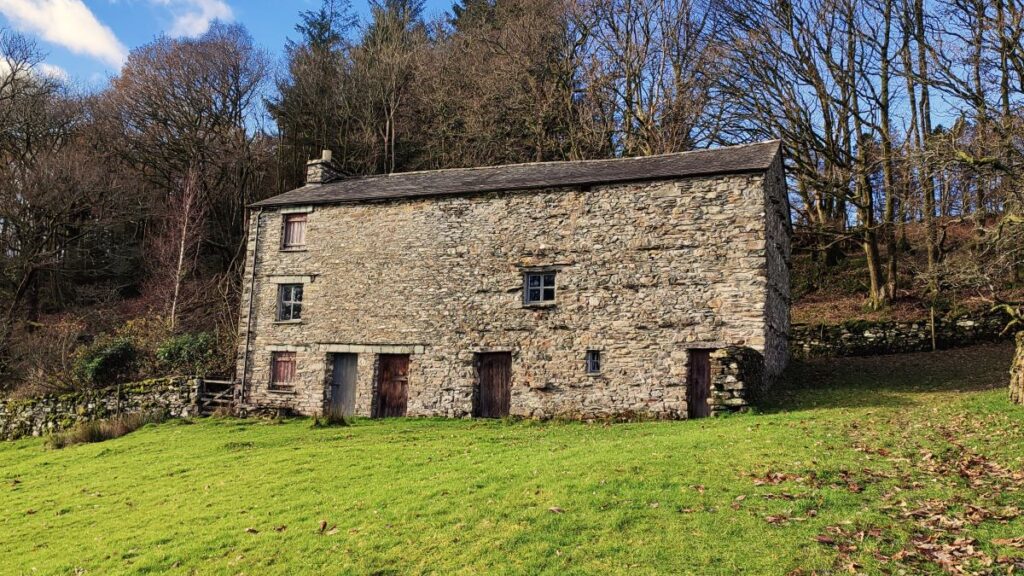
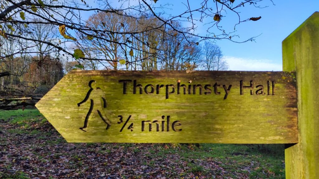
We follow the path south through the woods, cross Spannel Beck at a small wooden bridge, then walk behind the house at Little Thorphinsty. The path branches here and we need to make sure we keep left – so that we remain on a southerly course through more woodland until we arrive at a road next to a large barn. We head right here and walk uphill past Thorphinsty Hall. This grade II listed building dates back to at least 1708 (there is a dated lintel) but parts of it are probably older, with much remodelling – as indicated by the eclectic collection of window styles.
Just 50m beyond the house we take a marked footpath on the left back into dense woodland – this is Crag Wood. The path initially continues south, until we meet a field within the woodland which we cross to a gate diagonally opposite. We then start to veer right such that we end up heading west – in practice this is not especially noticeable on the ground as the path meanders around trees in a way that defies such straight line thinking. Be prepared for the last section of Crag Wood to be quite steep though!
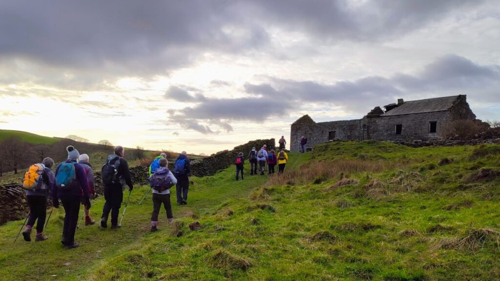
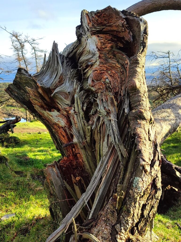
Eventually we arrive at a minor road and couple of buildings. We head right here and then see a fingerpost – we take the route to Simpson Ground, which takes us up to a wonderfully atmospheric derelict farm at Pattison How: The large scale of the building and the quality of the masonry are something of a surprise here – the building is now in a desperate state, but was clearly in use in the recent past – as evidenced by the fireplace still intact in the lower left hand room.
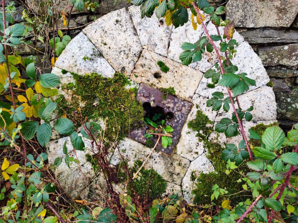
The path continues past the derelict farm and swings round slightly to the right – we need to look for a stile in the drystone wall opposite and then take the potentially boggy path up to the next set of farm buildings at Simpsons Ground. The path crosses two wooden footbridges and then heads to the left through the farm buildings and up the track toward the woodland. On the way, we pass a set of three millstones and then take a path signed as a bridleway to Staveley in Cartmel.
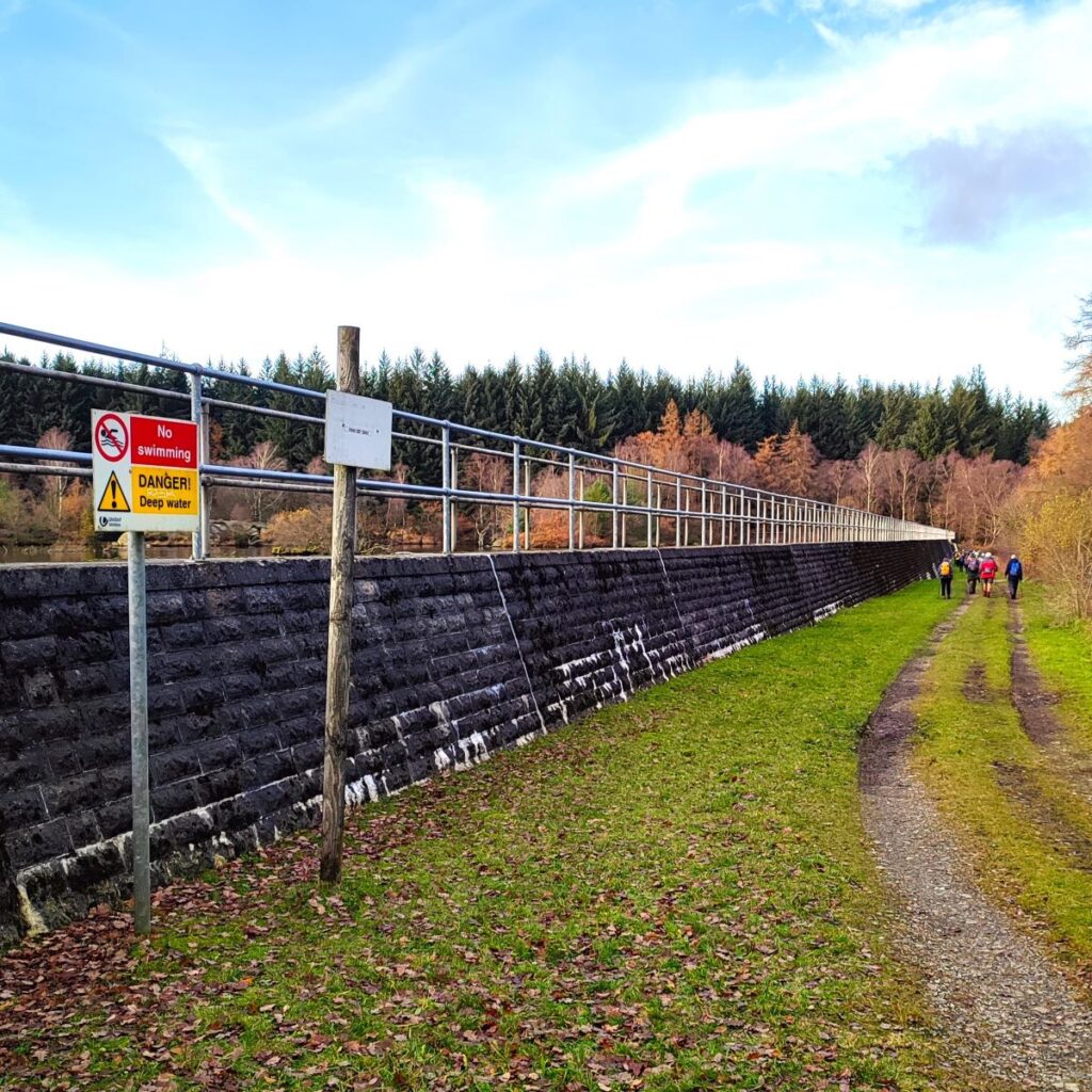
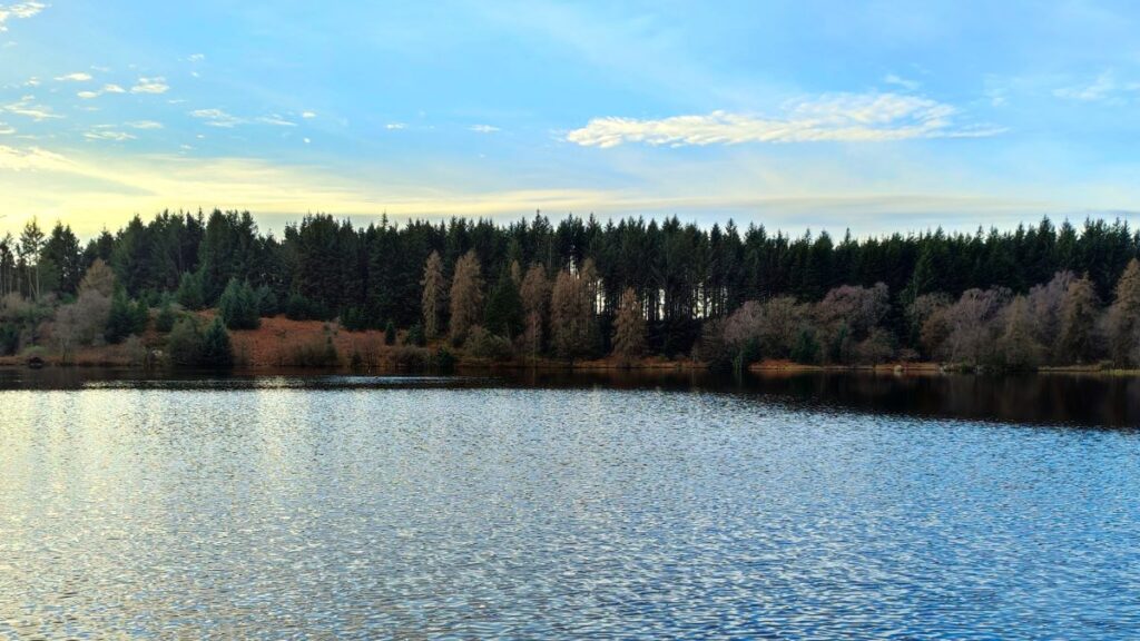
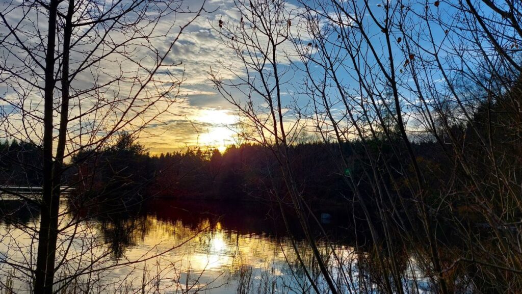
Although Staveley is the destination of the bridleway, it is not where we are going – after just 100m we follow a track round to the right to find the dam at the end of a the Simpson Ground Reservoir – which supplies fresh water to Grange-over-Sands. We walk along the front of the dam and then pick up a path at the far end which heads round to the right through more woodland.
The path heads northeast for a while now – though as before it meanders around amongst the tress so will not feel like a straight line. We eventually exit into more open land to see the path fork – we keep left and then stay with the path as it bears left to bring Sow How into view again. We are on the home straight now.
We walk back up through the farm and then back onto the lane we used earlier in the day, following it almost all the way back to Fell Foot Brow. Just 50m before we get that for though, we see a footpath on the left which takes us back through woodland to the car park where we started.
Interesting Links . . .
Click here for a panorama video
Click here for a panorama video from an alternate location