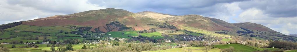
Moderate

Claughton

7.5 miles | 12.1 km | 274 m Ascent | 8.9 Naismith miles | Alison Kinder & Colin Stroud
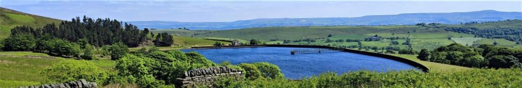
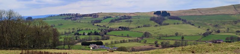
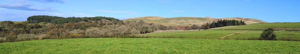
The road journey form Bentham to Lancaster is relatively mundane, making it easy to forget that that there are good walks on either side of the main road – as this excellent route shows. We start from the Bull Beck parking area on the A683 just east of Caton, then walk over fields to Brookhouse. A quiet country road takes us up to the wind farm at Caton Moor, with fantastic views across the valley and Morecambe Bay, before we head back down to the main road passing the quarries that feed the Claughton Brick works. We then cross the road and pass more evidence of the area’s railway history before coming through fields at the back of the brickworks to follow the banks of the Lune back to Bull Beck.
We list this walk as a “moderate” challenge, simply because it’s just over our 12km threshold. The route is generally quite easy and there are relatively few stiles, so if you normally prefer “easy” walks, don’t discount this one.

Claughton Read More »

Pendle Hill

8.4 miles | 13.5 km | 479 m Ascent | 10.8 Naismith miles | Ed Badley
Infamous for its links to the witch trials of 1612, Pendle Hill and the surrounding villages are a lovely part of the Forest of Bowland Area of Outstanding Natural Beauty (AONB). Bentham Footpath Group explored the Sabden Valley in an earlier walk (https://benthamfootpathgroup.co.uk/sabden-valley/) and have climbed Pendle hill before – though prior to logging our walks on our website.
For this walk we climb Pendle Hill again, starting from the Nick of Pendle on the Clitheroe Road. Rather than walking on the road to start the climb, we cross and head west to pick up the Ribble Valley Jubilee Trail at Parsley Barn, and then cross the road higher up, to head up Pendleton Moor. Instead of taking the direct route up Pendle Hill though, we veer left and circle round it via Mearley Moor and Pendle Moor before reaching the peak. Our return route is via Boar Clough then Ogden Clough, before climbing Black Hill to gain great views over Churn Clough reservoir. From there it’s an easy walk back to the Nick. Although classed as “moderate”, be aware that this walk can be challenging in poor weather.

Pendle Hill Read More »

Ravenstonedale and Smardale

7.8miles | 12.6 km | 328 m Ascent | 9.5 Naismith miles | Jim Shuttleworth
Bentham Footpath Group has enjoyed many good walks in the Howgills. This time we go just a little bit further North and explore Ravenstonedale, Smardale and the fantastic Smardale Gill Viaduct.
The viaduct alone is worth the trip, but this walk offers much more: a thriving nature reserve, great views back to the Howgills and Wild Boar Fell or across to Brough Castle and Warcop Fell, industrial archaeology, and free parking within walking distance of two award winning pubs.
Much of the route is on accessible paths so although the walk is long enough to be classed as moderate, it’s not too challenging and there are some potential shortcuts.

Ravenstonedale and Smardale Read More »

Furnessford & Hindburn Bridges

8.5 miles | 13.6 km | 361 m Ascent | 10.3 Naismith miles | Susan Badley
Bentham Footpath Group Walks generally start within an hour’s drive of Bentham – there is so much wonderful walking country within that radius that we are always spoiled for choice. This excellent walk – aided by near perfect weather – highlights the fact that Bentham itself is a great place to start a walk.
We start in low Bentham and cross the Wenning at the pedestrian bridge were the Silk Mills once stood, and then head up Mill Lane as far as Kirkbeck where we take paths across fields to Mewith lane and then across to Spens Farm.
We cross the Hindburn for the first time at Furnessford Bridge, and then head over to Cragg Hall, before descending back to the river to cross at Hindburn Bridge. From there we head up to Mealbank and take paths across fields to follow the Wenning Valley upstream with great views across to Ingleborough and Whernside along the way. Passing Robert Hall, we head down Eskew Lane and back to Low Bentham.

Furnessford & Hindburn Bridges Read More »

The Two Langdales

8.8 miles | 14.2 km |462 m Ascent | 11.1 Naismith miles | Alison Kinder & Colin Stroud
The two Langdales referred to in the title are Great Langdale and Little Langdale – in effect two parallel valleys separated by Lingmoor Fell.
Starting from Elterwater, we head up the valley along the gentle woodland paths of Great Langdale with Lingmoor Fell on our left and Chapel Stile on the right across a surprisingly flat valley with very steep sides. We then follow the direction of the beck upstream to Oak Howe where we pick up the Cumbria Way enjoying fantastic views of Dungeon Ghyll Force as we follow the path round the back of Side Pike to cross over a short but steep ridge into Little Langdale.
Pausing at the top of the ridge we have great views up Langdale and Oxendale, before we follow the path round and descend into Little Langdale, passing Blea Tarn on the way. A short road section on the Wrynose Pass road takes us down to Fell Foot Bridge where we head across fields to Slater Bridge and Little Langdale Tarn before we pick up a track back to Elterwater.

The Two Langdales Read More »

Dent Foot

8.1 miles | 13.0 km | 234 m Ascent | 9.3 Naismith miles | David Longton
Sedbergh is a favourite location for The Bentham Footpath Group, as is Dent, so surely there’s a walk based between the two that captures the best of both? There is – and this is it -typical Yorkshire Dales walking but with views of the Howgills.
We start next to the River Rawthey, just north of where it merges with the Lune, and track upstream toward Sedbergh, passing the confluence with the Dee, but staying with the Rawthey at first. We then cross the river and head to Millthrop, to pick up the Dales Way path which takes us down to Gate Manor in Dentdale. We then cross the Dee to return along the other side of Dentdale via Rash and Dent Foot, before skirting Holme Fell to arrive at Middleton Bridge via a Roman road. A short stroll back along the Rawthey concludes the walk.

Dent Foot Read More »

Sabden Valley

7.8miles | 12.6 km | 325m Ascent | 9.4 Naismith miles | George Sheridan
Bentham Footpath Group is lucky enough to have easy access to The Yorkshire Dales, The Lake District, and as for this walk, the Forest of Bowland. This 803km2 Area of Outstanding Natural Beauty (AONB) features a southern section known as the Forest of Pendle, which includes Pendle Hill, and the Sabden Valley. Pendle Hill is a great walk, and one that the Footpath Group have walked before, so this time we explore the Sabden Valley.
We start at the Nick of Pendle, taking a South-westerly route down one side of the valley before crossing the Sabden Brook, and returning to Sabden Village on the opposite side. The second half of the walk takes us out to the East as far as Dean Farm from where we return via Churn Clough Reservoir.

Sabden Valley Read More »

Pikedaw Hill and Malham

7.8 miles | 12.6 km | 525 m Ascent | 10.5 Naismith miles | Sandra Craggs
Malham is one of the “honeypot” villages of the Yorkshire Dales – and the use of the Cove as a backdrop for filming “Harry Potter and the Deathly Hallows” has made it even more popular. There’s more to this area than the Cove though – stunning as it is – and if you pick a weekday out of season, you can still enjoy a quiet walk. This moderately challenging walk starts in Malham, with a steep climb up Pikedaw Hill, offering great views back to Malham and over toward Pendle.
We pass Nappa Cross, then head down the spectacular dry valley at Watlowes to the top of the Cove, where we take the Dales Highway path to Goredale Bridge and return to Malham village via the always delightful Janet’s Foss path. We grade the walk as moderate, but be aware that the first section is relentlessly steep, and potentially quite boggy – and that the dry valley requires particular care.

Pikedaw Hill and Malham Read More »

Whitsundale from Keld

8.1 miles | 13.1 km | 578 m Ascent | 11.0 Naismith miles | Jim Shuttleworth
Swaledale is a great place to walk, and Keld is always a good place to start; There is convenient parking at Park Lodge farmyard with a handy tearoom serving locally made ice creams during the summer season.
Swaledale is famous for its fast flowing river, and this is so because a number of side dales each with their own river merge with the Swale within a short distance of each other.
As well as Swaledale itself, this moderate walk visits three of the side dales that connect with Swaledale – East Stonesdale, West Stonesdale and Whitsundale.
Most of the route is on clearly marked paths – some of them long distance routes, and there is some road walking on quiet roads, so navigation should be simple. Be aware through that Swaledale can be very wet, and as you can see from the gallery, winter walks in this area can damp and windy. Don’t let that put you off though – this is a walk to savour at any time of the year.

Whitsundale from Keld Read More »

Cowan Bridge, Ireby and Masongill

7.5 miles | 12.0 km | 299 m Ascent | 8.9 Naismith miles | Mary & Kate Taylor
Although Bentham Footpath Group regard anywhere in the Yorkshire Dales, the South Lakes or Forest of Bowland as “home”, this walk really is local – and it reminds us just how much wonderful walking lies on our doorstep.
This route takes the form of a figure 8, so there are clear opportunities to walk either loop independently, or to combine them as we have here, to create a moderate walk with great views.
We start with a pleasant stroll along Leck Beck, then take a quiet road up Leck Fell before heading down green lanes to Todgill farm – where the two loops of the walk cross – and from there to Ireby. We then go via Over Hall and Stirragap to Masongill, and back over fields to Ireby again. We then follow a quiet lane back to Cowan Bridge via Leck.

Cowan Bridge, Ireby and Masongill Read More »