Moderate

Train to Horton-in-Ribblesdale then walk to Settle

8.6 miles | 13.8 km | 429 m Ascent | 10.7 Naismith miles | Sandra Craggs
Most of the walks that Bentham Footpath Group offer are circular – that’s not a policy, just a practical constraint. However, the fact that one of the most scenic railway lines in the UK runs through “our patch” offers the opportunity to add linear walks where we let the train cover one half of a larger loop.
This walk does just that – we start from Settle and then take the train to Horton in Ribblesdale, before walking back.
There are many ways we could plan a walk from Horton to Settle, and in this case we opt to take a route via Brackenbottom and Dub Cote, before picking up the Pennine Journey and then Ribble Way paths to take us to Stainforth. We then climb Stainforth Scar past Lower Winskill, and then descend into Langcliffe before taking a quiet lane back into Settle. This involves a number of ascents – none of them too challenging, but together placing this walk at the top end of our “moderate” category.

Train to Horton-in-Ribblesdale then walk to Settle Read More »

Buckden to Yockenthwaite

8.3miles | 13.3 km | 262 m Ascent | 9.6 Naismith miles | Sandra Craggs
In February 2024, Bentham Footpath Group visited Kettlewell and walked up to Starbotton – where we crossed the river Wharfe. It occurred to us at the time that just a few miles further upstream was Buckden, another great starting point for walks in the Upper Wharfe valley. So, this time we drive just a little further and base ourselves at the convenient Yorkshire Dales National Park car park in the village and head out on the Pennine Journey path through Rakes Wood, along Buckden Rake, and on to Cray High Bridge where we enjoy the waterfalls. From there we head to the opposite side of the valley and walk down to Cray where we pick up a path that contours around the steep sides of Langstrothdale Chase above Hubberholme before falling to Yockenthwaite.
We then head back down the riverside path, now on the Dales Way, and soon arrive at Hubberholme and its beautiful church before finishing with a gentle stroll back to Buckden. As well as waterfalls, this walk offers great views, limestone pavements, ancient woodlands, and locations that you may well recognise from the TV series “All Creatures Great and Small”. Why do we start with a picture of a mouse? . . . read on.

Buckden to Yockenthwaite Read More »

Far Moor Bridge and Ribblesdale

7.8 miles | 12.6km | 297 m Ascent | 9.3 Naismith miles | Sandra Craggs
Horton in Ribblesdale is a great place to start a walk, and the “three peaks” are the big draw with Pen-y-Ghent an obvious choice, as is the Sulber Nick route over to Ingleborough.
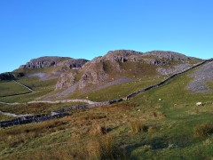
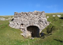
Both are good walks, but there is much else to see in this area, as we show with a route including a tarn, the stunning Far Moor Bridge, disappearing rivers, atmospheric lime kilns, a National Nature Reserve, extensive limestone pavement, and vast quarries, all of which is accessible via the Settle to Carlisle railway. What more could you want? A blue lagoon? – well there was one until recently, and we can offer pictorial evidence.

Far Moor Bridge and Ribblesdale Read More »

Rawthey Bridge

9.0 miles | 14.5 km | 431 m Ascent | 11.1 Naismith miles | Sandra Craggs
The Howgills are always a great place to walk, and autumn can be particularly beautiful with the bracken turning orange, hawthorn berries bright red, the grass still green, and the trees showing hints of purple as they start to drop their leaves. Add to this the many glorious becks and waterfalls, and the relatively secluded paths, and we have a recipe for a perfect day out.
This walk starts at Rawthey Bridge on the A683 then takes woodland paths to Narthwaite. From there, we contour around Wandale Hill using an old Pack horse route to Adamthwaite. We cross Wandale Beck and Stonely Gill and then head back toward Murthwaite, turning just before we get that far, to come back round the eastern side of Harter Fell on a public by-way. We cross the A583 at Fell End and then head up to the waterfalls at Uldale before returning to the start over moorlands at Bluecaster.

Rawthey Bridge Read More »

Pikedaw Hill and Malham

7.8 miles | 12.6 km | 525 m Ascent | 10.5 Naismith miles | Sandra Craggs
Malham is one of the “honeypot” villages of the Yorkshire Dales – and the use of the Cove as a backdrop for filming “Harry Potter and the Deathly Hallows” has made it even more popular. There’s more to this area than the Cove though – stunning as it is – and if you pick a weekday out of season, you can still enjoy a quiet walk. This moderately challenging walk starts in Malham, with a steep climb up Pikedaw Hill, offering great views back to Malham and over toward Pendle.
We pass Nappa Cross, then head down the spectacular dry valley at Watlowes to the top of the Cove, where we take the Dales Highway path to Goredale Bridge and return to Malham village via the always delightful Janet’s Foss path. We grade the walk as moderate, but be aware that the first section is relentlessly steep, and potentially quite boggy – and that the dry valley requires particular care.

Pikedaw Hill and Malham Read More »