Easy

Oxenholme round

7.2 miles | 11.6 km | 271 m Ascent | 8.6Naismith miles | Alison Kinder & Colin Stroud
Kendal styles itself as “The gateway to the Lakes”, and it is indeed a good base for those wishing to explore the southern end of the Lake District. The surrounding countryside also has much to offer in its own right– as we see in this walk.
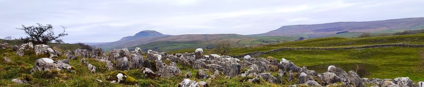
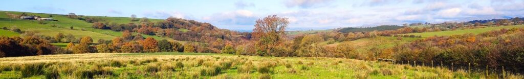
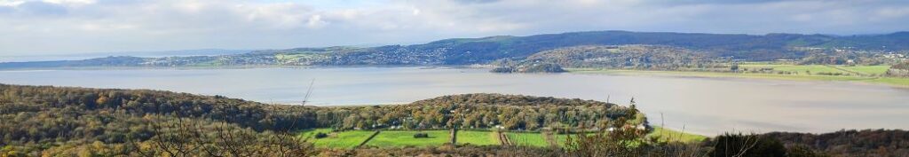
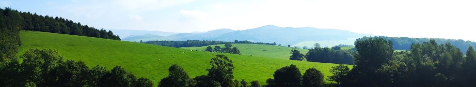
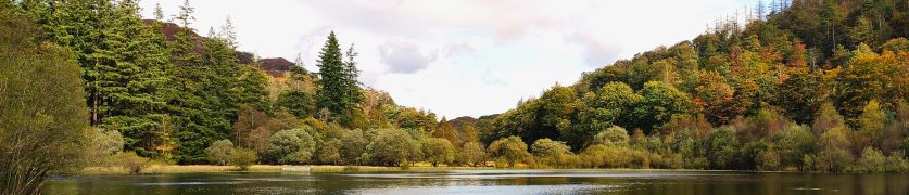
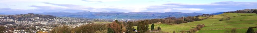
From convenient parking close to Oxenholme station, we start by climbing the Helm, gaining great views of the Lakeland Fells, the Howgills, and Morecambe Bay. From there we descend past an ancient fort, and a curious folly to pick up St Sunday’s Beck which we follow upstream to the delightful Bleasehall Wood. We note a syphon well before taking an isolated green lane to St Sunday’s Bridge and from there we head to Hawkrigg. The return leg involves a brief but quite steep climb up the aptly named Windy Hill, and then it’s a steady descent to the finish. We show this as an easy walk because it is (just) less than 12 km – but the consensus from the group was that it “feels more like a medium”.

Oxenholme round Read More »

Norber erratics from Clapham

6.9 miles | 11.0 km | 249 m Ascent | 8.1 Naismith miles | Mary Taylor
Bentham Footpath Group travel up to an hour or so to get to the start of our walks. This generally works well, but given that we already live in paradise, we sometimes find ourselves thinking – why not just stop here and just walk our own patch? So that’s exactly what we do on this walk.
The Norber erratics are well known, and one of the “tick list” attractions in the Yorkshire Dales. The usual starting point would be Austwick – and we have in the past walked from there, but this route extends the day and gives us a chance to take in Clapham and Wharfe, as well as Austwick.

Norber erratics from Clapham Read More »

Levens and Heversham

6.0 miles | 9.6 km | 205 m Ascent | 7.0 Naismith miles | Don Cartledge
A quick glance at our website shows that Levens is a firm favourite of the Bentham Footpath Group, and this easy walk demonstrates exactly why – it’s convenient to get to, offers easy walking, is packed with interesting locations, landscaped parks and industrial heritage, as well as offering stunning views back to the Yorkshire Dales, of the Kent estuary, and over to the Lake District fells.
The route we present here overlaps in places with a number of our other walks – the great advantage of this is that you can use this as the basis for longer or more challenging days out by adding sections from the connecting routes.

Levens and Heversham Read More »

Ingleton Circular via Fell Lane

4.1 miles | 6.6 km | 197 m Ascent | 5.1 Naismith miles |Alison Kinder & Colin Stroud
This walk was designed to be brief such that as a group we could meet as usual yet be finished in time to reconvene with friends and family at the Old Sawmill in Clapham for a convivial meal.
Don’t go thinking that this walk is any the lesser for being short and sweet though – it goes far enough up Fell Lane (one of the routes up Ingleborough) to give good views of the peak, and we have Ingleton and the Lune Valley to enjoy too.
A brief look at the OS map will show that this walk intersects with many other footpaths so there are ample opportunities to extend or modify the route – or simply enjoy it as it is: An easy but enjoyable walk that can be slotted into the day with minimal planning.

Ingleton Circular via Fell Lane Read More »

Bolton by Bowland

6.5 miles | 10.5 km | 155 m Ascent | 7.3 Naismith miles | George Sheridan
We head back to the Forest of Bowland for this great and relatively easy walk from the pretty village of Bolton by Bowland, creating a great opportunity to combine the walk with a visit to the village – which boasts two great pubs and a very interesting church.
We start at a free car park next to the road bridge over Skirden Beck and then follow the beck upstream to Oak Trees Nursery. A short section on the road takes us up to Forest Becks, where we pick up Monubent Lane, which we follow as far as Monubent Head. From there we cross Fooden Moor until we get to Raygill Moss where we pick up the Ribble Valley Jubilee Trail. This takes us to Fooden, where we start to see the Ribble over to our left. We then follow the Ribble Valley down to the estate where Bolton Hall once stood and walk back into Bolton by Bowland via the estate grounds. We then stroll through the village, passing the church, the two greens and one of the pubs.

Bolton by Bowland Read More »

Giggleswick Scar 2

5.4 miles | 8.6 km | 249 m Ascent | 6.6 Naismith miles | Sandra Craggs
In recent walks we have travelled further afield and enjoyed some stunning scenery. Sometimes though, it’s nice to remind ourselves just how beautiful our own area is – and this walk is a perfect way to do that.
This easy route is a shortened version of our earlier Giggleswick Scar walk and makes an ideal half day stroll. We start from The Mains in Settle and then head up to Stackhouse via Lord’s Wood. We then take the Pennine Journey path round the back of the scar, as if heading to Feizor, but before we get that far we find a fingerpost which indicates the path returning to the front of Giggleswick Scar.
The top edge of the scar gives us great views to the south and lots of interesting limestone features including caves and cairns, before we arrive at the Schoolboy Tower. We then circle round the now disused quarry and then wrap things up by heading back down to Lord’s Wood and our cars. Two added benefits for this walk are that starting from Settle makes it accessible by Public Transport, and adding Elaine’s Tea Rooms would be an easy (2km) extension.

Giggleswick Scar 2 Read More »

Tatham Fells

6.4 miles | 10.4km | 344 m Ascent | 8.2 Naismith miles | Mary Taylor
Members of the Bentham Footpath Group tend to consider the Yorkshire Dales, the Forest of Bowland, and the South Lakes as their walking territory. This relatively easy walk is at the North end of the Forest of Bowland and is very local to Bentham – so much so that many of the farms, and other buildings that we passed along the way hold important personal memories for those in the group lucky enough to be born and bred in and around Bentham.
For the rest of us, this is still a great walk in a timeless landscape that never gets busy – despite the idyllic autumn weather we enjoyed, we passed no other walkers, and the only people we met all day were residents pottering in their gardens and making the most of the sunshine before winter sets in.
Although we consider this walk to be “easy” based on the total distance and elevation change, you should be aware that Tatham Fells are poorly drained, and so the ground can be very wet. This can make the walk feel longer than stated but on the other hand wet weather makes the rivers and becks we cross so much more attractive.

Tatham Fells Read More »

Heathwaite Coastal

5.3 miles | 8.5 km | 243 m Ascent | 6.5 Naismith miles | Alison Kinder & Colin Stroud
We are lucky enough to live in a location that gives us easy access to some of the most beautiful countryside in the UK, and we immediately think of the Lake District, the Yorkshire Dales, and the Forest of Bowland in this context. To that list we must surely add the Arnside and Silverdale Area of Outstanding Natural Beauty (AONB) – a compact but varied area that offers a wide variety of scenery, flora and fauna: One of the smallest AONBs, it covers just 75 km2 between the Kent Estuary, the River Keer and the A6.
This easy walk starts from the ever popular seaside village of Arnside, then takes a route along the coastal fringe of the Kent Estuary, looping round to Morecambe Bay at Far Arnside before returning via Heathwaite and onto Arnside Knott with its fantastic viewpoint. We end with a view of the fabulous gnarled trees on the Knott – complete with artworks – before taking a woodland route back to Arnside.

Heathwaite Coastal Read More »

Gargrave and Eshton

6.3 miles | 10.2 km | 170 m Ascent | 7.2 Naismith miles | Peter Lennard
It’s easy to overlook Gargrave as you drive through on the A65, and it would be a mistake to do so: Gargrave is a great place to start a walk, with the added advantage that there are pubs, cafes, and an interesting variety of shops to enjoy. Parking is free and there are good quality public toilets.
Still not convinced, then add a walk that includes the Leeds Liverpool canal, parts of the Pennine Way, Country houses, enchanting wells, great views of Sharp Haw, a peaceful memorial garden, a curiously ornate lime kiln, and weather station. Where else other than the Yorkshire Dales would you find so much interest in just six miles?

Gargrave and Eshton Read More »

Tarn Hows

6.1 miles | 9.8 km | 261 m Ascent | 7.4 Naismith miles | Kate Rowe
One of the things that differentiates the Lake District from the Yorkshire Dales is the impervious nature of the rock, which means that lakes and tarns can form in valley bottoms – in the Dales water drains though the limestone.
This easy walk focusses on tarns rather than lakes: Tarn Hows was originally three separate tarns, which after landscaping by a former landowner became one larger tarn with water levels controlled by an overspill which feeds a spectacular waterfall.
Our route takes us up the side of that waterfall, round the tarns, then to the National Trust visitor centre before heading down through Tarn Hows Wood to Low Yewdale, then on to High Yewdale, over Shepherd’s Bridge, and then through Harry Guards Wood to Yew Tree Tarn. A lovely stroll around the tarn and then a short woodland section completes the walk.

Tarn Hows Read More »