Easy

The Tolkein Trail

6.8 miles | 11.0 km | 164 m Ascent | 7.6 Naismith miles | David & Sheila Longton
Think of Tolkein and Middle Earth, and many people will think of New Zealand – largely because The Lord of the Rings trilogy was filmed there. But where is Middle Earth in reality?
We can all agree that Great Britain is the centre of the civilized world – nowhere eats more custard cream biscuits. We also know from our Dunsop Bridge walk that the centre of Great Britain is within the Forest of Bowland.
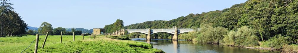
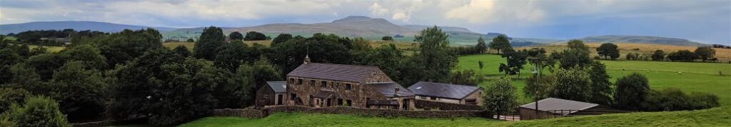
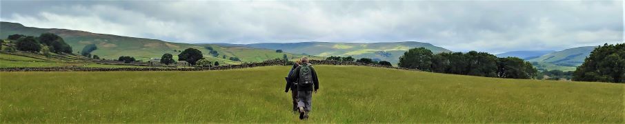
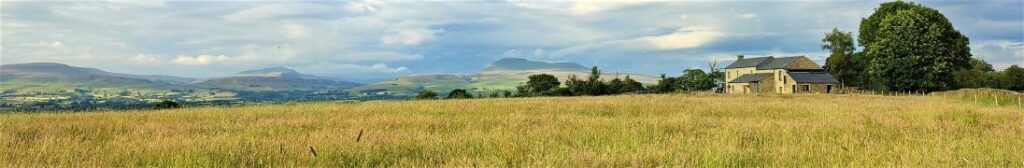
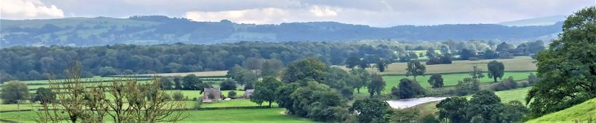
When we find out that Tolkein stayed at Stonyhurst College near Clitheroe whilst writing his masterpiece, it all falls into place: Middle Earth is the route we walk here. We start at Hurst Green, then walk down to the banks of the Ribble, past the confluence with the Calder, upstream to the union with the Hodder, then along the Hodder to pick up a path through the grounds of Stonyhurst College to return to Hurst Green. This excellent easy walk takes less time than watching the films.

The Tolkein Trail Read More »

Lune Bridges

7.0 miles | 11.3 km | 140 m Ascent | 7.7 Naismith miles | Graham Cooper
Driving through Caton on the A683 is a frequent occurrence for those of us luck enough to live in or around Bentham, and so it’s easy to forget that Caton is a great place to start a walk.
It offers easy access to the river Lune, and the Millenium Park path, or as our Claughton or Annas Ghyll Walks showed, the moors above Brookhouse.
For this walk, we again start at Bull Beck and then take riverside paths down the Lune to the Crook O’Lune bridge before returning on the other side of the river using the millennium way. The route is a figure of 8 shape so there’s an obvious opportunity to split it into two shorter walks if time is pressing or you want to explore Halton or kill time lazing by the river.

Lune Bridges Read More »

Hampsfell from Grange

4.5 miles | 7.2 km | 350 m Ascent | 6.5 Naismith miles | Alison Kinder / Colin Stroud
A good number of Bentham Footpath Groups walks have centred on Silverdale, and on those we always enjoy views over the Kent estuary toward Hampsfell. In this walk we climb Hampsfell and look the other way, using the viewing platform at the Hospice as our highpoint.
We have walked in this area before, using Cartmel as our starting point offering a walk with moderate challenge, so this time we offer slight variation – we start from Grange over Sands and make the walk shorter and easier. The aim here is to give the opportunity to spend time in Grange exploring what this delightful town has to offer.

Hampsfell from Grange Read More »

Brock Bottom and Beacon Fell

6.8 miles | 11.0 km | 215 m Ascent | 7.9 Naismith miles | Peter Lennard
Of the areas that Bentham Footpath Group walk, the Forest of Bowland is generally the quietest. That’s not to say it doesn’t have its hot spots though, and it’s at one of these – the Beacon Fell Country Park that we start this easy walk.
The Country Park has a number of attractions all within a well defined and quite small boundary, so you could easily augment the walk by adding one or more of . . . a sculpture trail, orienteering challenges, waymarked walks around the site, a barbecue site, viewing points, and a visitor centre with café and toilets. The whole site is a Biological Heritage Site, so you may also see interesting and rare flora and fauna.
Although we start at the Visitor Centre, we soon leave the site and head down to Brock Bottom, where we pick up the River Brock and head upstream passing Brockmill on the way to Gill Barn Wood. We then enjoy great views of Parlick and Fair Snape Fell before climbing back up to the Beacon Fell site where we wander around the Beacon.

Brock Bottom and Beacon Fell Read More »

Settle

7.1 miles | 11.4 km | 592 m Ascent | 10.0 Naismith miles | Bernie & Sheila Garrett
This excellent route showcases just what great walking country we have right on our doorstep. We start from Langcliffe, less than half an hour away from Bentham, and then fill the day with the kind of walking that you might see on one of those “celebrity buys some walking boots” TV shows.
We head out of Langcliffe on the Pennine Journey path, hop over to the Pennine Bridleway, and then take a footpath up to Victoria Cave, which we explore for a while before walking along the base of the wonderful Attermire Scar.
We follow that round, passing under the entrance to Horseshoe Cave, before heading over to Stockdale Lane with great views over to Pendle Hill, and Rye Loaf Hill. We then cut back along a footpath between High Hill and Sugar Loaf Hill to arrive at the base of the Warrendale Knotts. From here we retrace our outbound journey – although in this direction the views are surprisingly different -and then as a bonus treat, pop up to the smaller Jubilee Cave. The final part of the walk follows our outward route back to Langcliffe.

Settle Read More »

Blease Fell & Tebay Gill

6.2 miles | 10.0 km | 321 m Ascent | 7.8 Naismith miles | George Sheridan
The Howgills are a great place to walk – and a firm favourite of the Bentham Footpath Group. The hills here are formed from Ordovician and Silurian rocks, rather than the Carboniferous limestone elsewhere in the Yorkshire Dales, giving them a characteristic rounded appearance and a lovely velvety texture.
The Howgills are found in the triangle between Sedbergh, Kirkby Stephen and Tebay, and its to the latter that we go for this walk.
We start in Tebay village, and then head up onto the hills following the edge of Tebay Fell to the south with great views over the valley to Borrowdale until we get to the peak of Blease Fell where the vista down the Lune Valley as far as Morecambe Bay makes the climb seem well worthwhile. We then head round the fell, and back over a flattish top via Hare Shaw cairn, Weather Hill, and Waskew Head to cross Tebaygill Beck at a picturesque stone bridge, before returning to Tebay.

Blease Fell & Tebay Gill Read More »

Keasden Wander

4.5 miles | 7.3 km | 117 m Ascent | 5.1 Naismith miles | Kate Rowe
During the summer months, Bentham Footpath Group generally offers a walk in the evening – the aim is to take a short and easy stroll out of the heat of the afternoon sun, ideally with a brilliant sunset as a backdrop.
Things don’t always work out as we plan though – so although this is a great walk, the weather was not ideal, and our focus shifted to rainbows, brooding skies, unseasonably early fungi and unexpected streams – all equally beautiful in their own way.
Shorter walks mean that it makes sense to start nearer to home, so we set off from Keasden Church just 5 miles from Bentham, and then took a meandering route made up of three intersecting loops – hence the name “Keasden Wander”. Each of those loops offers an opportunity to shorten the route, or indeed to connect with other paths to extend it, so as well as being a good walk in its own right, this route can be the basis for a longer full day of walking.

Keasden Wander Read More »

Whitbarrow

6.7 miles | 10.8 km | 346 m Ascent | 8.5 Naismith miles | Terri Kwiecinska
In April this year, Bentham Footpath Group enjoyed a great walk at Storth and Arnside – that walk starts with a great view over the Kent estuary toward Whitbarrow Scar. This time we are on the other side of the estuary climbing Whitbarrow Scar and exploring the interesting geology of the area.
Whitbarrow Scar is designated as a Site of Special Scientific Interest, a National Nature Reserve, and a Special Area of Conservation, but still manages to offer easily accessible walks without being too crowded.
The route we take is loosely based on the Whitbarrow Geotrail – you can purchase a booklet describing that at the starting point. If geology is not your thing don’t worry – there are great views, fossils, birds of prey, abundant wildflowers, monuments, abandoned mines, forest trails, and newts to be seen too.

Whitbarrow Read More »

Hawes Mosaics (Part 2)

7.2 miles | 11.6 km | 261 m Ascent | 8.5 Naismith miles | Kate Rowe
In January 2023, Bentham Footpath Group enjoyed a fine walk from Appersett exploring parts of the Hawes 2000 Mosaic project. We saw about half of the 22 mosaics on that day, and we finish the task with this equally fine walk.
Starting from Hawes town centre, we head up to Burtersett, take Shaws Lane to Gayle, then head up Sleddale to see Aysgill Force. We return along a Green Lane back toward Gayle, before taking a final detour along Bands Lane and then the Cam Road.
A (very) brief section on the B6255 brings us to a path back over fields into Hawes. This is a great walk with fine views, add in the mosaics, a roman road, an impressive waterfall, and all the delights of Hawes, and we have a recipe for a perfect day.

Hawes Mosaics (Part 2) Read More »

Two counties walk

5.7miles | 9.2 km | 181 m Ascent | 6.6 Naismith miles | Mary Taylor
This easy route – ideal for a summer evening stroll – starts from Bentham and heads into open countryside to the South of the town, passing Lower Flannagill before entering Lancashire at Moorlands. We then go via Fleet House to Whitepits Lane, and then follow County Beck, which marks the county boundary, up to Oakhead.
We head west for a while before passing Oak Bank on the way to Mewith Lane and the County Beck again. We follow this – still in Lancashire – until we get to Kirkbeck where we cross back into Yorkshire, and head across fields back to Bentham.
This walk offers a variety of excellent views, wild flowers, glimpses of old mining activity, and lots of livestock. There are no steep climbs, but sections have the potential to be boggy after wet weather.

Two counties walk Read More »