Dales Hike

Lancaster – City country and coast

7.5 miles | 12.1 km | 139 m Ascent | 8.2 Naismith miles | Sandra Craggs
A couple of years ago, we tried an interesting experiment – we started a walk in the centre of Lancaster and included a significant rural element in our route. That walk was a great success, and with a little time having passed we thought it worth re-running with a few minor changes to the points of interest we visit in the city centre.
Starting from Sugar House Alley, we walk through the city centre to the Lancaster Canal where we head South along the towpath – this gives a very urban view of Lancaster and its industrial heritage.
We leave the canal just after the west coast main line railway bridge, and head down a side street into the Fairfield Association Nature Reserve. That trail brings us back to the canal at Haverbreaks, and we again head South before leaving almost immediately to take a path through Aldcliffe to the Lune estuary where we take the embankment North through the marshes. Opposite Oxcliffe Hill, we head inland through Freemans Wood and on to Abrahams Heights. We are now back in a very urban environment, heading past the bustle of the railway station and then the Priory and Castle, before returning to the city centre, where we visit more heritage sites.

Lancaster – City country and coast Read More »

Bordley

7.2 miles | 11.7 km | 296 m Ascent | 8.7 Naismith miles | Sandra Craggs
We try very hard when we design our walks: We need to find starting points with suitable parking, and we need to find walks that offer a wide variety of interests on the way round. We need to think about where we can stop for breaks, and we need to think about whether changing conditions might make the route impassible – ideally, with an alternative if that’s the case. Finally, we like to offer great views – because that after all is such a big part of why we go walking in this wonderful landscape.
What we can’t do unfortunately is turn off the fog. So, today’s walk does have brilliant views . . . it’s just that they were hidden by mist and so don’t show on the pictures. Follow the route on a better day and we promise you there’s a lot to see.

Bordley Read More »

Local Walk January 2025

5.2 miles | 8.4 km | 171 m Ascent | 6.1 Naismith miles | Sandra Craggs
The walk for January 9th was scheduled to be at Winster. However, prolonged freezing conditions made the minor roads in that area a significant black ice risk.
We therefore postponed that walk and substituted a local stroll in and around Bentham.
This is the second week in a row that icy conditions have triggered a change of plan, and just as last week, we see this as an opportunity rather than a problem: Bentham is a great place to live, and a great place to walk. The route we present here stands comparison with any of our more distant routes and reminds us how lucky we are to live here.

Local Walk January 2025 Read More »

Askrigg

6.5 miles | 10.4 km | 284 m Ascent | 7.9 Naismith miles | Sandra Craggs
Take a look at any tourist guide to the Yorkshire Dales and they all feature lovely bright midsummer days.
We do get some of those days, and they are indeed special, but perhaps even better are those really crisp wintery days when the ground is hard, the air is crystal clear and the views uninterrupted by haze.
This walk is not one that only works in winter through. Key attractions are Askrigg, the original and true All Creatures Great and Small village, a couple of water mills, long lost dams, waterfalls, perfect views of the Cam High Road, a unique chapel, a couple of fortified houses, a riverside stroll, a brief diversion to a lovely Dales village, magical stepping stones, and finally a visit to a really good café and cake shop.

Askrigg Read More »

Train to Horton-in-Ribblesdale then walk to Settle

8.6 miles | 13.8 km | 429 m Ascent | 10.7 Naismith miles | Sandra Craggs
Most of the walks that Bentham Footpath Group offer are circular – that’s not a policy, just a practical constraint. However, the fact that one of the most scenic railway lines in the UK runs through “our patch” offers the opportunity to add linear walks where we let the train cover one half of a larger loop.
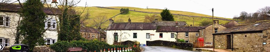
This walk does just that – we start from Settle and then take the train to Horton in Ribblesdale, before walking back.
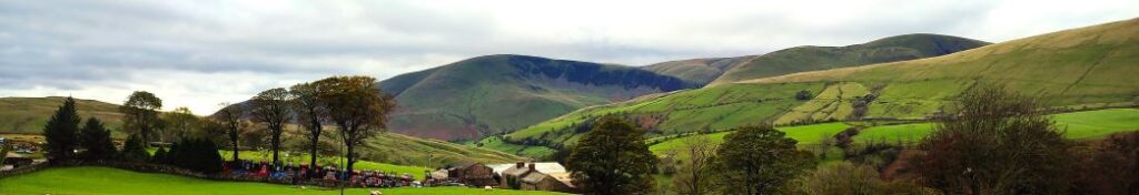
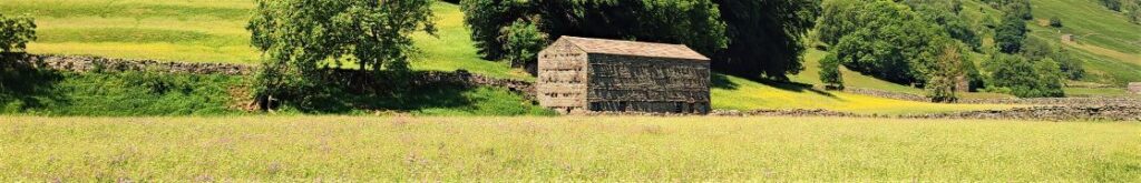
There are many ways we could plan a walk from Horton to Settle, and in this case we opt to take a route via Brackenbottom and Dub Cote, before picking up the Pennine Journey and then Ribble Way paths to take us to Stainforth. We then climb Stainforth Scar past Lower Winskill, and then descend into Langcliffe before taking a quiet lane back into Settle. This involves a number of ascents – none of them too challenging, but together placing this walk at the top end of our “moderate” category.

Train to Horton-in-Ribblesdale then walk to Settle Read More »

Malham Tarn and the Monks Road

9.3 miles | 15.0 km | 392 m Ascent | 11.3 Naismith miles | Sandra Craggs
Malham is one of the great attractions of the Yorkshire Dales, and with good reason: Malham Cove is a spectacular sight – as are Goredale Scar, and Janet’s Foss. Slightly further north, and less crowded, is Malham Tarn – one of a very small number of bodies of water in the Dales, and it is from the car park at the Tarn that we set out on this walk.
We head up Great Close Hill for views of the Tarn and as far afield as Pendle Hill before picking up the Monk’s Road near Middle House Farm. We then head north toward Arncliffe passing a wonderfully atmospheric ruined farmhouse before pausing to look at some of the best limestone pavement in the Dales. From there we follow the Monks Road along the edge of the steep Yew Cogar Scar until we have a spectacular view over Arncliffe and the Littondale Valley. We take in the views over lunch then return along much of the same route but come back to the Tarn via a different path with a pleasant lakeside end to the walk.

Malham Tarn and the Monks Road Read More »

Buckden to Yockenthwaite

8.3miles | 13.3 km | 262 m Ascent | 9.6 Naismith miles | Sandra Craggs
In February 2024, Bentham Footpath Group visited Kettlewell and walked up to Starbotton – where we crossed the river Wharfe. It occurred to us at the time that just a few miles further upstream was Buckden, another great starting point for walks in the Upper Wharfe valley. So, this time we drive just a little further and base ourselves at the convenient Yorkshire Dales National Park car park in the village and head out on the Pennine Journey path through Rakes Wood, along Buckden Rake, and on to Cray High Bridge where we enjoy the waterfalls. From there we head to the opposite side of the valley and walk down to Cray where we pick up a path that contours around the steep sides of Langstrothdale Chase above Hubberholme before falling to Yockenthwaite.
We then head back down the riverside path, now on the Dales Way, and soon arrive at Hubberholme and its beautiful church before finishing with a gentle stroll back to Buckden. As well as waterfalls, this walk offers great views, limestone pavements, ancient woodlands, and locations that you may well recognise from the TV series “All Creatures Great and Small”. Why do we start with a picture of a mouse? . . . read on.

Buckden to Yockenthwaite Read More »

Far Moor Bridge and Ribblesdale

7.8 miles | 12.6km | 297 m Ascent | 9.3 Naismith miles | Sandra Craggs
Horton in Ribblesdale is a great place to start a walk, and the “three peaks” are the big draw with Pen-y-Ghent an obvious choice, as is the Sulber Nick route over to Ingleborough.
Both are good walks, but there is much else to see in this area, as we show with a route including a tarn, the stunning Far Moor Bridge, disappearing rivers, atmospheric lime kilns, a National Nature Reserve, extensive limestone pavement, and vast quarries, all of which is accessible via the Settle to Carlisle railway. What more could you want? A blue lagoon? – well there was one until recently, and we can offer pictorial evidence.

Far Moor Bridge and Ribblesdale Read More »

Kettlewell to Starbotton

6.4 miles | 10.3 km | 335 m Ascent | 8.1 Naismith miles | Sandra Craggs
Kettlewell is one of the “Honey pot” villages in the Yorkshire Dales, and so during the peak of the tourist season, it gets rather crowded – and justifiably so – it’s a lovely place.
However, if you pick a glowering day during February when the weather forecast is gloomy, not only will you have the pick of the parking places, but all the paths will be deserted and if the weather proves to be better than expected you will still get some great views.
This walk takes us from Kettlewell up the Top Mere Road to Cam Head and then down Starbotton Cam Road into Starbotton. We then return along a riverside path enjoying typical Upper Wharfedale views. Although we class this walk as easy, based on the distance and total ascent, be aware that the first section is steep, though there are a couple of benches to take a rest.

Kettlewell to Starbotton Read More »

Giggleswick Scar 2

5.4 miles | 8.6 km | 249 m Ascent | 6.6 Naismith miles | Sandra Craggs
In recent walks we have travelled further afield and enjoyed some stunning scenery. Sometimes though, it’s nice to remind ourselves just how beautiful our own area is – and this walk is a perfect way to do that.
This easy route is a shortened version of our earlier Giggleswick Scar walk and makes an ideal half day stroll. We start from The Mains in Settle and then head up to Stackhouse via Lord’s Wood. We then take the Pennine Journey path round the back of the scar, as if heading to Feizor, but before we get that far we find a fingerpost which indicates the path returning to the front of Giggleswick Scar.
The top edge of the scar gives us great views to the south and lots of interesting limestone features including caves and cairns, before we arrive at the Schoolboy Tower. We then circle round the now disused quarry and then wrap things up by heading back down to Lord’s Wood and our cars. Two added benefits for this walk are that starting from Settle makes it accessible by Public Transport, and adding Elaine’s Tea Rooms would be an easy (2km) extension.

Giggleswick Scar 2 Read More »