Roman Road

Into the heart of Three Peaks Country from Gearstones

6.8miles | 10.9 km | 279 m Ascent | 8.2 Naismith miles | Mary & Kate Taylor
January can be a great time of the year to go walking, but as we have seen over the last couple of weeks, snow and ice can make some routes inaccessible or unsafe. No such problems this week, and it’s great to get back to our published programme.
We start at Gearstones and then set out up the Cam Road on the Dales Way, as far as Cam End where we pick up the Pennine Bridleway which we follow down to the lovely Ling Gill bridge, and the nearby Ling Gill nature reserve. The bridleway contours around Cave Hill to High Birkwith, where we take the Ribble Way over to God’s Bridge, then Nether Lodge, before crossing Thorns Moss on the way back to Gearstones.

Into the heart of Three Peaks Country from Gearstones Read More »

Local Walk January 2025

5.2 miles | 8.4 km | 171 m Ascent | 6.1 Naismith miles | Sandra Craggs
The walk for January 9th was scheduled to be at Winster. However, prolonged freezing conditions made the minor roads in that area a significant black ice risk.
We therefore postponed that walk and substituted a local stroll in and around Bentham.
This is the second week in a row that icy conditions have triggered a change of plan, and just as last week, we see this as an opportunity rather than a problem: Bentham is a great place to live, and a great place to walk. The route we present here stands comparison with any of our more distant routes and reminds us how lucky we are to live here.

Local Walk January 2025 Read More »

Heughscar Hill and Bonscale Pike via High Street ridge

9.4 miles | 15.2 km | 421 m Ascent | 11.5 Naismith miles | Ed Badley
Part of the reason that so many of our group live in Bentham is easy access to the Yorkshire Dales and the Forest of Bowland: We really love these areas.
However, recent walks at The Old Man of Coniston and Askham reminded us just how spectacular the walking in the Lake District can be, so for this challenging route, right at the edge of our “patch”, we start just outside Helton and climb Heughscar Hill to get spectacular views of Ullswater. We then take the High Street (Roman road) down to an atmospheric stone circle before scaling Arthurs Pike and then Bonscale Pike where the scenery is just jaw-dropping. Our return route runs along the edge of the ridge at Barton Fell giving us even more great views. Finally, we return to the cars via the Pulpit Holes at Moor Divock.

Heughscar Hill and Bonscale Pike via High Street ridge Read More »

Chapel le Dale and Ingleborough environs

8.0 miles | 12.9 km | 226 m Ascent | 9.2 Naismith miles | Kate Rowe
Last week’s walk to the Old Man of Coniston from Torver was a real treat, but it’s not a walk that you could decide to do whilst eating your breakfast and be back in Bentham by mid-afternoon.
So, this week we offer a more local walk: For those of us lucky enough to be based in Bentham it is easy to get to, and despite being on the slopes of both Ingleborough and Whernside is generally quiet and peaceful.
We visit a lovely church, see a well-known statue, walk under the most photographed railway viaduct in the UK, have lunch in a nature reserve, before passing close to Viking settlements, seeing some wonderful limestone pavement, and the entrance to a cave. There are great views of the hills all the way along, and you could even have an ice cream or a pub lunch halfway round.

Chapel le Dale and Ingleborough environs Read More »

Askham

8.6 miles | 13.9 km | 317 m Ascent | 10.2 Naismith miles | Susan Badley
As a group, we put a huge amount of effort into researching our walks and scheduling them such that we make the most of the seasons. That diligent planning ensures that when we set out for the Levens Estuary (as we had always planned for this day), we do so safe in the knowledge that we will be enjoying the mid-august sunshine in complete safety.
Sometimes though, the weather doesn’t match our plan, and we find ourselves facing flood warnings on the route we had chosen: We are lucky that our walk leaders have an encyclopaedic knowledge of the area and can create a fresh walk out of thin air at short notice. This walk therefore is just such a piece of magic – a reprise of one that we did a few years ago which feels just as fresh and well prepared as usual. Keep checking the website to see whether we re-run the Spark Bridge and Levens Estuary walk, but in the meanwhile enjoy this excellent alternative.

Askham Read More »

Chapel-le-Dale, Scales Moor and Oddies Lane

7.4 miles | 11.9 km | 206 m Ascent | 8.4 Naismith miles | Mary Taylor
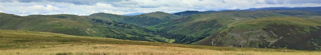
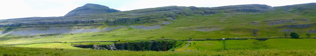
Living in Bentham gives us easy access to the Yorkshire Three Peaks, and many BFG walks have featured them as their main attraction. This walk however takes a route between two of them without climbing either. Does that mean we miss out on points of interest? Not at all – the best views of the peaks are often not from the top.
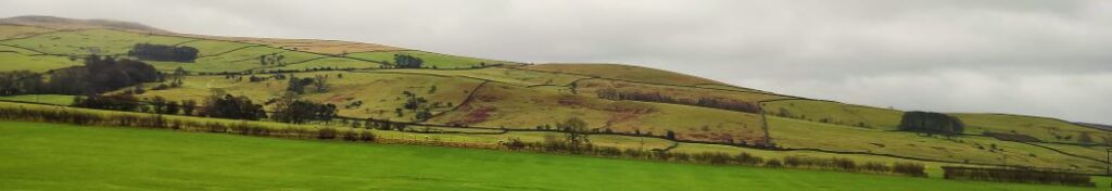
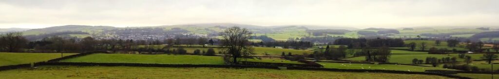
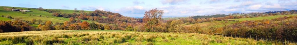
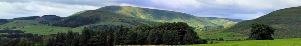
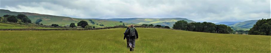
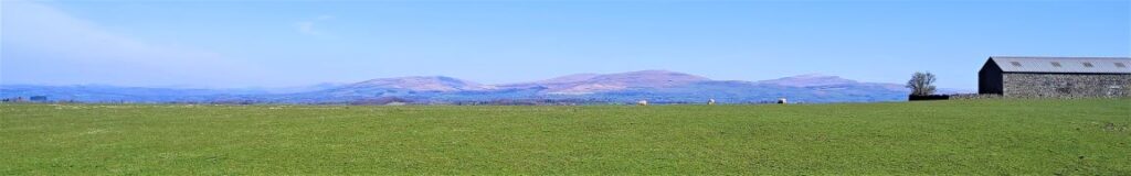
We start at Chapel-le-Dale, using the car park for the lovely St Leonard’s Church, and then head up toward Ellerbeck, passing the interesting Statue of a Warrior by Charles I’Anson. From there we head left onto Scales Moor – in effect the southern slopes of Whernside, seeing some of the best limestone pavement anywhere. Once at Twisleton Scar End, we take a path down to Twisleton Hall, and then on to Oddies Lane – a metalled road, built over the route of a Roman Road, which sees very little traffic. This takes us back to Chapel-le-Dale, with great views of Ingleborough along the way.

Chapel-le-Dale, Scales Moor and Oddies Lane Read More »

Kirkby Lonsdale and Casterton circular

5.0 miles | 8.1km | 164 m Ascent | 5.9 Naismith miles | Don Cartledge
This is one of our shorter walks – partly because we revised part of the route on the day to avoid flooding, and partly because sometimes it’s just nice to offer an easier route that can be used to fill a Sunday afternoon or a spare couple of hours on a balmy summer evening.
Despite being quite compact, this walk packs a lot in – we get to see the dismantled railway line that once linked Ingleton and Sedbergh, via Barbon, we walk on a Roman road, pass a number of Andy Goldsworthy art installations, catch a distant glimpse of a stone circle, visit the beautiful Holy Trinity Church in Casterton, walk on the access road to coal mines that can be traced back to the reign of Charles I, and all still have time left to get some shopping in Kirkby.

Kirkby Lonsdale and Casterton circular Read More »

Barbon Beck and Brownthwaite

8.2 miles | 13.3 km | 385 m Ascent | 10.2 Naismith miles | Rick Clapham
Barbon is great place to start and end a walk. Not only is there convenient parking – either at the layby at Hodge Bridge, or at the Village Hall – but there is a great deli and a highly rated pub, the remains of a Roman Road, the course of a disused railway, grand houses, ancient stone circles, and a motor sport venue.
This moderately challenging walk offers all that, plus artworks by Andy Goldsworthy, great views down the Lune Valley, an invigorating climb up Brownthwaite, a very attractive waterfall, and then an easy finish along the banks of Barbon Beck in the grounds of Barbon Manor.

Barbon Beck and Brownthwaite Read More »

Tatham Fells

6.4 miles | 10.4km | 344 m Ascent | 8.2 Naismith miles | Mary Taylor
Members of the Bentham Footpath Group tend to consider the Yorkshire Dales, the Forest of Bowland, and the South Lakes as their walking territory. This relatively easy walk is at the North end of the Forest of Bowland and is very local to Bentham – so much so that many of the farms, and other buildings that we passed along the way hold important personal memories for those in the group lucky enough to be born and bred in and around Bentham.
For the rest of us, this is still a great walk in a timeless landscape that never gets busy – despite the idyllic autumn weather we enjoyed, we passed no other walkers, and the only people we met all day were residents pottering in their gardens and making the most of the sunshine before winter sets in.
Although we consider this walk to be “easy” based on the total distance and elevation change, you should be aware that Tatham Fells are poorly drained, and so the ground can be very wet. This can make the walk feel longer than stated but on the other hand wet weather makes the rivers and becks we cross so much more attractive.

Tatham Fells Read More »