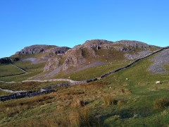
Pennine Bridleway

The High Way Upper Wensleydale

7.1 miles | 11.5 km | 371 m Ascent | 9.0 Naismith miles | George Sheridan
Walking is a somewhat weather-dependant hobby, and this route demonstrates that clearly: When we completed our Grisedale and Garsdale walk in this area in June 2022, we enjoyed bright sunshine, walked over dry fields, and asked ourselves why bridges had been provided to cross mere trickles of streams. Fast forward to the wettest start to year that anyone can remember, and we see why the bridges are there – those same streams are now small rivers in full flow.
So, does the rain spoil the experience? Not at all, it just gives us a different perspective: Wonderful waterfalls roar into life, mosses and lichens proliferate, and we get extra exercise jumping over streams and fighting to stay upright on muddy descents. Whatever the weather, this walk offers a great deal – we rate it as easy based on the distance and ascent but be aware that there are steep sections and in the event of poor conditions, extra care is needed.

The High Way Upper Wensleydale Read More »

Far Moor Bridge and Ribblesdale

7.8 miles | 12.6km | 297 m Ascent | 9.3 Naismith miles | Sandra Craggs
Horton in Ribblesdale is a great place to start a walk, and the “three peaks” are the big draw with Pen-y-Ghent an obvious choice, as is the Sulber Nick route over to Ingleborough.
Both are good walks, but there is much else to see in this area, as we show with a route including a tarn, the stunning Far Moor Bridge, disappearing rivers, atmospheric lime kilns, a National Nature Reserve, extensive limestone pavement, and vast quarries, all of which is accessible via the Settle to Carlisle railway. What more could you want? A blue lagoon? – well there was one until recently, and we can offer pictorial evidence.

Far Moor Bridge and Ribblesdale Read More »

Norber erratics from Clapham

6.9 miles | 11.0 km | 249 m Ascent | 8.1 Naismith miles | Mary Taylor
Bentham Footpath Group travel up to an hour or so to get to the start of our walks. This generally works well, but given that we already live in paradise, we sometimes find ourselves thinking – why not just stop here and just walk our own patch? So that’s exactly what we do on this walk.
The Norber erratics are well known, and one of the “tick list” attractions in the Yorkshire Dales. The usual starting point would be Austwick – and we have in the past walked from there, but this route extends the day and gives us a chance to take in Clapham and Wharfe, as well as Austwick.

Norber erratics from Clapham Read More »

Settle

7.1 miles | 11.4 km | 592 m Ascent | 10.0 Naismith miles | Bernie & Sheila Garrett
This excellent route showcases just what great walking country we have right on our doorstep. We start from Langcliffe, less than half an hour away from Bentham, and then fill the day with the kind of walking that you might see on one of those “celebrity buys some walking boots” TV shows.
We head out of Langcliffe on the Pennine Journey path, hop over to the Pennine Bridleway, and then take a footpath up to Victoria Cave, which we explore for a while before walking along the base of the wonderful Attermire Scar.
We follow that round, passing under the entrance to Horseshoe Cave, before heading over to Stockdale Lane with great views over to Pendle Hill, and Rye Loaf Hill. We then cut back along a footpath between High Hill and Sugar Loaf Hill to arrive at the base of the Warrendale Knotts. From here we retrace our outbound journey – although in this direction the views are surprisingly different -and then as a bonus treat, pop up to the smaller Jubilee Cave. The final part of the walk follows our outward route back to Langcliffe.

Settle Read More »

Stainforth

6.9miles | 11.1 km | 329 m Ascent | 8.5 Naismith miles | Bernie & Sheila Garrett
What are the ingredients for a perfect walk? For some it’s something easily accessible with good parking and not too far from home, perhaps with riverside walks, and a waterfall or two. Or you may prefer ancient packhorse bridges, and traditional village greens, and perhaps a war memorial and village church. Or water mills and abandoned industrial remains excite you.
This walk has all of these and is so densely packed with interest that all this is delivered within our 12 km limit for an easy walk.
What more could you want? No wonder we had such a good turn out for this walk.

Stainforth Read More »

Long Preston

9.8 miles | 15.8 km | 462m Ascent | 12.1 Naismith miles | David Longton
Long Preston is a small village that many people drive through on the way to better known destinations in the Yorkshire Dales. It’s well worth stopping though to explore this village and the excellent walks that can be accessed from it.
The walk we present here is classified as challenging simply because it just exceeds our 15km limit for a moderate walk – but much of the route is on tracks, or minor roads, and there are no steep climbs, so if you feel comfortable with our moderate walks give this one a go too. There are some shortcuts highlighted.
As you can see from the gallery, we picked a wet day to walk it, but in better weather, the views over the Ribble Valley, and the flood plains south of Settle are well worth seeing, as is Scaleber Foss at the halfway point.

Long Preston Read More »

Norber Erratics

5.9 miles | 9.5 km | 348 m Ascent | 7.6 Naismith miles | Graham Cooper
A quick glance at the “Big Map” page on our website shows just how much Bentham Footpath Group favours Austwick as a base for walks, and a look at today’s gallery clearly shows why.
For this easy walk, we park near the Traddock Inn and stroll through Austwick and out to the Horton Road where we pick up Townhead Lane to start the climb up to the Erratics. When we meet the Pennine Bridleway we take left to enter the fields that lead up to the Erratics, where we explore for a while, before heading across Nappa Scars and over to the Wash Dubs. From there we walk gently downhill to Wharfe and across to Wood Lane which we follow as far as Austwick Bridge, and the Traddock.

Norber Erratics Read More »

Grisedale and Garsdale

9.5 miles | 15.3 km | 590 m Ascent | 12.4 Naismith miles | Sandra Craggs
Grisedale is not well known, and often missed by visitors, but there is a simple beauty in this Dale – which is what why we chose this walk.
We start at Garsdale Station and then head up Grisedale to East Scale and the Quaker Burial Ground, before walking up Galey hill to Flust where we pick up the Pennine Journey path down to the B6259.
A very short section of road walking takes us to Quarry Farm where we head over fields and through a plantation to Lunds Chapel, before climbing (quite steeply) up the side of Abbotside Common to pick up (Lady Anne’s) High Way. We follow this along the valley side for a while before heading down the Pennine Bridleway to the Cobbles Plantation and Ure Force.
A brief stop at The Moorcock Inn is a recommended option, before crossing the A684 and walking under the impressive Dandry Mire Viaduct to return to the start.

Grisedale and Garsdale Read More »

Mallerstang

11.7 miles | 18.9 km | 811 m Ascent | 15.8 Naismith miles | Jim Shuttleworth
Mallerstang, and the Upper Eden Valley, are among England’s few remaining wild and peaceful places.
David Bellamy described this general area as “England’s last Wilderness”.

This challenging walk has everything: Lady Anne’s way, sculpture, the source of the river Eden, spectacular scars, cairns, disused quarries, incredible views, gentle riverside sections, and even a castle.

Not enough? Pick the right day and you might see a steam train and the RAF in training.

Mallerstang Read More »