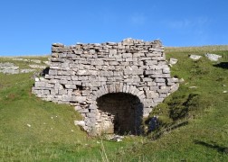
Lime Kiln

Dentdale

5.6 miles | 9.1 km | 302 m Ascent | 7.1 Naismith miles | Rick Clapham
Dentdale is one of the more popular gems of the Yorkshire Dales, and so not surprisingly, Bentham Footpath Group visit regularly. Every time we come here there is something different to see, and this time we start from the Church Bridge and take a riverside path downstream for a short distance before coming back to the centre of the village via the picnic area. We then head up the enchanting Flintergill, visiting an open air museum and enjoying a viewpoint, before climbing to the Occupation Road overlooked by the Megger Stones.
After following the Occupation Road for about a mile we head back downhill along a green lane to High Nun House, then cross the minor road and head down to Deepdale Beck which we follow downstream back to the Dee, which we then follow back to our starting point.

Dentdale Read More »

The High Way Upper Wensleydale

7.1 miles | 11.5 km | 371 m Ascent | 9.0 Naismith miles | George Sheridan
Walking is a somewhat weather-dependant hobby, and this route demonstrates that clearly: When we completed our Grisedale and Garsdale walk in this area in June 2022, we enjoyed bright sunshine, walked over dry fields, and asked ourselves why bridges had been provided to cross mere trickles of streams. Fast forward to the wettest start to year that anyone can remember, and we see why the bridges are there – those same streams are now small rivers in full flow.
So, does the rain spoil the experience? Not at all, it just gives us a different perspective: Wonderful waterfalls roar into life, mosses and lichens proliferate, and we get extra exercise jumping over streams and fighting to stay upright on muddy descents. Whatever the weather, this walk offers a great deal – we rate it as easy based on the distance and ascent but be aware that there are steep sections and in the event of poor conditions, extra care is needed.

The High Way Upper Wensleydale Read More »

Far Moor Bridge and Ribblesdale

7.8 miles | 12.6km | 297 m Ascent | 9.3 Naismith miles | Sandra Craggs
Horton in Ribblesdale is a great place to start a walk, and the “three peaks” are the big draw with Pen-y-Ghent an obvious choice, as is the Sulber Nick route over to Ingleborough.
Both are good walks, but there is much else to see in this area, as we show with a route including a tarn, the stunning Far Moor Bridge, disappearing rivers, atmospheric lime kilns, a National Nature Reserve, extensive limestone pavement, and vast quarries, all of which is accessible via the Settle to Carlisle railway. What more could you want? A blue lagoon? – well there was one until recently, and we can offer pictorial evidence.

Far Moor Bridge and Ribblesdale Read More »

Gargrave and Eshton

6.3 miles | 10.2 km | 170 m Ascent | 7.2 Naismith miles | Peter Lennard
It’s easy to overlook Gargrave as you drive through on the A65, and it would be a mistake to do so: Gargrave is a great place to start a walk, with the added advantage that there are pubs, cafes, and an interesting variety of shops to enjoy. Parking is free and there are good quality public toilets.
Still not convinced, then add a walk that includes the Leeds Liverpool canal, parts of the Pennine Way, Country houses, enchanting wells, great views of Sharp Haw, a peaceful memorial garden, a curiously ornate lime kiln, and weather station. Where else other than the Yorkshire Dales would you find so much interest in just six miles?

Gargrave and Eshton Read More »

Settle

7.1 miles | 11.4 km | 592 m Ascent | 10.0 Naismith miles | Bernie & Sheila Garrett
This excellent route showcases just what great walking country we have right on our doorstep. We start from Langcliffe, less than half an hour away from Bentham, and then fill the day with the kind of walking that you might see on one of those “celebrity buys some walking boots” TV shows.
We head out of Langcliffe on the Pennine Journey path, hop over to the Pennine Bridleway, and then take a footpath up to Victoria Cave, which we explore for a while before walking along the base of the wonderful Attermire Scar.
We follow that round, passing under the entrance to Horseshoe Cave, before heading over to Stockdale Lane with great views over to Pendle Hill, and Rye Loaf Hill. We then cut back along a footpath between High Hill and Sugar Loaf Hill to arrive at the base of the Warrendale Knotts. From here we retrace our outbound journey – although in this direction the views are surprisingly different -and then as a bonus treat, pop up to the smaller Jubilee Cave. The final part of the walk follows our outward route back to Langcliffe.

Settle Read More »

Scout Scar and Underbarrow

5.7 miles | 9.1 km |255 m Ascent | 6.9 Naismith miles | Alison Kinder & Colin Stroud
The area of the South Lakes between the Kent and Levens Estuaries provides a rich source of walks and is particularly favoured by The Bentham Footpath Group. This walk shows why: It’s relatively short and generally easy, but still manages to deliver spectacular views, well preserved industrial archaeology, a roman road, an ancient pele tower, sites of special scientific interest and ancient woodlands.

Scout Scar and Underbarrow Read More »

Whitsundale from Keld

8.1 miles | 13.1 km | 578 m Ascent | 11.0 Naismith miles | Jim Shuttleworth
Swaledale is a great place to walk, and Keld is always a good place to start; There is convenient parking at Park Lodge farmyard with a handy tearoom serving locally made ice creams during the summer season.
Swaledale is famous for its fast flowing river, and this is so because a number of side dales each with their own river merge with the Swale within a short distance of each other.
As well as Swaledale itself, this moderate walk visits three of the side dales that connect with Swaledale – East Stonesdale, West Stonesdale and Whitsundale.
Most of the route is on clearly marked paths – some of them long distance routes, and there is some road walking on quiet roads, so navigation should be simple. Be aware through that Swaledale can be very wet, and as you can see from the gallery, winter walks in this area can damp and windy. Don’t let that put you off though – this is a walk to savour at any time of the year.

Whitsundale from Keld Read More »

Dent

8.0 miles | 12.9 km | 466 m Ascent | 10.3 Naismith miles | Rick Clapham
Dentdale and Dent Village are stunningly beautiful, but perhaps because the roads into them are all minor, they tend to be less crowded than we might expect – a good thing in our books.
This walk combines the flat tranquil meadows along the Dee with a stroll through the village and up Flintergill where we take the ancient Green Lane known as the Occupation Road, enjoying long distance views down Barbondale, and over to the Howgills.
At the end of the Occupation Road, we turn right toward Gawthrop, and then loop round Stone Rigg, now with views up Dentdale, before following a path down to Dillicar where the Dales Way leads back to our start.

Dent Read More »