Easy

Ravenstonedale and Newbiggin-on-Lune

6.9 miles | 11.1 km | 199 m Ascent | 7.9 Naismith miles | Alison Kinder & Colin Stroud
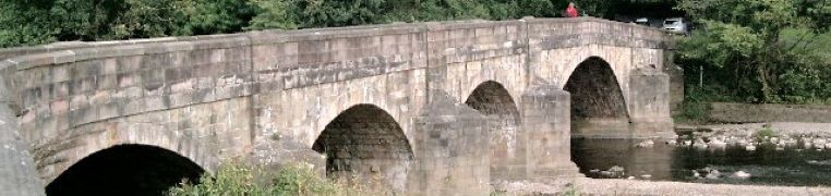
In a recent group trip to Kirkby Stephen, we enjoyed a great walk along a disused railway line. A quick glance at the map shows that the fantastic Smardale viaduct which we visit today is not far from there – and unsurprisingly it’s on the same disused line, so if you wanted to join the two routes you could.
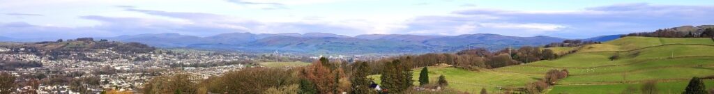
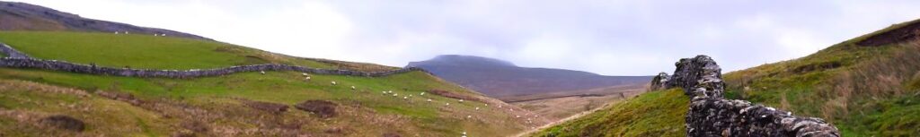
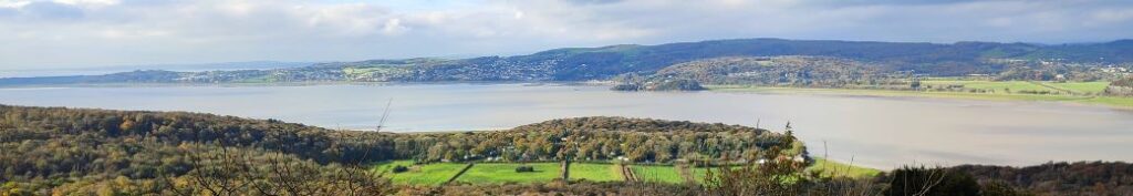
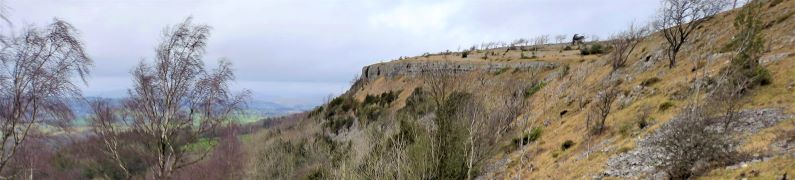
The viaduct alone is worth the trip, but this walk offers much more: Great views back to the Howgills and Wild Boar Fell, industrial archaeology, wildflowers, lizards, and free parking within walking distance of two award winning pubs.
Much of the route is on accessible paths so although it’s close to our 12km threshold for an easy walk, this one is well worth considering for those wanting a gentler stroll.

Ravenstonedale and Newbiggin-on-Lune Read More »

Glasson Dock and Lancaster Canal Spur

6.0 miles | 9.6 km | 67 m Ascent | 6.3 Naismith miles | Alison Kinder & Colin Stroud
The Lancaster Canal features in a number of Bentham Footpath Group Walks – not entirely surprising given that Bentham has a Lancaster postcode, and canals generally offer scenic walking opportunities. This time, we explore Glasson Dock and the Glasson Branch – one of the last parts of the UK canal network to be built, before the railways largely replaced water transport.
From convenient parking at Conder Green, we first head inland first through farms and up to the Lancaster Canal at Galgate. We then go south along the towpath until we get to the junction with the Glasson Arm, which we follow all the way down to Glasson Dock – one of the few places where our canal network connects to the sea.
The return from the Marina and Dock is via a disused railway line offering great views of the estuary, and there are several opportunities along the route to combine this easy and generally flat walk with pub lunches.

Glasson Dock and Lancaster Canal Spur Read More »

Around Gilpin Beck

6.3 miles | 10.2 km | 393 m Ascent | 8.3 Naismith miles | Alison Kinder & Colin Stroud
Sometimes our program works out such that we are in the same area for two consecutive walks – and that’s the case this time. This walk is at times no more than 200m from our recent Winster Valley walk, and at first we though that must be why a couple of locations looked familiar – we later realised that it is becase our equally excellent route at Lord’s Lot used a short section of the same paths from Spigot House to Bow Mabble Breast.
What does separate this walk from the earlier Lords Lot walk is the weather – we were rather unlucky this time. Despite that, there is much to recommend this walk – easy parking, rivers and tarns, woodland, working farms and some great views. Even in the rain it’s well worth the effort.

Around Gilpin Beck Read More »

Oxenholme round

7.2 miles | 11.6 km | 271 m Ascent | 8.6Naismith miles | Alison Kinder & Colin Stroud
Kendal styles itself as “The gateway to the Lakes”, and it is indeed a good base for those wishing to explore the southern end of the Lake District. The surrounding countryside also has much to offer in its own right– as we see in this walk.
From convenient parking close to Oxenholme station, we start by climbing the Helm, gaining great views of the Lakeland Fells, the Howgills, and Morecambe Bay. From there we descend past an ancient fort, and a curious folly to pick up St Sunday’s Beck which we follow upstream to the delightful Bleasehall Wood. We note a syphon well before taking an isolated green lane to St Sunday’s Bridge and from there we head to Hawkrigg. The return leg involves a brief but quite steep climb up the aptly named Windy Hill, and then it’s a steady descent to the finish. We show this as an easy walk because it is (just) less than 12 km – but the consensus from the group was that it “feels more like a medium”.

Oxenholme round Read More »

Ingleton Circular via Fell Lane

4.1 miles | 6.6 km | 197 m Ascent | 5.1 Naismith miles |Alison Kinder & Colin Stroud
This walk was designed to be brief such that as a group we could meet as usual yet be finished in time to reconvene with friends and family at the Old Sawmill in Clapham for a convivial meal.
Don’t go thinking that this walk is any the lesser for being short and sweet though – it goes far enough up Fell Lane (one of the routes up Ingleborough) to give good views of the peak, and we have Ingleton and the Lune Valley to enjoy too.
A brief look at the OS map will show that this walk intersects with many other footpaths so there are ample opportunities to extend or modify the route – or simply enjoy it as it is: An easy but enjoyable walk that can be slotted into the day with minimal planning.

Ingleton Circular via Fell Lane Read More »

Heathwaite Coastal

5.3 miles | 8.5 km | 243 m Ascent | 6.5 Naismith miles | Alison Kinder & Colin Stroud
We are lucky enough to live in a location that gives us easy access to some of the most beautiful countryside in the UK, and we immediately think of the Lake District, the Yorkshire Dales, and the Forest of Bowland in this context. To that list we must surely add the Arnside and Silverdale Area of Outstanding Natural Beauty (AONB) – a compact but varied area that offers a wide variety of scenery, flora and fauna: One of the smallest AONBs, it covers just 75 km2 between the Kent Estuary, the River Keer and the A6.
This easy walk starts from the ever popular seaside village of Arnside, then takes a route along the coastal fringe of the Kent Estuary, looping round to Morecambe Bay at Far Arnside before returning via Heathwaite and onto Arnside Knott with its fantastic viewpoint. We end with a view of the fabulous gnarled trees on the Knott – complete with artworks – before taking a woodland route back to Arnside.

Heathwaite Coastal Read More »

Scout Scar and Underbarrow

5.7 miles | 9.1 km |255 m Ascent | 6.9 Naismith miles | Alison Kinder & Colin Stroud
The area of the South Lakes between the Kent and Levens Estuaries provides a rich source of walks and is particularly favoured by The Bentham Footpath Group. This walk shows why: It’s relatively short and generally easy, but still manages to deliver spectacular views, well preserved industrial archaeology, a roman road, an ancient pele tower, sites of special scientific interest and ancient woodlands.

Scout Scar and Underbarrow Read More »

Abbeystead and Tarnbrook

6.3 miles | 10.1 km | 251 m Ascent | 7.5 Naismith miles | Alison Kinder & Colin Stroud
This excellent walk starts next to the “Shepherd’s Church”, before heading across fields, with extensive views of the distant Hawthornthwaite and Tarnbrook fells, on the way to Abbeystead. From there we strike out across country, using parts of the underappreciated Wyre Way long distance path via Emmetts to Tarnbrook where we find the Tarnbrook Wyre. We cross the river and then follow it downstream to Lower Lee before returning via fields to the church. We were lucky enough to have bright and cold weather with lying snow for this walk, but it works equally well in other conditions – although it is worth noting that this part of the world can get a bit muddy after prolonged wet spells.

Abbeystead and Tarnbrook Read More »

Great Mitton

5.2 miles | 10.7 km | 170m Ascent | 6.0 Naismith miles | Alison Kinder & Colin Stroud
This easy riverside walk starts from Edisford Bridge in Clitheroe and follows the Ribble downstream, to Mitton Bridge, where we cross and return.
The route could easily be combined with a day out in Clitheroe – the castle and museum are well worth visiting.
During the summer months, the bridge and the banks of the River Ribble are a magnet for families enjoying picnics; The Bentham Footpath group tackled the walk on a cold and icy winter’s day, so we had the place to ourselves.

Great Mitton Read More »

Lower Garsdale

6.4 miles | 10.3 km | 295 m Ascent | 7.9 Naismith miles | Alison Kinder & Colin Stroud
Garsdale is one of the less-visited Dales in the Yorkshire Dales National Park, and that’s something of a shame, because it’s particularly attractive. It runs East / West between Baugh Fell to the North, and Rise Hill to the South.
This walk starts at a large car park on the A684 with great views of the Howgills, and then heads up the dale on a small and very quiet road following the lower slopes of the imposing Baugh Fell.
We return on the other side of the dale following the Clough River past New Bridge before picking up the Sedgwick Geological trail on our way back to the car park.

Lower Garsdale Read More »