Pennine Journey

Kirkby Stephen poetry stones and river walk

6.9 miles | 11.1 km | 199 m Ascent | 7.9 Naismith miles |Terri Kwiecinska
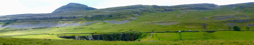
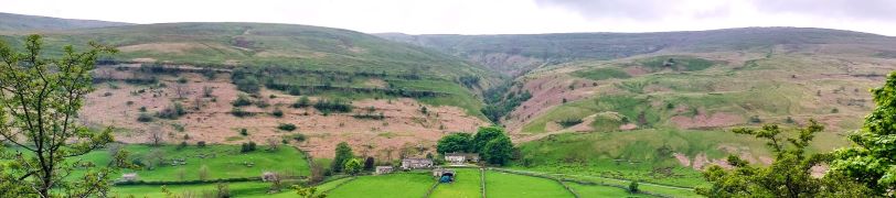
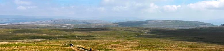
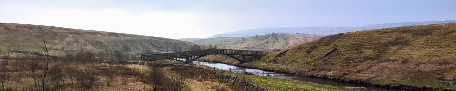
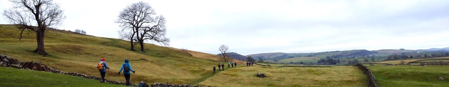
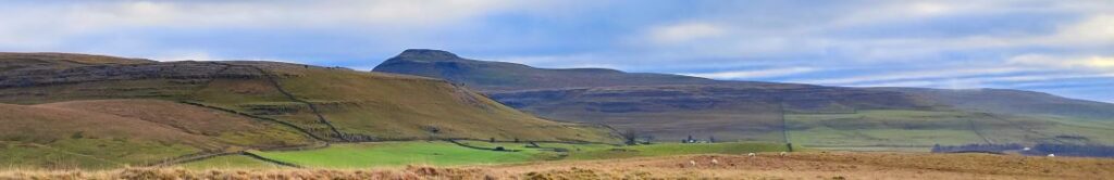
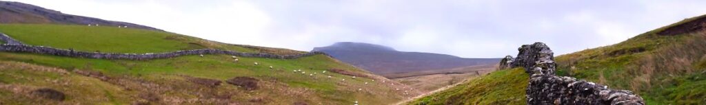
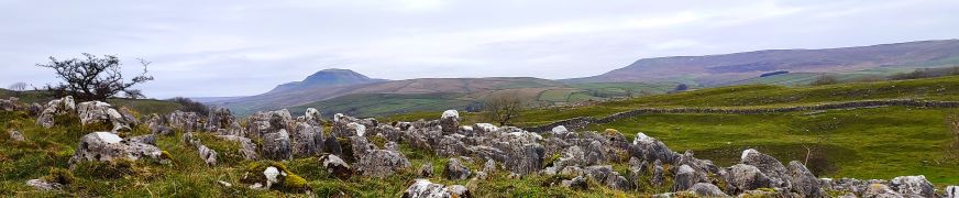
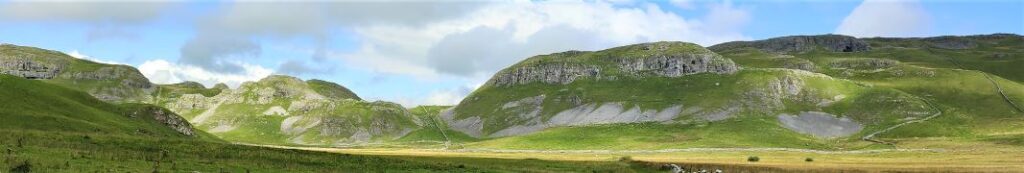
In April 2023, Bentham Footpath Group enjoyed a great walk in Ravenstonedale and Smardale, where we explored a disused railway line and crossed the magnificent Smardale Gill viaduct. At the time, we made a mental note to come back and explore other parts of this line, and so when one of our group members suggested a walk at the poetry stones in Kirkby Stephen, we grasped the opportunity to combine the two. This walk visits the poetry stones on a route that includes parts of that disused railway line, and two more viaducts. We add interesting geology, a lovely riverside section, and Kirkby Stephen town centre – all crammed into a relatively short and easy walk.

Kirkby Stephen poetry stones and river walk Read More »

Chapel-le-Dale, Scales Moor and Oddies Lane

7.4 miles | 11.9 km | 206 m Ascent | 8.4 Naismith miles | Mary Taylor
Living in Bentham gives us easy access to the Yorkshire Three Peaks, and many BFG walks have featured them as their main attraction. This walk however takes a route between two of them without climbing either. Does that mean we miss out on points of interest? Not at all – the best views of the peaks are often not from the top.
We start at Chapel-le-Dale, using the car park for the lovely St Leonard’s Church, and then head up toward Ellerbeck, passing the interesting Statue of a Warrior by Charles I’Anson. From there we head left onto Scales Moor – in effect the southern slopes of Whernside, seeing some of the best limestone pavement anywhere. Once at Twisleton Scar End, we take a path down to Twisleton Hall, and then on to Oddies Lane – a metalled road, built over the route of a Roman Road, which sees very little traffic. This takes us back to Chapel-le-Dale, with great views of Ingleborough along the way.

Chapel-le-Dale, Scales Moor and Oddies Lane Read More »

Buckden to Yockenthwaite

8.3miles | 13.3 km | 262 m Ascent | 9.6 Naismith miles | Sandra Craggs
In February 2024, Bentham Footpath Group visited Kettlewell and walked up to Starbotton – where we crossed the river Wharfe. It occurred to us at the time that just a few miles further upstream was Buckden, another great starting point for walks in the Upper Wharfe valley. So, this time we drive just a little further and base ourselves at the convenient Yorkshire Dales National Park car park in the village and head out on the Pennine Journey path through Rakes Wood, along Buckden Rake, and on to Cray High Bridge where we enjoy the waterfalls. From there we head to the opposite side of the valley and walk down to Cray where we pick up a path that contours around the steep sides of Langstrothdale Chase above Hubberholme before falling to Yockenthwaite.
We then head back down the riverside path, now on the Dales Way, and soon arrive at Hubberholme and its beautiful church before finishing with a gentle stroll back to Buckden. As well as waterfalls, this walk offers great views, limestone pavements, ancient woodlands, and locations that you may well recognise from the TV series “All Creatures Great and Small”. Why do we start with a picture of a mouse? . . . read on.

Buckden to Yockenthwaite Read More »

Ingleborough from Clapham

9.6 miles | 15.4 km | 751 m Ascent | 13.3 Naismith miles | Bernie & Sheila Garrett
One of the (many) advantages of living in Bentham is easy access to the Yorkshire Three Peaks. The group has taken various routes up each, and in this excellent walk we tackle Ingleborough again. Why? – because it’s still there as Mallory might say.
Most walkers start at Ingleton, but we take the slightly less common starting point at Clapham and approach the peak via a route that passes Clapdale Wood and Ingleborough Cave. We then take an optional short diversion to look at Trow Gill, before continuing slightly further north to find an easier route uphill across Clapham Bottoms and on to the famous Gaping Gill. After that there’s a steep climb up Little Ingleborough before we finally reach the peak, where we enjoy fine views and note bronze age remains and a demolished hospice. The diversions just tipped us over the 15km limit that we use to mark a walk as challenging but leave those out and it would be moderate – though still steep.

Ingleborough from Clapham Read More »

Far Moor Bridge and Ribblesdale

7.8 miles | 12.6km | 297 m Ascent | 9.3 Naismith miles | Sandra Craggs
Horton in Ribblesdale is a great place to start a walk, and the “three peaks” are the big draw with Pen-y-Ghent an obvious choice, as is the Sulber Nick route over to Ingleborough.
Both are good walks, but there is much else to see in this area, as we show with a route including a tarn, the stunning Far Moor Bridge, disappearing rivers, atmospheric lime kilns, a National Nature Reserve, extensive limestone pavement, and vast quarries, all of which is accessible via the Settle to Carlisle railway. What more could you want? A blue lagoon? – well there was one until recently, and we can offer pictorial evidence.

Far Moor Bridge and Ribblesdale Read More »

Norber erratics from Clapham

6.9 miles | 11.0 km | 249 m Ascent | 8.1 Naismith miles | Mary Taylor
Bentham Footpath Group travel up to an hour or so to get to the start of our walks. This generally works well, but given that we already live in paradise, we sometimes find ourselves thinking – why not just stop here and just walk our own patch? So that’s exactly what we do on this walk.
The Norber erratics are well known, and one of the “tick list” attractions in the Yorkshire Dales. The usual starting point would be Austwick – and we have in the past walked from there, but this route extends the day and gives us a chance to take in Clapham and Wharfe, as well as Austwick.

Norber erratics from Clapham Read More »

Kingsdale via the Turbary Road

8.0 miles | 12.8 km | 337 m Ascent | 9.6 Naismith miles | Mary & Kate Taylor
Walks for the Bentham Footpath Group are planned in four month programmes – which means that the date of this walk was fixed in September 2023. It could easily have been the case then that we encountered miserable rain with poor visibility whilst sliding around in ankle deep mud.
But we were lucky – we could not have had a better day for the start of 2024 – bright sunshine and clear air on the tops and atmospheric inversion clouds in the valley bottoms were even more beautiful than the pictures convey. Add potholes, caves, natural fountains, ancient monuments, and informed guides, to make for a perfect start to the new year.

Kingsdale via the Turbary Road Read More »

Ingleton Circular via Fell Lane

4.1 miles | 6.6 km | 197 m Ascent | 5.1 Naismith miles |Alison Kinder & Colin Stroud
This walk was designed to be brief such that as a group we could meet as usual yet be finished in time to reconvene with friends and family at the Old Sawmill in Clapham for a convivial meal.
Don’t go thinking that this walk is any the lesser for being short and sweet though – it goes far enough up Fell Lane (one of the routes up Ingleborough) to give good views of the peak, and we have Ingleton and the Lune Valley to enjoy too.
A brief look at the OS map will show that this walk intersects with many other footpaths so there are ample opportunities to extend or modify the route – or simply enjoy it as it is: An easy but enjoyable walk that can be slotted into the day with minimal planning.

Ingleton Circular via Fell Lane Read More »

Giggleswick Scar 2

5.4 miles | 8.6 km | 249 m Ascent | 6.6 Naismith miles | Sandra Craggs
In recent walks we have travelled further afield and enjoyed some stunning scenery. Sometimes though, it’s nice to remind ourselves just how beautiful our own area is – and this walk is a perfect way to do that.
This easy route is a shortened version of our earlier Giggleswick Scar walk and makes an ideal half day stroll. We start from The Mains in Settle and then head up to Stackhouse via Lord’s Wood. We then take the Pennine Journey path round the back of the scar, as if heading to Feizor, but before we get that far we find a fingerpost which indicates the path returning to the front of Giggleswick Scar.
The top edge of the scar gives us great views to the south and lots of interesting limestone features including caves and cairns, before we arrive at the Schoolboy Tower. We then circle round the now disused quarry and then wrap things up by heading back down to Lord’s Wood and our cars. Two added benefits for this walk are that starting from Settle makes it accessible by Public Transport, and adding Elaine’s Tea Rooms would be an easy (2km) extension.

Giggleswick Scar 2 Read More »

Settle

7.1 miles | 11.4 km | 592 m Ascent | 10.0 Naismith miles | Bernie & Sheila Garrett
This excellent route showcases just what great walking country we have right on our doorstep. We start from Langcliffe, less than half an hour away from Bentham, and then fill the day with the kind of walking that you might see on one of those “celebrity buys some walking boots” TV shows.
We head out of Langcliffe on the Pennine Journey path, hop over to the Pennine Bridleway, and then take a footpath up to Victoria Cave, which we explore for a while before walking along the base of the wonderful Attermire Scar.
We follow that round, passing under the entrance to Horseshoe Cave, before heading over to Stockdale Lane with great views over to Pendle Hill, and Rye Loaf Hill. We then cut back along a footpath between High Hill and Sugar Loaf Hill to arrive at the base of the Warrendale Knotts. From here we retrace our outbound journey – although in this direction the views are surprisingly different -and then as a bonus treat, pop up to the smaller Jubilee Cave. The final part of the walk follows our outward route back to Langcliffe.

Settle Read More »