Pele Tower

Sedbergh and Winder

7.7 miles | 12.4 km | 438 m Ascent | 9.9 Naismith miles | Valerie Eccles & Mary Pickstone

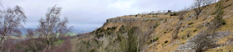
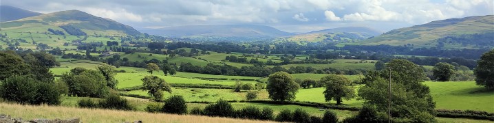
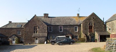
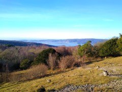
Sedbergh is a great place to use as a base for a walk – and it is location that Bentham Footpath Group have used a number of times. The usual choice is between quite steep walks on the Howgill Fells, or gentle riverside strolls. This excellent walk offers both on a route that delivers great views, trig points to tick off your list, a toposcope, disused railway lines, grand buildings, weirs, impressive Victorian bridges, a monument of disputed function, a lost mansion, and a stroll through the town centre, with opportunities for ice cream.
Add in the sunshine at the end of August when the first hints of autumn colours are starting to show, and this could well be a perfect walk.

Sedbergh and Winder Read More »

Askham

8.6 miles | 13.9 km | 317 m Ascent | 10.2 Naismith miles | Susan Badley
As a group, we put a huge amount of effort into researching our walks and scheduling them such that we make the most of the seasons. That diligent planning ensures that when we set out for the Levens Estuary (as we had always planned for this day), we do so safe in the knowledge that we will be enjoying the mid-august sunshine in complete safety.
Sometimes though, the weather doesn’t match our plan, and we find ourselves facing flood warnings on the route we had chosen: We are lucky that our walk leaders have an encyclopaedic knowledge of the area and can create a fresh walk out of thin air at short notice. This walk therefore is just such a piece of magic – a reprise of one that we did a few years ago which feels just as fresh and well prepared as usual. Keep checking the website to see whether we re-run the Spark Bridge and Levens Estuary walk, but in the meanwhile enjoy this excellent alternative.

Askham Read More »

Cunswick and Scout Scars

7.2 miles | 11.5 km | 298 m Ascent | 8.6 Naismith miles | George Sheridan
A quick glance at an OS map centred on Kendal shows a viewpoint just to the west of the town – not far from Underbarrow. This walk gave us the chance to see that view – and much more besides.
We start at a convenient free car park on the Underbarrow road, and head out along the top of Cunswick scar, with great views across Cunswick Fell to Kendal and beyond. We then drop down through Scar Wood, to skirt the edge of Cunswick Tarn and stroll past Cunswick Hall before taking a variety of woodland paths to Underbarrow.
From here we see Scout Scar looming ahead before climbing it at Barrowfield. Once at the top, we enjoy views across to the Lakeland fells, and Morecambe Bay before heading along the top of the scar to the viewpoint where we find an historic shelter and helpful graphics to identify the numerous hills we can see. A brief stroll downhill returns us to the car park.

Cunswick and Scout Scars Read More »

Scout Scar and Underbarrow

5.7 miles | 9.1 km |255 m Ascent | 6.9 Naismith miles | Alison Kinder & Colin Stroud
The area of the South Lakes between the Kent and Levens Estuaries provides a rich source of walks and is particularly favoured by The Bentham Footpath Group. This walk shows why: It’s relatively short and generally easy, but still manages to deliver spectacular views, well preserved industrial archaeology, a roman road, an ancient pele tower, sites of special scientific interest and ancient woodlands.

Scout Scar and Underbarrow Read More »

Norber Erratics

5.9 miles | 9.5 km | 348 m Ascent | 7.6 Naismith miles | Graham Cooper
A quick glance at the “Big Map” page on our website shows just how much Bentham Footpath Group favours Austwick as a base for walks, and a look at today’s gallery clearly shows why.
For this easy walk, we park near the Traddock Inn and stroll through Austwick and out to the Horton Road where we pick up Townhead Lane to start the climb up to the Erratics. When we meet the Pennine Bridleway we take left to enter the fields that lead up to the Erratics, where we explore for a while, before heading across Nappa Scars and over to the Wash Dubs. From there we walk gently downhill to Wharfe and across to Wood Lane which we follow as far as Austwick Bridge, and the Traddock.

Norber Erratics Read More »

Killington

7.2 miles | 11.6 km | 435 m Ascent | 9.4 Naismith miles | Robert Baines
Many people associate Killington with the reservoir and the services on the M6.
In fact, the pretty 14th century village that the reservoir is named after is some way to the east of there in the Lune Valley with impressive views over to the Howgills at Sedbergh.
This relatively easy walk takes the shape of a figure eight on the OS map – and there are paths to enable either loop of the figure 8 to be walked independently, so two shorter walks can also be found here.
Apart from some boggy ground at Tarn Moss, the walking is easy though, so we recommend the walk as published here.

Killington Read More »

Preston Patrick

7.5 miles | 12.0 km | 451 m Ascent | 9.7 Naismith miles | Robert Baines
A really good walk through less well walked areas: Although classed as moderate walk, this is because the distance is marginally over 12 km. The surfaces are easy, and the inclines gentle, so dont dismiss this walk as too harsh.
Good views over Hutton Roof and Farleton Fell can be had an a clear day, and sections of canal always add interest.

Preston Patrick Read More »

Challan Hall and Arnside Tower

7.3 miles | 11.7 km | 439 m Ascent | 9.4 Naismith miles | Alison Kinder & Colin Stroud
Silverdale and Arnside are great walking locations – Bentham Footpath Group often base walks in this area.
This walk includes the Knott and it’s great views before heading to an ancient “pele” tower and through a nature reserve to Challan Hall and Hawes Water. From there we pass a gingerbread house in the woods before seeing an even bigger pele tower and ending the walk.

Challan Hall and Arnside Tower Read More »

Silverdale, Arnside Knott and The Pepperpot Monument

6.9 miles | 11.1 km | 478 m Ascent | 8.2 Naismith miles | Sandra Craggs
Silverdale is a great place to walk, and BFG have used it as start point many times. This easy walk heads out of the village up to Arnside Knott where there are panoramic views over the Kent Estuary. We then head over to Arnside Tower, Eaves Wood and the Pepper pot monument before returning to the start.

Silverdale, Arnside Knott and The Pepperpot Monument Read More »