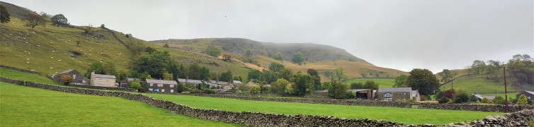
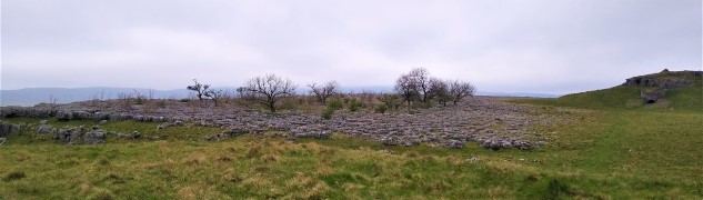
Easy

Giggleswick Scar

7.4 miles | 11.9 km | 400m Ascent | 9.4 Naismith miles | Sandra Craggs
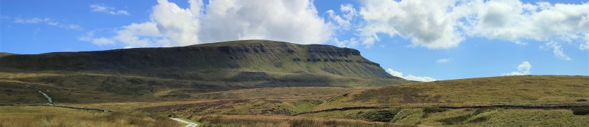
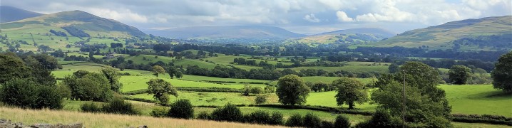
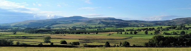
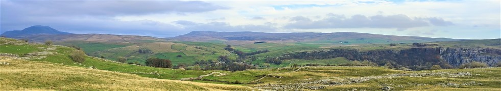
This walk starts from Giggleswick Village and then heads up through Lord’s Wood, past the quarry, to join the top of Giggleswick Scar at Schoolboy’s Tower where we get great views across the Ribble valley. From there we walk along the top of the scar until we meet the path coming up from Buck Haw Brow, when we head North to Feizor Thwaite.
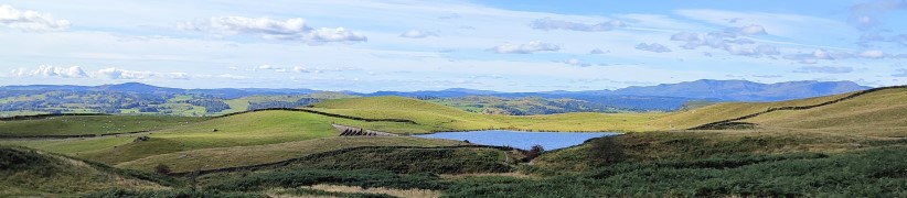
A sharp turn back along the Pennine journey path brings us down to Stackhouse, and from there we stroll back to Giggleswick along the side of the Ribble at Settle.
Although this walk is classed as easy because it’s (marginally) less than 12 km, be aware that there is a steep climb and some terrain that can be wet and slippery in poor weather.

Giggleswick Scar Read More »

Norber Erratics

5.9 miles | 9.5 km | 348 m Ascent | 7.6 Naismith miles | Graham Cooper
A quick glance at the “Big Map” page on our website shows just how much Bentham Footpath Group favours Austwick as a base for walks, and a look at today’s gallery clearly shows why.
For this easy walk, we park near the Traddock Inn and stroll through Austwick and out to the Horton Road where we pick up Townhead Lane to start the climb up to the Erratics. When we meet the Pennine Bridleway we take left to enter the fields that lead up to the Erratics, where we explore for a while, before heading across Nappa Scars and over to the Wash Dubs. From there we walk gently downhill to Wharfe and across to Wood Lane which we follow as far as Austwick Bridge, and the Traddock.

Norber Erratics Read More »

Austwick

6.4 miles | 10.3 km | 305 m Ascent | 7.9 Naismith miles | Bernie & Sheila Garrett
This circular walk starts from Austwick– where there is generally parking available free of charge on the roadside: For this walk we start by the Traddock Hotel.
We stroll through Austwick and out to the Horton Road where we pick up the footpath over Flascoe Bridge before taking the bridleway over to Feizor. The Dales Highway then takes us up toward Little Stainforth, but before we get that far we divert up to Smearsett Scar, before looping round to enter the top of Wharfe Wood.
We walk through Wharfe Woods, and then through parts of Oxenber wood before heading back downhill to Wood Lane which we follow as far as Austwick Bridge, and the Traddock.

Austwick Read More »

Staveley Tarns

7.0 miles | 11.3 km | 477 m Ascent | 9.4 Naismith miles | Kate Rowe
Staveley is a great place to walk, and one that the Bentham Footpath Group has often visited: Not only is the area beautiful, but it’s easily accessible, and relatively quiet when compared with the “honeypot” towns of Kendal and Windermere, between which it sits.
This walk falls within the distance and ascent parameters for a BFG “easy” walk, but you should expect some steep climbing as we set of to find three of the tarns on Potter Fell: Potter Tarn itself, then Gurnal Dubs, and finally Ghyll Pool.
We return via Hundhowe and Hagg Foot and then track upstream along the banks of the river Kent as it winds through the woodland at Beckmingle Ing.

Staveley Tarns Read More »

Pen-y-ghent

6.8 miles | 11.0 km | 617 m Ascent | 9.9 Naismith miles | Peter Lennard
Pen-y-ghent is the smallest of the “three peaks” at 694m (2277ft).
This circular walk goes anticlockwise so that we tackle the steep ascent at the South end of the hill first followed by a gentler downhill return with views over to Horton, Ingleborough, and Hull Pot.
BFG walks are rated based on a combination of distance and ascent, and this one is quite short and so is classified as “easy”. Be aware through, that the climb to the peak is steep and rocky, so care is needed.

Pen-y-ghent Read More »

Killington

7.2 miles | 11.6 km | 435 m Ascent | 9.4 Naismith miles | Robert Baines
Many people associate Killington with the reservoir and the services on the M6.
In fact, the pretty 14th century village that the reservoir is named after is some way to the east of there in the Lune Valley with impressive views over to the Howgills at Sedbergh.
This relatively easy walk takes the shape of a figure eight on the OS map – and there are paths to enable either loop of the figure 8 to be walked independently, so two shorter walks can also be found here.
Apart from some boggy ground at Tarn Moss, the walking is easy though, so we recommend the walk as published here.

Killington Read More »

Eldroth

4.1 miles | 6.7 km | 144 m Ascent | 4.8 Naismith miles | Kate Rowe
This excellent walk in and around Eldroth takes no more than 2 -3 hours – even with a brief stop at the quarry, and allowing time for several stiles.
We start by heading across farmland toward Lawkland with the panoramic views of Giggleswick Scar. Just before Lawkland Hall we double back and cross the railway before heading back to the Eldroth Road where we cross over to the disused quarry. Good views in all directions can be enjoyed from this high spot.
A short section of walking on generally empty roads then takes us to Accerhill Hall and Howith Farm before we return to the road at Black Bank Farm
We then take a footpath North at Black Bank to come back under the railway to the village hall where the walk ends.

Eldroth Read More »

Ribblehead

5.7 miles | 9.2 km | 208 m Ascent | 6.8 Naismith miles | Graham Cooper
Bentham Footpath Group aims to offer a wide choice of walks, showcasing the wonderful area that we live in.
We start at the Ribblehead Viaduct – perhaps the most photographed structure in the Yorkshire Dales, and then set off as if we were heading up Whernside. Just before the Bleamoor signal box though we divert under the railway to track along the contours of Whernside at low level on flat(ish) ground and solid paths. This gives us great views toward Ingleborough.
When we meet the path coming back down from the top of Whernside, we go left down Philpin Lane to pick up the return path along the valley bottom to Haws Gill Wheel. This is the only part of the walk where we need to tread carefully as wet limestone can be slippery.
We follow Winterscales Beck all the way back to Gunnerfleet Farm and then back under the centre of the viaduct to complete the walk

Ribblehead Read More »

Low Bentham

4.8 miles | 7.7 km | 264 m Ascent | 6.1 Naismith miles | Alan Parker
We start from the free car park at Harley Bank and then cross the Wenning to walk up Mill lane as far as Clouds Bank. We then take a path over fields to pick up Eskew Lane at the Punch Bowl, and cross the river again to take the “fairy steps” to West End Farm.
From there we take a lane and then a footpath to Goodenburgh Holiday Park, where we cross Ravens Close Brow and take the footpath over to Gill Farm. Here we turn right on Back Lane. This brings us back to Ravens Close Brow at the Solar Farm where we cross the fields to arrive back at Low Bentham at Green Head Farm. We end the walk with a pleasant stroll through the village.

Low Bentham Read More »

Copplestone Gate and Conistone Pie

7.3 miles | 11.8 km | 437 m Ascent | 9.5 Naismith miles | Mary & Kate Taylor
Wharfedale is an exceptionally beautiful part of the world, and this walk from Conistone shows us the best of it. The first part of the walk involves some hard walking up the Dib – a steep gorge.
We then take the Bycliffe road up as far as the Conistone Turf Road where we head onto Conistone Moor and Copplestone Gate.
We then head downhill to find the Dales Way again and follow this back to Conistone Pie before returning to Conistone village via Scot Gate Lane.
The modest distance means that this is classed as an easy walk, but the clambering up the Dib means that you need to be fit and appropriately clothed / booted.

Copplestone Gate and Conistone Pie Read More »