Given that all three of the Yorkshire Dales “three peaks” are close to our base in Bentham, and feature as prominent landmarks on many of our walks, we really should walk them from time to time – and this time we pick Pen-y-ghent – the lowest of the three at 694m (2277ft).
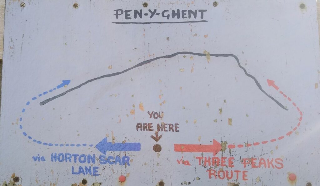
This circular walk goes anticlockwise so that we tackle the steep ascent at the South end of the hill first followed by a gentler downhill return with views over to Horton, Ingleborough, and Hull Pot.
BFG walks are rated based on a combination of distance and ascent, and this one is quite short and so is classified as “easy”.
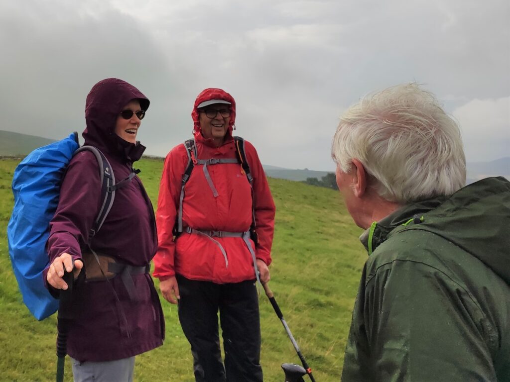
Be aware through, that despite being part of the popular Pennine Way, the climb to the peak is steep and rocky, so care is needed. Do not start this walk without appropriate equipment – waterproofs and good boots are essential.
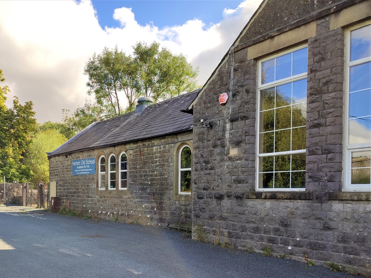
We start at the old primary school at the southern end of Horton in Ribblesdale. The access road – called Brackenbottom lane – is off the B6479 just after you enter the village (when travelling from the Helwith Bridge side). If that is unavailable, there is some on-road parking in Horton, or the National Parks car park has paid parking.
Paper map users will find the grid reference SD81167227 works, as does What-3-words tag shoulders.boating.workloads while satnav users can try Brackenbottom Lane or BD24 0EX as a destination.
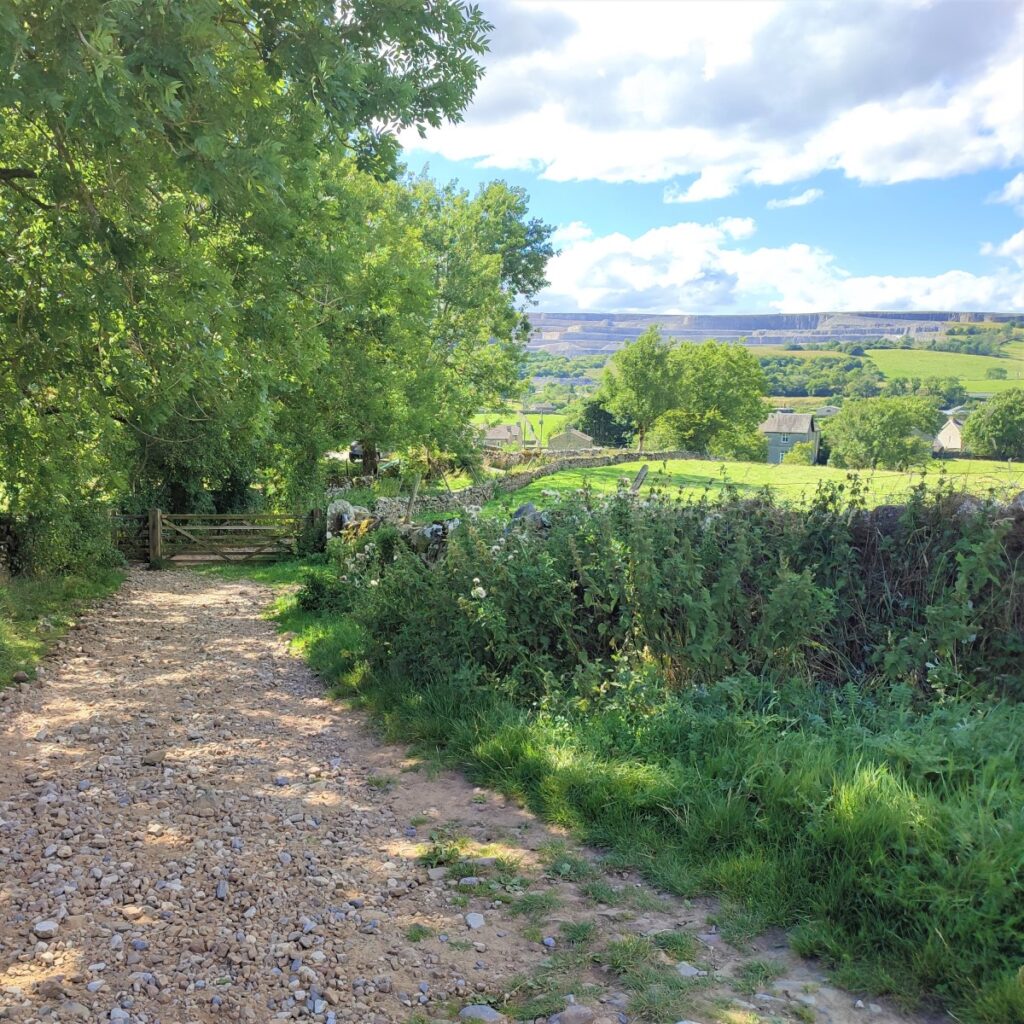
We start by heading up Brackenbottom lane away from the main road – so Horton beck should be on your left. Be aware that we are still on a road at this point, and although traffic to Brackenbottom is sparse, care is recommended.
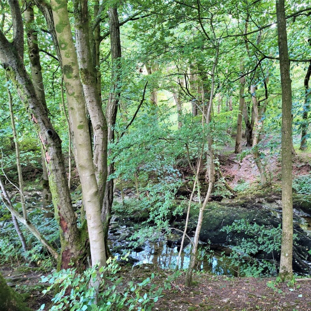
The road rises gently and starts to curve round to the right. At first it follows the course of the beck – and it may be worth taking a moment to explore the beck and its surrounding woodland before going much further.
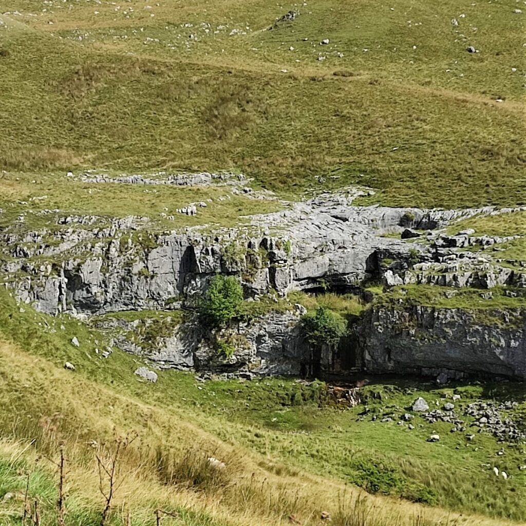
Soon the road moves further round to the right and the beck disappears uphill on the left toward Douk Ghyll Scar where there is a waterfall. Unfortunately, this is not accessible by foot.
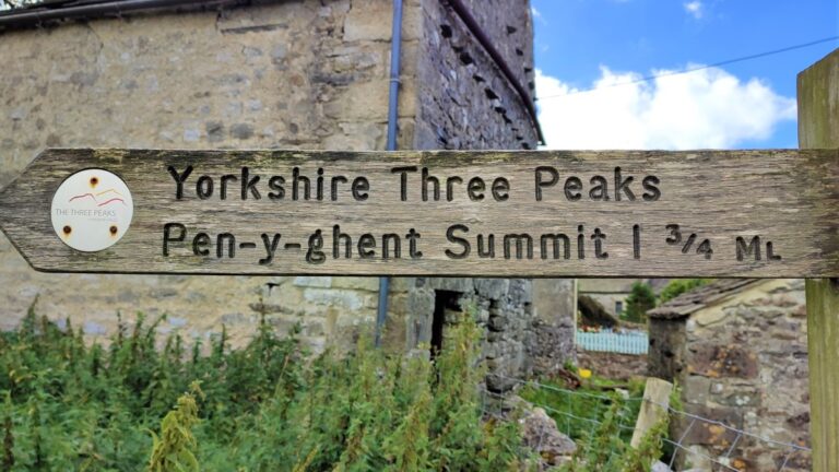
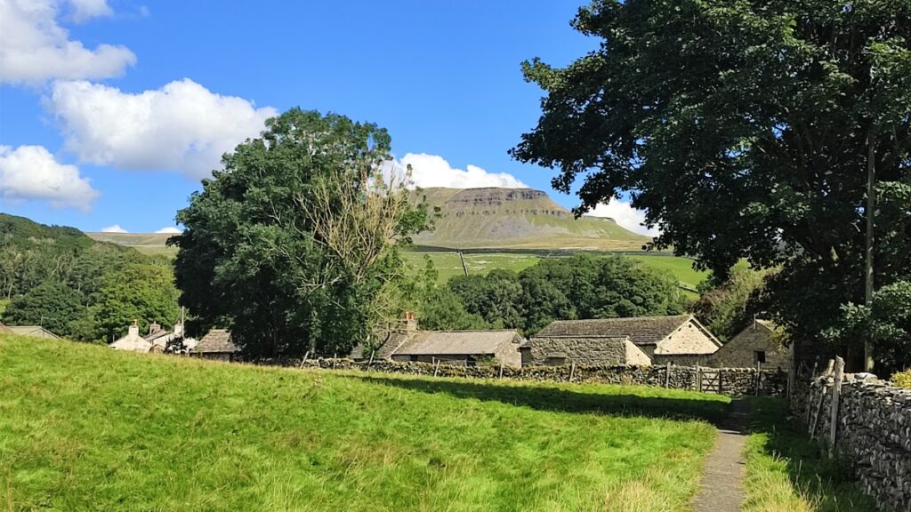
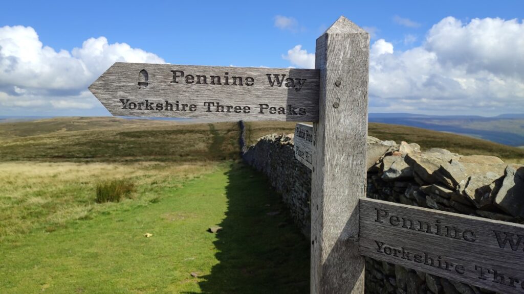
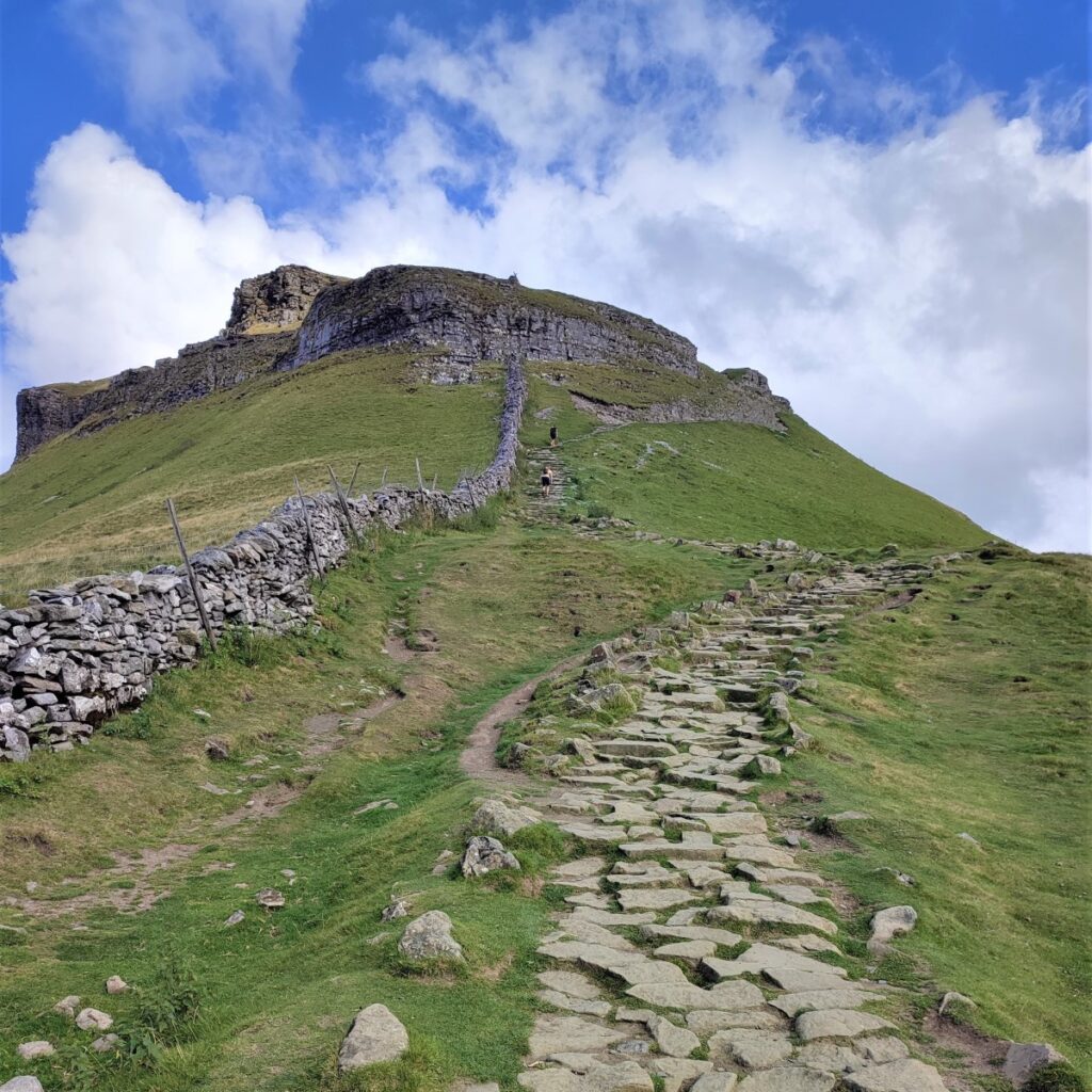
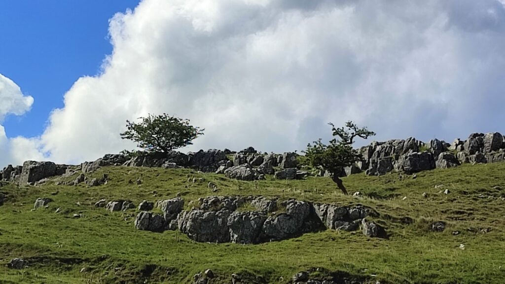
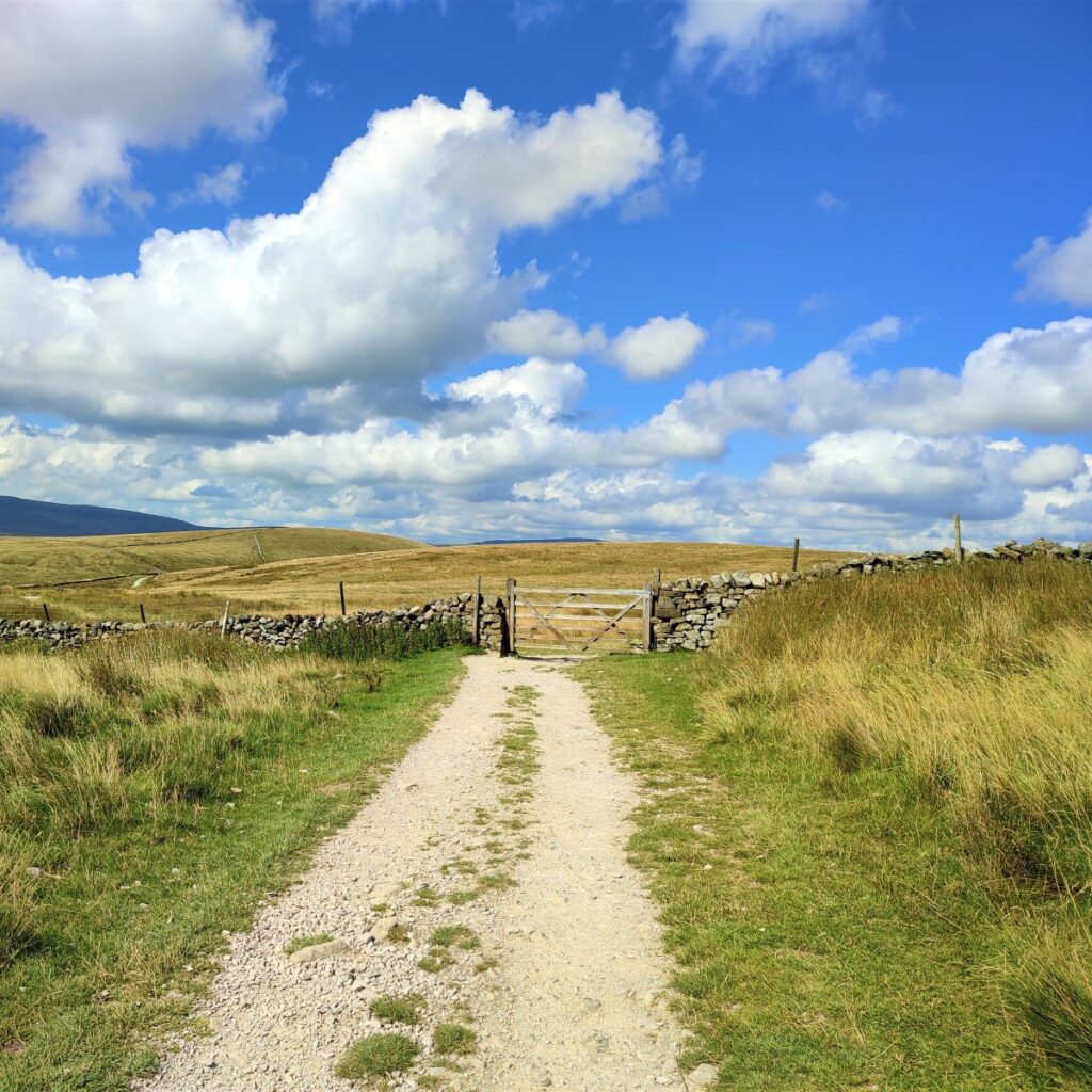
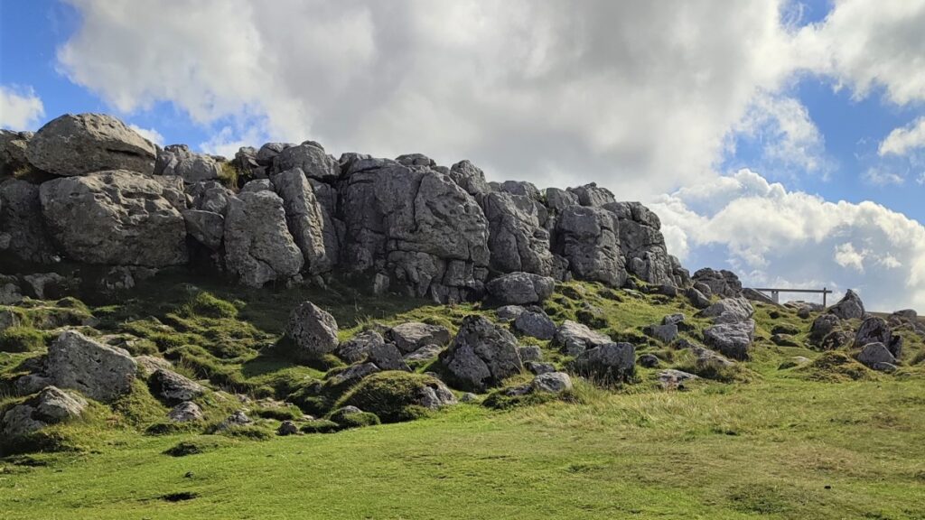
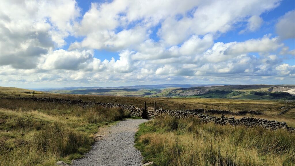
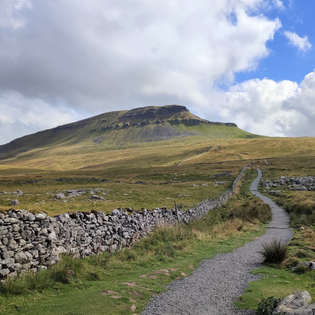
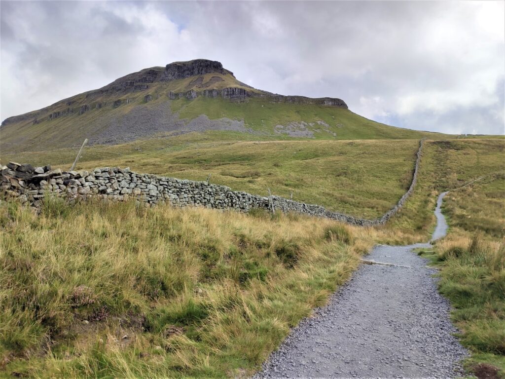
As we come round the bend and start to see dwellings at Brackenbottom, we keep a lookout for the Yorkshire Three Peaks fingerpost and the access gate to the path up Pen-y-ghent. Given that this is such a popular route – an estimated 80,000 people climb it every year – extensive work to reduce erosion has been needed, so spotting the rather “engineered” path should not be a problem.
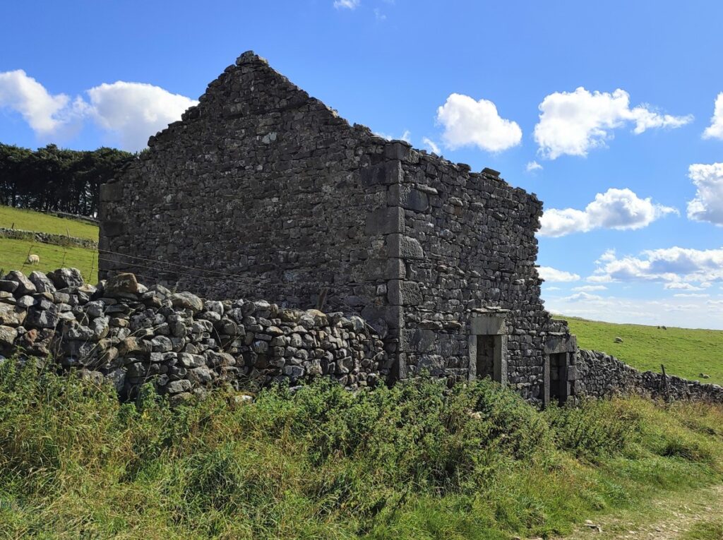
We take a gate on the left into a yard in front of a barn, and then a pedestrian gate onto the fell and the path to Pen-y-ghent. From here the climbing gets tougher, so don’t forget to take a moment every now and then to look back and admire the views of the three quarries at Horton, as well as the wider views up and down Ribblesdale.
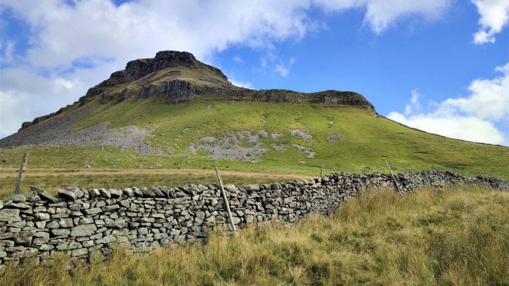
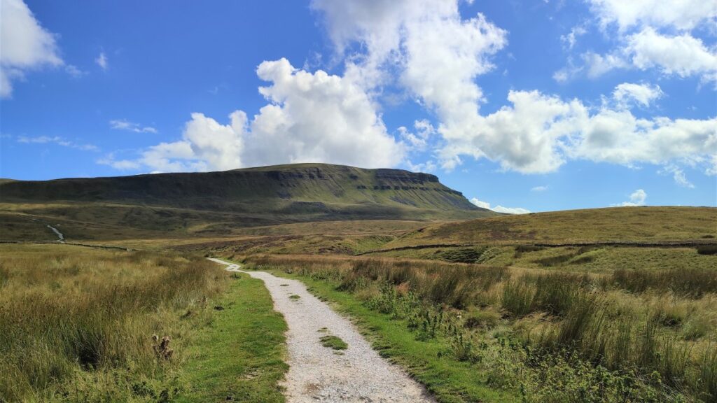
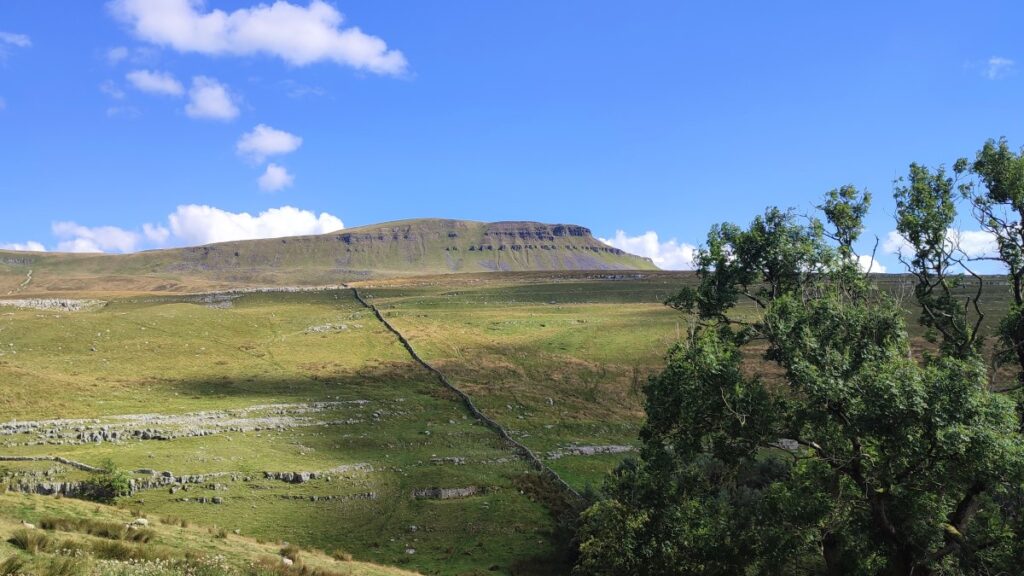
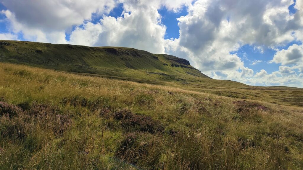
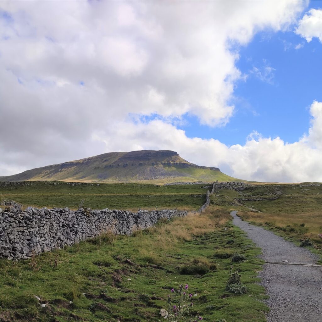
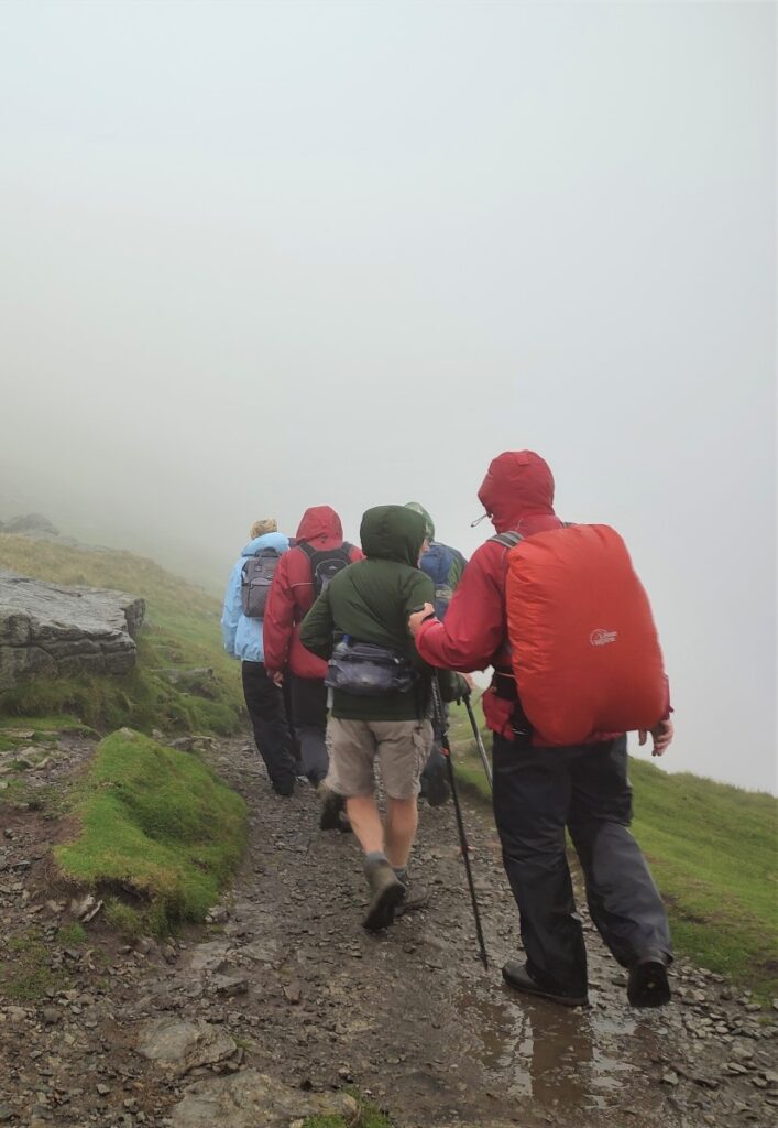
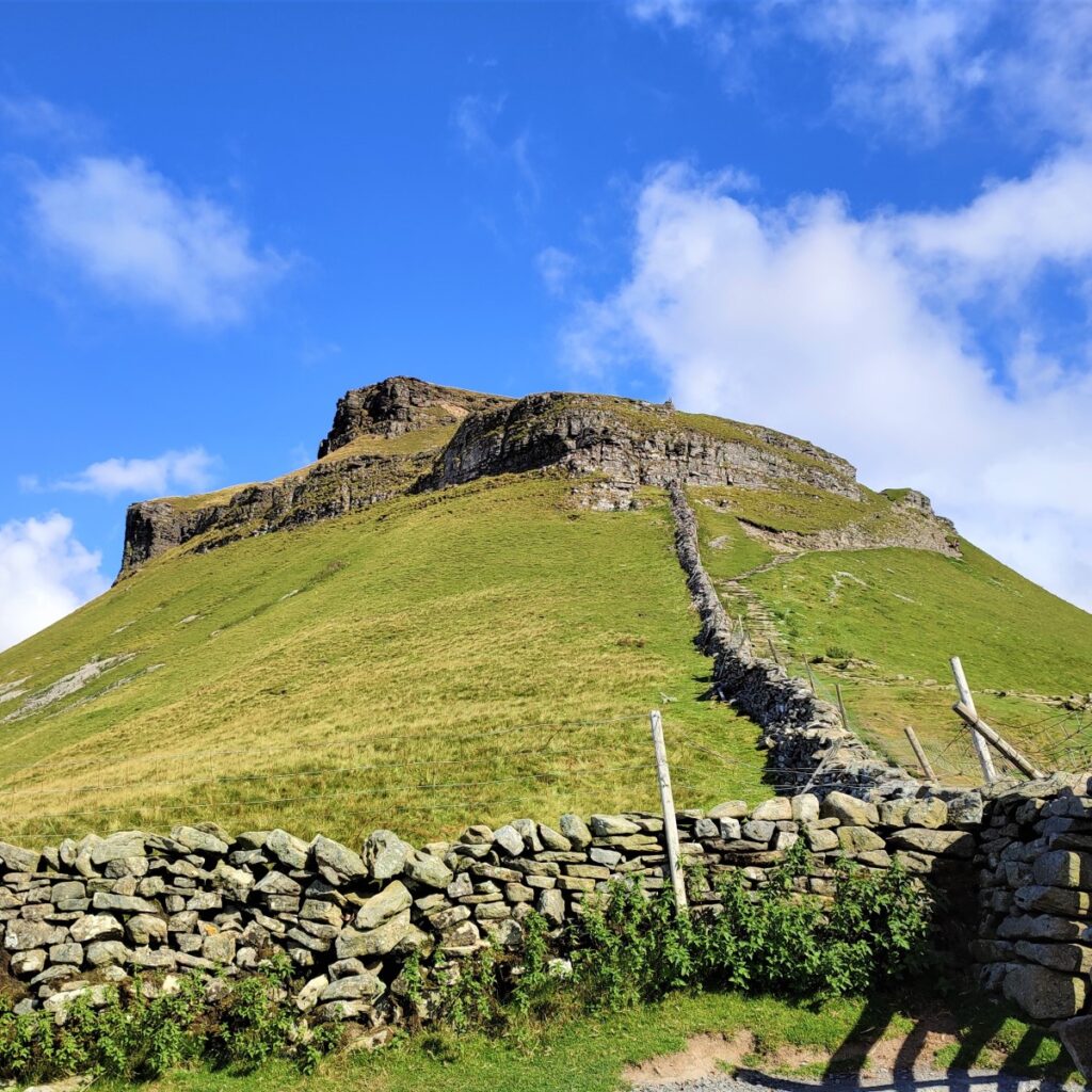
From here onward, the path is clear, as is the destination – Pen-y-Ghent looms over us ahead and slightly to the left. If the weather is poor however, the peak may not be visible, so make sure you follow the path upward and in a North-easterly direction keeping the wall on your left at all times.
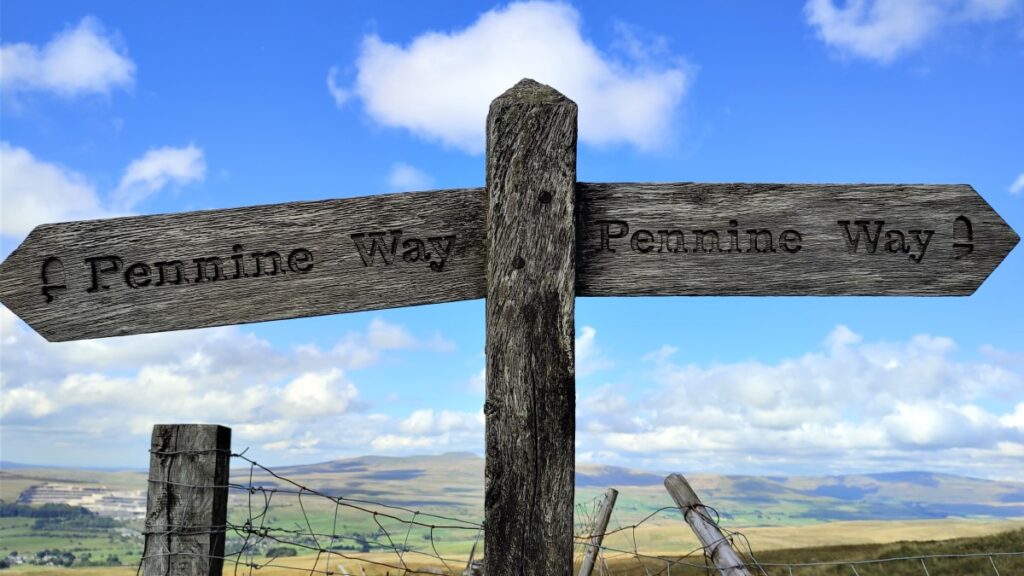
After a number of short diversions away from the wall to enable us to pass rocky outcrops, we arrive at a pedestrian gate where the Yorkshire Three Peaks path we have been following so far meets the Pennine Way footpath at a T-junction.
We will take left at the that junction, following the steep scramble up the slopes of Pen-y-ghent, but before we tackle that, the wall junction at the gate may well be the most sheltered spot you will see for a while, so base camp snacks and a brew may be advised.
Suitably refreshed we head left and up toward the peak. Your compass should be telling you that we are now heading North.
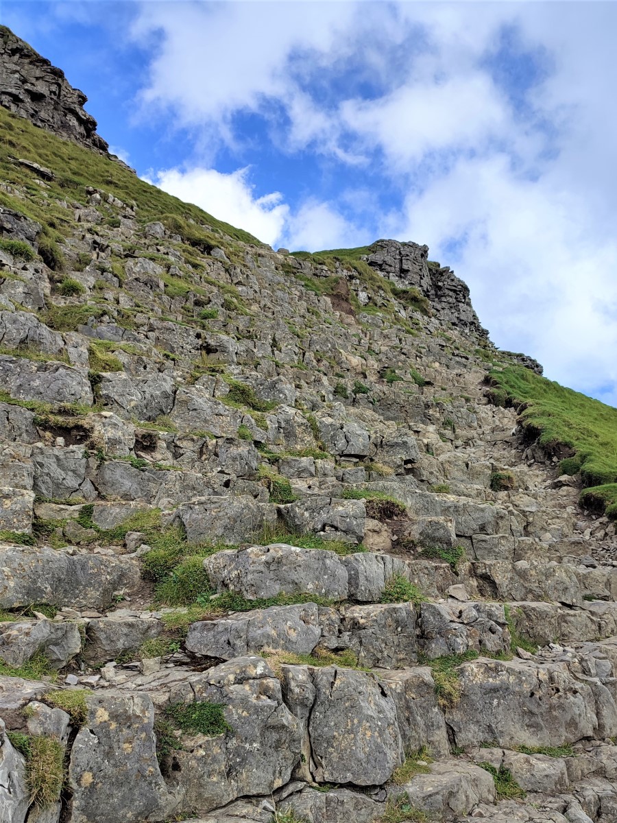
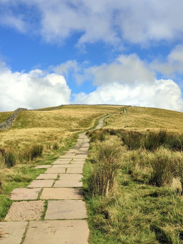
At this point, the path is made up of recycled stone – and so the going is relatively easy. As we shall soon see, not all of the approach to the top will be so gentle. Notice that much of the stone used here has been recovered from derelict industrial buildings, and you will see a number of slabs that are heavily oil stained having been the foundation slabs for once busy machines.
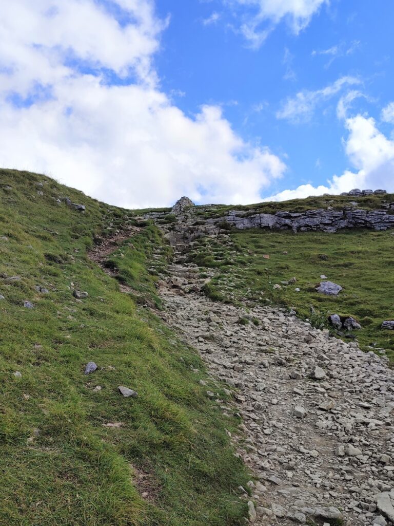
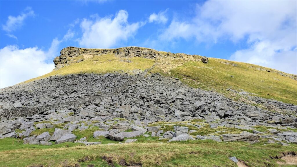
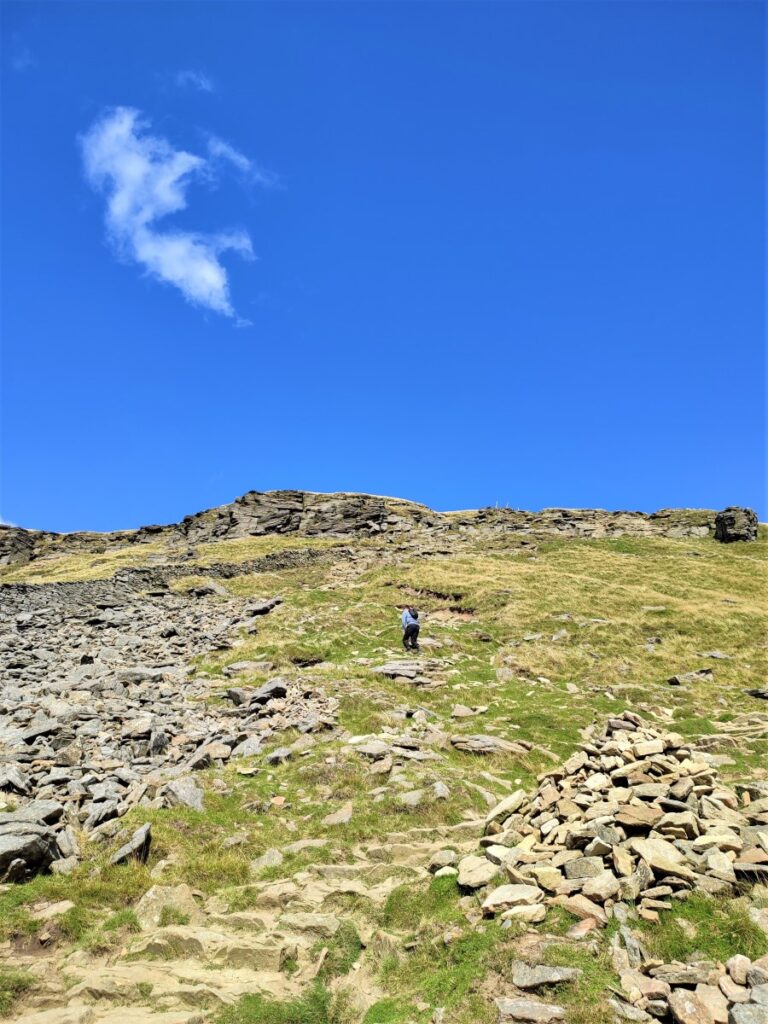
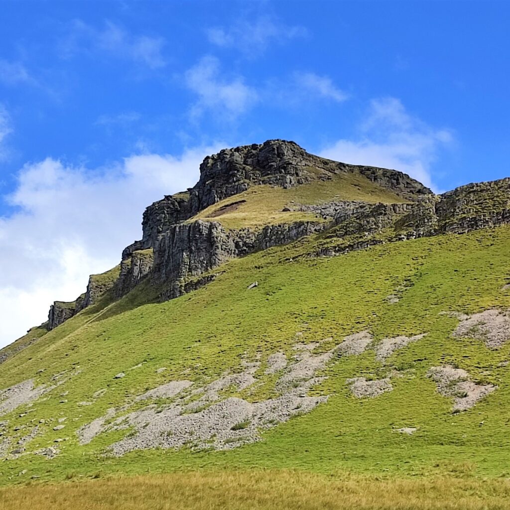
As we follow the Pennine way upward, the path becomes less secure, and we soon find ourselves scrambling up a very steep section. Take care here – particularly if the day is wet.
Rather surprisingly, this section soon gives way to a gentler approach to the top, where the path is again surfaced with recovered slabs – so if you find the rocky sections uncomfortable, be encouraged to press on – that part is soon over.
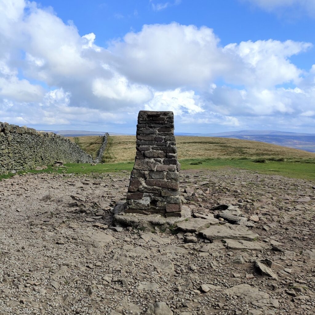
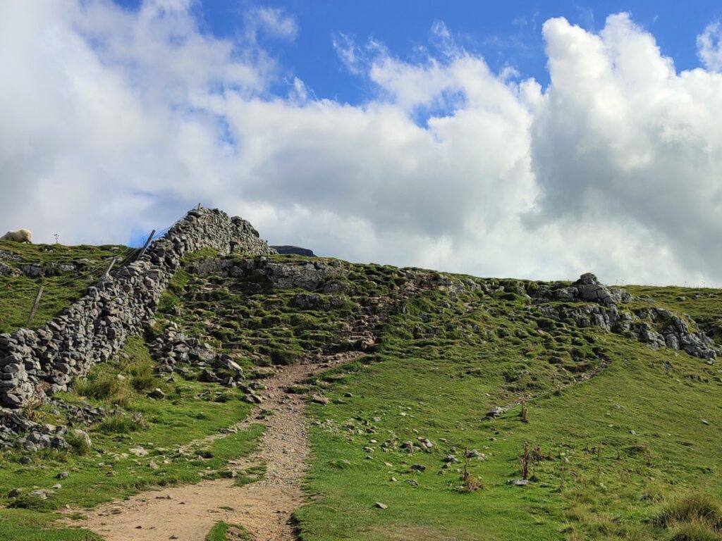
As we get still higher, we see a cairn and a trig point ahead, and as we approach them we notice a welcoming pair of shelters with benches built into the dry stone wall at the top of the hill.
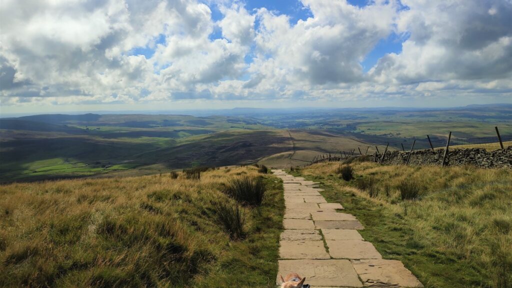
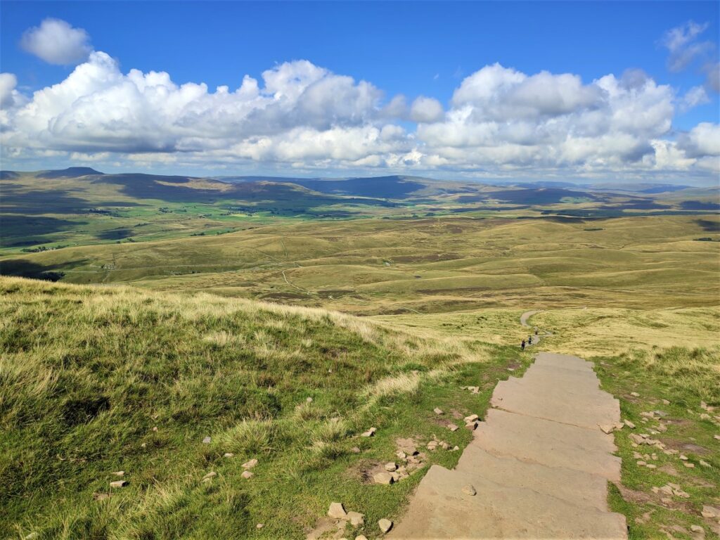
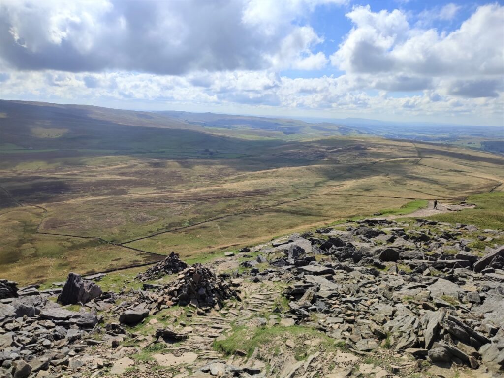
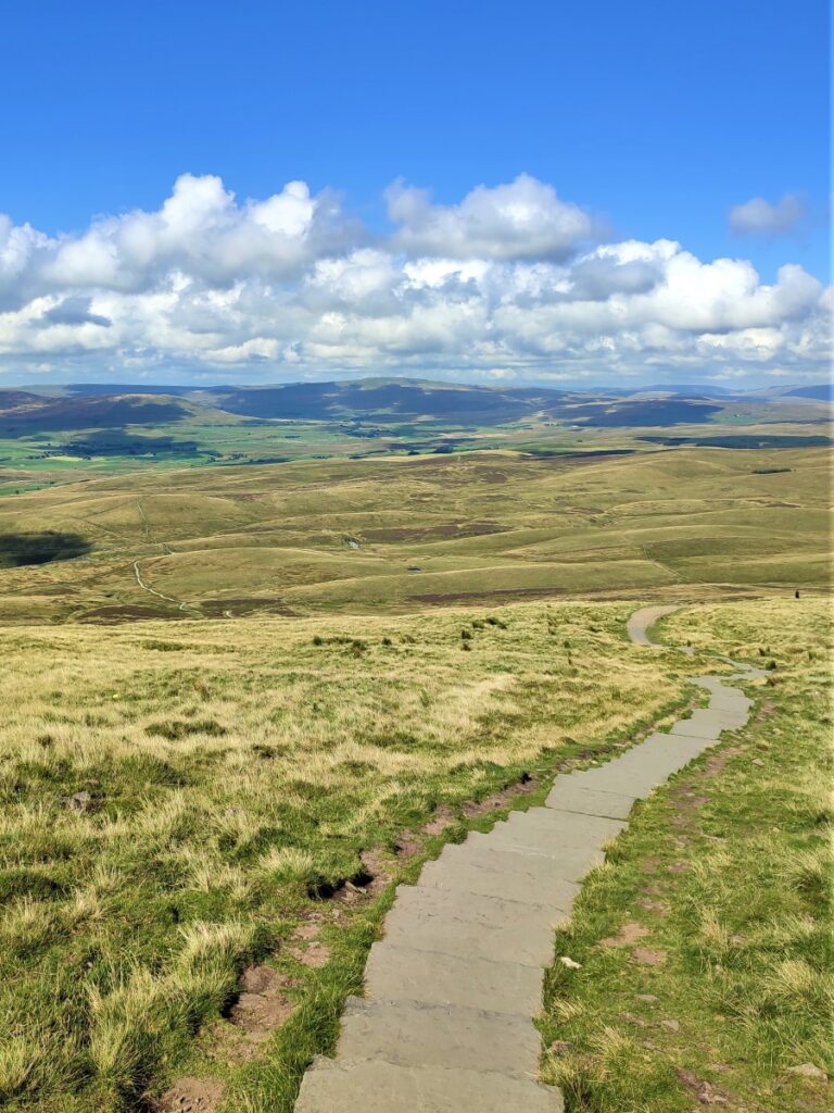
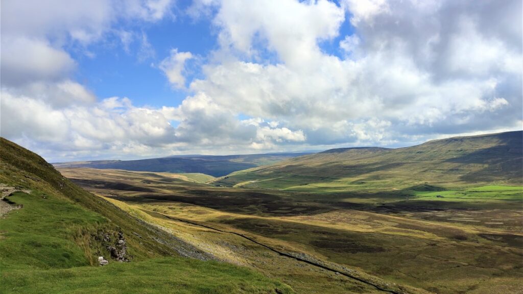
This is the peak, and from here we have excellent views:
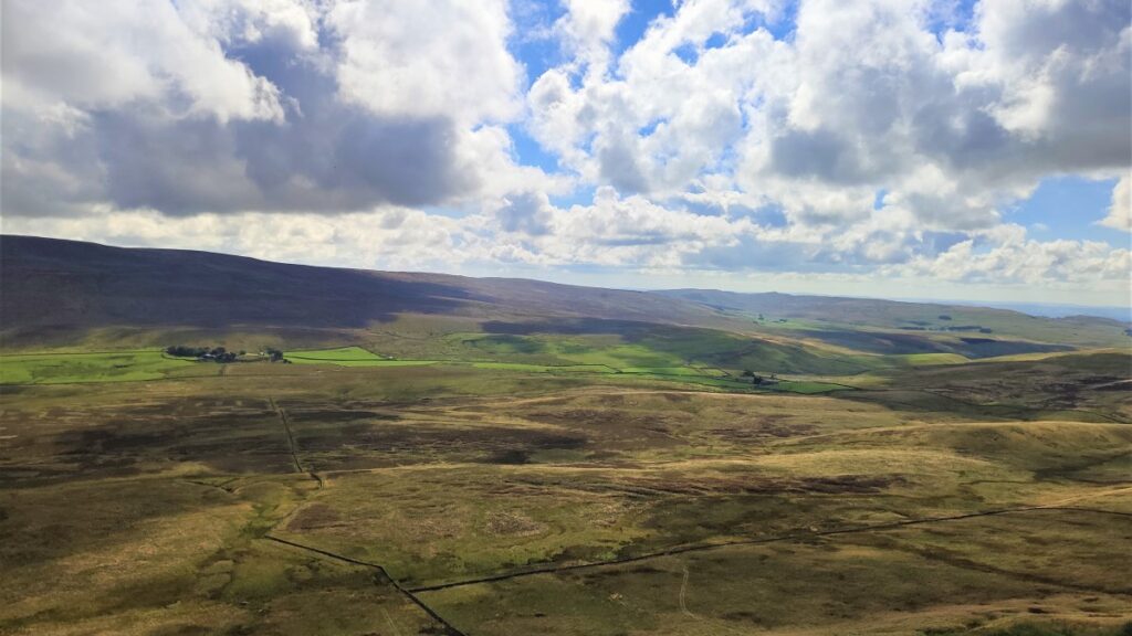
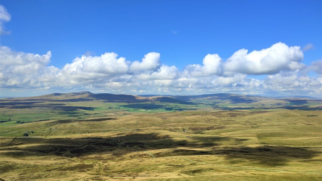
To the East we look over the valley toward Fountains Fell, and the top end of Littondale.
To the North is Pen-y-ghent side and Plover Hill – in effect and extension of the ridge at the top of Pen-y-ghent.
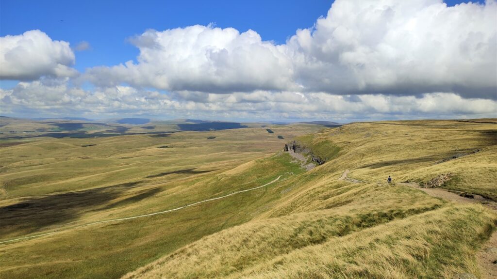
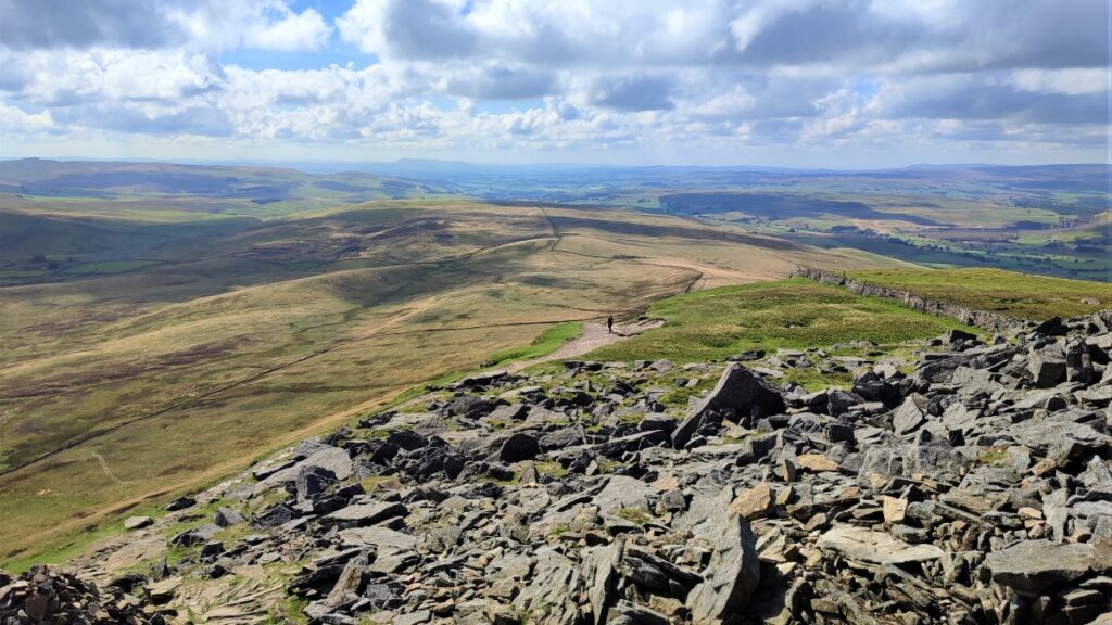
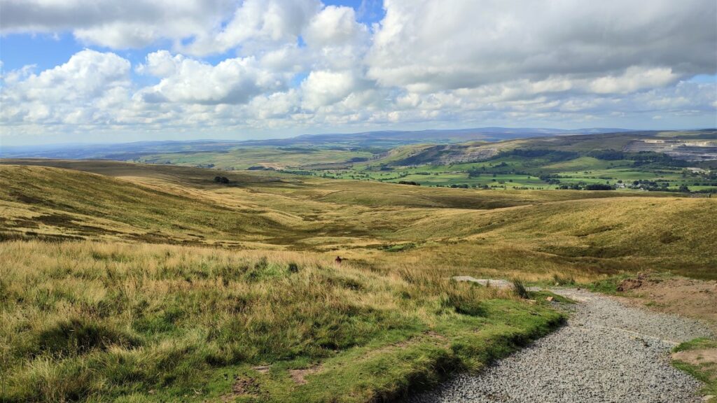
To the South we look down Silverdale toward Stainforth and Settle, with the Pennine way path clearly visible
To the West we can see Horton nestling next to the Ribble, the quarries that dominate the valley sides, and further in the distance (and from left to right) Ingleborough, Simon Fell, and Park Fell.
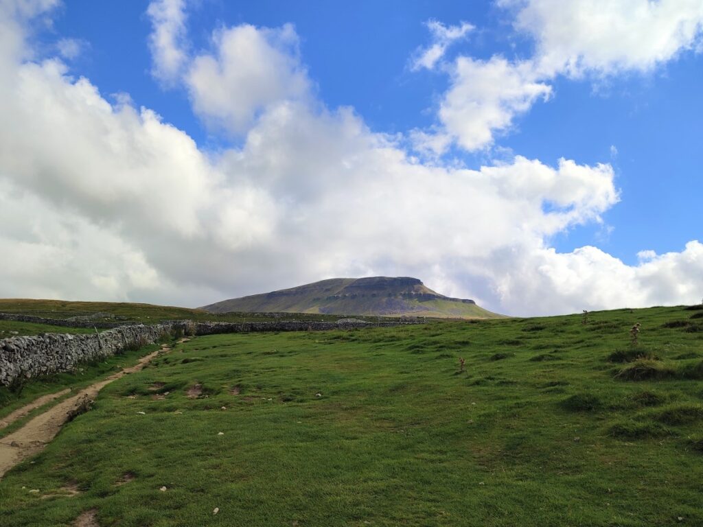
The return route is gentler than the approach, and we start by crossing the drystone wall via one of two gates and taking the clear path downhill and slightly to the right (Northwest). Ahead we soon see the path head sharp left and we continue with it. There is a path to the right which takes us up to Plover Hill, and that’s well worth exploring another time.
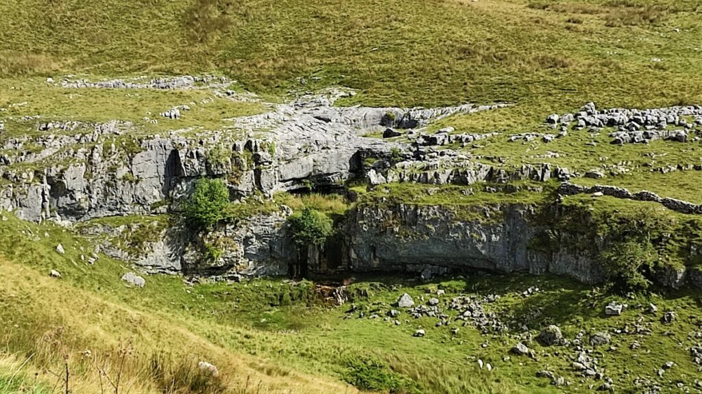
We carry on down the path – which remains clear – until we are heading West. On a clear day you will be able to see Hull Pot over to the right of the path – Hull pot is well worth seeing and is featured in another of the Bentham Footpath Group walks. Meanwhile over to our left (but not so clearly visible) is Hunt pot.
The slot of Hunt Pot is a typical example of a Yorkshire Dales pothole. Having washed away a shallow coating of glacial boulder clay, a surface stream has found a weakness in the underlying limestone and cut a vertical channel, which has been expanded by dissolution to produce a 60m deep chasm. If you do decide to go off the path to find Hunt Pot, be aware that it is NOT fenced off.
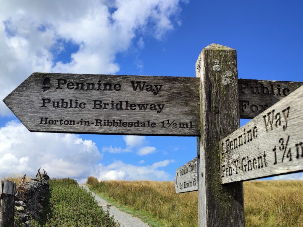
We carry on down until we meet a fingerpost showing an intersection of four paths – this is Tarn Bar.
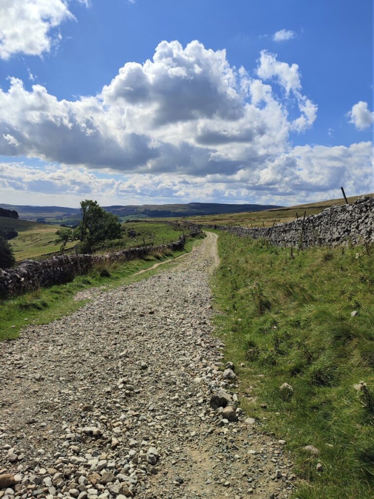
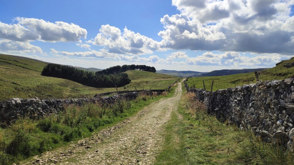
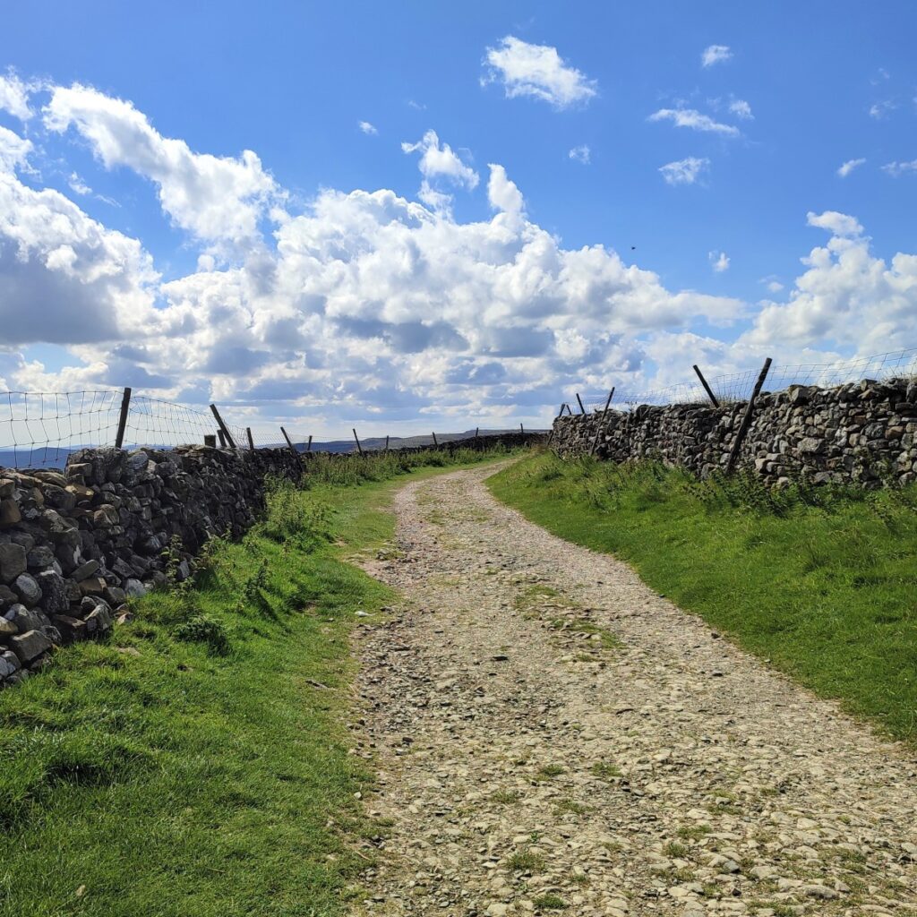
Here we take the path on the left indicated as Pennine Way to head down a bridleway between drystone walls heading Southwest into Horton.
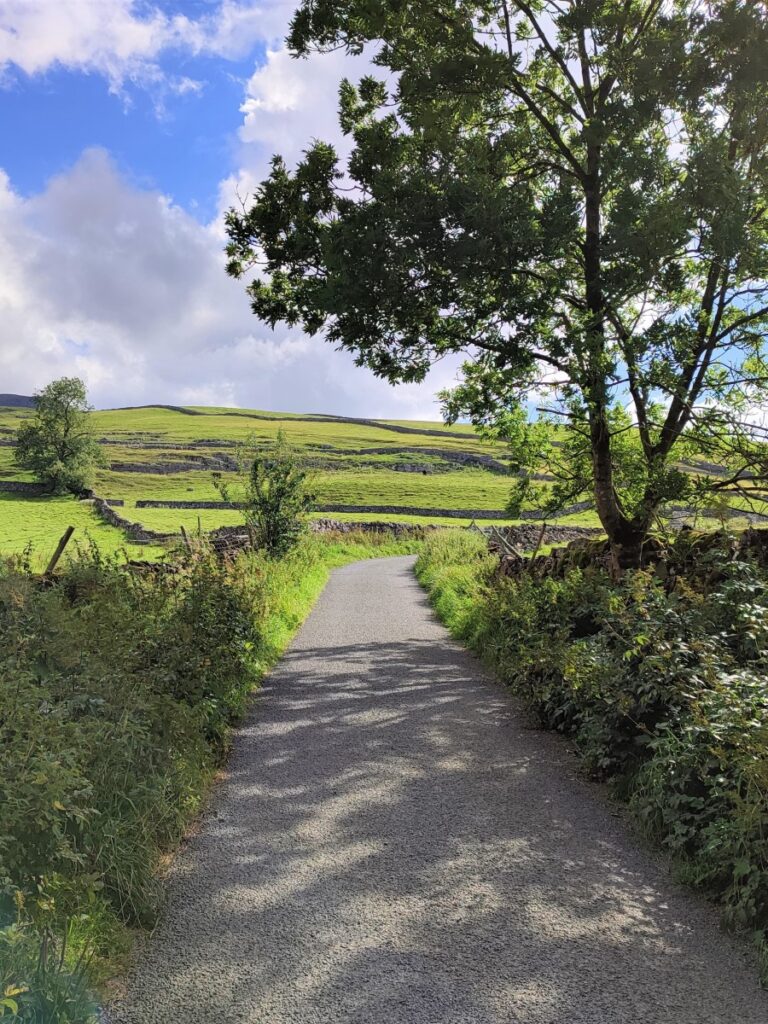
From here, navigation is fairly fool-proof: simply follow the lane down toward Horton In Ribblesdale.
The route indicated in the GPX shows us following the lane down as far as the main road through the village – where we turn left along the main road.
The advantage of doing this is that we can pop into the village shop for an ice cream, and then continue on to the church of St Oswald. This ancient church built in the early 12th Century has many interesting features unique in the Dales, particularly the Norman doorway and tub font with herringbone decoration.
Just before the church is a path which passes along the side of the church grounds to exit onto the lane behind the church. We take this and then turn left to cross the footbridge on the right over Horton Beck where we see the primary school and end the walk.
If the church does not appeal, or a shorter walk is needed, then look out for the three way junction in the lanes before we get to the main road – take the left hand fork here and pass the farm to arrive at the footbridge over the beck. This hand-painted sign tells you that you are at the correct junction
Note that the quoted distance does not use this final short-cut.