Sedbergh

Blease Fell & Tebay Gill

6.2 miles | 10.0 km | 321 m Ascent | 7.8 Naismith miles | George Sheridan
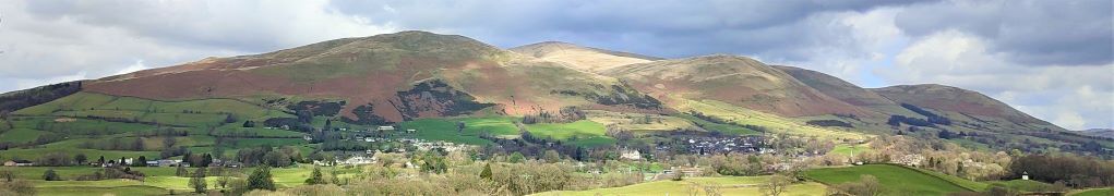
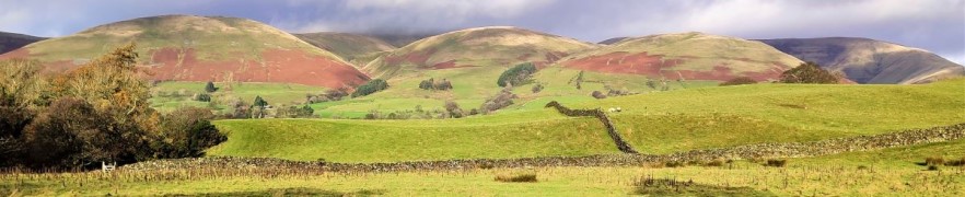
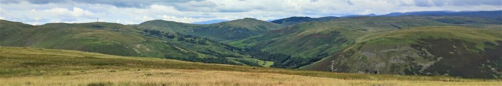
The Howgills are a great place to walk – and a firm favourite of the Bentham Footpath Group. The hills here are formed from Ordovician and Silurian rocks, rather than the Carboniferous limestone elsewhere in the Yorkshire Dales, giving them a characteristic rounded appearance and a lovely velvety texture.
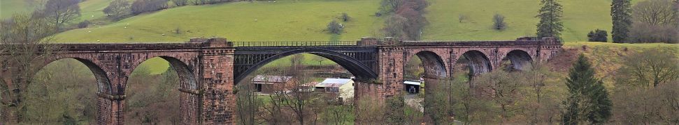
The Howgills are found in the triangle between Sedbergh, Kirkby Stephen and Tebay, and its to the latter that we go for this walk.
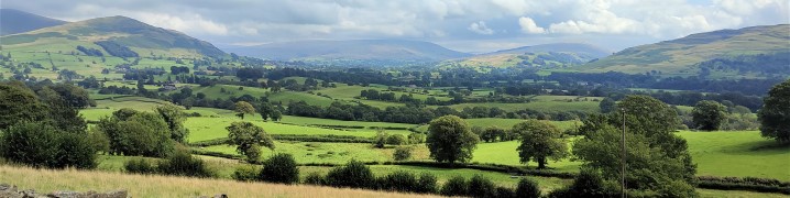
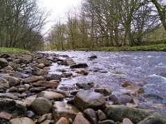
We start in Tebay village, and then head up onto the hills following the edge of Tebay Fell to the south with great views over the valley to Borrowdale until we get to the peak of Blease Fell where the vista down the Lune Valley as far as Morecambe Bay makes the climb seem well worthwhile. We then head round the fell, and back over a flattish top via Hare Shaw cairn, Weather Hill, and Waskew Head to cross Tebaygill Beck at a picturesque stone bridge, before returning to Tebay.

Blease Fell & Tebay Gill Read More »

Sedbergh Riverside and the Lune Viaduct

6.3 miles | 10.1 km | 248 m Ascent | 7.5 Naismith miles | Peter Lennard
The Dent Foot walk that we completed on 17/03/23, connected with two of the three rivers in and around Sedbergh – the Rawthey and the Dee. This walk completes the set by adding the Lune.
We start by heading out onto the fells at the base of Winder, with great views over to the Lune Valley and the disused railway viaduct. We then cross farmland to pick up the Dales Way and have a close look at the spectacular viaduct.
From there we follow the Lune downstream before cutting back to Ingmire Hall. Next, we head down to the beautiful Friends Meeting House at Brigflatts, and finish by following the Rawthey upstream back to Sedbergh. The walk is classified as easy – althtough there is a bit of a climb at the start.

Sedbergh Riverside and the Lune Viaduct Read More »

Dent Foot

8.1 miles | 13.0 km | 234 m Ascent | 9.3 Naismith miles | David Longton
Sedbergh is a favourite location for The Bentham Footpath Group, as is Dent, so surely there’s a walk based between the two that captures the best of both? There is – and this is it -typical Yorkshire Dales walking but with views of the Howgills.
We start next to the River Rawthey, just north of where it merges with the Lune, and track upstream toward Sedbergh, passing the confluence with the Dee, but staying with the Rawthey at first. We then cross the river and head to Millthrop, to pick up the Dales Way path which takes us down to Gate Manor in Dentdale. We then cross the Dee to return along the other side of Dentdale via Rash and Dent Foot, before skirting Holme Fell to arrive at Middleton Bridge via a Roman road. A short stroll back along the Rawthey concludes the walk.

Dent Foot Read More »

Dowbiggin

6.6 miles | 10.6 km | 312m Ascent | 8.1 Naismith miles | George Sheridan
The Howgills, are a firm favourite of Bentham Footpath Group: These distinctive rounded hills with their lovely velvety appearance offer a wide variety of walks with peaks such as The Calf, Calders, and Arant Haw, along with the spectacular waterfall of Cautley Spout.
This easy walk does not do any of these big climbs – instead we focus on gaining a great view of the wider area. It starts from New Bridge just outside Sedbergh and then heads East along the Clough River, before turning North at Dovecote Gill. We pass through Dowbiggin and then cross the Hebblethwaite Hall Gill before heading West at Hebblethwaite Hall. We then press on to the A683 via an Alpaca farm at Ghyllas, and after a very short section of road walk take the Pennine Journey path along the Rawthey back to New Bridge.

Dowbiggin Read More »

Killington

7.2 miles | 11.6 km | 435 m Ascent | 9.4 Naismith miles | Robert Baines
Many people associate Killington with the reservoir and the services on the M6.
In fact, the pretty 14th century village that the reservoir is named after is some way to the east of there in the Lune Valley with impressive views over to the Howgills at Sedbergh.
This relatively easy walk takes the shape of a figure eight on the OS map – and there are paths to enable either loop of the figure 8 to be walked independently, so two shorter walks can also be found here.
Apart from some boggy ground at Tarn Moss, the walking is easy though, so we recommend the walk as published here.

Killington Read More »

Lower Garsdale

6.4 miles | 10.3 km | 295 m Ascent | 7.9 Naismith miles | Alison Kinder & Colin Stroud
Garsdale is one of the less-visited Dales in the Yorkshire Dales National Park, and that’s something of a shame, because it’s particularly attractive. It runs East / West between Baugh Fell to the North, and Rise Hill to the South.
This walk starts at a large car park on the A684 with great views of the Howgills, and then heads up the dale on a small and very quiet road following the lower slopes of the imposing Baugh Fell.
We return on the other side of the dale following the Clough River past New Bridge before picking up the Sedgwick Geological trail on our way back to the car park.

Lower Garsdale Read More »