Roman Road

Furnessford & Hindburn Bridges

8.5 miles | 13.6 km | 361 m Ascent | 10.3 Naismith miles | Susan Badley
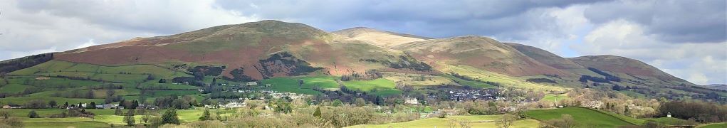
Bentham Footpath Group Walks generally start within an hour’s drive of Bentham – there is so much wonderful walking country within that radius that we are always spoiled for choice. This excellent walk – aided by near perfect weather – highlights the fact that Bentham itself is a great place to start a walk.
We start in low Bentham and cross the Wenning at the pedestrian bridge were the Silk Mills once stood, and then head up Mill Lane as far as Kirkbeck where we take paths across fields to Mewith lane and then across to Spens Farm.
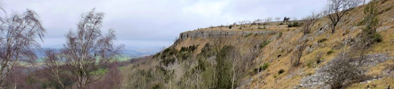
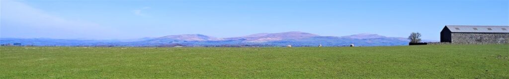
We cross the Hindburn for the first time at Furnessford Bridge, and then head over to Cragg Hall, before descending back to the river to cross at Hindburn Bridge. From there we head up to Mealbank and take paths across fields to follow the Wenning Valley upstream with great views across to Ingleborough and Whernside along the way. Passing Robert Hall, we head down Eskew Lane and back to Low Bentham.

Furnessford & Hindburn Bridges Read More »

Dent Foot

8.1 miles | 13.0 km | 234 m Ascent | 9.3 Naismith miles | David Longton
Sedbergh is a favourite location for The Bentham Footpath Group, as is Dent, so surely there’s a walk based between the two that captures the best of both? There is – and this is it -typical Yorkshire Dales walking but with views of the Howgills.
We start next to the River Rawthey, just north of where it merges with the Lune, and track upstream toward Sedbergh, passing the confluence with the Dee, but staying with the Rawthey at first. We then cross the river and head to Millthrop, to pick up the Dales Way path which takes us down to Gate Manor in Dentdale. We then cross the Dee to return along the other side of Dentdale via Rash and Dent Foot, before skirting Holme Fell to arrive at Middleton Bridge via a Roman road. A short stroll back along the Rawthey concludes the walk.

Dent Foot Read More »

Scout Scar and Underbarrow

5.7 miles | 9.1 km |255 m Ascent | 6.9 Naismith miles | Alison Kinder & Colin Stroud
The area of the South Lakes between the Kent and Levens Estuaries provides a rich source of walks and is particularly favoured by The Bentham Footpath Group. This walk shows why: It’s relatively short and generally easy, but still manages to deliver spectacular views, well preserved industrial archaeology, a roman road, an ancient pele tower, sites of special scientific interest and ancient woodlands.

Scout Scar and Underbarrow Read More »

Long Preston

9.8 miles | 15.8 km | 462m Ascent | 12.1 Naismith miles | David Longton
Long Preston is a small village that many people drive through on the way to better known destinations in the Yorkshire Dales. It’s well worth stopping though to explore this village and the excellent walks that can be accessed from it.
The walk we present here is classified as challenging simply because it just exceeds our 15km limit for a moderate walk – but much of the route is on tracks, or minor roads, and there are no steep climbs, so if you feel comfortable with our moderate walks give this one a go too. There are some shortcuts highlighted.
As you can see from the gallery, we picked a wet day to walk it, but in better weather, the views over the Ribble Valley, and the flood plains south of Settle are well worth seeing, as is Scaleber Foss at the halfway point.

Long Preston Read More »