Semerwater is one of only two freshwater lakes in the Yorkshire Dales. That in itself makes it worth visiting.
Add in spectacular views, a Roman road, two idyllic villages and an atmospheric ruined church and this relatively easy 10km walk becomes very attractive
Parking for this walk is by the lakeside. There is a modest charge, payable at a farm – clear instructions are provided at the parking place.
We leave the car park, with our back to the lake, and turn left walking slightly uphill along the road we came in on. We cross the pack horse bridge over the river – which at this point is called the Low Wheel – although it later becomes the River Bain, which as the name suggests flows through Bainbridge.
We continue uphill on the road and ignore the first footpath off on the left – we carry on steeply uphill to the road junction at Countersett. Ahead is the road that we came in on, turn right past this and look for a footpath sign immediately after the junction (Hawes End 1/2 mile). The path now takes us down a lane toward a house.
After no more than 20m look your left hand side for the fingerpost to a footpath to Hawes End and take that footpath down the track about 50 metres before taking a gate into a field where the route is marked with yellow topped posts.
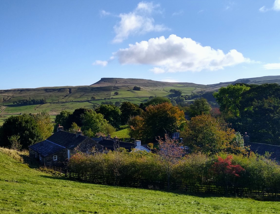
Take a moment to look backwards for a good view of the flat-topped Addleborough hill before pressing on up to the far end of the field, where we cross a small stile and dry stone wall into a meadow containing a dilapidated farm building.
The path here is not very distinct, so make sure you pass to the left of the farm building at which point we see the stile through the dry stone wall that we take into the next field on our left.
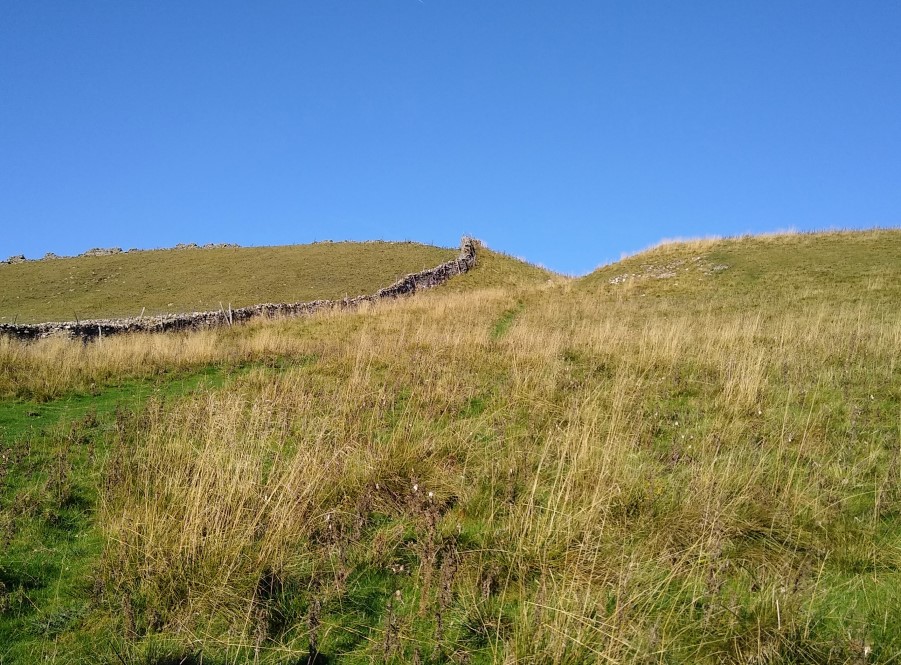
We now walk slightly downhill of an enclosed shake hole and approach a second dry stone wall. At this point we turn slightly right follow the wall uphill through a small dip in the ridge looming above us, where we cross a drystone wall.
We carry on in this direction keeping the dry stone wall on our left hand side. At the top of this field is a gate where we again meet the road from Hawes. At the road turn right, which is slightly uphill and offers good views over the valley toward Sedbusk and Abbotside Common. Stay on the road for about 200m and just beyond the passing place, look for a fingerpost on the right. Here we pass through the gate toward Horton Gill Bridge.
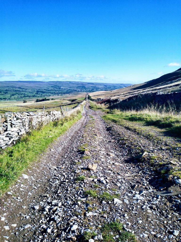
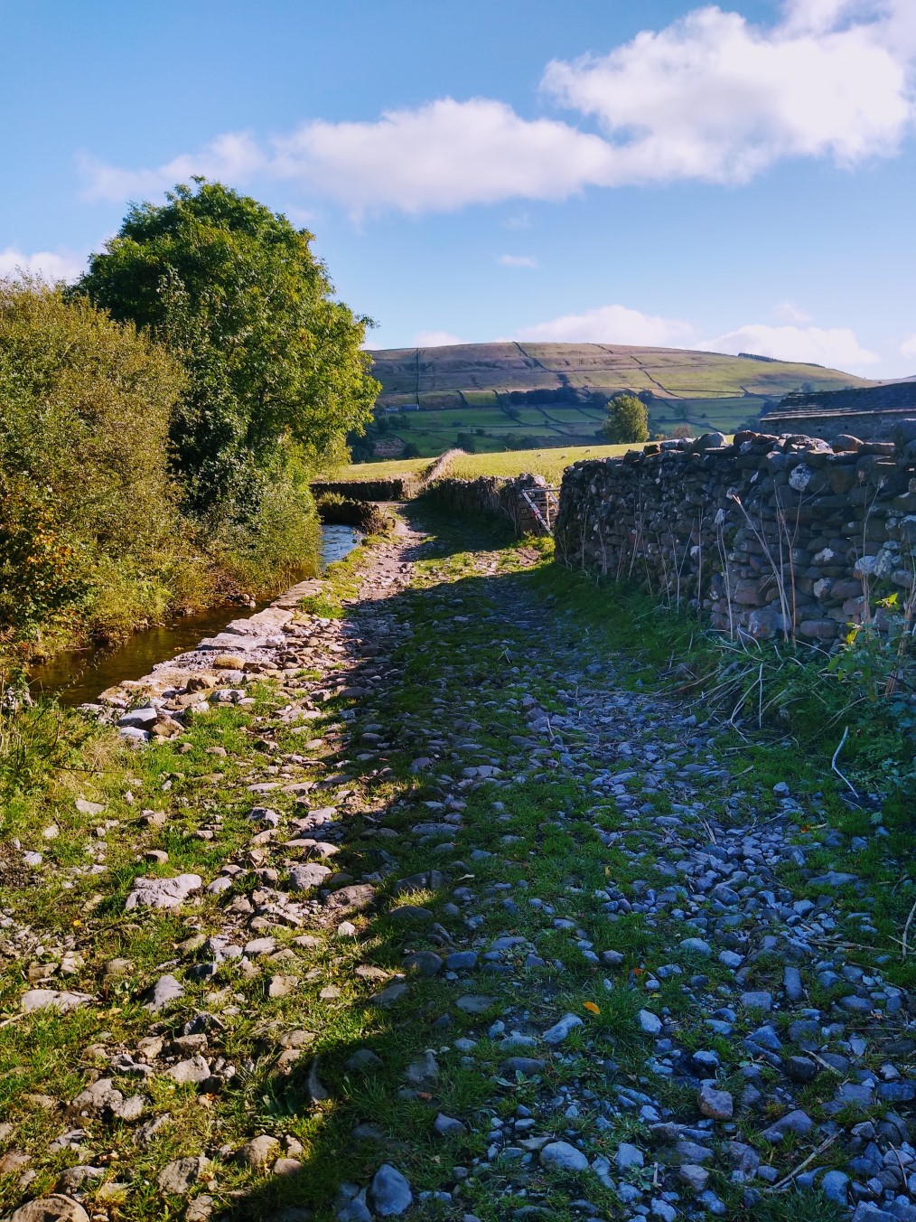
The path is clear and heads diagonally downhill where we can see the Cam High Road, part of a Roman Road that ran from what is now Bainbridge to Ingleton, and possibly on from there over to Low Bentham, although nothing south of Ingleton now survives. Before we get there though we cross a broad farm track – don’t be distracted by this – carry on down to the gate onto the Roman Road.
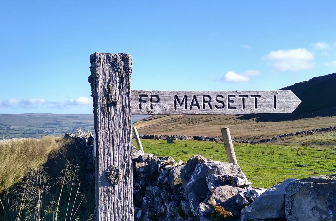
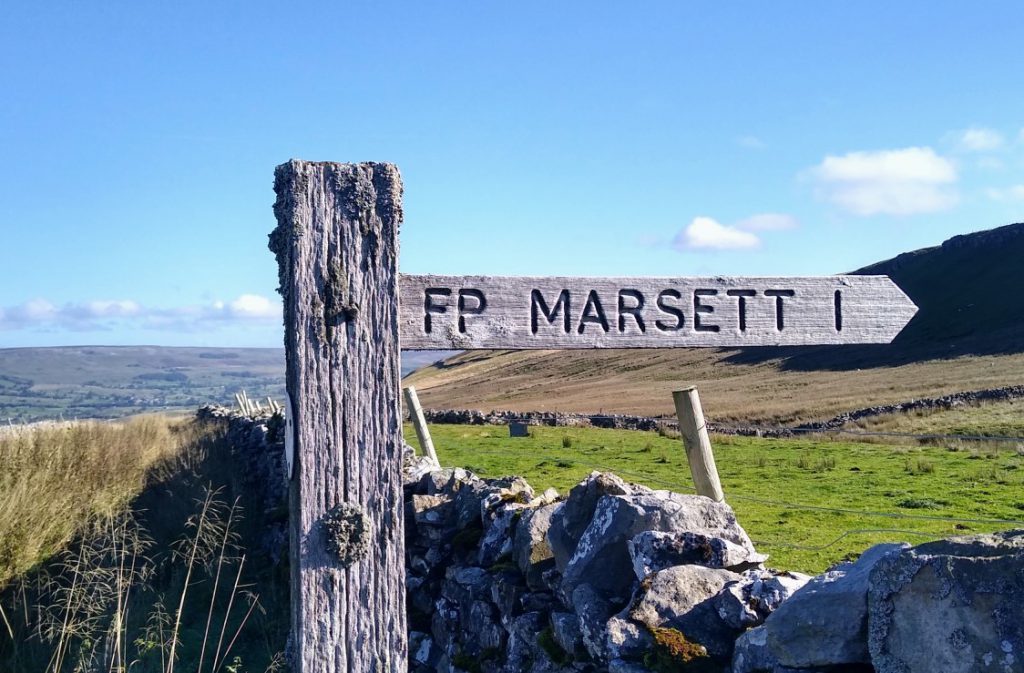
At the Cam high Road, we turn left which is slightly uphill, and after just a few minutes, we return to the Hawes Road. We cross this and pick up the Roman Road on the other side finding a post indicating Beggerman’s Road three-and-a-half miles. We stay with the Roman Road for three quarters of a mile until we see a finger post on our left hand side (Marsett 1 mile) which takes you up the hill over slightly boggy ground to small dip in the ridge ahead.
We cross a stile and after about 70 m there is a fork in the path. The easier (dryer) route is left which takes us uphill through a dry stone wall. This is the high point of the walk at just over 500m. Ahead of us we see a four way finger post. We carry on in the same direction as before (SSE) which is signposted as footpath (the route crossing is a bridleway).
We now start heading down hill and very good views over the Raydale Valley now open up. We can also see Semerwater again over to our left. As we continue to head downhill it’s worth glancing right to see some evidence of quarrying and an old Lime Kiln. We press on downhill – quite steeply at times to a dry stone wall where we find a steep ladder stile with a convenient dog gate next to it.
We continue to walk downhill keeping the drystone wall on our right hand side. The path is clear and well-trodden, and before long we start to move away from the wall and further over to the left. As we continue down, we see the farms and houses of Marsett ahead of us. At this point navigation is not quite so clear: It looks like the path goes to a gate in the corner of the field, but in fact this a farm access track – the real path is to the left of this via a gate in the drystone wall ahead.
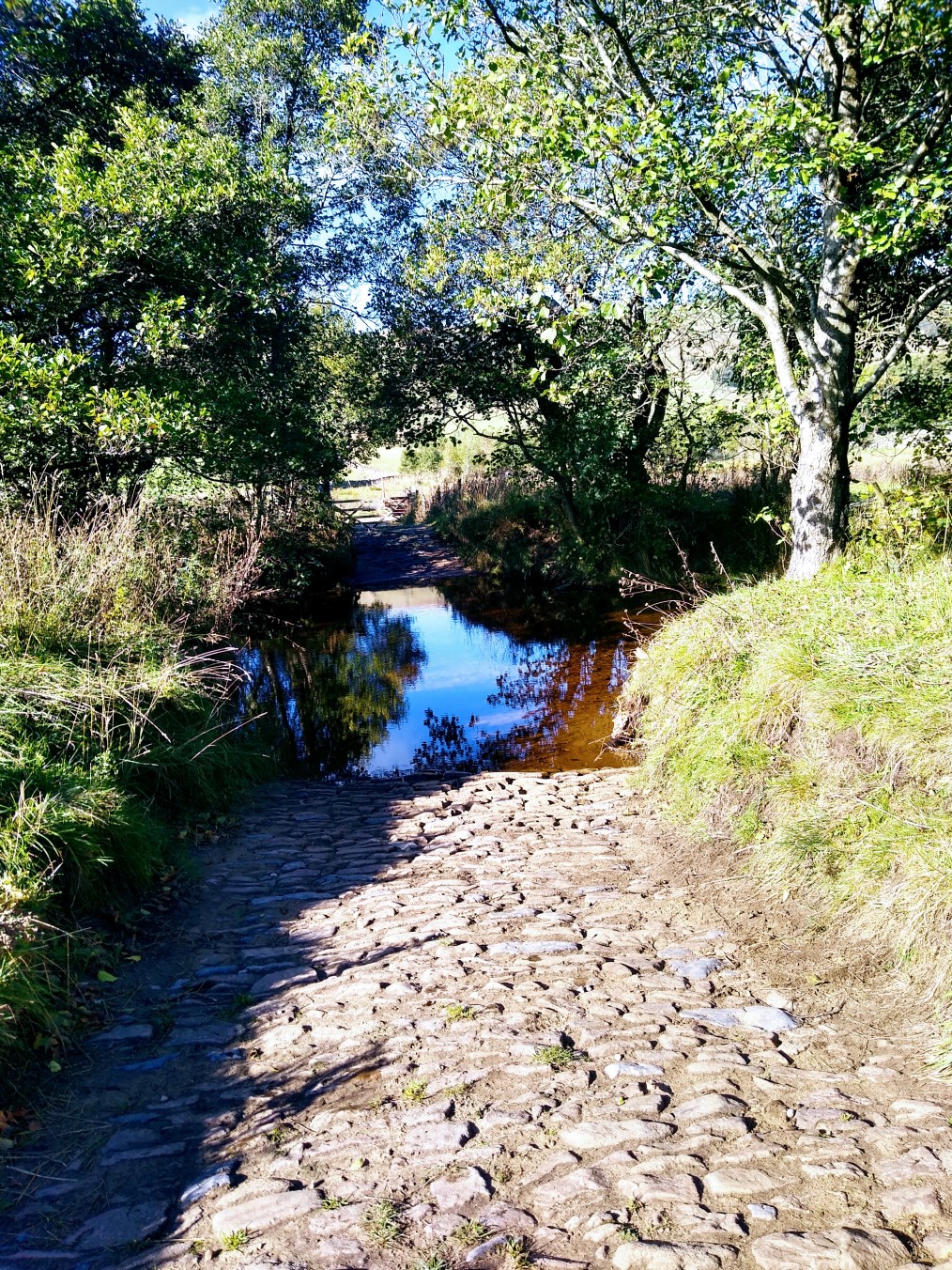
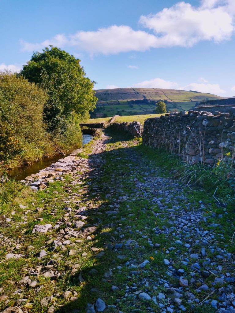
Beyond here, we carry on downhill keeping the drystone wall to our right hand side until we arrive at a gate onto a stony track where we turn left and downhill into village. After 400m we meet a small tarmac road at this point we turn right to see a sign welcoming us to Marsett. We cross the road bridge and immediately turn left onto a grassy track along the side of the river. We keep the riverbank on our left hand side, initially walking right next to the river, though after a short while the path veers to the right and away from the water.
After 100m the track arrives at the gate into the Semerwater nature reserve. We pass through the gate and continue with the track for a further 100 meters at which point we cross the Longdale Sike via the ford or footbridge and after another 50m we meet another foot bridge on our left. We ignore this and carry on along the riverbank with the water on our left until the path crosses the river on a structure that looks like a very shallow bridge in dry times, or a ford in wet periods.
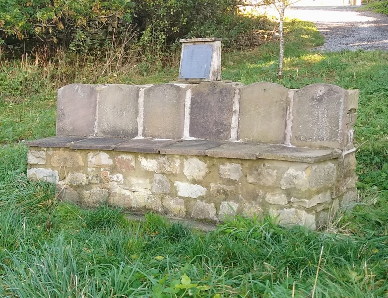
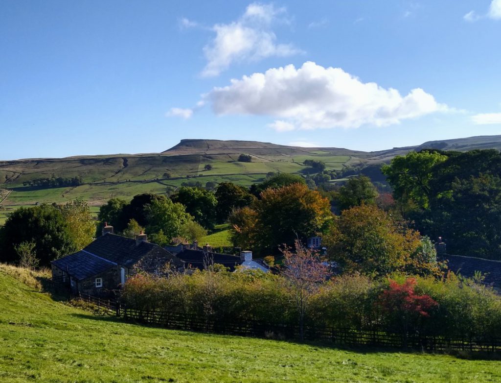
We continue to follow the track – now steeply uphill – toward the village ahead, and we see a number of paths signposted off the main track. We ignore all of them and carry on with the lane until we reach houses and a pleasant green space with a memorial bench. This is Stalling Busk.
It is worth taking a moment to explore Stalling Busk – but come back to the memorial bench.
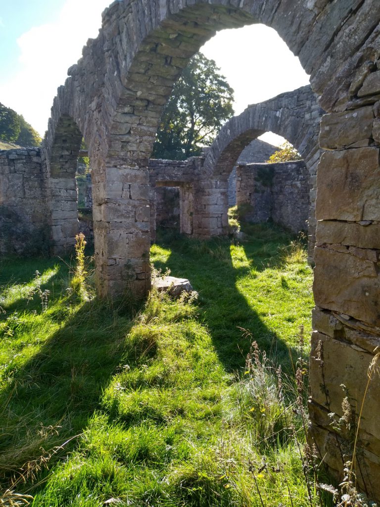
We now take a path down to the ruined church. This is not immediately visible, so from a seated position on the memorial bench, look toward the lower right hand corner of the green where a lane continues between some buildings and down to a stile into a field. From here we walk downhill keeping the field boundary at our left and down toward the church which is now clearly visible.
Access to the ruined church – the original parish church for Stalling Busk – is via a stile through the church wall. Take a while to explore the church ruins, and the surprisingly recent grave markings before leaving by the same stile to continue with the path toward Semerwater.
The path now winds gently downhill passing through several field boundaries and stiles, before entering the nature reserve.
The path remains clear and skirts the waterside before heading across a field to pick up the road adjacent to the farm where the parking was paid for. Follow the road to the left to get back to the car park.