Morecambe Bay

Bardsea and Urswick

7.4 miles | 11.8 km | 250 m Ascent | 8.6 Naismith miles | Terri Kwiecinska
In March 2024, Bentham Footpath Group walked at Flookburgh, and enjoyed views over the Cartmel sands to Bardsea. This time we are on the other side of the estuary for a great walk starting from Bardsea then heading inland to visit Urswick and its tranquil tarn. On the way we have the corresponding views back toward Flookburgh and the whole of Morecambe Bay. We also see a beautiful church, a curious three sided folly, get more than one ice cream opportunity, and pass the site of an ancient hill fort, before noting alpacas, highland cattle and a stone circle. We end by walking on the beach with opportunities to see and hear all the birdlife teeming at the margins. All this with free parking and public toilets.

Bardsea and Urswick Read More »

Winster Valley

8.3 miles | 13.3 km | 391 m Ascent | 10.2 Naismith miles | Kate Rowe
Spring is such an optimistic time of the year, and getting out and about on a walk with friends is a great way to experience it. So the Bentham Footpath Group have developed an informal habit of taking a walk each year that celebrates the season by picking a route that features the best of the new daffodils or bluebells.
So, here is a “daffodil walk”, and as all Wordsworth fans will appreciate, it really has to be in the Lake District to be authentic – which means of course that as well as the spring flowers we get great views of the fells, tranquil tarns and on this walk, links to Arthur Ransome.
Although our focus was the daffodils, this is a great walk at any time of the year. We rate it as “moderate” based on distance and elevation change but you should be aware that it can feel challenging under wetter conditions.

Winster Valley Read More »

Flookburgh, Cark and the coast

8.3 miles | 13.4 km | 138 m Ascent | 9.0 Naismith miles | David & Sheila Longton
A number of Bentham Footpath Group walks feature views of Morecambe Bay – usually with the Kent or Levens estuaries as the backdrop to higher level walks such as those at Cartmel or Silverdale. This time we do the full seaside experience: Starting at Flookburgh, we walk along the coast getting sand on our boots for a while, before heading inland to Cark, on to Low Bank Side, then across the valley to Templand before returning on a route running through trees below Boarbank Hall. On the way we pass old airbases from both world wars, atmospheric salt marshes, bridleways across the bay, signs of the old shrimping industries, grand Italianate houses, and the odd lime kiln.

Flookburgh, Cark and the coast Read More »

Heathwaite Coastal

5.3 miles | 8.5 km | 243 m Ascent | 6.5 Naismith miles | Alison Kinder & Colin Stroud
We are lucky enough to live in a location that gives us easy access to some of the most beautiful countryside in the UK, and we immediately think of the Lake District, the Yorkshire Dales, and the Forest of Bowland in this context. To that list we must surely add the Arnside and Silverdale Area of Outstanding Natural Beauty (AONB) – a compact but varied area that offers a wide variety of scenery, flora and fauna: One of the smallest AONBs, it covers just 75 km2 between the Kent Estuary, the River Keer and the A6.
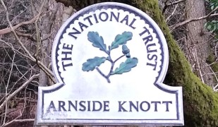
This easy walk starts from the ever popular seaside village of Arnside, then takes a route along the coastal fringe of the Kent Estuary, looping round to Morecambe Bay at Far Arnside before returning via Heathwaite and onto Arnside Knott with its fantastic viewpoint. We end with a view of the fabulous gnarled trees on the Knott – complete with artworks – before taking a woodland route back to Arnside.

Heathwaite Coastal Read More »

Arnside

6.4 miles | 10.3 km | 236 m Ascent | 7.5 Naismith miles | Don Cartledge
Arnside is a favourite with Bentham Footpath Group – this small and very accessible area provides a huge variety of interesting features such as The Knott, a tidal bore, estuary views, a Pele tower, a Marylin, a wonderful railway bridge, Victorian architecture, rare butterflies, atmospheric distorted trees, and a seaside promenade.
This walk forms a figure of eight shape, so there is a good opportunity to approach it as two smaller walks, or because there are so many paths in the area, there are many ways that it could be combined with other BFG walks in our library to make a more challenging route.

Arnside Read More »

Warton Crag from Silverdale

8.7 miles | 14.0 km | 452 m Ascent | 10.9 Naismith miles | Rick Clapham
Another Silverdale walk from the Bentham Footpath Group – but this one takes us over to Warton Crag and the Beacon, with great views over Morecambe Bay at many points.
We pass a Victorian folly, a number of interesting sites of industrial archaeology, a failed attempt to reclaim land from the sea, and an iron-age hill fort.
The walk is classed as moderate mainly because it’s quite long, and although there is some climbing, the paths are generally good – at least in the weather that favoured us in April 2022.
Be aware that parts of the walk are on the edge of the bay so can be muddy in wet weather and/or during high tides.

Warton Crag from Silverdale Read More »

Challan Hall and Arnside Tower

7.3 miles | 11.7 km | 439 m Ascent | 9.4 Naismith miles | Alison Kinder & Colin Stroud
Silverdale and Arnside are great walking locations – Bentham Footpath Group often base walks in this area.
This walk includes the Knott and it’s great views before heading to an ancient “pele” tower and through a nature reserve to Challan Hall and Hawes Water. From there we pass a gingerbread house in the woods before seeing an even bigger pele tower and ending the walk.

Challan Hall and Arnside Tower Read More »