Kirkby Lonsdale and Casterton circular

5.0 miles | 8.1km | 164 m Ascent | 5.9 Naismith miles | Don Cartledge
This is one of our shorter walks – partly because we revised part of the route on the day to avoid flooding, and partly because sometimes it’s just nice to offer an easier route that can be used to fill a Sunday afternoon or a spare couple of hours on a balmy summer evening.
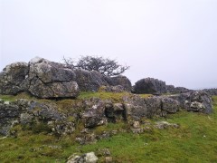
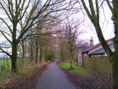
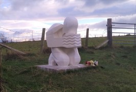
Despite being quite compact, this walk packs a lot in – we get to see the dismantled railway line that once linked Ingleton and Sedbergh, via Barbon, we walk on a Roman road, pass a number of Andy Goldsworthy art installations, catch a distant glimpse of a stone circle, visit the beautiful Holy Trinity Church in Casterton, walk on the access road to coal mines that can be traced back to the reign of Charles I, and all still have time left to get some shopping in Kirkby.

Kirkby Lonsdale and Casterton circular Read More »

Levens and Heversham

6.0 miles | 9.6 km | 205 m Ascent | 7.0 Naismith miles | Don Cartledge
A quick glance at our website shows that Levens is a firm favourite of the Bentham Footpath Group, and this easy walk demonstrates exactly why – it’s convenient to get to, offers easy walking, is packed with interesting locations, landscaped parks and industrial heritage, as well as offering stunning views back to the Yorkshire Dales, of the Kent estuary, and over to the Lake District fells.
The route we present here overlaps in places with a number of our other walks – the great advantage of this is that you can use this as the basis for longer or more challenging days out by adding sections from the connecting routes.

Levens and Heversham Read More »

Wigglesworth

6.5 miles | 10.5 km | 155 m Ascent | 7.3 Naismith miles | Don Cartledge
Bentham Footpath Group considers the Yorkshire Dales, the Forest of Bowland and the South Lakes to be our home territory, and we often venture further afield during the summer months when the days are longer.
However, it’s nice to remind ourselves just how beautiful the countryside on our own doorstep is, and to make the most of the flatter land in the flood plain of the Ribble Valley.
This easy walk loops out from Wigglesworth to the curiously named Hard Head Farm, then over to Cappleside before picking up the Ribble Way to return through the Long Preston Flood Plain Project, Cow Bridge and then via gentle fields back to Wigglesworth, where there is a very inviting pub.

Wigglesworth Read More »

Arnside

6.4 miles | 10.3 km | 236 m Ascent | 7.5 Naismith miles | Don Cartledge
Arnside is a favourite with Bentham Footpath Group – this small and very accessible area provides a huge variety of interesting features such as The Knott, a tidal bore, estuary views, a Pele tower, a Marylin, a wonderful railway bridge, Victorian architecture, rare butterflies, atmospheric distorted trees, and a seaside promenade.
This walk forms a figure of eight shape, so there is a good opportunity to approach it as two smaller walks, or because there are so many paths in the area, there are many ways that it could be combined with other BFG walks in our library to make a more challenging route.

Arnside Read More »

Fairy steps from Beetham

5.7 miles | 9.2 km | 309 m Ascent | 7.2 Naismith miles | Don Cartledge
December 2022 saw The Bentham Footpath Group walking from Heversham with views South toward Beetham and the Arnside and Silverdale Area of Outstanding Natural Beauty (AONB).
Just one month later, we start at the Heron Corn Mill in Beetham and then head through woodland and the famous “Fairy steps” to gain the complementary view – West across the estuary toward the Lakeland fells, and North toward Heversham and St. Anthony’s Tower.
We then skirt the estuary via the old railway track bed that we met on the Heversham walk, and then head up the river Bela, past Dallam Tower, and then though the deer park back to Beetham.
This walk is ideal for the shorter winter days – it’s relatively easy and offers a variety of landscapes as well as breath-taking views.

Fairy steps from Beetham Read More »

Holmepark Fell

7.1 miles | 11.4 km | 383 m Ascent | 9.0 Naismith miles | Don Cartledge
We start in Holme village and pick up the Lancaster Canal heading north and passing Farleton.
We then take minor lanes around the back of Farleton Fell, before taking paths over fields to Puddlemire lane and then from Town End Farm up onto the base of Newbiggin Crags at Whin Yeats. The landscape here is dominated by limestone outcrops and spectacular pavements with atmospheric isolated trees that attract many an amateur photographer.
We briefly return to a minor lane before cutting through Holmepark Fell, next to the huge Holme Park Quarry, before meeting the A6070 at Holme Park Farm. A short section on the verge of the road returns us to Holme.

Holmepark Fell Read More »

Bull Beck and Annas Ghyll

5.3 miles | 8.5 km | 228 m Ascent | 6.4 Naismith miles | Don Cartledge
An easy walk takes us out from Bull Beck car park down the Millennium park way to Caton where we head up toward Brookhouse Methodist Church. Here we take a path over fields toward Gresgarth Hall, before taking a path over open fields to a green lane and the Littledale Road.
A short road section takes us to Annas Ghyll where we crest the ridge and walk down to Caton Green Road. A path through housing takes back into open fields and we return to the A683 and Bull Beck car park

Bull Beck and Annas Ghyll Read More »

Hest Bank via Vineyard

6.7 miles | 10.7 km | 316 m Ascent | 8.2 Naismith miles | Don Cartledge
This walk combines sections of the Lancaster Canal with parts of the Lancashire Coastal path. It’s no surprise then that it’s a relatively gentle walk with little climbing. The only notable exception to this is a diversion at the start to pass a site where vineyards one produced white wine.

Hest Bank via Vineyard Read More »