2023

Barbon Beck and Brownthwaite

8.2 miles | 13.3 km | 385 m Ascent | 10.2 Naismith miles | Rick Clapham
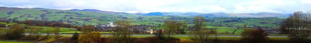
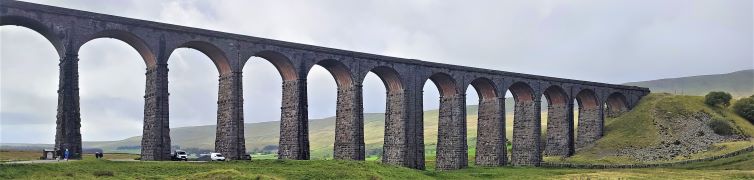
Barbon is great place to start and end a walk. Not only is there convenient parking – either at the layby at Hodge Bridge, or at the Village Hall – but there is a great deli and a highly rated pub, the remains of a Roman Road, the course of a disused railway, grand houses, ancient stone circles, and a motor sport venue.
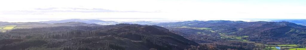
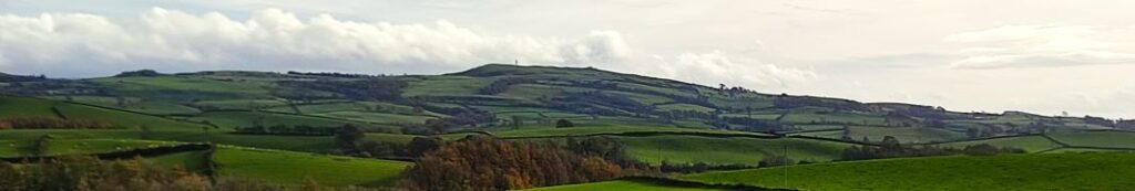
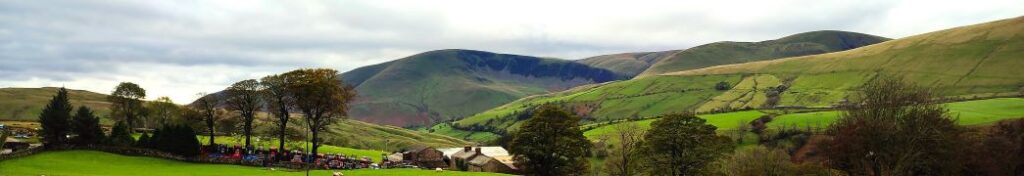
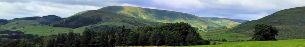
This moderately challenging walk offers all that, plus artworks by Andy Goldsworthy, great views down the Lune Valley, an invigorating climb up Brownthwaite, a very attractive waterfall, and then an easy finish along the banks of Barbon Beck in the grounds of Barbon Manor.

Barbon Beck and Brownthwaite Read More »

Gummer’s How and Cartmel Fell

8.9 miles | 14.3km | 467 m Ascent | 11.2 Naismith miles | Susan Badley
The Bentham Footpath Group typically undertakes about 50 walks each year. Given where we live, many of these will be in the rain or have poor visibility. Sometimes though we are spectacularly lucky with the weather and get to enjoy simply stunning views, and this walk was just such an occasion.
If you follow this route, you may or may not be so lucky, but whatever the weather, this will always be a great walk: We start from a free and convenient parking spot, climb up to one of the best views of Windermere, sharing the How with Luing cattle. We then head over to Sow How Tarn, clip the edge of Middle Tarn, and then go via Heights Cottage onto Ravens Barrow, and a curious monument. From there we visit a lovely ancient church and old schoolhouse, and through fungi-rich woodland to Thorphinsty Hall, through Crag Wood and up to an atmospheric derelict farmhouse en-route to Simpson Ground. We round the day off with a tranquil reservoir, and more woodland with lovely gnarled old trees. A perfect day.

Gummer’s How and Cartmel Fell Read More »

Rather Heath and Burneside

8.8 miles | 14.1km | 212 m Ascent | 9.8 Naismith miles |David & Sheila Longton
The Bentham Footpath Group have completed a number of great walks in and around Kendal – search on the website for Staveley, Levens or the Lancaster Canal to see some of them. This walk adds to that library and because it intersects with earlier offerings, creates a great opportunity to build our mental map of the area.
We start from a layby on the “old road” – once the main route from Kendal to Windermere – and then walk through woodland on Rather Heath passing the edge of Ratherheath Tarn before striking out to Plumgarths where we visit the Cumbria Wildlife Trust’s gardens. We then head parallel to the A591 before crossing onto Kendal Fell at Helsfell Nab. Unusually for a BFG walk, we then go into the outskirts of a town (Kendal), for lunch in the park, before we head out to Burneside. We have a good look at the Church and the paper mills before heading upstream along the Kent to Bowston on a section of the Dales Way. A final section over the railway, then under the main road brings us back to our starting point.

Rather Heath and Burneside Read More »

Levens Bridge and Holme

8.7 miles | 14 km | 115 m Ascent | 9.2 Naismith miles | Ed Badley
Most of the walks that Bentham Footpath Group offer are circular – we need to end where we started because that’s where our cars are.
That’s not a problem in itself, but sometimes there is an attractive route that’s well worth walking, but which offers no route back – without simply turning round.
So, here’s a solution: This walk is linear – we park at Holme and get the bus to Levens Bridge, then walk through Levens Hall Deer park to pick up the disused Lancaster Canal which we follow all the way back to Holme. Not only do we get to see more of the canal and its industrial archaeology than would otherwise have been possible, but we can include the deer park, which is simply stunning in autumn, as well as enjoying great views of the Kent estuary from the top deck of the bus.

Levens Bridge and Holme Read More »

Rawthey Bridge

9.0 miles | 14.5 km | 431 m Ascent | 11.1 Naismith miles | Sandra Craggs
The Howgills are always a great place to walk, and autumn can be particularly beautiful with the bracken turning orange, hawthorn berries bright red, the grass still green, and the trees showing hints of purple as they start to drop their leaves. Add to this the many glorious becks and waterfalls, and the relatively secluded paths, and we have a recipe for a perfect day out.
This walk starts at Rawthey Bridge on the A683 then takes woodland paths to Narthwaite. From there, we contour around Wandale Hill using an old Pack horse route to Adamthwaite. We cross Wandale Beck and Stonely Gill and then head back toward Murthwaite, turning just before we get that far, to come back round the eastern side of Harter Fell on a public by-way. We cross the A583 at Fell End and then head up to the waterfalls at Uldale before returning to the start over moorlands at Bluecaster.

Rawthey Bridge Read More »

Ribblehead & Chapel-le-Dale

7.8 miles | 12.5 km | 206 m Ascent | 8.8 Naismith miles | Valerie Eccles & Mary Pickstone
The Ribblehead Viaduct is probably the most photographed railway bridge in the UK, and an icon of the Yorkshire Dales. It’s more than just a bridge though; surrounded by stunning countryside, and with traces of industrial archaeology dating back to its construction, there’s lots to see. So where better to start a walk?
From Ribblehead, we head under the viaduct and over to Gunnerfleet before following Winterscales Beck down to the intriguing Haws Gill Wheel where the river disappears and then reappears. After a very short section of road walk, we pause at the lovely St Leonards Church, before heading up to Ellerbeck, passing a sculpture as we go, and from there take the Dales Highway back to the railway. After a brief look at the Signal Box at Blea Moor, we return via the Viaduct with views over to Ingleborough and Simon Fell.
The Dales’ favourite railway, that bridge, a disappearing river, a beautiful church, art, and great views.

Ribblehead & Chapel-le-Dale Read More »

Dunsop Bridge

7.6 miles | 12.3 km | 234 m Ascent | 8.8 Naismith miles | Peter Lennard
Within the Bentham Footpath Group, we tend to think of ourselves as living “up North”, and indeed we do – but only by a few miles: It turns out that the geographic centre of Great Britain is (according to the Ordnance Survey) in Dunsop Bridge. Given this curious fact, how can we decline the temptation to start a walk right from the centre of the country?
That curiosity aside, Dunsop Bridge is a great place to walk, and is often described as being at the heart of the Forest of Bowland. This gentle walk heads out from the village up the banks of the Dunsop before striking out to the isolated farms at Beatrix. From there, we cross Rough Syke at the bottom of Oxenhurst Clough and then after a brief but steep climb, follow green lanes and a very minor road to the lovely village of Newton where we pick up the Hodder, to follow it downstream back to Dunsop Bridge.
En route, we follow the Ribble Valley Jubilee Trail over Giddy Bridge, and then past Knowlmere Manor, and Thorneyholme Hall where we see the confluence of the Dunsop and the Hodder. The walk ends back at Dunsop Bridge where ice cream beckons.
We recommend that you take waterproofs on this walk – be aware that Dunsop Bridge holds the record for the most intense rainfall in the UK with 117mm (4.6 in) falling in just 90 minutes on 8th August 1967.

Dunsop Bridge Read More »

Claughton

7.5 miles | 12.1 km | 274 m Ascent | 8.9 Naismith miles | Alison Kinder & Colin Stroud
The road journey form Bentham to Lancaster is relatively mundane, making it easy to forget that that there are good walks on either side of the main road – as this excellent route shows. We start from the Bull Beck parking area on the A683 just east of Caton, then walk over fields to Brookhouse. A quiet country road takes us up to the wind farm at Caton Moor, with fantastic views across the valley and Morecambe Bay, before we head back down to the main road passing the quarries that feed the Claughton Brick works. We then cross the road and pass more evidence of the area’s railway history before coming through fields at the back of the brickworks to follow the banks of the Lune back to Bull Beck.
We list this walk as a “moderate” challenge, simply because it’s just over our 12km threshold. The route is generally quite easy and there are relatively few stiles, so if you normally prefer “easy” walks, don’t discount this one.

Claughton Read More »

Pendle Hill

8.4 miles | 13.5 km | 479 m Ascent | 10.8 Naismith miles | Ed Badley
Infamous for its links to the witch trials of 1612, Pendle Hill and the surrounding villages are a lovely part of the Forest of Bowland Area of Outstanding Natural Beauty (AONB). Bentham Footpath Group explored the Sabden Valley in an earlier walk (https://benthamfootpathgroup.co.uk/sabden-valley/) and have climbed Pendle hill before – though prior to logging our walks on our website.
For this walk we climb Pendle Hill again, starting from the Nick of Pendle on the Clitheroe Road. Rather than walking on the road to start the climb, we cross and head west to pick up the Ribble Valley Jubilee Trail at Parsley Barn, and then cross the road higher up, to head up Pendleton Moor. Instead of taking the direct route up Pendle Hill though, we veer left and circle round it via Mearley Moor and Pendle Moor before reaching the peak. Our return route is via Boar Clough then Ogden Clough, before climbing Black Hill to gain great views over Churn Clough reservoir. From there it’s an easy walk back to the Nick. Although classed as “moderate”, be aware that this walk can be challenging in poor weather.

Pendle Hill Read More »