2023

Giggleswick Scar 2

5.4 miles | 8.6 km | 249 m Ascent | 6.6 Naismith miles | Sandra Craggs
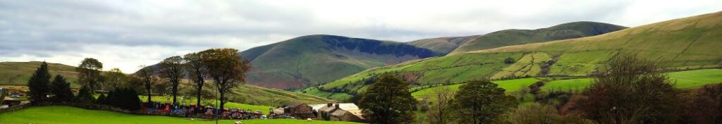
In recent walks we have travelled further afield and enjoyed some stunning scenery. Sometimes though, it’s nice to remind ourselves just how beautiful our own area is – and this walk is a perfect way to do that.
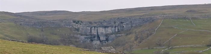
This easy route is a shortened version of our earlier Giggleswick Scar walk and makes an ideal half day stroll. We start from The Mains in Settle and then head up to Stackhouse via Lord’s Wood. We then take the Pennine Journey path round the back of the scar, as if heading to Feizor, but before we get that far we find a fingerpost which indicates the path returning to the front of Giggleswick Scar.
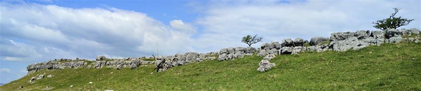
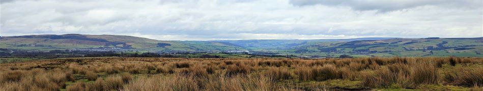
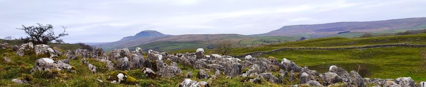
The top edge of the scar gives us great views to the south and lots of interesting limestone features including caves and cairns, before we arrive at the Schoolboy Tower. We then circle round the now disused quarry and then wrap things up by heading back down to Lord’s Wood and our cars. Two added benefits for this walk are that starting from Settle makes it accessible by Public Transport, and adding Elaine’s Tea Rooms would be an easy (2km) extension.

Giggleswick Scar 2 Read More »

Rawthey Bridge

9.0 miles | 14.5 km | 431 m Ascent | 11.1 Naismith miles | Sandra Craggs
The Howgills are always a great place to walk, and autumn can be particularly beautiful with the bracken turning orange, hawthorn berries bright red, the grass still green, and the trees showing hints of purple as they start to drop their leaves. Add to this the many glorious becks and waterfalls, and the relatively secluded paths, and we have a recipe for a perfect day out.
This walk starts at Rawthey Bridge on the A683 then takes woodland paths to Narthwaite. From there, we contour around Wandale Hill using an old Pack horse route to Adamthwaite. We cross Wandale Beck and Stonely Gill and then head back toward Murthwaite, turning just before we get that far, to come back round the eastern side of Harter Fell on a public by-way. We cross the A583 at Fell End and then head up to the waterfalls at Uldale before returning to the start over moorlands at Bluecaster.

Rawthey Bridge Read More »

Keld to Muker meadows

6.9 miles | 11.2 km | 408 m Ascent | 9.0 Naismith miles | Sandra Craggs
Bentham Footpath Group has started walks from Keld before – it’s at the top end of Swaledale. On the last occasion – in November 2022 – we headed up to Whitsundale, seeing the rivers that merge to form the Swale in full flow.
This slightly gentler summer walk takes us downstream to Muker via the Pennine Way, where having explored the village a little we walk through the ever popular wildflower meadows before returning on the far side of the river via Swinner Gill then Crackpot Hall and finally East Stonesdale waterfalls. You will notice from the gallery that the Swale was barely a trickle after a prolonged dry spell – such a contrast to our last visit.

Keld to Muker meadows Read More »

Yarnbury Lead Mines and Mossdale

9.9miles | 16.0 km | 333 m Ascent | 11.6 Naismith miles | Sandra Craggs
This walk can be considered to connect with at least two other Bentham Footpath Group walks: It physically shares part of the route of our Copplestone Gate and Conistone Pie walk, and although in a different part of the Yorkshire Dales, it shares much of the industrial heritage of the Gunnerside and Old Gang Smelt Mill walk.
The first half of the walk heads across Downs Pasture to the top of the Dib at Conistone, with great views of the Wharfe Valley and as far South as Pendle Hill. From there we head up the Bycliffe Road to Kelber Gate and then on to Mossdale Scar. The return journey takes us over Grassington Moor and through increasingly bleak, but strangely beautiful lead mining spoils back to the mines at Yarnbury where we spend a while exploring the remnants of this once vast industry.
We rate this walk as Challenging mainly because it’s quite long. There are no particularly steep climbs and there are options to shorten the route if needed.

Yarnbury Lead Mines and Mossdale Read More »

Sharp Haw and Flasby Fell

7.1 miles | 11.5 km | 374 m Ascent | 9.0 Naismith miles | Sandra Craggs
Living in and around the Dales means that we often drive through Gargrave, and as we exit the town on the Skipton side, we see an attractive fell ahead of us with a wooded side and a ridge that looks inviting as a walking area.
That’s our destination for this walk: The woods are Crag Wood, and the peak behind them is Sharp Haw and Flasby Fell. Rather than approaching them from Gargrave though, we head over to the B6265 Grassington Road so that we approach Sharp Haw from the Southeast on the Dales High Way. This route keeps more of the spectacular view over the Ribble and Aire Valleys hidden until a big reveal at the peak of Sharp Haw. We then continue round Flasby Fell to Flasby Village and return via forestry tracks through High Wood and Crag Wood, enjoying excellent views over Gargrave toward Clitheroe.

Sharp Haw and Flasby Fell Read More »

Pikedaw Hill and Malham

7.8 miles | 12.6 km | 525 m Ascent | 10.5 Naismith miles | Sandra Craggs
Malham is one of the “honeypot” villages of the Yorkshire Dales – and the use of the Cove as a backdrop for filming “Harry Potter and the Deathly Hallows” has made it even more popular. There’s more to this area than the Cove though – stunning as it is – and if you pick a weekday out of season, you can still enjoy a quiet walk. This moderately challenging walk starts in Malham, with a steep climb up Pikedaw Hill, offering great views back to Malham and over toward Pendle.
We pass Nappa Cross, then head down the spectacular dry valley at Watlowes to the top of the Cove, where we take the Dales Highway path to Goredale Bridge and return to Malham village via the always delightful Janet’s Foss path. We grade the walk as moderate, but be aware that the first section is relentlessly steep, and potentially quite boggy – and that the dry valley requires particular care.

Pikedaw Hill and Malham Read More »