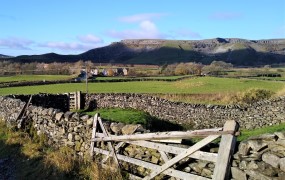
Pennine Way

Malham Tarn and the Monks Road

9.3 miles | 15.0 km | 392 m Ascent | 11.3 Naismith miles | Sandra Craggs
Malham is one of the great attractions of the Yorkshire Dales, and with good reason: Malham Cove is a spectacular sight – as are Goredale Scar, and Janet’s Foss. Slightly further north, and less crowded, is Malham Tarn – one of a very small number of bodies of water in the Dales, and it is from the car park at the Tarn that we set out on this walk.
We head up Great Close Hill for views of the Tarn and as far afield as Pendle Hill before picking up the Monk’s Road near Middle House Farm. We then head north toward Arncliffe passing a wonderfully atmospheric ruined farmhouse before pausing to look at some of the best limestone pavement in the Dales. From there we follow the Monks Road along the edge of the steep Yew Cogar Scar until we have a spectacular view over Arncliffe and the Littondale Valley. We take in the views over lunch then return along much of the same route but come back to the Tarn via a different path with a pleasant lakeside end to the walk.

Malham Tarn and the Monks Road Read More »

Far Moor Bridge and Ribblesdale

7.8 miles | 12.6km | 297 m Ascent | 9.3 Naismith miles | Sandra Craggs
Horton in Ribblesdale is a great place to start a walk, and the “three peaks” are the big draw with Pen-y-Ghent an obvious choice, as is the Sulber Nick route over to Ingleborough.
Both are good walks, but there is much else to see in this area, as we show with a route including a tarn, the stunning Far Moor Bridge, disappearing rivers, atmospheric lime kilns, a National Nature Reserve, extensive limestone pavement, and vast quarries, all of which is accessible via the Settle to Carlisle railway. What more could you want? A blue lagoon? – well there was one until recently, and we can offer pictorial evidence.

Far Moor Bridge and Ribblesdale Read More »

Keld to Muker meadows

6.9 miles | 11.2 km | 408 m Ascent | 9.0 Naismith miles | Sandra Craggs
Bentham Footpath Group has started walks from Keld before – it’s at the top end of Swaledale. On the last occasion – in November 2022 – we headed up to Whitsundale, seeing the rivers that merge to form the Swale in full flow.
This slightly gentler summer walk takes us downstream to Muker via the Pennine Way, where having explored the village a little we walk through the ever popular wildflower meadows before returning on the far side of the river via Swinner Gill then Crackpot Hall and finally East Stonesdale waterfalls. You will notice from the gallery that the Swale was barely a trickle after a prolonged dry spell – such a contrast to our last visit.

Keld to Muker meadows Read More »