Lancaster Canal

Glasson Dock and Lancaster Canal Spur

6.0 miles | 9.6 km | 67 m Ascent | 6.3 Naismith miles | Alison Kinder & Colin Stroud
The Lancaster Canal features in a number of Bentham Footpath Group Walks – not entirely surprising given that Bentham has a Lancaster postcode, and canals generally offer scenic walking opportunities. This time, we explore Glasson Dock and the Glasson Branch – one of the last parts of the UK canal network to be built, before the railways largely replaced water transport.
From convenient parking at Conder Green, we first head inland first through farms and up to the Lancaster Canal at Galgate. We then go south along the towpath until we get to the junction with the Glasson Arm, which we follow all the way down to Glasson Dock – one of the few places where our canal network connects to the sea.
The return from the Marina and Dock is via a disused railway line offering great views of the estuary, and there are several opportunities along the route to combine this easy and generally flat walk with pub lunches.

Glasson Dock and Lancaster Canal Spur Read More »

Levens and Heversham

6.0 miles | 9.6 km | 205 m Ascent | 7.0 Naismith miles | Don Cartledge
A quick glance at our website shows that Levens is a firm favourite of the Bentham Footpath Group, and this easy walk demonstrates exactly why – it’s convenient to get to, offers easy walking, is packed with interesting locations, landscaped parks and industrial heritage, as well as offering stunning views back to the Yorkshire Dales, of the Kent estuary, and over to the Lake District fells.
The route we present here overlaps in places with a number of our other walks – the great advantage of this is that you can use this as the basis for longer or more challenging days out by adding sections from the connecting routes.

Levens and Heversham Read More »

Killington

7.2 miles | 11.6 km | 435 m Ascent | 9.4 Naismith miles | Robert Baines
Many people associate Killington with the reservoir and the services on the M6.
In fact, the pretty 14th century village that the reservoir is named after is some way to the east of there in the Lune Valley with impressive views over to the Howgills at Sedbergh.
This relatively easy walk takes the shape of a figure eight on the OS map – and there are paths to enable either loop of the figure 8 to be walked independently, so two shorter walks can also be found here.
Apart from some boggy ground at Tarn Moss, the walking is easy though, so we recommend the walk as published here.

Killington Read More »

Holmepark Fell

7.1 miles | 11.4 km | 383 m Ascent | 9.0 Naismith miles | Don Cartledge
We start in Holme village and pick up the Lancaster Canal heading north and passing Farleton.
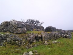
We then take minor lanes around the back of Farleton Fell, before taking paths over fields to Puddlemire lane and then from Town End Farm up onto the base of Newbiggin Crags at Whin Yeats. The landscape here is dominated by limestone outcrops and spectacular pavements with atmospheric isolated trees that attract many an amateur photographer.
We briefly return to a minor lane before cutting through Holmepark Fell, next to the huge Holme Park Quarry, before meeting the A6070 at Holme Park Farm. A short section on the verge of the road returns us to Holme.

Holmepark Fell Read More »

Hest Bank via Vineyard

6.7 miles | 10.7 km | 316 m Ascent | 8.2 Naismith miles | Don Cartledge
This walk combines sections of the Lancaster Canal with parts of the Lancashire Coastal path. It’s no surprise then that it’s a relatively gentle walk with little climbing. The only notable exception to this is a diversion at the start to pass a site where vineyards one produced white wine.

Hest Bank via Vineyard Read More »