Hodder

Stocks Reservoir circular

7.8 miles | 12.6 km | 190m Ascent | 8.7 Naismith miles | Valerie Eccles and Mary Pickstone
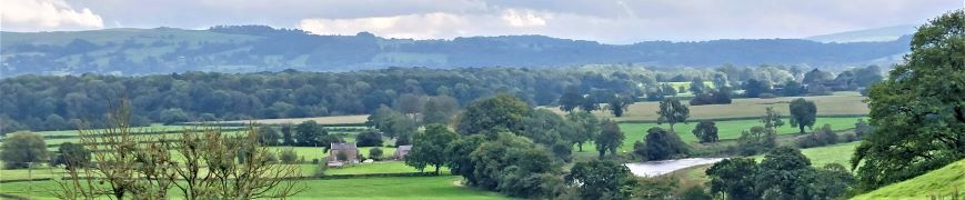
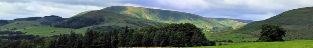
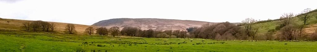
Bentham Footpath Group members are lucky enough to have the Yorkshire Dales and the South Lakes within easy reach. But our good fortune is not limited to that – we are also on the edge of the Forest of Bowland, which of course includes Gisburn Forest and Stocks Reservoir – which we explore today.
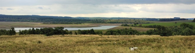
This walk starts from a car park next to the remains of a church that was relocated to enable the reservoir to be built, and then loops anticlockwise around the water – meaning that there is not much climbing.
We have been here before (September 2022) and at that time the water levels were deliberately very low – as part of engineering works to increase capacity in the long term. This time we get to see the levels replenished and the works complete – the contrast is striking. On the way round, we see signs of the buildings that were abandoned to enable construction, traces of the railway that enabled materials to be imported, and foundations for the village that temporarily housed the army of builders, as well as a more recent and very poignant woodland memorial site.

Stocks Reservoir circular Read More »

The Tolkein Trail

6.8 miles | 11.0 km | 164 m Ascent | 7.6 Naismith miles | David & Sheila Longton
Think of Tolkein and Middle Earth, and many people will think of New Zealand – largely because The Lord of the Rings trilogy was filmed there. But where is Middle Earth in reality?
We can all agree that Great Britain is the centre of the civilized world – nowhere eats more custard cream biscuits. We also know from our Dunsop Bridge walk that the centre of Great Britain is within the Forest of Bowland.
When we find out that Tolkein stayed at Stonyhurst College near Clitheroe whilst writing his masterpiece, it all falls into place: Middle Earth is the route we walk here. We start at Hurst Green, then walk down to the banks of the Ribble, past the confluence with the Calder, upstream to the union with the Hodder, then along the Hodder to pick up a path through the grounds of Stonyhurst College to return to Hurst Green. This excellent easy walk takes less time than watching the films.

The Tolkein Trail Read More »

Dunsop Bridge

7.6 miles | 12.3 km | 234 m Ascent | 8.8 Naismith miles | Peter Lennard
Within the Bentham Footpath Group, we tend to think of ourselves as living “up North”, and indeed we do – but only by a few miles: It turns out that the geographic centre of Great Britain is (according to the Ordnance Survey) in Dunsop Bridge. Given this curious fact, how can we decline the temptation to start a walk right from the centre of the country?
That curiosity aside, Dunsop Bridge is a great place to walk, and is often described as being at the heart of the Forest of Bowland. This gentle walk heads out from the village up the banks of the Dunsop before striking out to the isolated farms at Beatrix. From there, we cross Rough Syke at the bottom of Oxenhurst Clough and then after a brief but steep climb, follow green lanes and a very minor road to the lovely village of Newton where we pick up the Hodder, to follow it downstream back to Dunsop Bridge.
En route, we follow the Ribble Valley Jubilee Trail over Giddy Bridge, and then past Knowlmere Manor, and Thorneyholme Hall where we see the confluence of the Dunsop and the Hodder. The walk ends back at Dunsop Bridge where ice cream beckons.
We recommend that you take waterproofs on this walk – be aware that Dunsop Bridge holds the record for the most intense rainfall in the UK with 117mm (4.6 in) falling in just 90 minutes on 8th August 1967.

Dunsop Bridge Read More »

Stocks Reservoir

7.6 miles | 12.3 km | 329 m Ascent | 9.2 Naismith miles | Don Cartledge
Stocks Reservoir is just a short drive from Bentham over interesting roads with great views, and when you get there, the choice of walks is impressive.
This walk starts from the causeway linking the two parts of the reservoir, and then loops around the southern, and much larger, part of the reservoir.
At the time of the walk the reservoir levels were deliberately very low – as part of engineering works to increase capacity in the long term.
On the way round this relatively flat route, we see signs of the buildings that were abandoned to enable construction, traces of the railway that enabled materials to be imported, and foundations for the village that temporarily housed the army of builders.

Stocks Reservoir Read More »

Slaidburn short circular

4.7 miles | 7.5 km | 228 m Ascent | 5.8 Naismith miles | George Sheridan
Slaidburn is a great place to start a walk. Parking is at the village hall car park, adjacent to a good café for refreshments.
This easy walk takes us out of the village past the Hark To Bounty pub and then onto paths along the Croasdale Brook. We skirt Tenter Hill and then head north to the farm at Croasdale House where we set off back toward Slaidburn past Shay House. We re-join the road at Town Head and stroll back through the village to end the walk.
Excellent views of the moors are available throughout. Public toilets are sited at the car park.

Slaidburn short circular Read More »