David Longton

Dent Foot

8.1 miles | 13.0 km | 234 m Ascent | 9.3 Naismith miles | David Longton
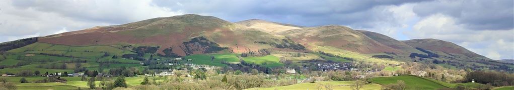
Sedbergh is a favourite location for The Bentham Footpath Group, as is Dent, so surely there’s a walk based between the two that captures the best of both? There is – and this is it -typical Yorkshire Dales walking but with views of the Howgills.
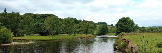
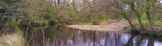
We start next to the River Rawthey, just north of where it merges with the Lune, and track upstream toward Sedbergh, passing the confluence with the Dee, but staying with the Rawthey at first. We then cross the river and head to Millthrop, to pick up the Dales Way path which takes us down to Gate Manor in Dentdale. We then cross the Dee to return along the other side of Dentdale via Rash and Dent Foot, before skirting Holme Fell to arrive at Middleton Bridge via a Roman road. A short stroll back along the Rawthey concludes the walk.

Dent Foot Read More »

Long Preston

9.8 miles | 15.8 km | 462m Ascent | 12.1 Naismith miles | David Longton
Long Preston is a small village that many people drive through on the way to better known destinations in the Yorkshire Dales. It’s well worth stopping though to explore this village and the excellent walks that can be accessed from it.
The walk we present here is classified as challenging simply because it just exceeds our 15km limit for a moderate walk – but much of the route is on tracks, or minor roads, and there are no steep climbs, so if you feel comfortable with our moderate walks give this one a go too. There are some shortcuts highlighted.
As you can see from the gallery, we picked a wet day to walk it, but in better weather, the views over the Ribble Valley, and the flood plains south of Settle are well worth seeing, as is Scaleber Foss at the halfway point.

Long Preston Read More »

Barden reservoirs

11.4 miles | 18.3 km | 469 m Ascent | 13.7 Naismith miles | David Longton
In the summer months, the light allows for walks that are longer, more challenging and which start from points that are farther from sunny Bentham.
This is the case for this varied walk in Wharfedale that covers rough moorland and a pleasant riverside view, with industrial and medieval heritage and wildlife.

Barden reservoirs Read More »

Bentham to Low Bentham Circular

5.3 miles | 8.6 km | 318 m Ascent | 6.9 Naismith miles | David Longton
The Bentham Footpath Group presents walks all over the Yorkshire Dales, Forest of Bowland, South Lakes and associated areas. It’s therefore easy to forget that we have great walks on our own doorstep.
This walk then, is a reminder of how lucky we are to live here.
The walk also remembers Dorothy Stubbs, a popular group member, and this easy route was chosen to allow as many family and Bentham Footpath Group members to join us as possible.
Although the route passes a number of places particularly associated with Dorothy, those who were not lucky enough to know her will still find this a great local walk with excellent views.

Bentham to Low Bentham Circular Read More »

Rydal Water

7.7 miles | 12.5 km | 756 m Ascent | 11.5 Naismith miles | David & Sheila Longton
Rydal Water is one of the smaller lakes in the Lake district at just 3/4 mile long and 1/4 mile wide.
We start at the lane next to the White Moss car park, then head up to White Moss Common, before tracking around the hillside below Alcock Tarn. We cross the A591 and take a low level path into Grasmere before re-joining the road and taking the pavement along the edge of the lake for a while.
We pick up a pleasant path down into the woods and follow the River Rothay to the western end of Rydal water then head uphill to Rydal Cave, before following the path down to Rydal Mount and Rydal Hall. From there we take the Coffin Route west toward Nab Scar, and White Moss Common, which leads us back to our start

Rydal Water Read More »

Devils Bridge to Casterton and Barbon

9.5 miles | 15.3 km | 350 m Ascent | 11.2 Naismith miles | David & Sheila Longton
This long but relatively gentle walk starts from Kirkby Lonsdale, and takes quiet lanes through High Casterton to Casterton Village. From here we follow the base of Barbon Low Fell over to Barbon where we cross the A683 and return through Kirkby Lonsdale Golf course before taking a path down the side of the River Lune for a while. We briefly return to Casterton before finding a route back to our starting point via Casterton Golf Course and the caravan park.

Devils Bridge to Casterton and Barbon Read More »