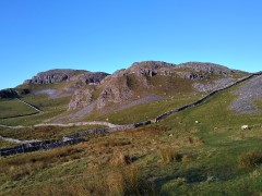
Dales Highway

Sedbergh and Winder

7.7 miles | 12.4 km | 438 m Ascent | 9.9 Naismith miles | Valerie Eccles & Mary Pickstone

Sedbergh is a great place to use as a base for a walk – and it is location that Bentham Footpath Group have used a number of times. The usual choice is between quite steep walks on the Howgill Fells, or gentle riverside strolls. This excellent walk offers both on a route that delivers great views, trig points to tick off your list, a toposcope, disused railway lines, grand buildings, weirs, impressive Victorian bridges, a monument of disputed function, a lost mansion, and a stroll through the town centre, with opportunities for ice cream.
Add in the sunshine at the end of August when the first hints of autumn colours are starting to show, and this could well be a perfect walk.

Sedbergh and Winder Read More »

Sunbiggin Tarn and Great Asby Scar

7.9 miles | 12.7 km | 233 m Ascent | 9.0 Naismith miles | Valerie Eccles & Mary Pickstone
Limestone pavement is one of the defining features of the Yorkshire Dales, and when asked to think of an example, most people mention Malham: that pavement and the Cove are indeed spectacular, and Bentham Footpath Group have enjoyed a number of good walks there.
This walk however visits the much larger (15 square miles) and rather more secluded Great Asby Scar National Nature reserve. Malham famously has a tarn, so we throw one of those in and start at Sunbiggin tarn before taking a gentle climb to the scar using the Dales Highway path. We then head west along the top of the scar and visit Castle Folds, the remains of a Romano-British walled settlement. From there we pick up the path coming up from Asby Winderwath Common and circle round the scar to head down to the Gamelands stone circle, before taking the Coast to Coast path back to the tarn.

Sunbiggin Tarn and Great Asby Scar Read More »

Ribblehead & Chapel-le-Dale

7.8 miles | 12.5 km | 206 m Ascent | 8.8 Naismith miles | Valerie Eccles & Mary Pickstone
The Ribblehead Viaduct is probably the most photographed railway bridge in the UK, and an icon of the Yorkshire Dales. It’s more than just a bridge though; surrounded by stunning countryside, and with traces of industrial archaeology dating back to its construction, there’s lots to see. So where better to start a walk?
From Ribblehead, we head under the viaduct and over to Gunnerfleet before following Winterscales Beck down to the intriguing Haws Gill Wheel where the river disappears and then reappears. After a very short section of road walk, we pause at the lovely St Leonards Church, before heading up to Ellerbeck, passing a sculpture as we go, and from there take the Dales Highway back to the railway. After a brief look at the Signal Box at Blea Moor, we return via the Viaduct with views over to Ingleborough and Simon Fell.
The Dales’ favourite railway, that bridge, a disappearing river, a beautiful church, art, and great views.

Ribblehead & Chapel-le-Dale Read More »

Pikedaw Hill and Malham

7.8 miles | 12.6 km | 525 m Ascent | 10.5 Naismith miles | Sandra Craggs
Malham is one of the “honeypot” villages of the Yorkshire Dales – and the use of the Cove as a backdrop for filming “Harry Potter and the Deathly Hallows” has made it even more popular. There’s more to this area than the Cove though – stunning as it is – and if you pick a weekday out of season, you can still enjoy a quiet walk. This moderately challenging walk starts in Malham, with a steep climb up Pikedaw Hill, offering great views back to Malham and over toward Pendle.
We pass Nappa Cross, then head down the spectacular dry valley at Watlowes to the top of the Cove, where we take the Dales Highway path to Goredale Bridge and return to Malham village via the always delightful Janet’s Foss path. We grade the walk as moderate, but be aware that the first section is relentlessly steep, and potentially quite boggy – and that the dry valley requires particular care.

Pikedaw Hill and Malham Read More »