Sandra Craggs

Gunnerside and Old Gang Smelt Mill

10.4 miles | 16.7 km | 927 m Ascent | 15.0 Naismith miles | Sandra Craggs
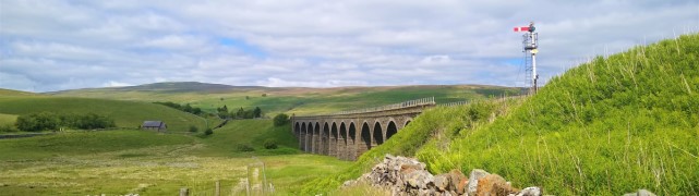
We tend to think of the Yorkshire Dales as a rural idyll, but there is also a great deal of industrial heritage to be found. This walk starts in the lovely village of Gunnerside in Swaledale and then heads up Gunnerside Gill into an area that from the 15th to 19th centuries was the centre of a vast lead mining industry.
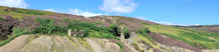
We explore remains of the lead mining sites – now mostly reclaimed by nature, before taking the steep scramble to cross Melbecks moor where we find an altogether bleaker and more damaged landscape –the result of lead smelting. This is where we find the Old Gang Smelt Mill, a much larger and toxic operation than the remains we saw at Gunnerside.
From there we walk down to Surrender bridge and then take a return route along the side of Swaledale with fantastic views up the valley to Muker and beyond or down toward Reeth and the North Yorks Moors.

Gunnerside and Old Gang Smelt Mill Read More »

Grisedale and Garsdale

9.5 miles | 15.3 km | 590 m Ascent | 12.4 Naismith miles | Sandra Craggs
Grisedale is not well known, and often missed by visitors, but there is a simple beauty in this Dale – which is what why we chose this walk.
We start at Garsdale Station and then head up Grisedale to East Scale and the Quaker Burial Ground, before walking up Galey hill to Flust where we pick up the Pennine Journey path down to the B6259.
A very short section of road walking takes us to Quarry Farm where we head over fields and through a plantation to Lunds Chapel, before climbing (quite steeply) up the side of Abbotside Common to pick up (Lady Anne’s) High Way. We follow this along the valley side for a while before heading down the Pennine Bridleway to the Cobbles Plantation and Ure Force.
A brief stop at The Moorcock Inn is a recommended option, before crossing the A684 and walking under the impressive Dandry Mire Viaduct to return to the start.

Grisedale and Garsdale Read More »

Semerwater from Bainbridge

9.8 miles | 15.8 km | 492 m Ascent | 12.3 Naismith miles | Sandra Craggs
Our walk starts from Bainbridge and initially follows a Roman road known as the Cam High Road up Wensleydale until we overlook Burtersett. We then cross the ridge into Raydale, and head down to Marsett where we cross the river, walk through a nature reserve and over toward the atmospheric old church at Stalling Busk.
From there we track round Semerwater – again in a nature reserve – to visit the lake shore at Turner’s seat. The final part of the walk sees us follow the river Bain back to Bainbridge, with good views over the site of the Roman fort of Virosidum.
Although quite long, and steep in places, this walk offers great views, and an opportunity to explore some of the quieter parts of the Yorkshire Dales.

Semerwater from Bainbridge Read More »