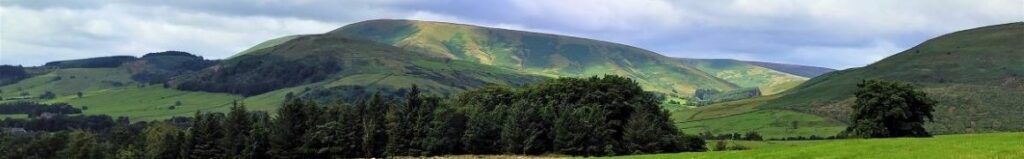
Aqueduct

Tatham Fells

6.4 miles | 10.4km | 344 m Ascent | 8.2 Naismith miles | Mary Taylor
Members of the Bentham Footpath Group tend to consider the Yorkshire Dales, the Forest of Bowland, and the South Lakes as their walking territory. This relatively easy walk is at the North end of the Forest of Bowland and is very local to Bentham – so much so that many of the farms, and other buildings that we passed along the way hold important personal memories for those in the group lucky enough to be born and bred in and around Bentham.
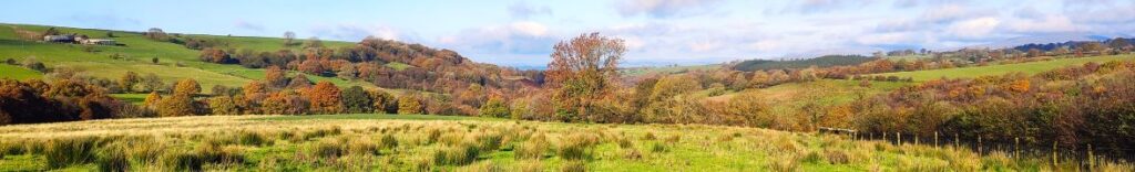
For the rest of us, this is still a great walk in a timeless landscape that never gets busy – despite the idyllic autumn weather we enjoyed, we passed no other walkers, and the only people we met all day were residents pottering in their gardens and making the most of the sunshine before winter sets in.
Although we consider this walk to be “easy” based on the total distance and elevation change, you should be aware that Tatham Fells are poorly drained, and so the ground can be very wet. This can make the walk feel longer than stated but on the other hand wet weather makes the rivers and becks we cross so much more attractive.

Tatham Fells Read More »

Dunsop Bridge

7.6 miles | 12.3 km | 234 m Ascent | 8.8 Naismith miles | Peter Lennard
Within the Bentham Footpath Group, we tend to think of ourselves as living “up North”, and indeed we do – but only by a few miles: It turns out that the geographic centre of Great Britain is (according to the Ordnance Survey) in Dunsop Bridge. Given this curious fact, how can we decline the temptation to start a walk right from the centre of the country?
That curiosity aside, Dunsop Bridge is a great place to walk, and is often described as being at the heart of the Forest of Bowland. This gentle walk heads out from the village up the banks of the Dunsop before striking out to the isolated farms at Beatrix. From there, we cross Rough Syke at the bottom of Oxenhurst Clough and then after a brief but steep climb, follow green lanes and a very minor road to the lovely village of Newton where we pick up the Hodder, to follow it downstream back to Dunsop Bridge.
En route, we follow the Ribble Valley Jubilee Trail over Giddy Bridge, and then past Knowlmere Manor, and Thorneyholme Hall where we see the confluence of the Dunsop and the Hodder. The walk ends back at Dunsop Bridge where ice cream beckons.
We recommend that you take waterproofs on this walk – be aware that Dunsop Bridge holds the record for the most intense rainfall in the UK with 117mm (4.6 in) falling in just 90 minutes on 8th August 1967.

Dunsop Bridge Read More »

Holmepark Fell

7.1 miles | 11.4 km | 383 m Ascent | 9.0 Naismith miles | Don Cartledge
We start in Holme village and pick up the Lancaster Canal heading north and passing Farleton.
We then take minor lanes around the back of Farleton Fell, before taking paths over fields to Puddlemire lane and then from Town End Farm up onto the base of Newbiggin Crags at Whin Yeats. The landscape here is dominated by limestone outcrops and spectacular pavements with atmospheric isolated trees that attract many an amateur photographer.
We briefly return to a minor lane before cutting through Holmepark Fell, next to the huge Holme Park Quarry, before meeting the A6070 at Holme Park Farm. A short section on the verge of the road returns us to Holme.

Holmepark Fell Read More »