Limestone Pavement

Sell Gill Holes from Horton in Ribblesdale

7.1 miles | 11.4 km | 247 m Ascent | 8.3 Naismith miles | Alison Kinder & Colin Stroud
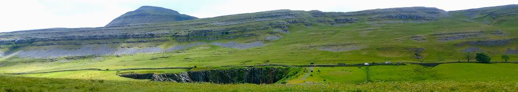
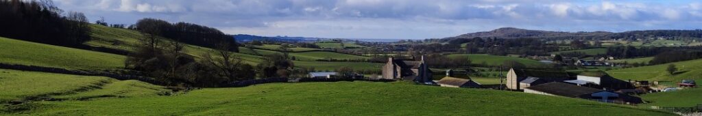
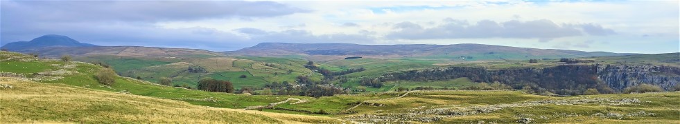
During last week’s Chapel-le-Dale and Ingleborough environs walk we took a path down the side of the Ribblehead viaduct and enjoyed great views down the Ribble valley toward Pen-y-Ghent and Horton in Ribblesdale. This week we start from Horton and get a much closer look, this time with the viaduct in the far distance.
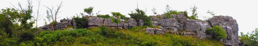
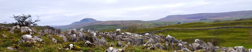
On a route that is a figure of eight – giving an opportunity to opt for a short version should the weather change – we get to see the two entrances to the Sell Gill Holes cave system before taking the Ribble Way path along the side of the valley as far as Old Ing. From there we cross Birkwith Moor to pick up the Pennine Way to bring us back toward Horton at a higher level. Once we get back to Sell Gill Holes, we opt to take a path across to New Houses rather than repeat the outbound route and end with a stroll along the banks of the Ribble.

Sell Gill Holes from Horton in Ribblesdale Read More »

Hutton Roof Crags

3.9 miles | 6.3 km | 175 m Ascent | 4.8 Naismith miles | Valerie Eccles & Mary Pickstone
Bentham Footpath Group try to hold a few evening walks each year – typically during the summer months. Evening walks are accessible to those who have commitments during the day, and because they are typically shorter in length, they are suitable for those unable to join us for our more challenging offerings. Summer evenings can also provide great clear skies with pink sunsets, making for stunning views, although as our pictures show, that can be something of a lottery.
Even in the rain and mist though, this is a great walk – Hutton Roof is a favourite place to start a walk and is a location that we have used before. This time we start in the village centre and take a path up the edge of Hutton Roof Crags heading toward Newbiggin Crags, before heading back past Whin Yeats, and then taking quiet backroads to St John’s church, where we see the memorial stone for Bentham’s best known war hero.

Hutton Roof Crags Read More »

Chapel-le-Dale, Scales Moor and Oddies Lane

7.4 miles | 11.9 km | 206 m Ascent | 8.4 Naismith miles | Mary Taylor
Living in Bentham gives us easy access to the Yorkshire Three Peaks, and many BFG walks have featured them as their main attraction. This walk however takes a route between two of them without climbing either. Does that mean we miss out on points of interest? Not at all – the best views of the peaks are often not from the top.
We start at Chapel-le-Dale, using the car park for the lovely St Leonard’s Church, and then head up toward Ellerbeck, passing the interesting Statue of a Warrior by Charles I’Anson. From there we head left onto Scales Moor – in effect the southern slopes of Whernside, seeing some of the best limestone pavement anywhere. Once at Twisleton Scar End, we take a path down to Twisleton Hall, and then on to Oddies Lane – a metalled road, built over the route of a Roman Road, which sees very little traffic. This takes us back to Chapel-le-Dale, with great views of Ingleborough along the way.

Chapel-le-Dale, Scales Moor and Oddies Lane Read More »

Giggleswick Scar 2

5.4 miles | 8.6 km | 249 m Ascent | 6.6 Naismith miles | Sandra Craggs
In recent walks we have travelled further afield and enjoyed some stunning scenery. Sometimes though, it’s nice to remind ourselves just how beautiful our own area is – and this walk is a perfect way to do that.
This easy route is a shortened version of our earlier Giggleswick Scar walk and makes an ideal half day stroll. We start from The Mains in Settle and then head up to Stackhouse via Lord’s Wood. We then take the Pennine Journey path round the back of the scar, as if heading to Feizor, but before we get that far we find a fingerpost which indicates the path returning to the front of Giggleswick Scar.
The top edge of the scar gives us great views to the south and lots of interesting limestone features including caves and cairns, before we arrive at the Schoolboy Tower. We then circle round the now disused quarry and then wrap things up by heading back down to Lord’s Wood and our cars. Two added benefits for this walk are that starting from Settle makes it accessible by Public Transport, and adding Elaine’s Tea Rooms would be an easy (2km) extension.

Giggleswick Scar 2 Read More »

Hampsfell from Grange

4.5 miles | 7.2 km | 350 m Ascent | 6.5 Naismith miles | Alison Kinder / Colin Stroud
A good number of Bentham Footpath Groups walks have centred on Silverdale, and on those we always enjoy views over the Kent estuary toward Hampsfell. In this walk we climb Hampsfell and look the other way, using the viewing platform at the Hospice as our highpoint.
We have walked in this area before, using Cartmel as our starting point offering a walk with moderate challenge, so this time we offer slight variation – we start from Grange over Sands and make the walk shorter and easier. The aim here is to give the opportunity to spend time in Grange exploring what this delightful town has to offer.

Hampsfell from Grange Read More »

Dalton Crags

6.5 miles | 10.5 km | 283 m Ascent | 7.9 Naismith miles | John Smithson
The triangle formed by the pinch point of the M6 and the A65 is often overlooked as a walking area – it’s not the Yorkshire Dales, and it’s not the Lakes – it’s not even the Forest of Bowland. But it is easy to reach, it offers great walks and not surprisingly then, is popular with The Benham Footpath Group.
This relatively easy walk focusses on Dalton Crags – the area of limestone pavement to the South of Hutton Roof. We start at Plain Quarry car park and then meander South through the rolling hills around Dalton Old Hall before heading back up to Burton-in-Kendal where we pick up the path along Slape Lane and into Pickles Wood, before taking a track through Storth Wood. This takes us part way up Dalton Crags, where we have a good look at the limestone pavement before heading back down to the car park.

Dalton Crags Read More »

Giggleswick Scar

7.4 miles | 11.9 km | 400m Ascent | 9.4 Naismith miles | Sandra Craggs
This walk starts from Giggleswick Village and then heads up through Lord’s Wood, past the quarry, to join the top of Giggleswick Scar at Schoolboy’s Tower where we get great views across the Ribble valley. From there we walk along the top of the scar until we meet the path coming up from Buck Haw Brow, when we head North to Feizor Thwaite.
A sharp turn back along the Pennine journey path brings us down to Stackhouse, and from there we stroll back to Giggleswick along the side of the Ribble at Settle.
Although this walk is classed as easy because it’s (marginally) less than 12 km, be aware that there is a steep climb and some terrain that can be wet and slippery in poor weather.

Giggleswick Scar Read More »