Coffin Road

Fairy steps from Beetham

5.7 miles | 9.2 km | 309 m Ascent | 7.2 Naismith miles | Don Cartledge
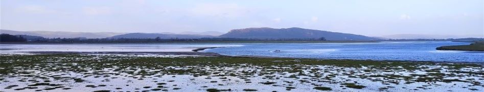
December 2022 saw The Bentham Footpath Group walking from Heversham with views South toward Beetham and the Arnside and Silverdale Area of Outstanding Natural Beauty (AONB).
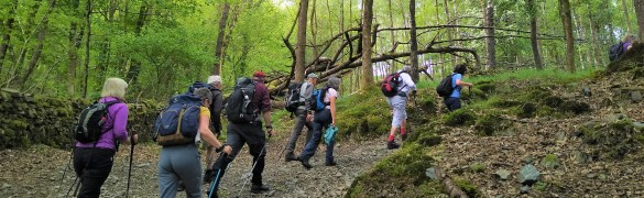
Just one month later, we start at the Heron Corn Mill in Beetham and then head through woodland and the famous “Fairy steps” to gain the complementary view – West across the estuary toward the Lakeland fells, and North toward Heversham and St. Anthony’s Tower.
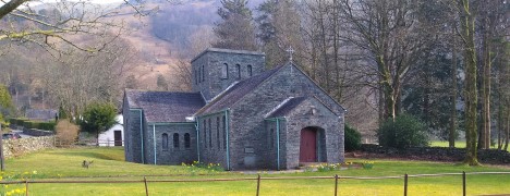
We then skirt the estuary via the old railway track bed that we met on the Heversham walk, and then head up the river Bela, past Dallam Tower, and then though the deer park back to Beetham.
This walk is ideal for the shorter winter days – it’s relatively easy and offers a variety of landscapes as well as breath-taking views.

Fairy steps from Beetham Read More »

Bouth

9.8 miles | 15.8 km | 665 m Ascent | 12.1 Naismith miles | Susan Badley
Starting from a convenient and little-used layby on the A590 at Pool Foot, we head upstream to the village of Bouth. From there we enter Old Hall Woods and head over to Colton before taking a path North to Oxen Park.
We then pick up a woodland route over to Whitestock Hall before a short section on-road brings us to Hulleter. Excellent views across the Rusland Valley and Rusland Moss National Nature Reserve are enjoyed through this section of the walk.
At Hay Bridge we enter the nature reserve with its tranquil tarns, before heading over to Moss Wood. This track brings us back to Bouth, but rather than returning exactly as we started, we now turn right and head toward the woodland at Ashes Intake. We divert back to the causeway south of Bouth before retracing our steps back to the start

Bouth Read More »

Rydal Water

7.7 miles | 12.5 km | 756 m Ascent | 11.5 Naismith miles | David & Sheila Longton
Rydal Water is one of the smaller lakes in the Lake district at just 3/4 mile long and 1/4 mile wide.
We start at the lane next to the White Moss car park, then head up to White Moss Common, before tracking around the hillside below Alcock Tarn. We cross the A591 and take a low level path into Grasmere before re-joining the road and taking the pavement along the edge of the lake for a while.
We pick up a pleasant path down into the woods and follow the River Rothay to the western end of Rydal water then head uphill to Rydal Cave, before following the path down to Rydal Mount and Rydal Hall. From there we take the Coffin Route west toward Nab Scar, and White Moss Common, which leads us back to our start

Rydal Water Read More »