Windermere to Ambleside – bus back

9.0 miles | 14.5 km | 472m Ascent | 11.4 Naismith miles | Rick Clapham
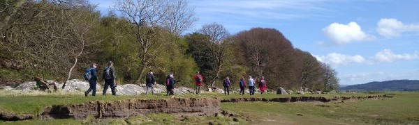
Last week we walked in Coverdale and noted how remarkably few visitors it had. This week, we walk from Windermere to Ambleside – and find that the same description does not apply. In fact, if you ask Google (other search engines are available) where the busiest places in the Lake District are, the answer is Windermere and Ambleside.
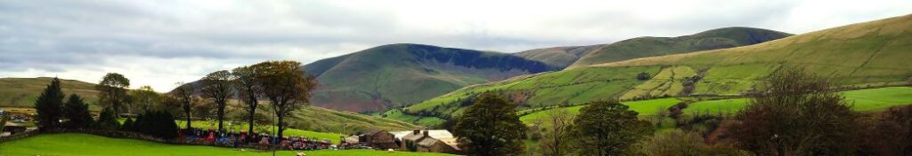
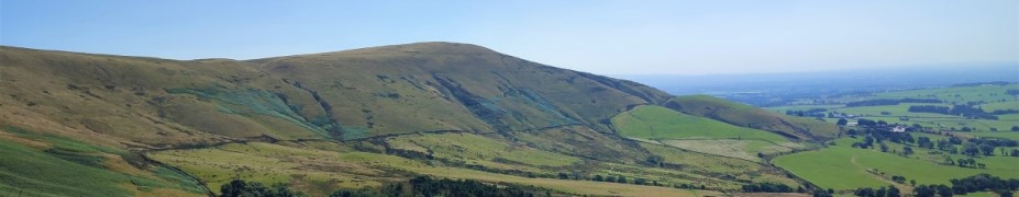
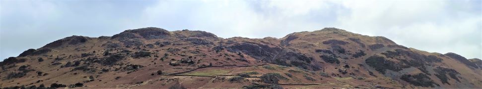
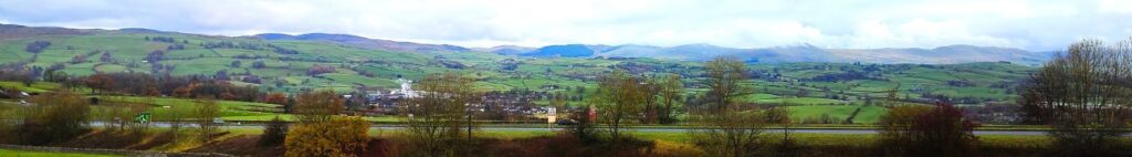
So, did we fall into a tourist hell hole? Not at all: Skilful route selection meant that for much of the walk we were free from crowds, and even the ever popular Orrest Head was approached by the less well known Common Wood route. From the Head we take the Dubbs Road to Dubbs Reservoir and then down to Limefitt where we cross the Trout Beck, and then the A592. After a quick look at Jesus Church, we climb to Troutbeck village before taking Robin Lane through Skelghyll Wood and then down to Waterhead in Ambleside. A convenient bus back to Windermere ends the trip.

Windermere to Ambleside – bus back Read More »

Rawthey Bridge

9.0 miles | 14.5 km | 431 m Ascent | 11.1 Naismith miles | Sandra Craggs
The Howgills are always a great place to walk, and autumn can be particularly beautiful with the bracken turning orange, hawthorn berries bright red, the grass still green, and the trees showing hints of purple as they start to drop their leaves. Add to this the many glorious becks and waterfalls, and the relatively secluded paths, and we have a recipe for a perfect day out.
This walk starts at Rawthey Bridge on the A683 then takes woodland paths to Narthwaite. From there, we contour around Wandale Hill using an old Pack horse route to Adamthwaite. We cross Wandale Beck and Stonely Gill and then head back toward Murthwaite, turning just before we get that far, to come back round the eastern side of Harter Fell on a public by-way. We cross the A583 at Fell End and then head up to the waterfalls at Uldale before returning to the start over moorlands at Bluecaster.

Rawthey Bridge Read More »

Gummer’s How and Cartmel Fell

8.9 miles | 14.3km | 467 m Ascent | 11.2 Naismith miles | Susan Badley
The Bentham Footpath Group typically undertakes about 50 walks each year. Given where we live, many of these will be in the rain or have poor visibility. Sometimes though we are spectacularly lucky with the weather and get to enjoy simply stunning views, and this walk was just such an occasion.
If you follow this route, you may or may not be so lucky, but whatever the weather, this will always be a great walk: We start from a free and convenient parking spot, climb up to one of the best views of Windermere, sharing the How with Luing cattle. We then head over to Sow How Tarn, clip the edge of Middle Tarn, and then go via Heights Cottage onto Ravens Barrow, and a curious monument. From there we visit a lovely ancient church and old schoolhouse, and through fungi-rich woodland to Thorphinsty Hall, through Crag Wood and up to an atmospheric derelict farmhouse en-route to Simpson Ground. We round the day off with a tranquil reservoir, and more woodland with lovely gnarled old trees. A perfect day.

Gummer’s How and Cartmel Fell Read More »

Newton to Dunsop and Hodder Bank

8.9 miles | 14.3 km | 333 m Ascent | 10.5 Naismith miles | David Longton
Within the Bentham Footpath Group, we regard the Yorkshire Dales, the South Lakes and the Forest of Bowland as our home patch. Of those three, it’s the latter that offers the best opportunity for quiet walks free from the more popular tourist hotspots.
Does that mean that the Forest of Bowland is remote and inaccessible then? Not in our opinion – in fact this walk passes through the centre of the United Kingdom which, as it turns out is Dunsop Bridge.
We start though in Newton – where there is good parking, then go via Beatrix to Dunsop Bridge with great views of Beatrix and Burn Fells along the way. We then stroll along the banks of the Hodder down to Burholme before returning via Hodder Bank Fell.

Newton to Dunsop and Hodder Bank Read More »

Bleasdale Fells, Fair Snape Fell and Parlick

8.8 miles | 14.2 km | 594 m Ascent | 11.8 Naismith miles | Mary & Kate Taylor
One of the many advantages of living in Bentham is easy access to the Forest of Bowland.
We start with a steep climb up the imposing Parlick Hill, rewarding ourselves with a break at the summit where we enjoy westerly views over Lancashire toward the coast and easterly across the Forest of Bowland. From there, we walk the ridge of Blindhurst Fell over to the summit of Fair Snape Fell, where a convenient stone shelter hosts a lunch break.
We then back track a little to take a zig-zag path down the side of the fell to Higher Fair Snape, before striking out across fields toward Holme House. Just before we get that far though, we divert left to Bleasdale with an optional visit to the circle before taking a gentle low level path through pastures back to fell foot and the start of the walk.

Bleasdale Fells, Fair Snape Fell and Parlick Read More »

The Two Langdales

8.8 miles | 14.2 km |462 m Ascent | 11.1 Naismith miles | Alison Kinder & Colin Stroud
The two Langdales referred to in the title are Great Langdale and Little Langdale – in effect two parallel valleys separated by Lingmoor Fell.
Starting from Elterwater, we head up the valley along the gentle woodland paths of Great Langdale with Lingmoor Fell on our left and Chapel Stile on the right across a surprisingly flat valley with very steep sides. We then follow the direction of the beck upstream to Oak Howe where we pick up the Cumbria Way enjoying fantastic views of Dungeon Ghyll Force as we follow the path round the back of Side Pike to cross over a short but steep ridge into Little Langdale.
Pausing at the top of the ridge we have great views up Langdale and Oxendale, before we follow the path round and descend into Little Langdale, passing Blea Tarn on the way. A short road section on the Wrynose Pass road takes us down to Fell Foot Bridge where we head across fields to Slater Bridge and Little Langdale Tarn before we pick up a track back to Elterwater.

The Two Langdales Read More »

Rather Heath and Burneside

8.8 miles | 14.1km | 212 m Ascent | 9.8 Naismith miles |David & Sheila Longton
The Bentham Footpath Group have completed a number of great walks in and around Kendal – search on the website for Staveley, Levens or the Lancaster Canal to see some of them. This walk adds to that library and because it intersects with earlier offerings, creates a great opportunity to build our mental map of the area.
We start from a layby on the “old road” – once the main route from Kendal to Windermere – and then walk through woodland on Rather Heath passing the edge of Ratherheath Tarn before striking out to Plumgarths where we visit the Cumbria Wildlife Trust’s gardens. We then head parallel to the A591 before crossing onto Kendal Fell at Helsfell Nab. Unusually for a BFG walk, we then go into the outskirts of a town (Kendal), for lunch in the park, before we head out to Burneside. We have a good look at the Church and the paper mills before heading upstream along the Kent to Bowston on a section of the Dales Way. A final section over the railway, then under the main road brings us back to our starting point.

Rather Heath and Burneside Read More »

Warton Crag from Silverdale

8.7 miles | 14.0 km | 452 m Ascent | 10.9 Naismith miles | Rick Clapham
Another Silverdale walk from the Bentham Footpath Group – but this one takes us over to Warton Crag and the Beacon, with great views over Morecambe Bay at many points.
We pass a Victorian folly, a number of interesting sites of industrial archaeology, a failed attempt to reclaim land from the sea, and an iron-age hill fort.
The walk is classed as moderate mainly because it’s quite long, and although there is some climbing, the paths are generally good – at least in the weather that favoured us in April 2022.
Be aware that parts of the walk are on the edge of the bay so can be muddy in wet weather and/or during high tides.

Warton Crag from Silverdale Read More »