Sugar Loaf Hill

Settle

7.1 miles | 11.4 km | 592 m Ascent | 10.0 Naismith miles | Bernie & Sheila Garrett
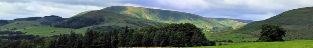
This excellent route showcases just what great walking country we have right on our doorstep. We start from Langcliffe, less than half an hour away from Bentham, and then fill the day with the kind of walking that you might see on one of those “celebrity buys some walking boots” TV shows.
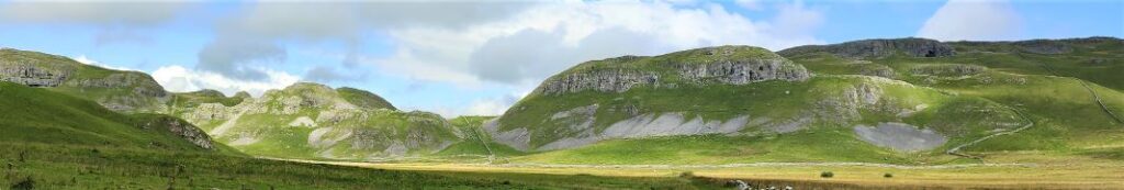
We head out of Langcliffe on the Pennine Journey path, hop over to the Pennine Bridleway, and then take a footpath up to Victoria Cave, which we explore for a while before walking along the base of the wonderful Attermire Scar.
We follow that round, passing under the entrance to Horseshoe Cave, before heading over to Stockdale Lane with great views over to Pendle Hill, and Rye Loaf Hill. We then cut back along a footpath between High Hill and Sugar Loaf Hill to arrive at the base of the Warrendale Knotts. From here we retrace our outbound journey – although in this direction the views are surprisingly different -and then as a bonus treat, pop up to the smaller Jubilee Cave. The final part of the walk follows our outward route back to Langcliffe.

Settle Read More »

Dunsop Bridge

7.6 miles | 12.3 km | 234 m Ascent | 8.8 Naismith miles | Peter Lennard
Within the Bentham Footpath Group, we tend to think of ourselves as living “up North”, and indeed we do – but only by a few miles: It turns out that the geographic centre of Great Britain is (according to the Ordnance Survey) in Dunsop Bridge. Given this curious fact, how can we decline the temptation to start a walk right from the centre of the country?
That curiosity aside, Dunsop Bridge is a great place to walk, and is often described as being at the heart of the Forest of Bowland. This gentle walk heads out from the village up the banks of the Dunsop before striking out to the isolated farms at Beatrix. From there, we cross Rough Syke at the bottom of Oxenhurst Clough and then after a brief but steep climb, follow green lanes and a very minor road to the lovely village of Newton where we pick up the Hodder, to follow it downstream back to Dunsop Bridge.
En route, we follow the Ribble Valley Jubilee Trail over Giddy Bridge, and then past Knowlmere Manor, and Thorneyholme Hall where we see the confluence of the Dunsop and the Hodder. The walk ends back at Dunsop Bridge where ice cream beckons.
We recommend that you take waterproofs on this walk – be aware that Dunsop Bridge holds the record for the most intense rainfall in the UK with 117mm (4.6 in) falling in just 90 minutes on 8th August 1967.

Dunsop Bridge Read More »

Long Preston

9.8 miles | 15.8 km | 462m Ascent | 12.1 Naismith miles | David Longton
Long Preston is a small village that many people drive through on the way to better known destinations in the Yorkshire Dales. It’s well worth stopping though to explore this village and the excellent walks that can be accessed from it.
The walk we present here is classified as challenging simply because it just exceeds our 15km limit for a moderate walk – but much of the route is on tracks, or minor roads, and there are no steep climbs, so if you feel comfortable with our moderate walks give this one a go too. There are some shortcuts highlighted.
As you can see from the gallery, we picked a wet day to walk it, but in better weather, the views over the Ribble Valley, and the flood plains south of Settle are well worth seeing, as is Scaleber Foss at the halfway point.

Long Preston Read More »