Grisedale and Garsdale
9.5 miles | 15.3 km | 590 m Ascent | 12.4 Naismith miles | Sandra Craggs
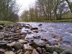
Grisedale is not well known, and often missed by visitors, but there is a simple beauty in this Dale – which is what why we chose this walk.
We start at Garsdale Station and then head up Grisedale to East Scale and the Quaker Burial Ground, before walking up Galey hill to Flust where we pick up the Pennine Journey path down to the B6259.
A very short section of road walking takes us to Quarry Farm where we head over fields and through a plantation to Lunds Chapel, before climbing (quite steeply) up the side of Abbotside Common to pick up (Lady Anne’s) High Way. We follow this along the valley side for a while before heading down the Pennine Bridleway to the Cobbles Plantation and Ure Force.
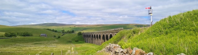
A brief stop at The Moorcock Inn is a recommended option, before crossing the A684 and walking under the impressive Dandry Mire Viaduct to return to the start.
Grisedale and Garsdale Read More »