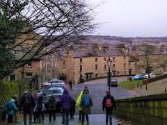
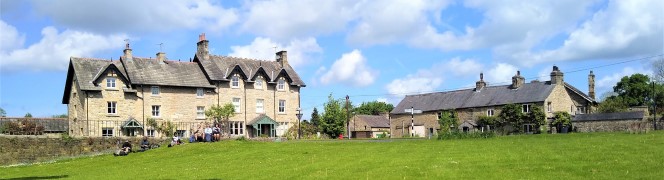
Castle

Low Tatham church to Melling and back

3.5 miles | 5.7 km | 151 m Ascent | 4.3 Naismith miles | Mary Taylor
Most of the walks we do are around 7 miles in length. They are all great walks but given that we tend to average around 2mph when we factor in time for pausing to enjoy the view, we need to set aside at least four hours to enjoy them.
So that leaves a gap for the evening walk where we have a couple of free hours and want to fill them with something more challenging than a stroll around the village or watching another failed politician eating unhygienic bits of a kangaroo in the jungle.
This excellent shorter walk fits the bill perfectly: It’s easy and short enough to undertake in the evening, and close enough to home to make a last minute decision viable.
Does short and easy inevitably mean dull though? No, of course, not – you can rely on our expert walk creators to pull together a route that includes great views, interesting landscapes, a rare (for here) taste of arable farming, and some local history, all with easy parking and even a well rated pub close to the end.

Low Tatham church to Melling and back Read More »

Lancaster – City country and coast

7.5 miles | 12.1 km | 139 m Ascent | 8.2 Naismith miles | Sandra Craggs
A couple of years ago, we tried an interesting experiment – we started a walk in the centre of Lancaster and included a significant rural element in our route. That walk was a great success, and with a little time having passed we thought it worth re-running with a few minor changes to the points of interest we visit in the city centre.
Starting from Sugar House Alley, we walk through the city centre to the Lancaster Canal where we head South along the towpath – this gives a very urban view of Lancaster and its industrial heritage.
We leave the canal just after the west coast main line railway bridge, and head down a side street into the Fairfield Association Nature Reserve. That trail brings us back to the canal at Haverbreaks, and we again head South before leaving almost immediately to take a path through Aldcliffe to the Lune estuary where we take the embankment North through the marshes. Opposite Oxcliffe Hill, we head inland through Freemans Wood and on to Abrahams Heights. We are now back in a very urban environment, heading past the bustle of the railway station and then the Priory and Castle, before returning to the city centre, where we visit more heritage sites.

Lancaster – City country and coast Read More »

Wennington

12.7 miles | 20.5 km | 371 m Ascent | 14.6 Naismith miles | Alison Kinder & Colin Stroud
This walk gives us the opportunity to explore some of the excellent walking country right on our doorstep.
We start in Wray just a few minutes’ drive from Bentham, and walk back to Wennington before heading over to Wrayton. From there we walk back down the Lune Valley to Loyn Bridge and then into Hornby before returning to Wray.
This walk offers a wide variety of landscapes. There are a good number of stiles, but none of the hills are steep.
We grade it as challenging simply because it’s quite long, and if you wanted a shortened version, cutting back to Hornby from Loyn Bridge along the road would be viable.

Wennington Read More »

Lancaster: City and Country

6.6 miles | 10.6 km | 319 m Ascent | 8.2 Naismith miles | Susan Badley
Walking from a city centre is unusual for The Bentham Footpath Group. This interesting walk starts in Lancaster city centre and takes the Lancaster Canal South to the Fairfield Nature Reserve, where we loop round the “Fauna”, “Flora” and community orchard areas to arrive back at the canal.
We then head through Aldcliffe to the Lune estuary and the Lancashire Coastal Way, before returning via Freemans Woods to the city centre.
Good views of the Priory and Castle end this refreshing walk.

Lancaster: City and Country Read More »