Search Results for: Roman

Heughscar Hill and Bonscale Pike via High Street ridge

9.4 miles | 15.2 km | 421 m Ascent | 11.5 Naismith miles | Ed Badley
Part of the reason that so many of our group live in Bentham is easy access to the Yorkshire Dales and the Forest of Bowland: We really love these areas.
However, recent walks at The Old Man of Coniston and Askham reminded us just how spectacular the walking in the Lake District can be, so for this challenging route, right at the edge of our “patch”, we start just outside Helton and climb Heughscar Hill to get spectacular views of Ullswater. We then take the High Street (Roman road) down to an atmospheric stone circle before scaling Arthurs Pike and then Bonscale Pike where the scenery is just jaw-dropping. Our return route runs along the edge of the ridge at Barton Fell giving us even more great views. Finally, we return to the cars via the Pulpit Holes at Moor Divock.

Heughscar Hill and Bonscale Pike via High Street ridge Read More »

Long Preston

9.8 miles | 15.8 km | 462m Ascent | 12.1 Naismith miles | David Longton
Long Preston is a small village that many people drive through on the way to better known destinations in the Yorkshire Dales. It’s well worth stopping though to explore this village and the excellent walks that can be accessed from it.
The walk we present here is classified as challenging simply because it just exceeds our 15km limit for a moderate walk – but much of the route is on tracks, or minor roads, and there are no steep climbs, so if you feel comfortable with our moderate walks give this one a go too. There are some shortcuts highlighted.
As you can see from the gallery, we picked a wet day to walk it, but in better weather, the views over the Ribble Valley, and the flood plains south of Settle are well worth seeing, as is Scaleber Foss at the halfway point.

Long Preston Read More »

Semerwater from Bainbridge

9.8 miles | 15.8 km | 492 m Ascent | 12.3 Naismith miles | Sandra Craggs
Our walk starts from Bainbridge and initially follows a Roman road known as the Cam High Road up Wensleydale until we overlook Burtersett. We then cross the ridge into Raydale, and head down to Marsett where we cross the river, walk through a nature reserve and over toward the atmospheric old church at Stalling Busk.
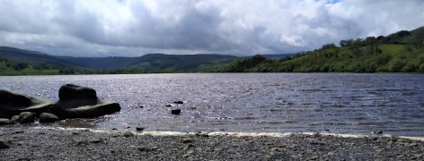
From there we track round Semerwater – again in a nature reserve – to visit the lake shore at Turner’s seat. The final part of the walk sees us follow the river Bain back to Bainbridge, with good views over the site of the Roman fort of Virosidum.
Although quite long, and steep in places, this walk offers great views, and an opportunity to explore some of the quieter parts of the Yorkshire Dales.

Semerwater from Bainbridge Read More »

Mallerstang

11.7 miles | 18.9 km | 811 m Ascent | 15.8 Naismith miles | Jim Shuttleworth
Mallerstang, and the Upper Eden Valley, are among England’s few remaining wild and peaceful places.
David Bellamy described this general area as “England’s last Wilderness”.

This challenging walk has everything: Lady Anne’s way, sculpture, the source of the river Eden, spectacular scars, cairns, disused quarries, incredible views, gentle riverside sections, and even a castle.

Not enough? Pick the right day and you might see a steam train and the RAF in training.

Mallerstang Read More »

Devils Bridge to Casterton and Barbon

9.5 miles | 15.3 km | 350 m Ascent | 11.2 Naismith miles | David & Sheila Longton
This long but relatively gentle walk starts from Kirkby Lonsdale, and takes quiet lanes through High Casterton to Casterton Village. From here we follow the base of Barbon Low Fell over to Barbon where we cross the A683 and return through Kirkby Lonsdale Golf course before taking a path down the side of the River Lune for a while. We briefly return to Casterton before finding a route back to our starting point via Casterton Golf Course and the caravan park.

Devils Bridge to Casterton and Barbon Read More »