Jump to . . .Step by Step | OS Map | Downloads | Gallery | Fly through
Last week’s walk to the Old Man of Coniston from Torver was a real treat, but it’s not a walk that you could decide to do whilst eating your breakfast and be back in Bentham by mid-afternoon.
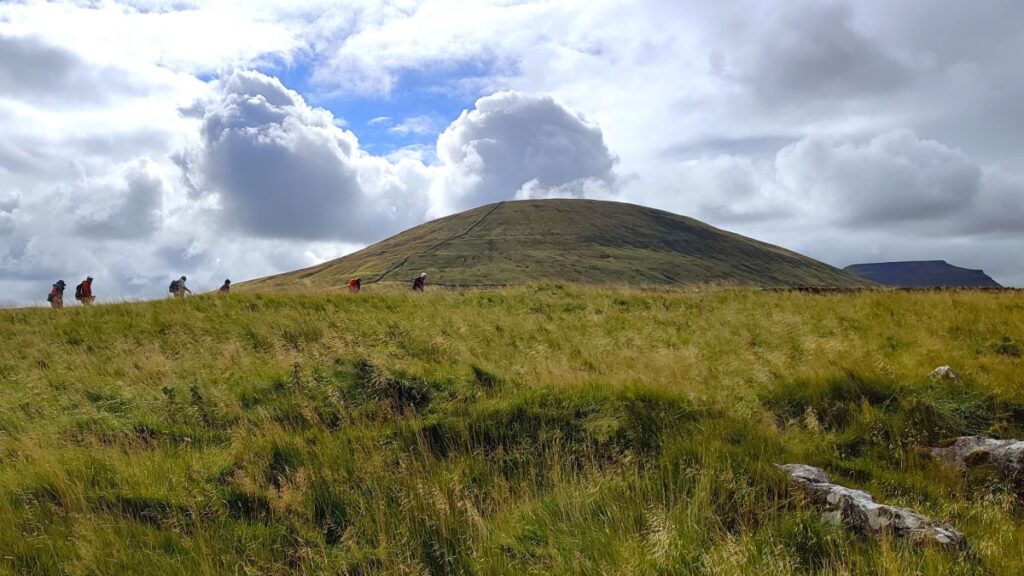
So, this week we offer a more local walk: For those of us lucky enough to be based in Bentham it is easy to get to, and despite being on the slopes of both Ingleborough and Whernside is generally quiet and peaceful.
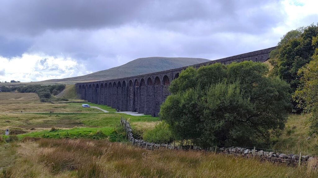
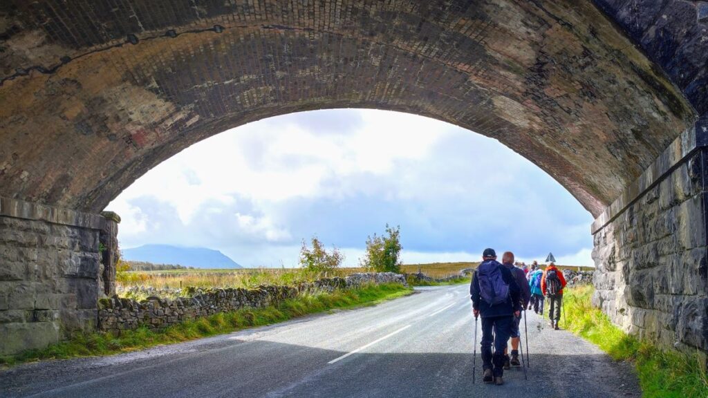
We visit a lovely church, see a well-known statue, walk under the most photographed railway viaduct in the UK, have lunch in a nature reserve, before passing close to Viking settlements, seeing some wonderful limestone pavement, and the entrance to a cave. There are great views of the hills all the way along, and you could even have an ice cream or a pub lunch halfway round.
- Total distance 12.9 km (8.0 miles)
- Total ascent 226 m
- Moderate walk
Step-by-Step

We start at the car park for St Leonard’s church in Chapel-le-Dale. The is easily found – take the B6255 from Ingleton toward Hawes. Pass the White Scar Caves, then 1500m (1 mile) later, look for signs to Chapel le Dale at a minor road on the left. Head down there, then just 100m after leaving the B6255 go left again into the carpark. The gate to the carpark may well be closed, but it is not usually locked, and this convenient site may be used in exchange for a donation which should be left at the honesty box at the church. Please give generously and respect the fact that the carpark is primarily for the church and worshippers – taking parking spaces when they are needed by the congregation would be inconsiderate.
For those using Satnav to get to the start, try the address for St Leonards – Roman Road, Chapel-le-Dale, LA6 3AR, or if your device uses what-3-words, the tag is obeyed.aunts.fruits whilst the OS grid reference is SD73837715.
From the car park head back to the minor road and turn left toward St Leonards. The postal address for the church identifies the minor road as Roman Road, with the modern name reflecting the fact that it is built over the route of a Roman road that we have encountered on other Bentham Footpath Group walks. It is usually referred to as the Cam High Road and fits into a numbering system for all known Roman Roads in the UK via its “Margery number” of RR73. If you wanted to walk more of the RR73, try these other Bentham Footpath Group walks:
After no more than 100m on the Roman Road, we arrive at St Leonard’s Church. Regular walkers with the group will remember this from our Ribblehead and Chapel-le-Dale Walk.
St Leonards was built in the 16th century as a chapel of ease – a church building subsidiary to the parish church, built for the attendance of those who cannot reach the parish church conveniently, generally due to geographical constraints. In this case the main parish was St John the Baptist in Low Bentham, about 8 miles away.


Like many of the small Yorkshire Dales Churches, St Leonard’s is worth visiting simply to enjoy the beautiful setting, but in this case, there are a number of additional features which make this a particularly noteworthy site:
It is the burial site for the many men who lost their lives in the construction of the Ribblehead Viaduct. This is marked on a white marble memorial which reads: “To the memory of those who through accidents lost their lives, in constructing the railway works, between Settle, and Dent head. This tablet was erected at the joint expense, of their fellow workmen and the Midland Railway Company 1869 to 1876”.
More than 200 Ribblehead labourers, their wives, and children are buried at Chapel-le-Dale. Funerals were so numerous during construction that the churchyard had to be extended to contain their poor, unmarked, and often unremembered, graves. As well as falling victim to what we would now call industrial accidents, many died of smallpox during an epidemic that swept through the timber huts in 1870.

We all refer to this church as St Leonard’s (who incidentally was the patron saint of prisoners, women in labour and horses), as indeed does its own signage, but curiously it has never been formally named as such. The first written reference to the chapel dates to 1595 and refers to the Chapel of Wyersdaile. It was called the Chapel of Witfalls in later documents, and by the 18th century was generally known as the Ingleton Fells Chapel. It has only been known as St Leonard’s since the 1940s, when a reference to St Leonard’s in Ingleton (now dedicated to St Mary) in an old will was mistaken for a reference to the chapel. In fact, the chapel has never been officially dedicated to St Leonard.
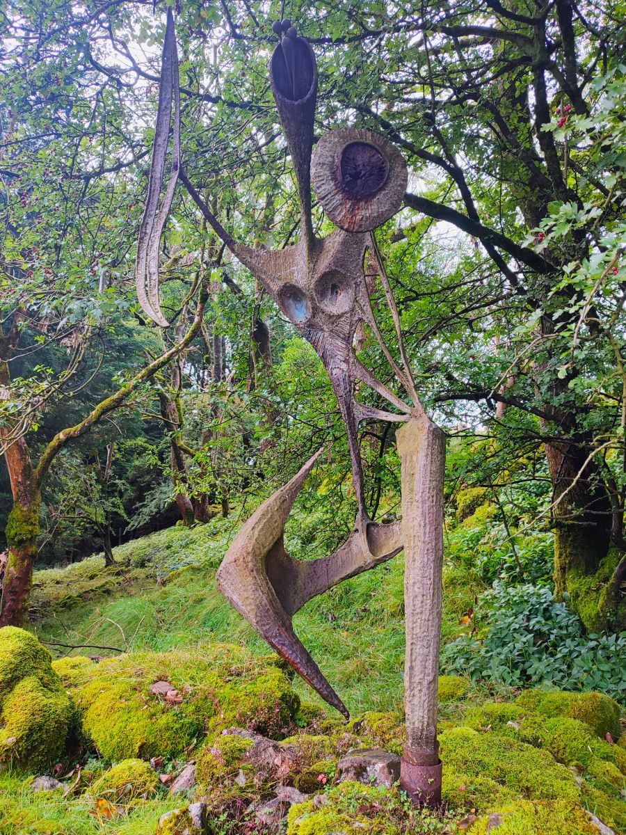
Just beyond St Leonards there is a lane on the right – we take this and head up toward Ellerbeck. We pass signs for a number of properties on the way up but ignore all of them and stay on the road, which soon degrades into a rough track as it heads uphill. We pass a pothole, on the right, behind St Leonards – this is known as Hurtle Pot. Don’t be surprised if you miss it, it’s not particularly visible from the track, but it is clearly well-known to local miscreants, as they relocated a statue from a site next to the lane to the bottom of the pot in 1983.
The artwork was created by Charles I’Anson and is known as the Statue of a Warrior. It has stood at this location since the 1960s but was vandalised on Saturday August 27th, 1983, and subsequently found in 30 feet of water at the bottom of Hurtle Pot. An enthusiastic team of divers managed a retrieval, and it has been re-erected, this time in a deeper foundation.
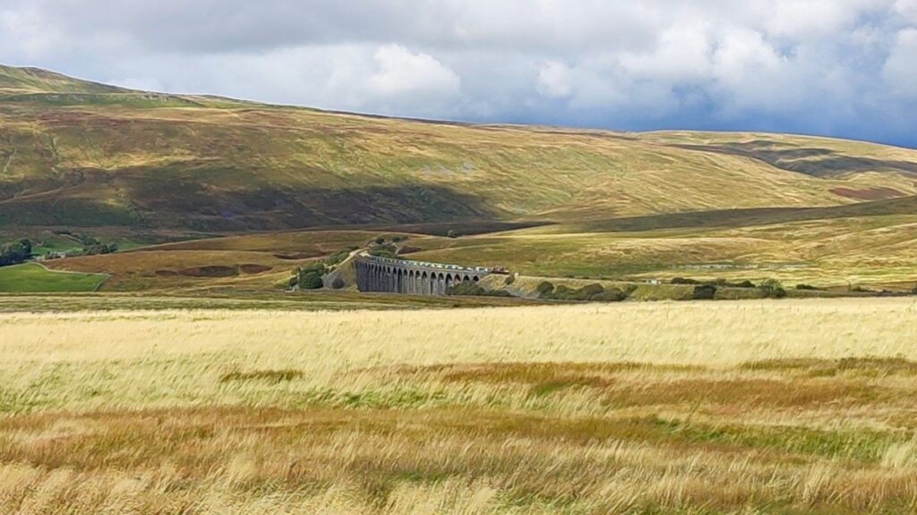
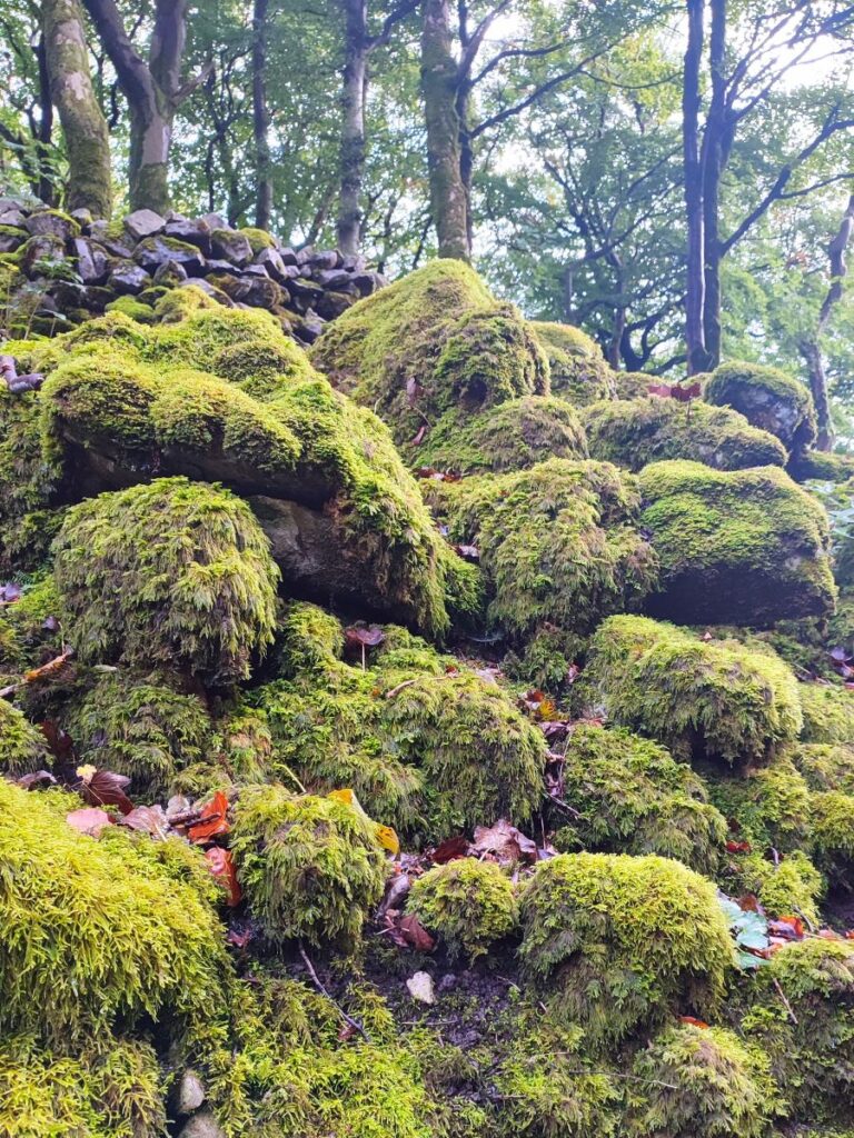
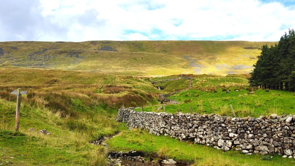
We continue up the lane through an atmospheric mossy woodland, and then exit the trees to walk along a flatter track toward the flank of Whernside – with views of the Ribblehead Viaduct over to our right as well as of Whernside itself. We are heading northwest now, and as we progress further, we catch sight of, and then approach, Ellerbeck Gill. During dry weather (which according to myth can happen here) this is a small stream, but it swells to a fast flowing torrent during wetter periods. We soon reach a point where we find a fingerpost offering us a choice of routes – we go right today toward Deepdale, but if you were curious about the option for Scar End, check out our Chapel-le-Dale, Scales Moor & Oddies Lane walk.


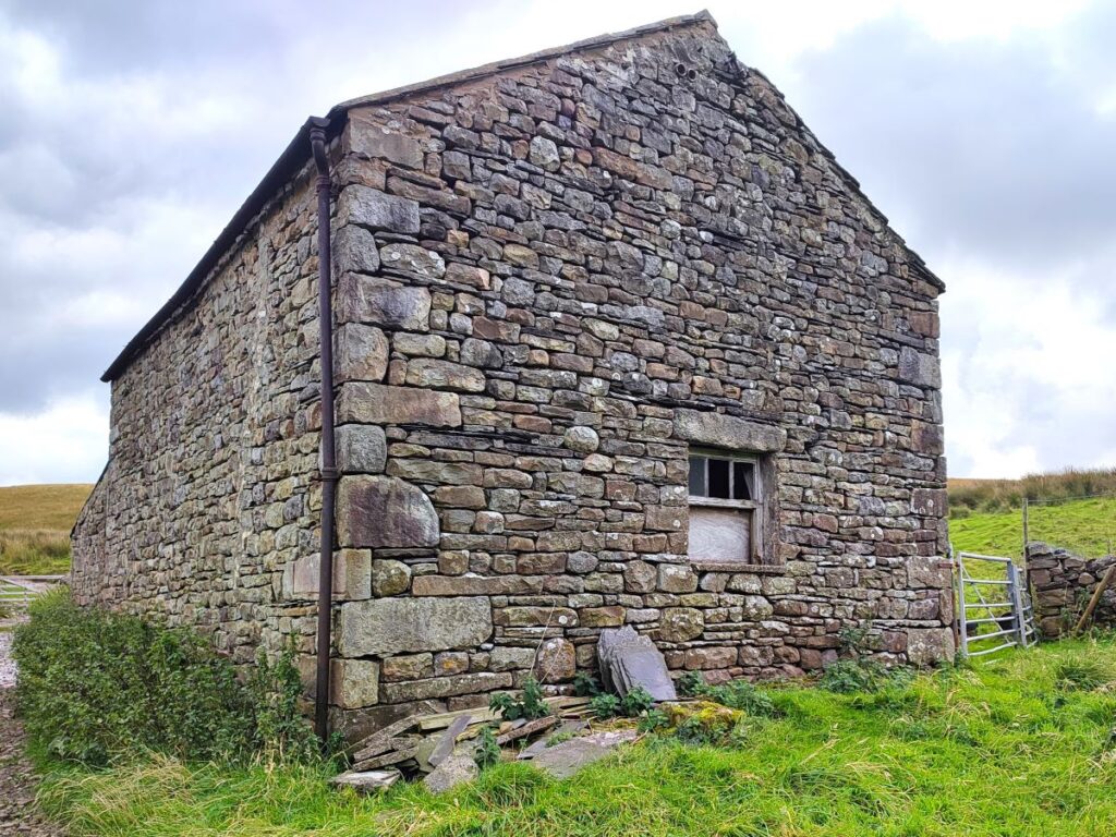
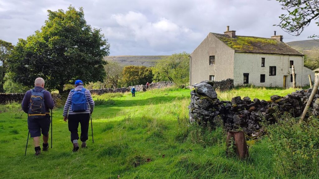
We carry on – now on the Dales Highway – and we head right along the bottom of Whernside on a well signed and generally easy track, passing a number of farms – the route is clear and well signposted at all of them. Highlights along the way are Bruntscar – a 17th century Grade II listed farmhouse, and just beyond this a limekiln where the path down from Whernside crosses ours. We need to continue Northeast on the flat track back toward the viaduct.
Our next landmark is Broadrake which combines a bunk barn with craft workshops – visit https://broadrake.co.uk/workshops.html to see the impressive range of activities available there.
We soon pass Winterscales farm and follow the track up to a concrete tunnel under the railway – we are now to the North of the viaduct at a place noted on the OS map as Blea Moor Sidings – although there is no sign of any rail line other than the main through line. At this point, you could take a small detour to the left up to the signal box where the portal for the Blea Moor Tunnel can be seen.
We opt not to, and head back down the path at the side of the railway line, enjoying a different perspective of the viaduct, initially looking down on the line as it arcs round to Ribblehead station. At this point we have a good view of Ingleborough, Simon Fell and Park Fell to the right of the station. Also worth noting are the traces of the old narrow gauge tracks that serviced the construction site and temporary encampments for the navvies – look out for interpretation boards on the way back to the main road. Click

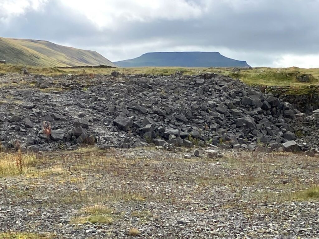
As we arrive at the road, we go right and past the Station Inn (perhaps even pausing for a pint – their beer is recommended), then under the railway bridge to find a road on the left up to the quarry. It is worth noting that this road is used by quarry traffic, so take care.
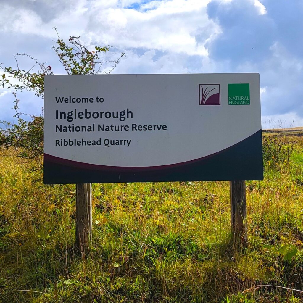
We pass Ribblehead Station, then look for the entrance to the nature reserve on the right. The site was once a quarry but is now part of the Ingleborough National Nature Reserve. The quarry opened in the late 1800s to provide limestone for ballast on the adjacent Settle Carlisle Railway. In 2000 it was donated by Hansons to Natural England and has been left alone to enable nature to slowly recover.

Once in the quarry, look for a stone bench designed to recreate the Ingleborough skyline. This is a great place to sit and enjoy lunch. There are holes on top of the structure to pour water down showing how water flows through the cave systems – the water emerges where you, or a nominated victim sit, providing an opportunity for entertainment.
We are now 2/3 of the way round the walk, and now need to find the green topped marker posts that lead us south out of the quarry and up toward Gauber. Farmsteads here date back well over a thousand years.
If you are lucky, and have time to seek them out, the foundations of three buildings, a long house, kitchen and workshop around a central yard, can be seen in the grass. Finding these faint traces is largely a matter of luck though and needs the grass to have died back – so we found no sign in later summer.
- Click here for a Yorkshire Dales.org web page about the settlement
- or here to see a great Oldfields Limestone Blog on the subject
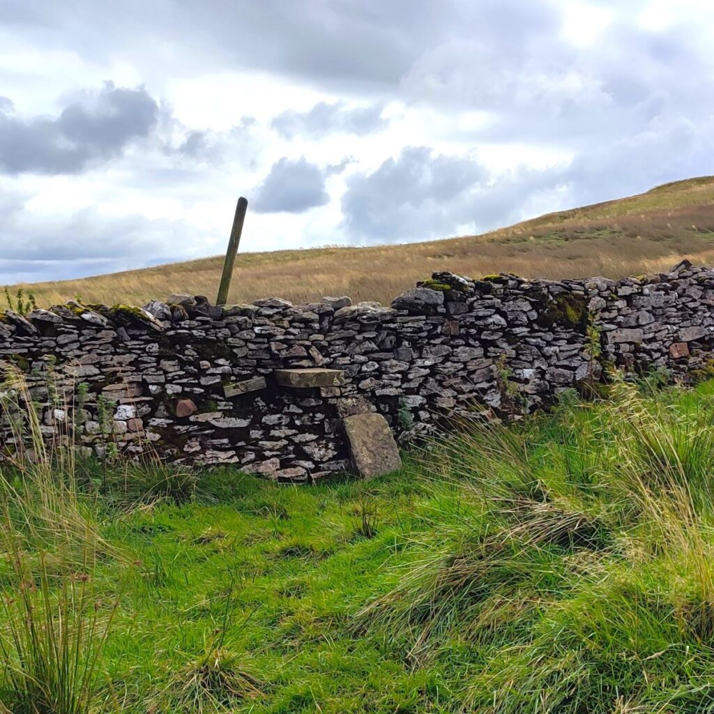
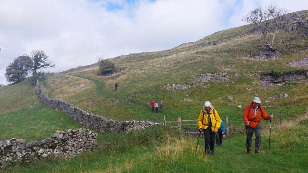
The path remains clear and soon arrives at a drystone wall with a step stile – here we pick up a path crossing ours, and rather than hopping over the stile, go right to circle round the base of Park Fell crossing the limestone pavement as we admire Whernside, getting a good appreciation of how far the Ribblehead Viaduct that we walked next to earlier in the day curves round as it approaches the tunnel.


After about 250m, with the southern slope of Whernside as a target, we arrive at a drystone wall and cross to continue to the corner of the next field to find another wall – from here we stay with the drystone wall – keeping it on our left as we contour round Sleights Pasture Rocks.
People have lived and farmed this land for thousands of years. Sleights Pasture contains a large, chambered Neolithic stone cairn (29 metres across and 1.6 metres high). It was reportedly excavated in the 1800s and contained a stone coffin with an entire human skeleton.
We soon arrive at a track – which runs down to the main road – we carry on though and continue to follow the contours round eventually re-crossing the wall at a particularly impressive area of limestone pavement before continuing to follow the wall down to Great Douk Cave.
The cave is surrounded by a wall and fence and is not signed so would be easy to miss. There is a gate onto a steep path down to the cave, and when the ground is dry, this is safe for general use. We opted not to explore the cave on this occasion, but should you wish to taste the thrill (?) of cave exploration at no risk to yourself, there is a great video here which shows an exploration of the cave with no specialist equipment used.
Alternatively click

To end the walk, we continue downhill for 100m to a point where the main Ingleborough path comes up from the road. We cross this and take a smaller path down to a farmhouse at Souther Scales before arriving back at the road with the car park in sight.
At the end of the route we have covered just over 12 km, which tips the walk into our “moderate” category, but at no point during the day has the walk been difficult, and there are many opportunities to take a breather so if you normally only select our “easy” routes, give this one a try too – it repays in spades.