Jump to . . .Step by Step | OS Map | Downloads | Gallery | Fly through
Staveley and the River Kent have long been a favourite of the Bentham Footpath Group – it’s an easy place for us to get to and there are some wonderful walks in the area. This time though, we go through Staveley and venture further up the valley.
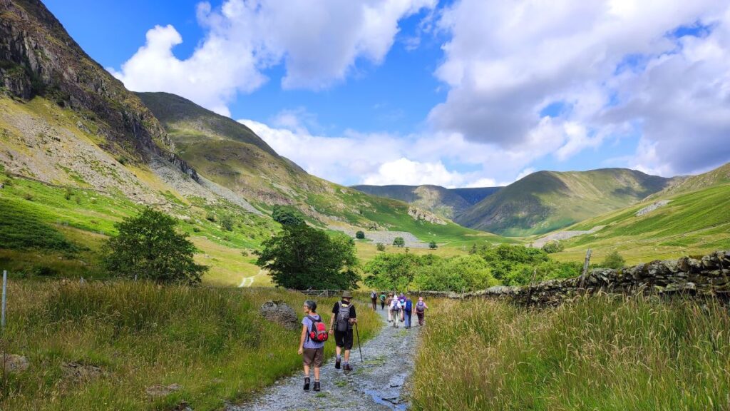
Starting at Green Quarter, we stroll down to Kentmere, and then follow the river upstream past the imposing Rainsborrow Crag and as far as the reservoir that was built to control the flow to the mills downstream. We then cross to the east of the river and come back on a route tht gives us great views of old quarrying works.
The last part of the route back to the parking is a steep climb, so although this is an easy route overall, expect to be out of breath at the end.
- Total distance 11.1 km (6.9 miles)
- Total ascent 291 m
- Easy walk
Step-by-Step

Parking is at a premium in Kentmere: There are a few roadside spaces near the Kentmere Institute, parking in fields is available on summer weekends, or as we preferred for our walk there is a small car park at Maggs Howe – this is chargeable via an honesty box, but proceeds go to local charities so please give generously.
To get to this car park, first drive to Staveley, then take the minor road signed for Kentmere. Pass the fire station (on the right) and the church (on the left), then 400m later the road crosses the Kent at a stone bridge on a sharp bend.
Follow this (very narrow) road for about 2km, noting the occasional sign for the “H&V” works. The factory is on the left, but we carry on for a further 600m until the road forks – we go right onto Lowfield Lane, and then 200m later bear right again up to Maggs Howe. If you are using Satnav to get there, the postcode is LA8 9JP, but this covers a large area, so “Lowfield Lane Kentmere” might be safer. If you are using a paper map, then the OS grid reference is NY46230412, whilst the parking is pinpointed by the What-3-Words tag shatters.zapped.vibe
From the car park, we walk downhill and back to Lowfield Lane, where we go right to follow the road downhill with great views over the valley toward Kentmere. Almost immediately, we see a finger post for a footpath on the left hand side of the road – we didn’t take this, but we do pass the far end of it in a moment or two so if you prefer that to a short section of quiet road feel free to take this alternative.
The road bears right and then forks – we go left and continue downhill, before looping back passing the far end of the footpath we saw a moment ago and then arriving at a road junction. We go right and take the bridge over the Kent. From here we have great views of Kentmere a short distance ahead with the church of St Cuthbert’s dominating the scene. Also worth noting here is that this final junction before the bridge is where the field parking is available during summer weekends. From here, the road bends to the left and then heads uphill to the church, and the Kentmere Institute.
Click here to visit the village website


The current church building, which is Grade II listed, dates from the 16th century, although it is likely that there has been a place of worship here for much longer – the yew tree in the church yard for example is known to be about a thousand years old. The building was subject to extensive restoration in the 1860s during which the height of the tower was increased, further improvements took place in the 1930s, and in recent years extensive roof repairs have taken place.
St Cuthbert is a saint particularly associated with the north of England, having been a monk and then Bishop on Holy Island, or Lindisfarne. His body now rests in Durham Cathedral. He was originally buried on Lindisfarne but when the Danes attacked in 875 his remains were taken to various places in the north of England and even as far as southern Scotland. It has been suggested that his body rested at Kentmere during these movements, but there seems to be no reliable evidence for this. To read more aboute the church try
- This Visit Cumbria page or
- This Wikipedia article
Just round the corner from St Cuthberts is the Kentmere Institute, we walk past this and continue on the road for about 150m to arrive at a steel gate onto a track up the valley – this is signed as Hartrigg, and you may also notice a miles without stiles roundel as confirmation that you are in the right place.
The Miles without Stiles project is a great scheme to make the countryside that we all love so much more accessible to those who cannot manage stiles. They are also good for those who have a dog lacking the agility to scale stiles, for families with small children, or adults coming back to fitness. There are fifty routes in the Lake District, and a similarly wide choice in the Yorkshire Dales.
We are now on a well surfaced track heading north, and we are following the river valley up toward the reservoir at the top. This is not apparent at the lower reaches however, as the river is out of sight and about 250m to our right in these early stages.


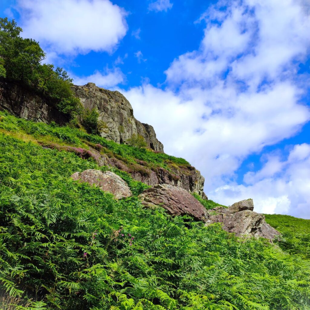
As we progress further, the view is dominated by a series of steep and imposing crags to our left. The first is Raven Crag, soon followed by Calfhowe Crag, and then Scale Knotts.
By the time we are walking around the base of Calfhowe Crag, we are much closer to the river – it is about 100m over to the right and stays within sight for most of the way up to the reservoir.
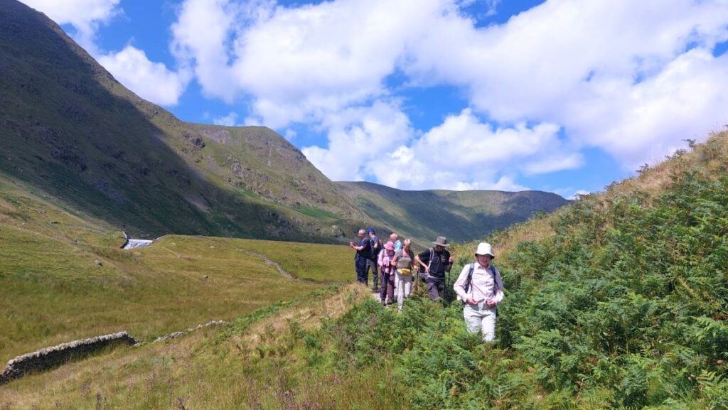
We stay on the track for a while now – until we arrive at Hartrigg. This is where the Miles without Stiles access path turns back, but we continue to the left, before the farm, and onto a rougher track, which takes us past some woodland (on our right) where you may be lucky enough to catch sight of deer. Even without the deer, this is a great place to stop and enjoy a break.
We press on, heading northwest on the same track for a while now, gaining great views across the valley to the spectacular quarry spoil heaps that we will walk through later in the day. We soon have Rainsborrow Crag to our left, along numerous streams coming down from the hillside. These were rather quiet during the dry period we were lucky enough to enjoy but are no doubt capable of being much more energetic during periods of heavy rain (generally the period between September and August).


Once we are beyond the bulk of Rainsborrow crag we catch sight of a white cottage ahead. This is surrounded by the spoil heaps from the long abandoned Steel Rigg quarry, so it’s tempting to assume that the cottage was part of the quarry infrastructure. However, it’s not – it was built to house the caretaker for Kentmere Dam and associated control gear, which we will meet soon. The site currently belongs to Blackburn with Darwen Young Peoples Services, who operate it as a residential outdoor activity centre.
The path now curves round to the right and rises through the spoil heaps, which despite being literally piles of industrial waste, are strangely beautiful.
As we round the last bend, we see a waterfall. This is fed by a spillway from the reservoir ahead – which as we get closer looks almost canal like in the sense that it has straight sides. As we walk further upstream however we see that there is a stepped overflow from the reservoir above feeding the spillway, and a corresponding stepped section leading back out into the river Kent.
Clearly there was a huge investment in all this infrastructure many years ago – which begs the question – what’s it all for?
The answer to the question is found downstream. We will recall that we passed a factory on the way to Kentmere, and that was once a mill – one of many along the length of the Kent that used water to power the mill processes.
After Kentmere Tarn (which is to the south of Kentmere and not part of today’s walk) was drained to provide agricultural land in the 1840s, water supply to the mills became unreliable, threatening the viability of the industry. The mill owners were in competition with each other but were far sighted enough to cooperate in a plan to build a reservoir to regulate the flow. Click here to read a wikipedia article.


They contracted the water engineer John Frederick Bateman to advise, and the Act of Parliament obtained in 1845 authorised up to five reservoirs. Despite Bateman’s preference for the reservoir at Skeggles Water, the millers opted to build that at Kentmere Head, and construction was completed in 1848. Mill owners paid for the water based on their usage as measured by the drop in river level at their specific mill, with the smallest mills exempt from all charges.
Soon after the project was commissioned, the arrival of the railways ensured that cheap coal became more available, and the number of mills using water power steadily declined. This process was accelerated by the Water Resources Act 1963, under which the Lancashire River Authority levied prohibitive charges for using water to generate power.
The use of waterpower effectively ceased in 1972, with James Cropper becoming the owner of the reservoir, simply because the paper mills at Burneside were the last users of water from the reservoir. By 1995 there were serious problems with the dam, with structural integrity under question. At one point there was serious consideration given to breaching the dam, as a mechanism to ensure that it would no longer be subject to the provisions of the Reservoir (Safety Provisions) Act 1930. News of this intention created a public outcry, because the reservoir is in an area of natural beauty, and to their eternal credit, despite not needing the water James Croppers paid for engineering work to remedy the faults. The works included a slightly lower maximum water level, and a wall being constructed along the top of the dam to prevent wave action causing the downstream face to erode and possibly fail.
We have a walk at Burneside which passes the Cropper mills – click here to see it
Today, the dam is stable, and the structures considered safe for the foreseeable future. The presence of a tranquil body of water at the head of this rugged valley is a great contrast and one that we should treasure – as we did whilst we enjoyed lunch.
To see panorama shots of the views on the day, follow these links:
Our return journey is on the other side of the Kent and starts by backtracking to the bottom of the spillway where we take the footbridge to the path down to the river Kent. Over to our left in the base of the dam we see a doorway. This gives access to the valve gear that feeds water into the Kent downstream at a controlled rate – the sole function of the much more visible spillway is to manage overflow during wet periods.


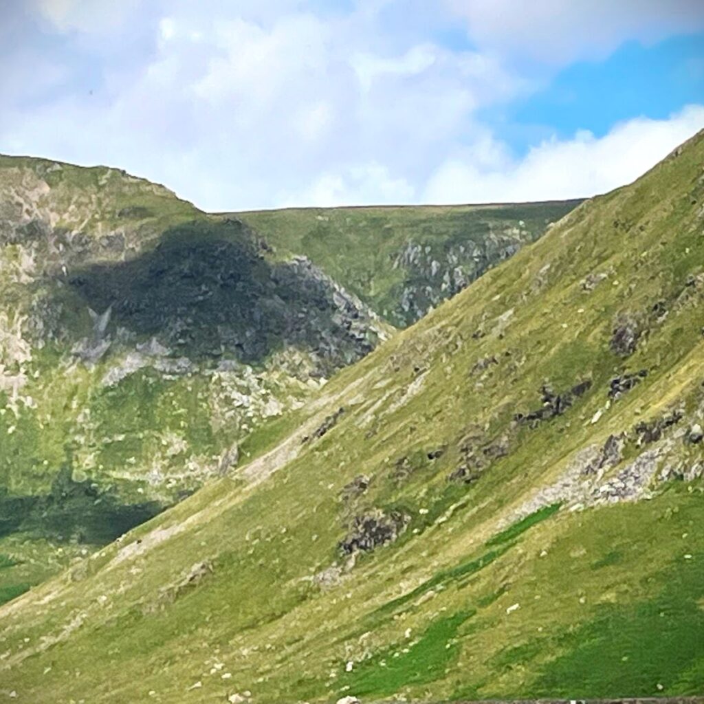
Once over a second much smaller footbridge we head right and follow the clear path downstream through further areas of quarrying waste – and with great views across to the crags that we walked next to earlier in the day. To our left on the way down is Tongue Scar, with precarious remnants of quarry structures still visible at the top. We follow the path down and soon arrive at a barn, identified on the OS map as Tongue House.
The path continues through a number of fields – where we met an intimidatingly large but entirely placid bull. There is a short riverside section of path – with an interesting arched bridge, and then we approach a cluster of houses at Overend. There is a spilt in the path here – we need to take the route through the gate and closer to the river rather than the metalled track – don’t worry if you make a mistake here though – you will rejoin us later.
We follow the path from Overend for another 800m or so – the route is clear and obvious. At the lower end it is shown on the OS map as Low Lane and runs parallel to the metalled road out of Overend, known as High Lane. The two soon come together, so if you took the wrong path earlier, welcome back.

We head right at the junction, and in 100m recognise the route from the start of our walk. From here, all we need to do is complete the steep walk back up to the car park.