Jump to . . .Step by Step | OS Map | Downloads | Gallery | Fly through
Last week’s walk at Waddington took us to the Forest of Bowland, where we noted that there were fewer visitors than our typical Yorkshire Dales walks. This time we do exactly the opposite – we head to one of the best loved peaks in the Lake District, and trust that the stunning scenery makes up for the higher visitor numbers.
So, did this work? Absolutely: A quick glance at the gallery on our website shows that we picked a perfect day – bright late summer sunshine, without being too hot – made the whole day simply perfect.
If you pick this walk expect a steep climb, some clambering over rocks, idyllic tarns, daring rock climbers, jaw dropping views, industrial archaeology, waterfalls, and an ice cream stop. Take your costume and you can add wild swimming to the day’s fun.
- Total distance 14.7 km (9.2 miles)
- Total ascent 859 m
- Moderate walk
Step-by-Step

We start at Torver, a lovely village 3 miles southwest of Coniston itself, and 1 mile (1.6 km) west of Coniston Water. To get to Torver take the A65 to the M6 then continue opposite on the A590 as far as the Levens roundabout then turn left (still on the A590).
Follow the A590 as far as Greenodd, to take the A5092 on the right as far as Lowick Green where we take the A5084 on the right until we get to a T junction in Torver. Parking may be available at the roadside in the village near the Wilson Arms, or if not, turn right and continue for another 150m to find the car park at the Old School Hall on the right. Note that there is a fee for parking – payable via an honesty box. Please give generously.
We start out by taking a right turn out of the car park and walking on the road toward Coniston. We are on the road for only 100m, but this is a busy road so please take care.
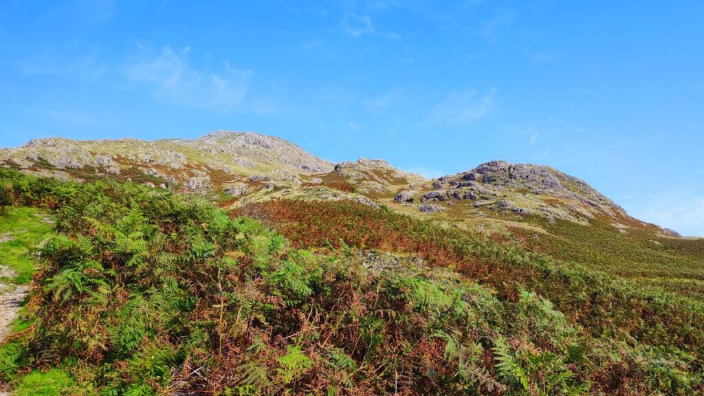
We soon see a bend ahead with a lane exiting the main road on the left – we head up that lane. It soon bends round to the left and then meets a T junction – we go sharp right here almost doubling back on ourselves as we follow the track up past Scarr Head – and from here we start to get views of the Old Man, our destination for the day. This might be a good point at which to address the question why the Old Man is so named – the shape of the mountain is not in any way reminiscent of a human form in the way that the Old Man of Frodsham is for example, so why the odd name?
It is believed that “Old Man” is derived from the ancient Celtic “Alt Maen” meaning “High Stone” and the Coniston part comes from the Old Norse “Konigs Tun” meaning King’s Farm. This much loved and very popular fell is the highest peak in the Cumbrian Furness Fells, but was once in Lancashire, where it was celebrated as the highest point in the county at 802m. Since the re-drawing of the county boundaries, Lancashire now claims Green Hill near Cowan Bridge at 628m as its high point.

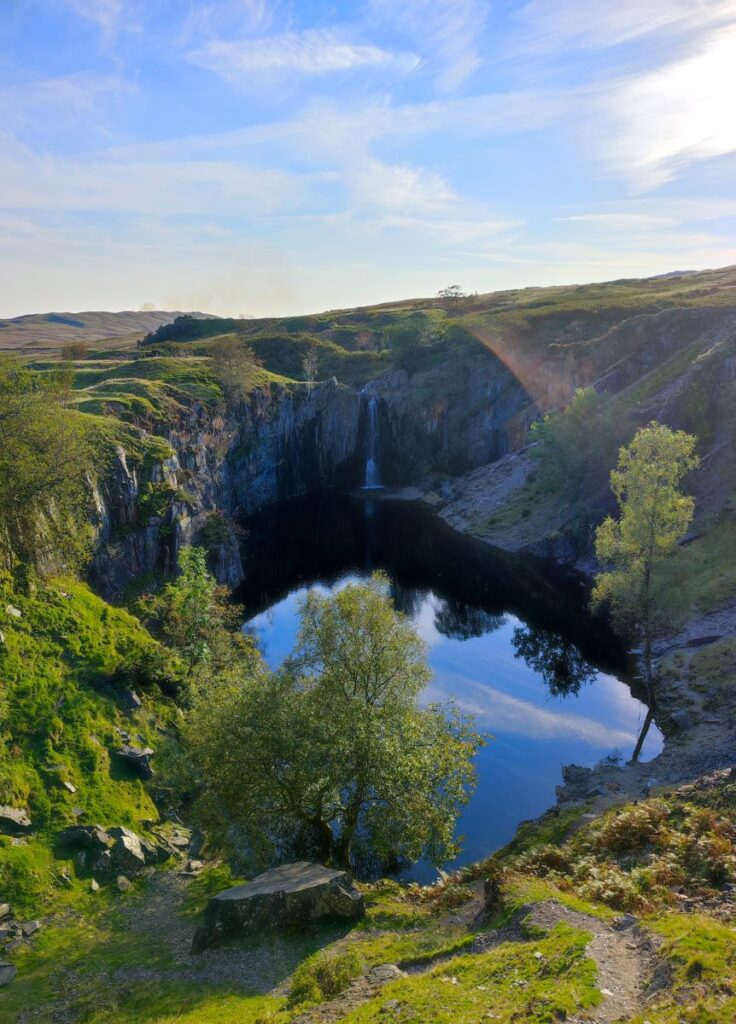
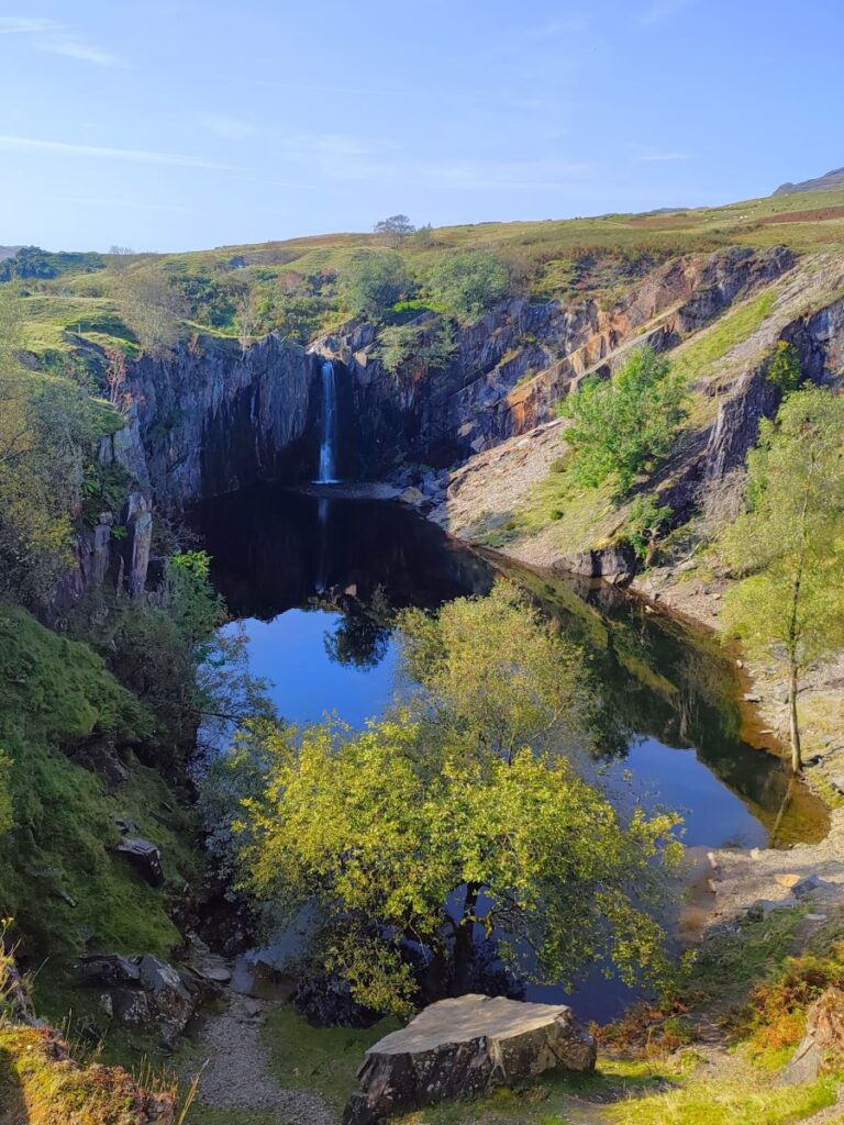
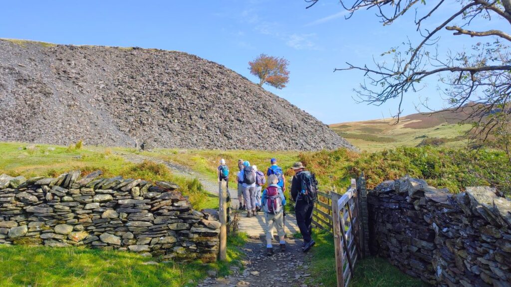
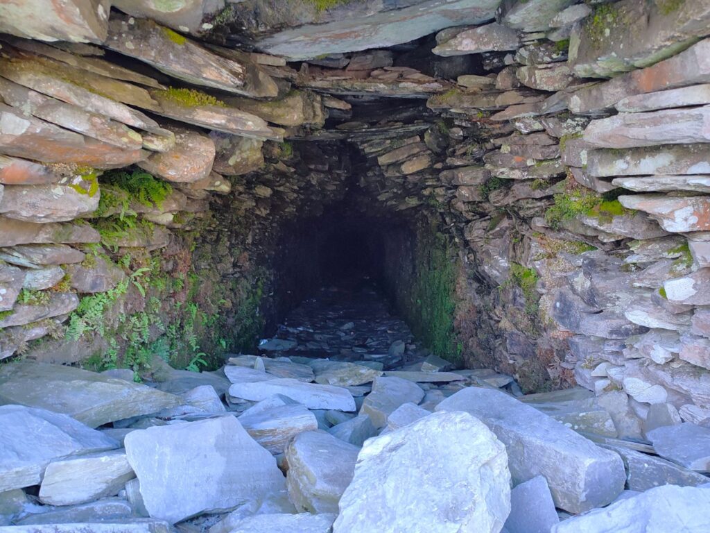
We are climbing steadily now, and 1 mile after the sharp change of direction at the base of the lane, we meet a footbridge over Torver Beck. Beyond the bridge we see prominent spoil heaps that make it apparent that the whole of this area was once heavily industrialised with slate and copper mines going back hundreds of years. Our path now goes left between the spoil heaps and as we continue to climb, we soon meet Banishead quarry on the left with its spectacular waterfall at the far end.
What we are seeing here is the remains of slate mines and there were once two large quarries here, Eddy Scale and Banishead, one on each side of Torver Beck which was left flowing down a ridge between the two. Eventually, a section collapsed creating the waterfall into Banishead.
The question we need to ask is: if the quarry is fed by a waterfall, why does it not fill up? It seems that the base of the quarry is actually sandstone, a permeable rock, so water levels naturally stabilise, creating a constant safe level that is popular with wild swimmers. This breach of the beck into the quarry was relatively recent, and legend has it that the beck side was deliberately breached by two lads from the local farm in the 1950s.

We continue upward, and just past the quarry, we see a path coming in from the right – we stay left for now, but make a mental note that the path to the right is our return route at the end of the day.
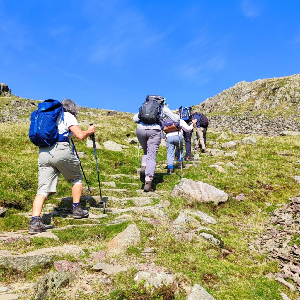
The climb starts to get steeper from here – we are following the line of Torver Beck, but this is not a riverside walk, so don’t be too concerned if the beck is not very apparent. We soon see a clear and well walked path crossing ours. This is Walna Scar Road an old packhorse route, that formed an important medieval route from Furness Abbey to Coniston as part of the wool trade. It is a good option for accessing the ridge along the top of Brown Pike, Buck Pike, and Dow Crag – perhaps a walk for another day.
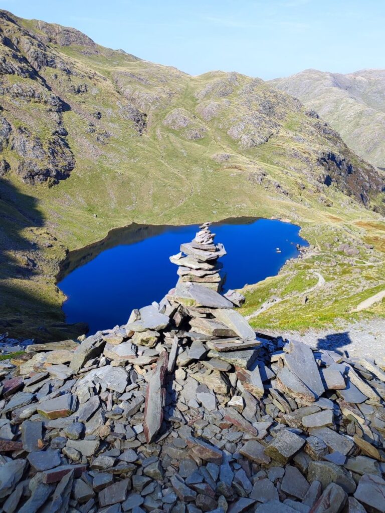
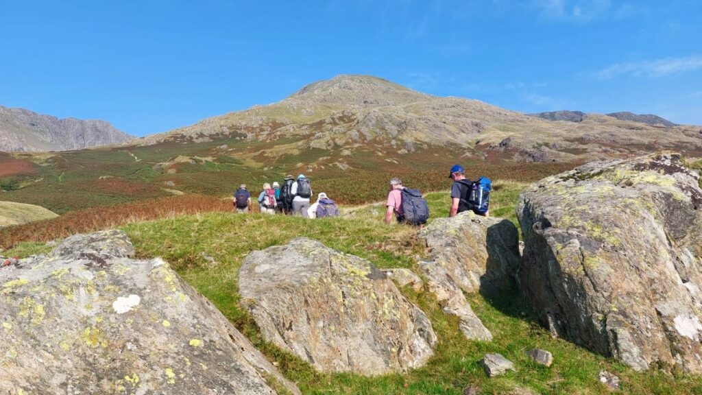
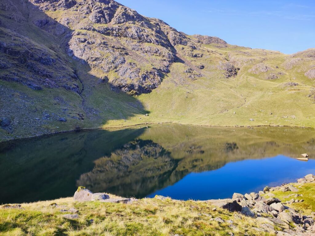
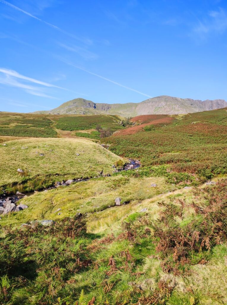
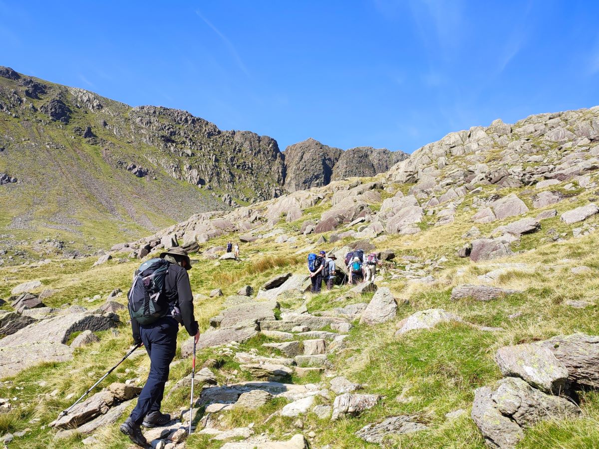
Our target now is the path up between the Old Man on our right and Dow Crag on the left. The route is clear and obvious, but quite steep in places so care is needed, and it is well worth pausing a couple of times up this section to look back at the view over the south of Coniston Water and out to Morecambe Bay. All the hard work is soon rewarded as we arrive at a tarn known as Goat’s Water. This comes as a bit of a surprise, because the view we have as we climb gives no hint that there is space between the fells for such a large body of water.
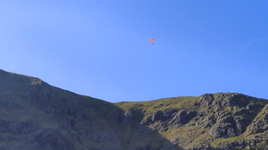
This is a good place to stop for a while, particularly if there is entertainment provided by climbers attempting one of the many routes up the imposing face of Dow Crag opposite. For those less energetic, wild swimming is possible here, as is angling for trout or char.
Click here to see a BBC iplayer program showing the face of Dow Crag being climbed.


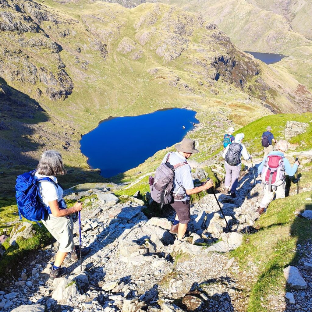
We now need to walk all the way along the right hand side of the water, to pick up the path which rises quite steeply to meet the ridge at the far end of the tarn. This is quite hard work but is made easier by recent stabilisation works making the path safe and clear. Once we arrive at the top of the ridge, we have great views ahead toward the Langdale Fells and can even see Sellafield on a clear day.
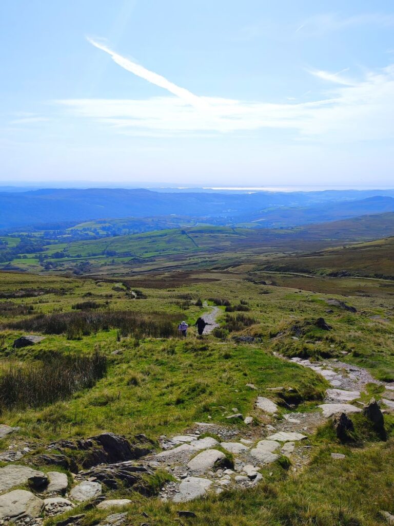
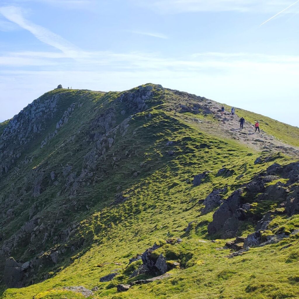
At this point, we head to the right and see our path curving round to approach the Old Man in a south easterly direction – the peak is just 1 km away, but relentlessly uphill, and this section will take a while, so take a moment every now and again to take in the views along the way – as is so often the case, the best views may well be behind you.
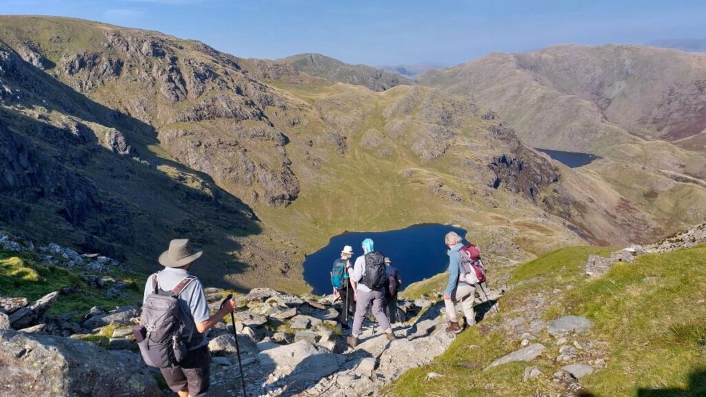
We soon reach the top of the ridge that leads to the Old Man, and from here we start to get our first glimpses of the valley on the far side. We can see our path down, along with Low Water Tarn that we will get to later in the day, and further over to the left scarring left from extensive copper mining activity – this is Coppermines Valley, an area with a rich industrial heritage where we could fill a whole day with fascinating exploration.


Industrial mining of copper at Coniston is said to have started when Elizabeth I brought over German miners to exploit the local deposits – they used a technique known as “fire cracking” – where fires were built to heat the rock which then expanded and then cracked, giving access to the copper ore which was removed and processed by hand. This is an inefficient technique though, so output remained low until 1756, when Charles Roe, a Derbyshire industrialist began investing heavily in the mines. Further improvements in the nineteenth century enabled waterpower to be used and the mines were then extensively developed by John Taylor. The shafts at this stage reached depths of 270 feet (82 m). Deep mines tend to flood, so a pumping system was required, and this was in turn powered by a water wheel – this is still visible from the Old Man, as are the terraced miner’s cottages.
Click here for a YouTube video where the old workings are reconstructed.
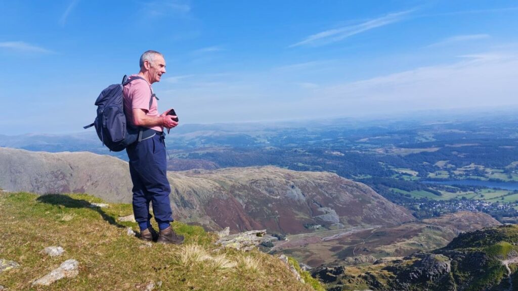
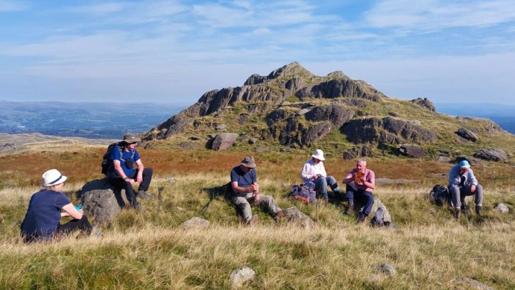
Ahead, we have the cairn at the peak of the Old Man, and as is traditional, we pause for a break here, enjoying views over to the Irish sea and the wind farms, or to Coppermine Valley, just depending on where we choose to sit.
Our path down starts behind the cairn and is quite steep – the route we are taking down is one of the popular ways up, so be prepared to negotiate with walkers coming in the opposite direction. The path is clear throughout, and navigation is not a problem, as the path zig zags down to Low Water Tarn, where depending on the weather people may be enjoying wild swimming.
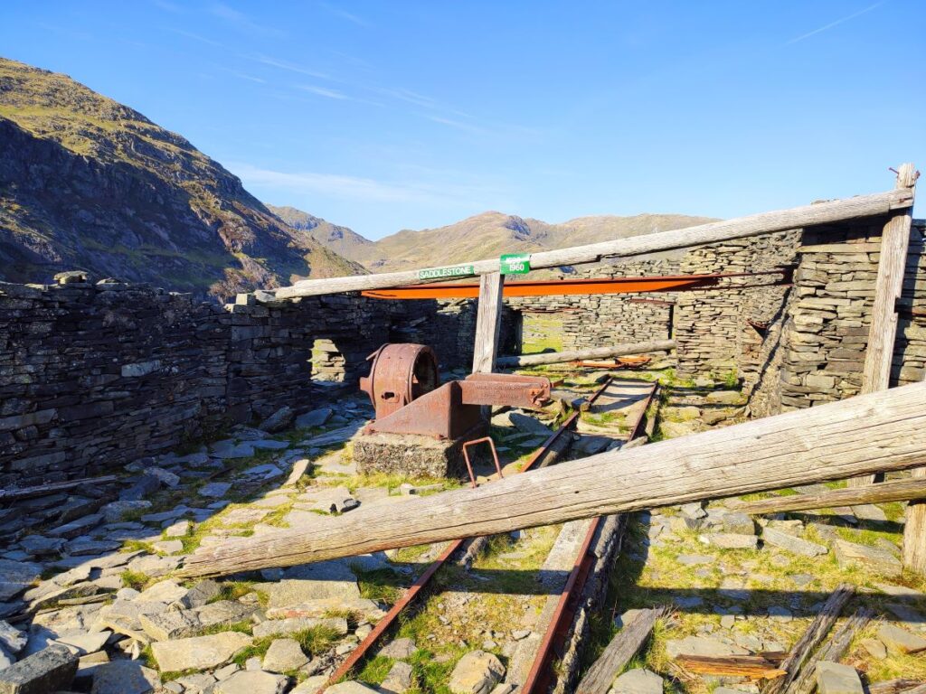
Once at the level of the tarn, the path cuts to the right and heads east toward another area of lost industrial activity the Saddlestone slate quarry remains.


As well as copper, which was found in thin vertical seams, high quality slate for roofing and other buildings works was extracted from this area, and this mixed history made the working particularly dangerous – copper is extracted by digging down, whilst slate is recovered by digging in, so where the two coincide, slate miners run the risk of falling down shafts previously used for copper, many of them being covered by loose debris so barely visible. This risk is still present, so for this reason, entering the visible traces of the mines is not recommended.
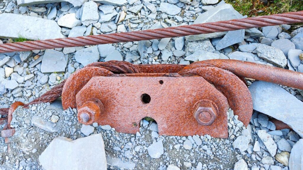
Still visible on the surface are remnants of office buildings, and narrow gauge railway lines that carried the slate to the cutting sheds. When the slate was ready, winches and cables were used to pull wagons – these are still intact, and well worth exploring.
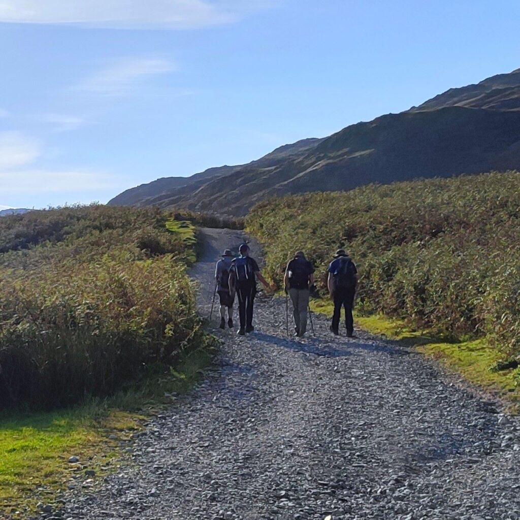
The path continues down – in fact we need to duck under a cable way to make progress, before we head down hill toward a smaller hill called The Bell, where the path turns right and heads south for the next 1 km to arrive at a car park – this is on the limit of the metalled section of the Walna Scar Road, and is an alternate option for a start point for the walk. Be aware that the parking here is chargeable, and that the end space needs to be left clear for the ice cream van – a very welcome find on a hot day.
Once at the car park we head right (i.e. away from the access road) and follow the track uphill. We are now on the Walna Scar Road, and as we saw earlier in the day, the track intersects with the early stages of our walk. We could walk up the Walna Scar Road until we get to that crossroads and then head left to get back to Torver. But as we all needed to be back, we took the opportunity to cut off to the left after about 1km, and find a rough but clear path though undergrowth to meet the outbound route nearer the Banishead quarry. From here the rest of the walk is a simple matter of reversing the early stages until we get back to Torver.
Bentham Footpath Group walks are rated according to the length and the change in elevation. This walk comes in at the very top of our “moderate” category – in fact opting not to do the shortcut at the Walna Scar Road would have us in the “challenging” category. Add to this the potentially difficult terrain, and we recommend that this walk be considered one to approach with due care.
To give yourself a clearer idea about the terrrain, click here to see a YouTube video posted by another walker that shows most of the route we followed. Or click the following links for panorama shots of our trip