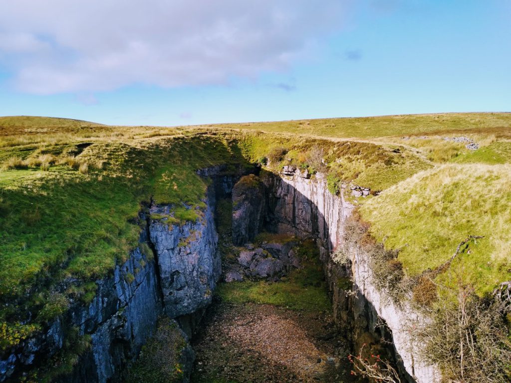
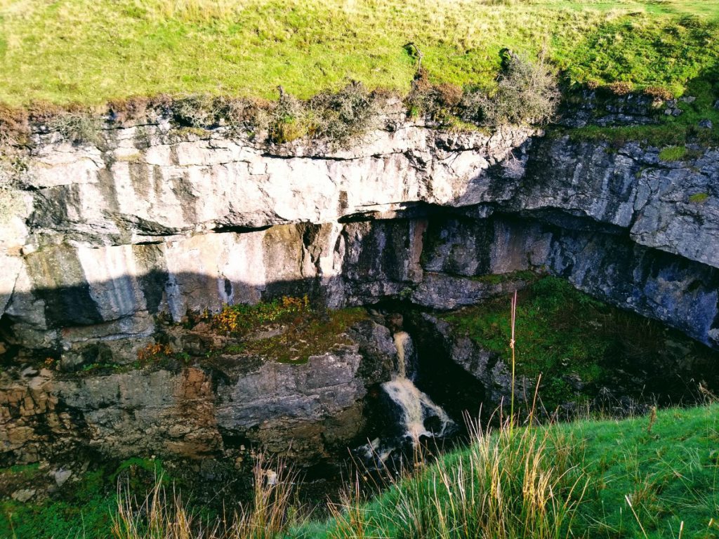
The Yorkshire Dales and it’s underlying limestone feature many caves and caverns. Hull pot was once one of them – It is believed that millennia ago a large cavern collapsed to create the hole that we now call Hull Pot.
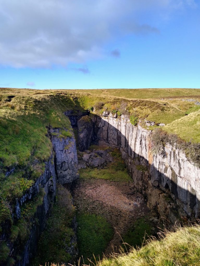
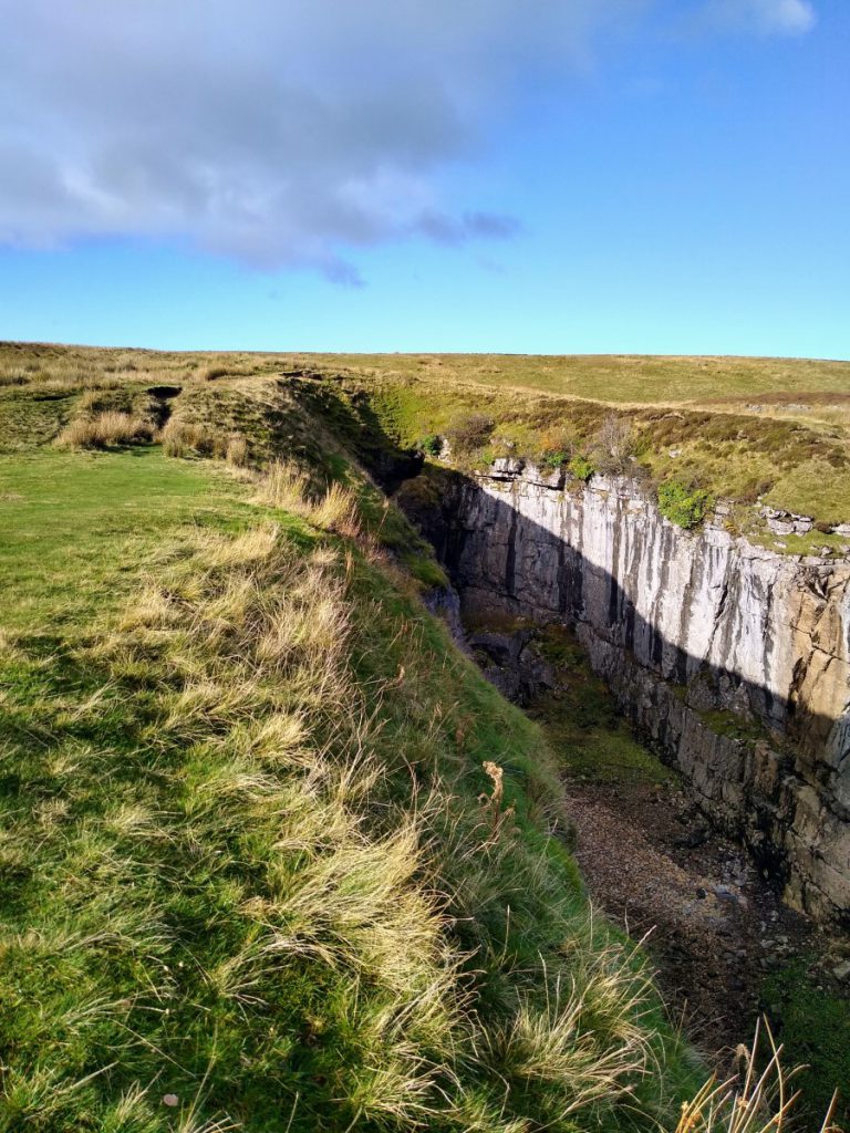
Because of the collapse, there is little to explore underground, so this is not a destination for cavers. However, for walkers it is an impressive sight measuring 91 metres (300 feet) long by 18 metres (60 feet) wide by 18 metres (60 feet) deep. The sides are steep and unguarded so take care.
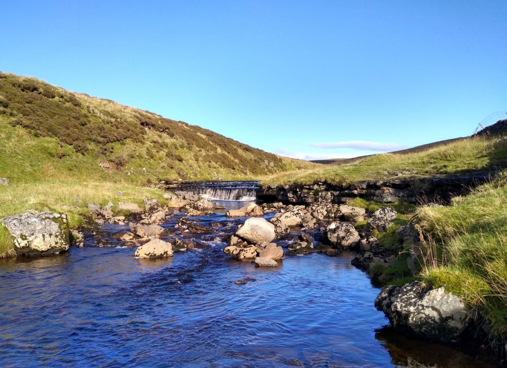
In dry weather Hull Pot Beck goes underground before it gets to the rim of the pot and resurfaces again as a waterfall below in the pot itself. The water then disappears again and re-emerges at Brants Gill Head, a short distance from the Pennine Way and Ribble Way near to Horton-in-Ribblesdale.
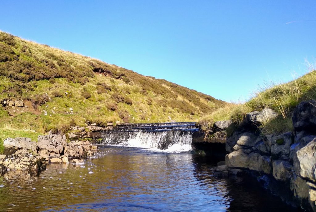
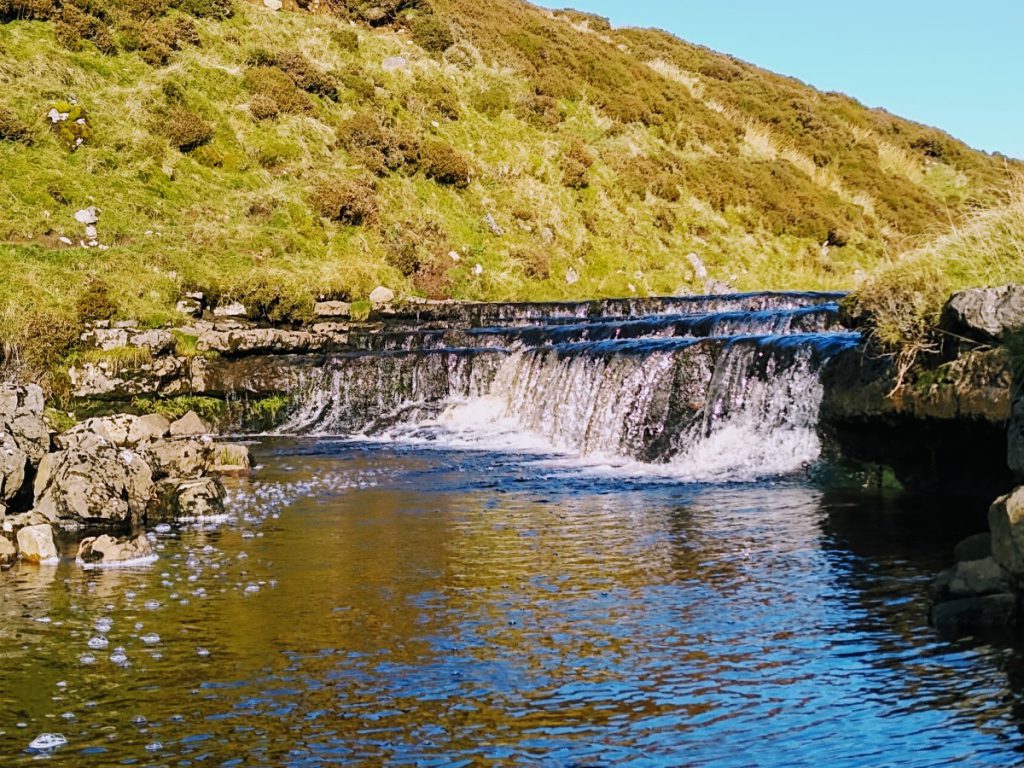
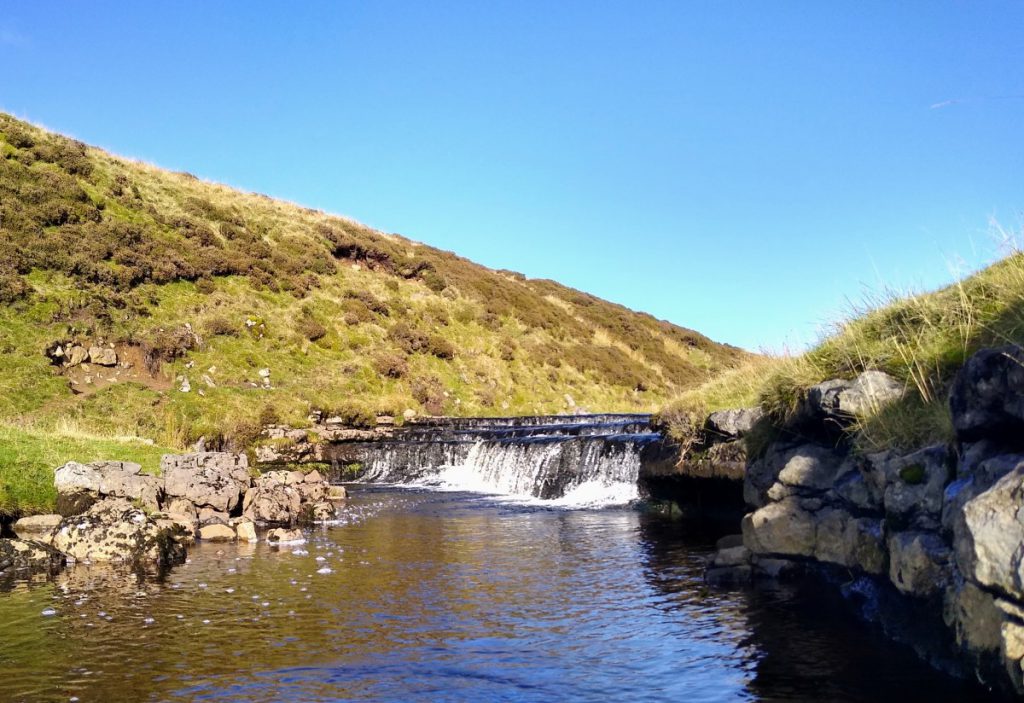
Just upstream of the pot are a set of (small) waterfalls which make a good point to take a break halfway round the walk.
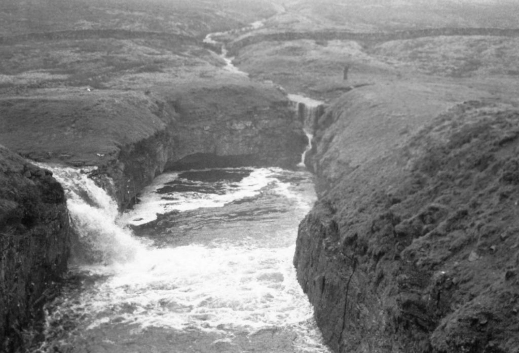
In very wet weather the stream runs over the edge into the pot, creating a spectacular waterfall. In fact, it has been known to fill it to the brim with the water overflowing and running down the hillside. This is a rare occurrence, but as this archive picture shows – it can happen.
Total distance 8.9 km (5.5 miles)
Total Ascent 411 m
Easy walk
NEWS! Hull pot filled again on 11/01/23 click hereto see a video.
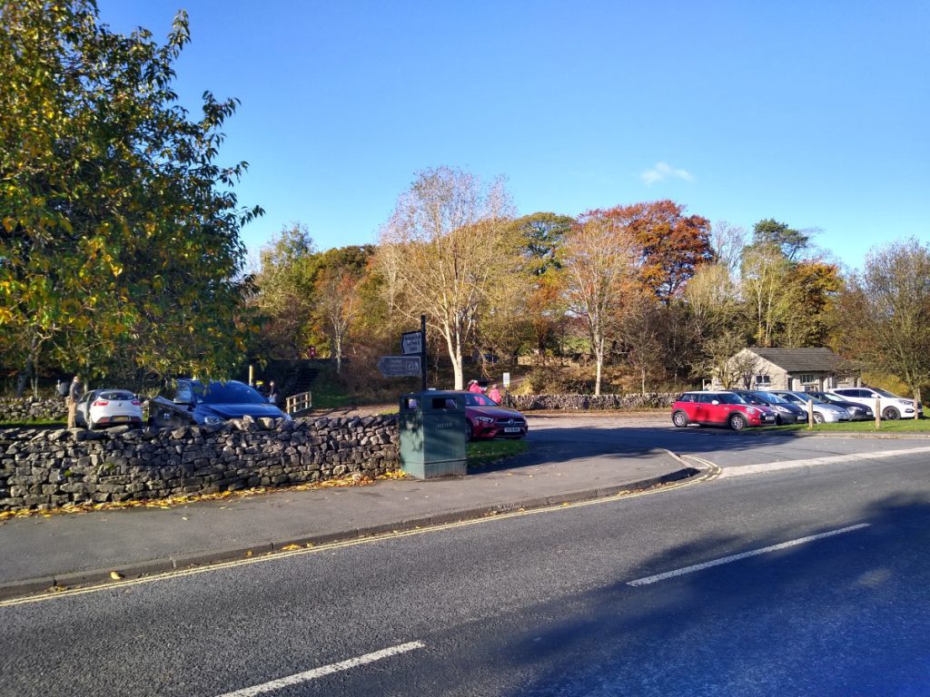
We start at the National Park car park in Horton in Ribblesdale – or on street parking is often available just beyond the bridge. Toilets are available at the car park.
We exit the car park and turn right walking along the main road through the village. Just past the tourist information office, look out for a fingerpost on your right hand side directing you across the road and up a lane toward Pen-y-Ghent. This lane is used as an access road for a number of properties at its lower end so be aware that traffic may have legitimate reason to use this lane.
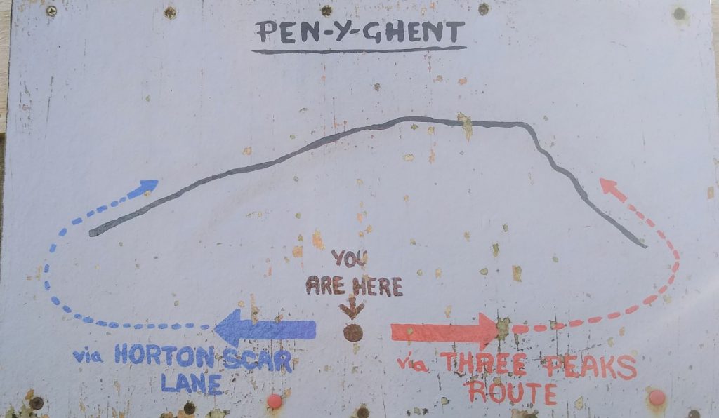
Once we clear the houses, the lane becomes rougher, and traffic free and we soon approach a junction where a handmade sign offers two routes to Pen-y-Ghent. We chose the left hand option labelled “via Horton Scar Lane” and so avoid the more popular and heavily trafficked Three Peaks route.
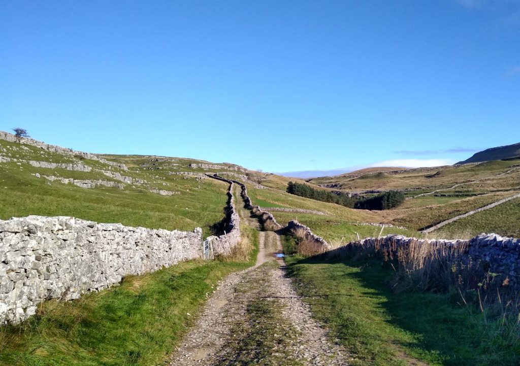
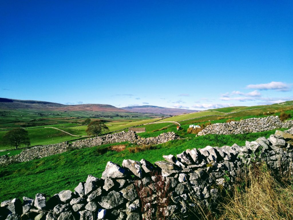
We continue uphill, and the lane bears right, opening up a near perfect view of Yorkshire Dales lanes, with drystone walls on either side, and spectacular views in all directions.
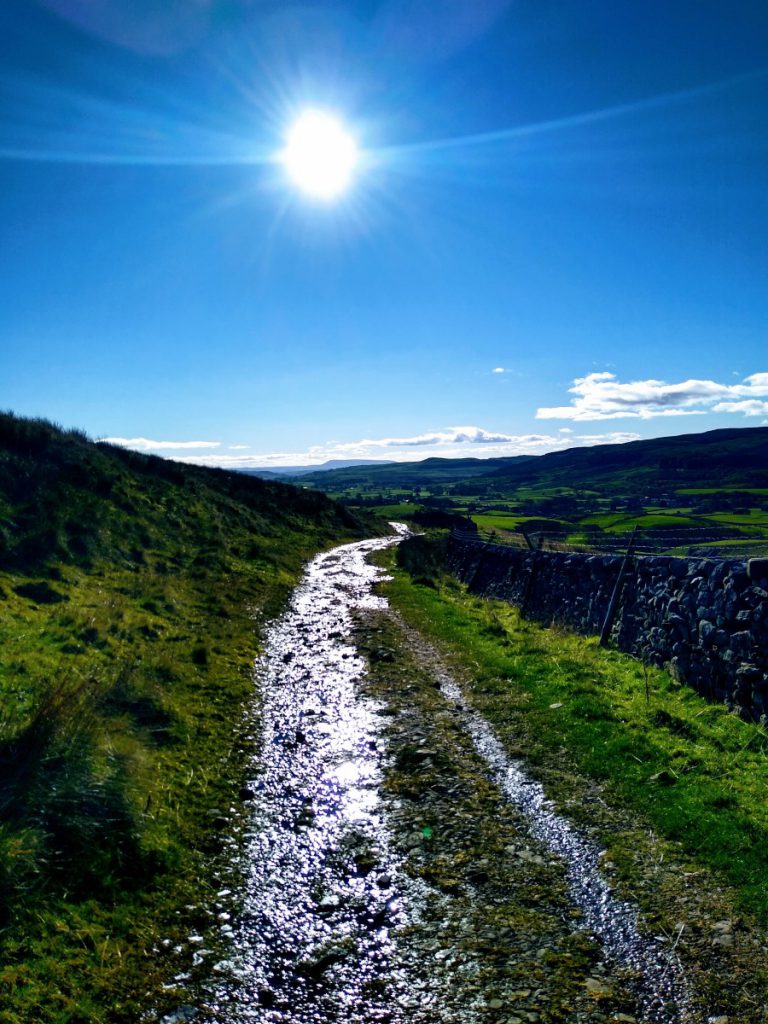
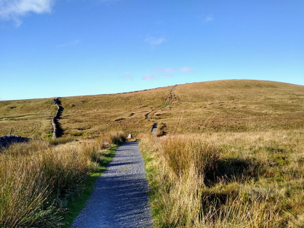
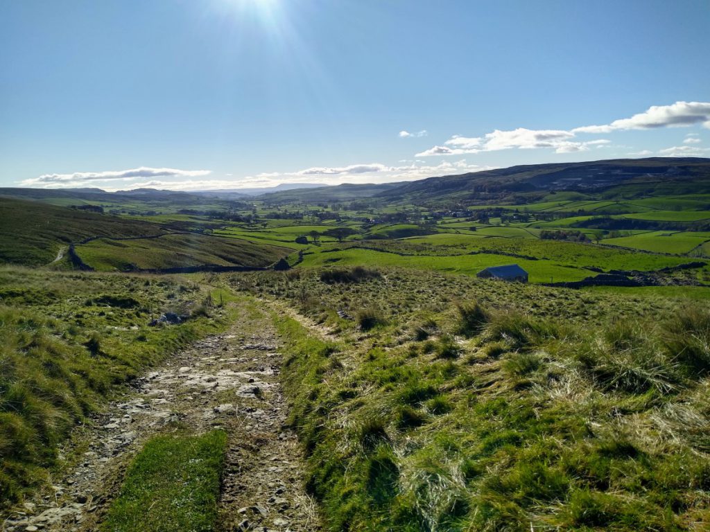
We press on for a while now – the route is clear and with the exception of a few well maintained gates, there are no navigational milestones. Although we are climbing, the rate of ascent is quite gentle, and the surface of the track makes for easy walking.
It is worth noting that the track we are using here is part of the Pennine Journey route – this is a 400 km long circular route well worth researching.
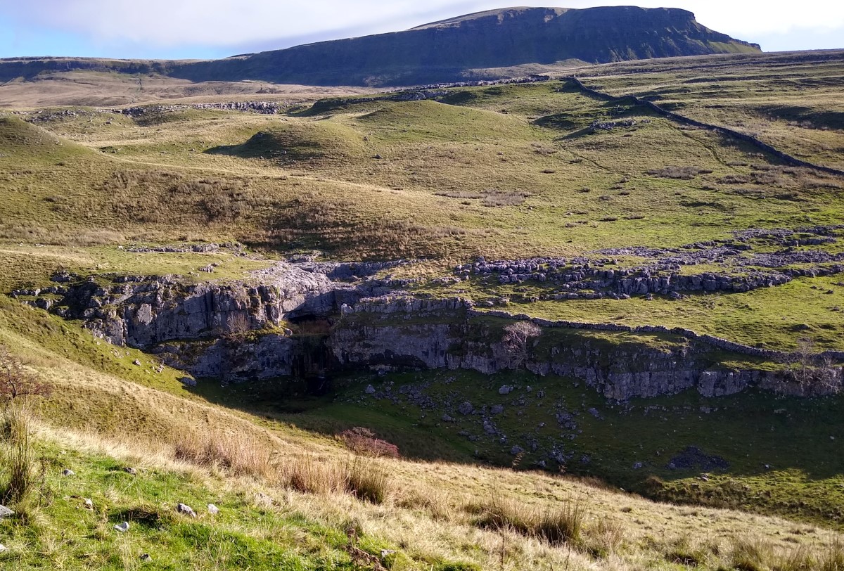
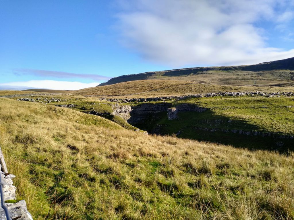
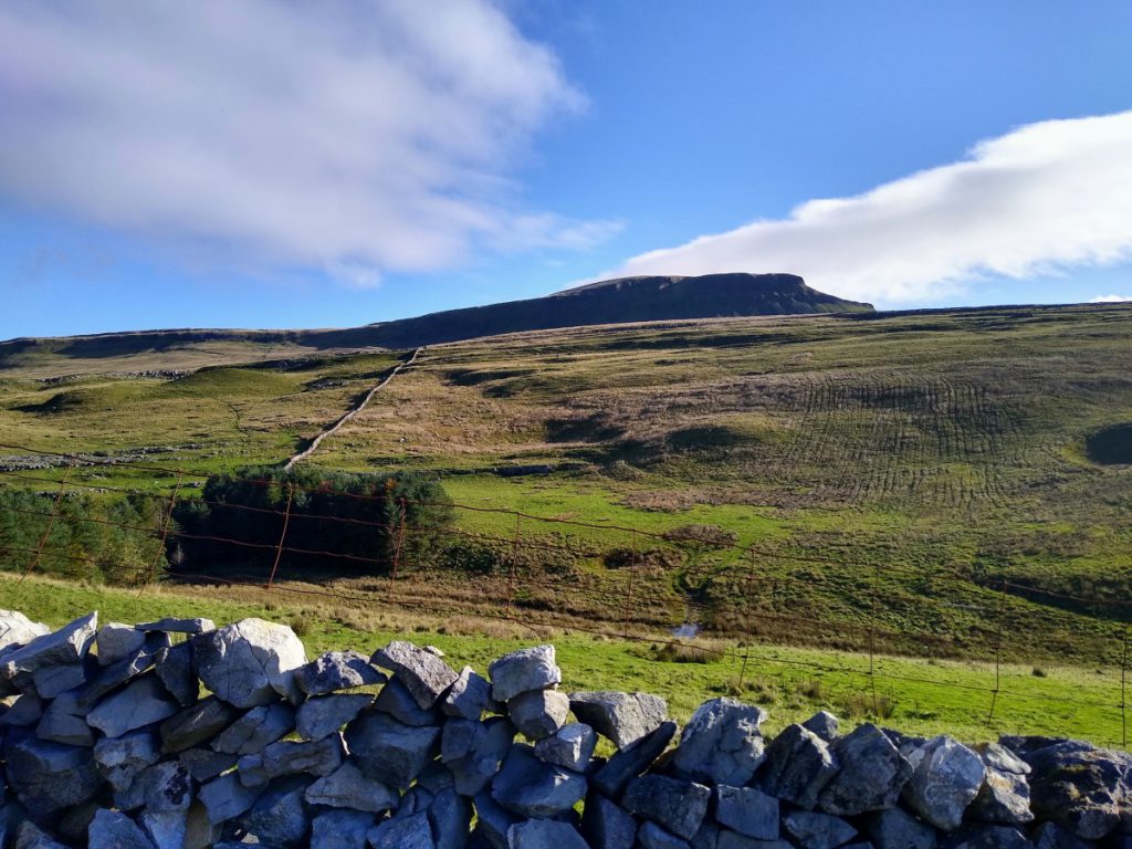
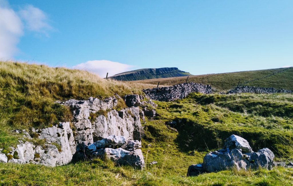
We continue with our altogether shorter route and after a little more climbing, the path levels off and we track the contour along the side of Horton Scar. At this point, the land to our right, always under the brooding presence of Pen-y-Ghent is prone to shake holes, giving a hint of what is to come at Hull Pot. Clearest of these is Tarn Bar – a hole similar to, through smaller than, Hull Pot.
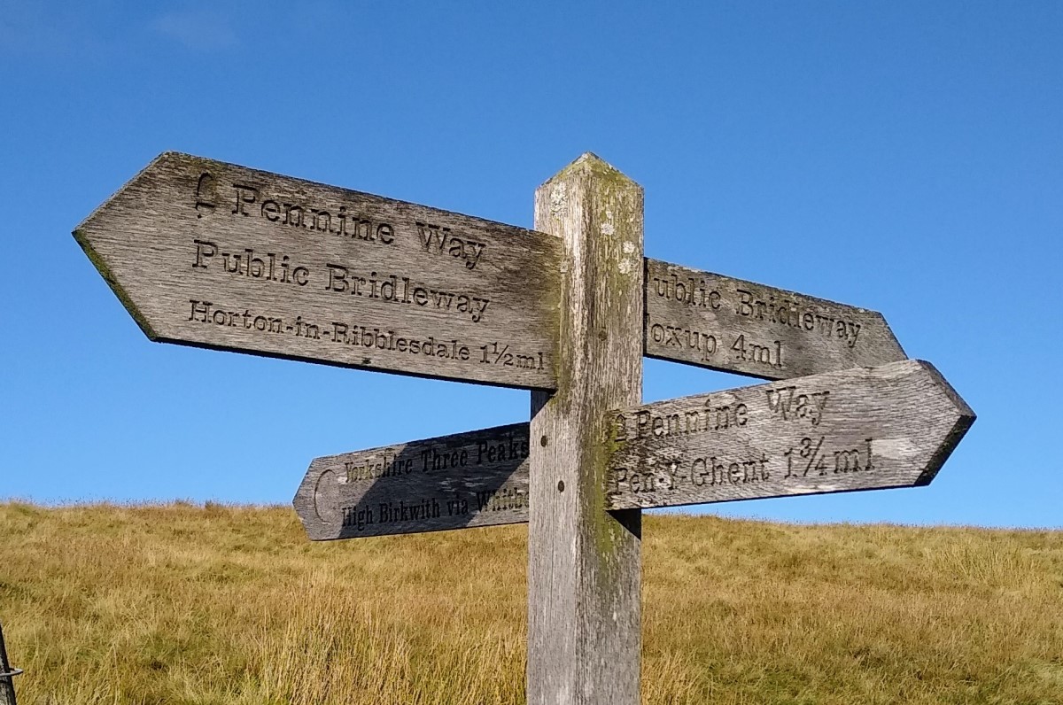
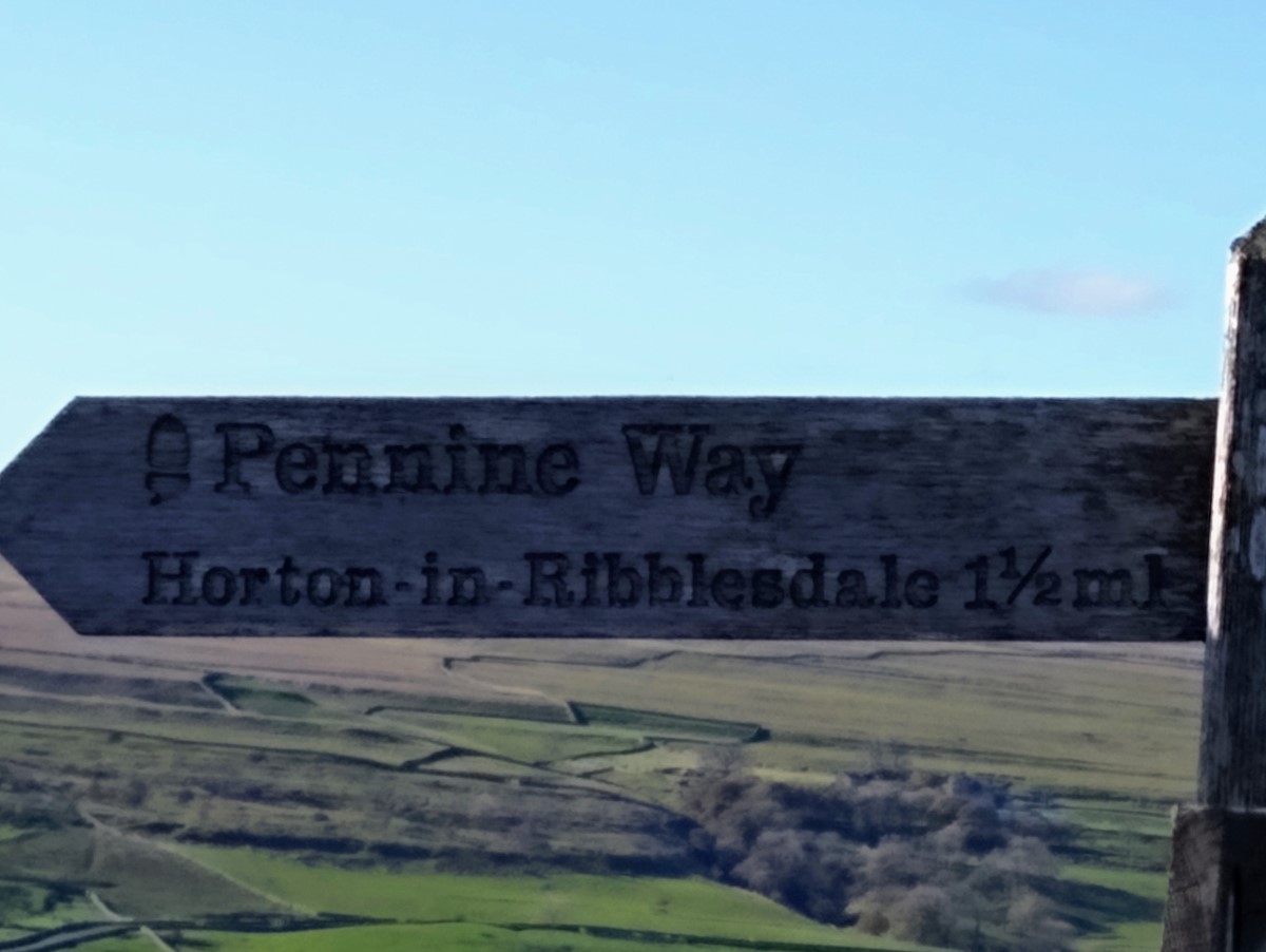
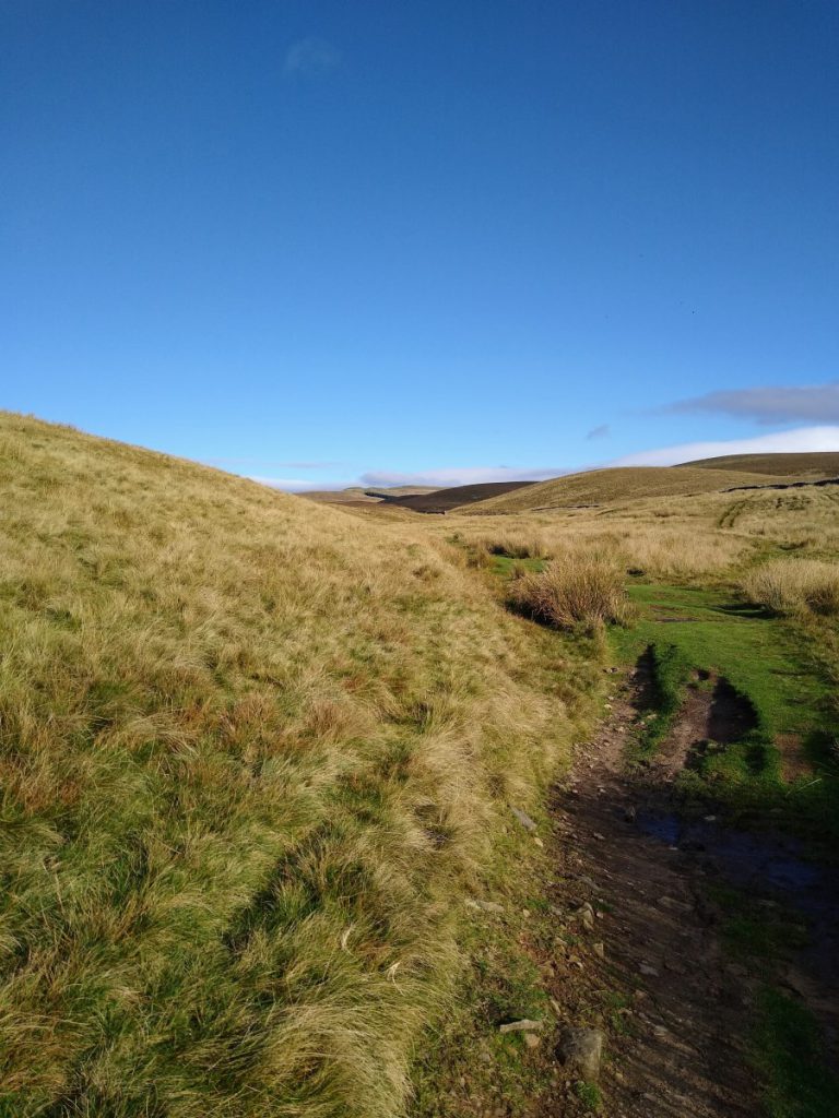
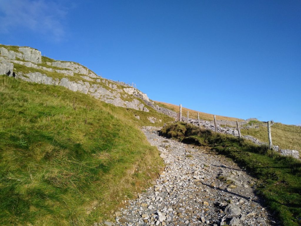
Just beyond Tarn Bar, our path crosses another at a four way finger post. We follow straight ahead (NNE) along a grassy path signposted Foxup that is much less clear than the lanes we have enjoyed so far. The route is clear enough though, and we note that the Pennine Journey Path and our path to Hull Pot diverge at this point: We take the lower, left hand, fork maintaining a steady level. If you find yourself meeting a drystone wall, you have taken the Pennine Journey path, and will need to backtrack a little.
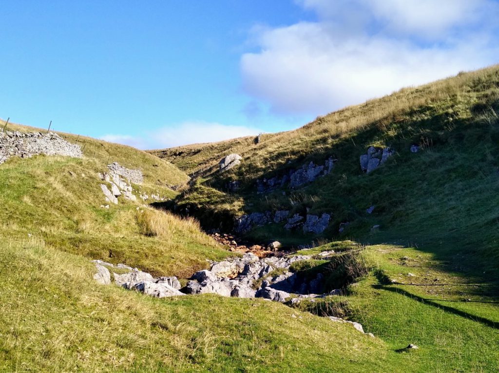
The clearest indication that we have chosen the right path is that Hull Pot appears out of nowhere after perhaps 250m.
On the far side of the Pot is a small river – Hull Pot Beck – That’s how naming works in Yorkshire. Depending on the weather, Hull Pot Beck could be anything from an arid stream bed with dry boulders through to a raging torrent and spectacular waterfall. The reason it varies so much is that the bed of the beck connects with an underground chamber that opens into the Pot, so when the flow is light to moderate, the water in the beck trickles through the bed and emerges at a hole in the side of the Pot – visible on the photo (top left above). When rain has been heavy, the capacity of the underground route is exceeded and water will flow all the way down to the end of the beck creating a waterfall. In exceptional circumstances, the flow can be high enough to fill the Pot – as seen in the earlier archive picture.
Under normal circumstances, Hull Pot drains through the base of the hole into channels that emerge at Brants Gill Head. We pass a path to this point on the return journey. For now, we enjoy the view of Hull Pot – inevitably there is a temptation to get closer to the edge for a better view – please take care, and expect the best views from the rocks safely above the Pot on the Eastern end, or on the hillside above on the West.
Also worth exploring before we turn back is the beck itself. Even if there is no visible flow into the Pot, it is worth following the route upstream where before long a steady flow will be found. Small waterfalls can be found after just 100m or so, and these make a good stopping point before we journey back.
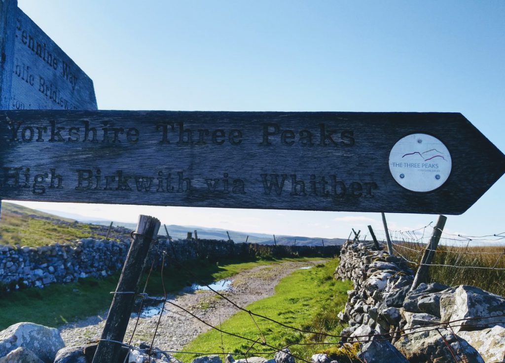
To start the return journey, we simply reverse our route until we get back to the finger post marking the point where the Pennine Journey meets the Pennine way. This time we take the Three Peaks route to the right (signed High Birkwith), taking the well-made path uphill for a while.
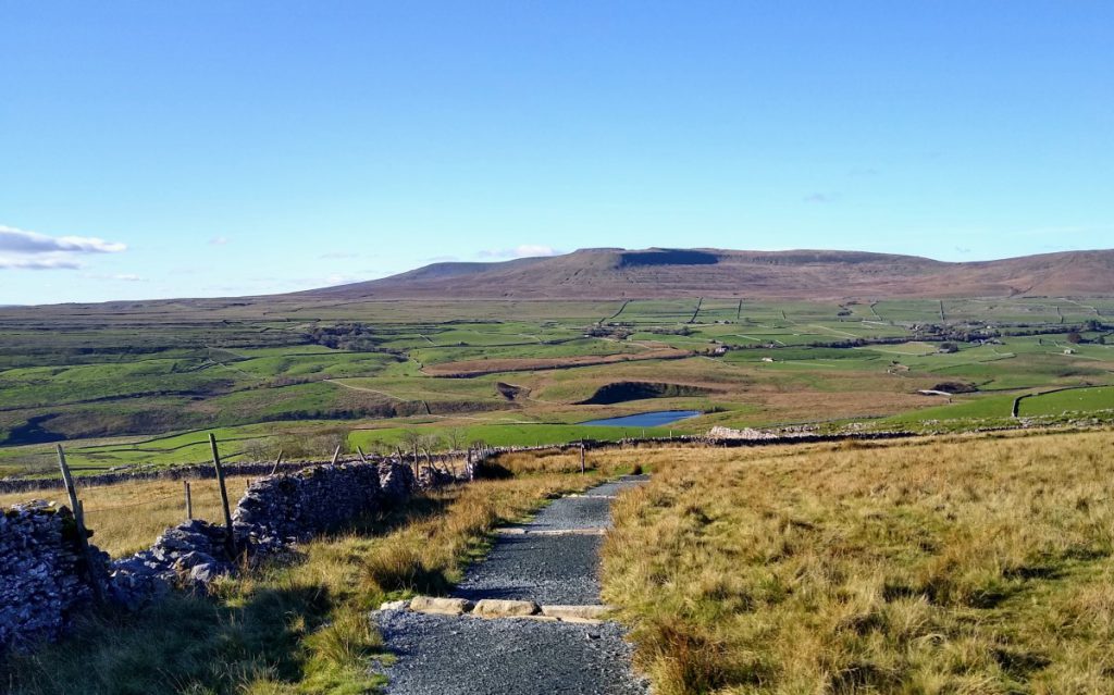
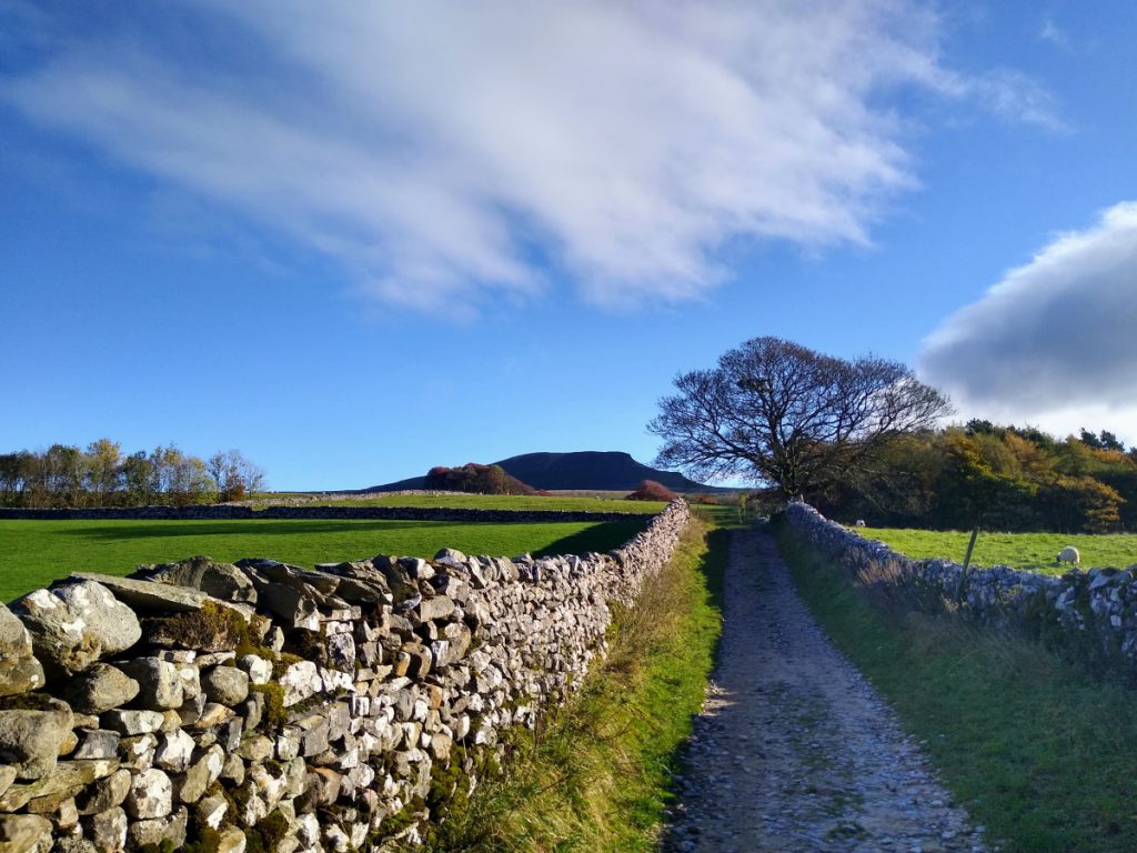
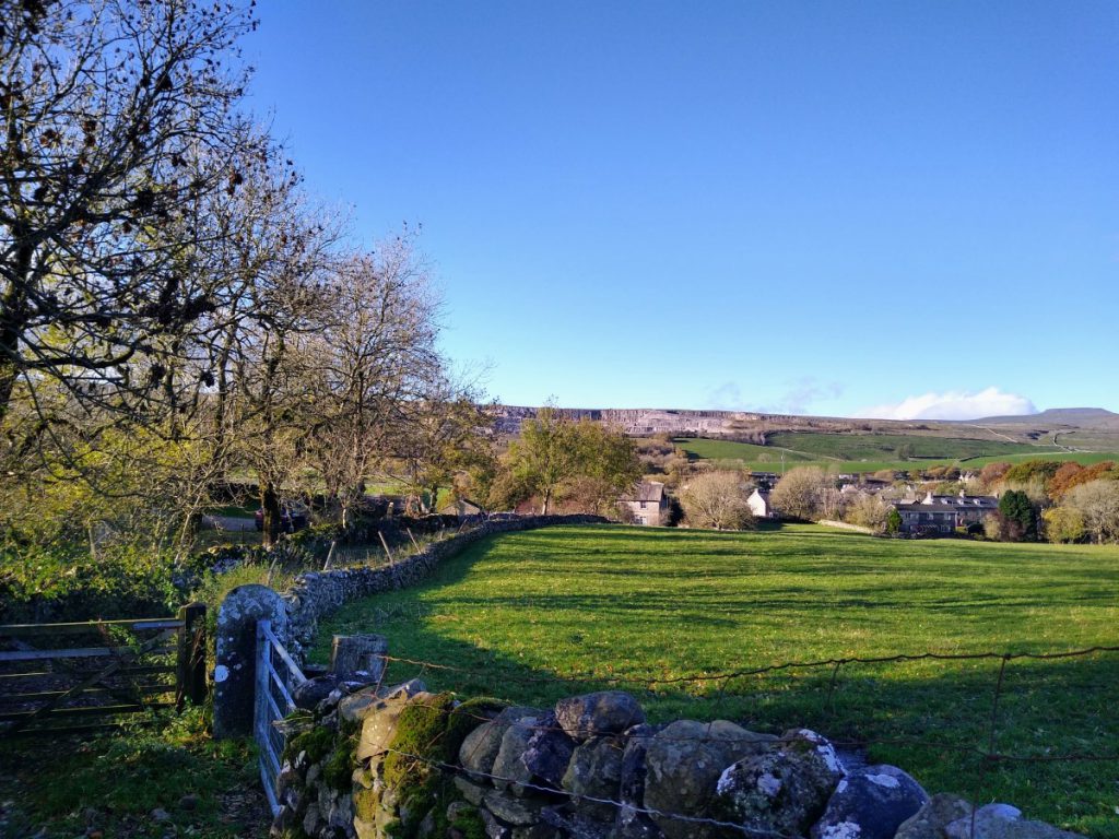
Navigation is simple for while now – we simply follow the Three Peaks route, generally with Ingleborough dominating our view. Further on, Whernside also comes into sight, along with the Ribblehead Viaduct.
Eventually we meet a junction where the Three Peaks path and the Pennine Way diverge. This is marked by a finger post, and we take left here signed Pennine Way to Horton in Ribblesdale.
From here we walk consistently downhill, and are back in traditional Dales lanes similar to the ones we started on. There should be no traffic here though, although Mountain Bikers often use this route – so be aware of their potential presence.
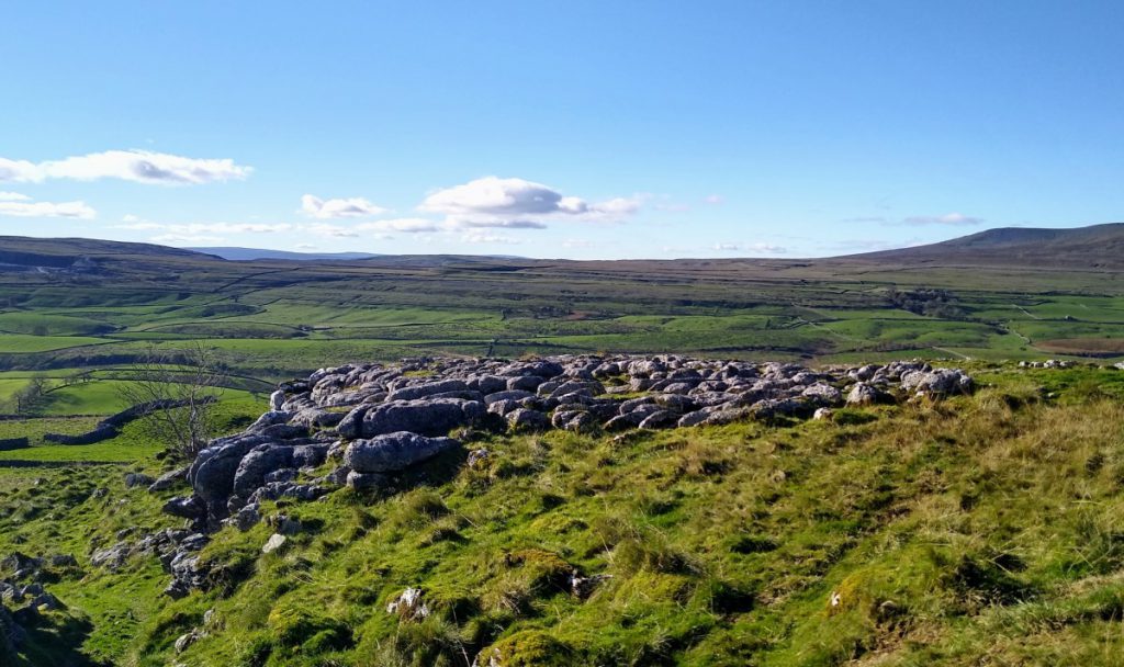
There are paths clearly visible on both sides of the Pennine Way all along this part of the route. Many of them are worth exploring on another occasions, but for now we press on. Navigation is clear, and the points worth noting on the way down are small waterfalls at Sell Gill, along with some impressive areas of limestone pavement. To the right of the path down in the base of the valley, a small tarn and an impressive footbridge over the Ribble might be visible depending on weather conditions.
As Horton Ribblesdale comes into view, we note (though do not see) the re-emergence of the water from Hull Pot as a waterfall at Brants Gill Head. Although not part of this route, this is accessible via a footpath which leaves the Pennine Way on our left as we walk down toward Horton.
The Pennine Way path soon arrives back at Horton in Ribblesdale, and we turn left along the main road to find the carpark where we started.