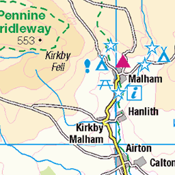
Malham is one of the great attractions of the Yorkshire Dales, and with good reason: Malham Cove is a spectacular sight – as are Goredale Scar, and Janet’s Foss. Slightly further north, and less crowded, is Malham Tarn – one of a very small number of bodies of water in the Dales, and it is from the car park at the Tarn that we set out on this walk.
We head up Great Close Hill for views of the Tarn and as far afield as Pendle Hill before picking up the Monk’s Road near Middle House Farm. We then head north toward Arncliffe passing a wonderfully atmospheric ruined farmhouse before pausing to look at some of the best limestone pavement in the Dales. From there we follow the Monks Road along the edge of the steep Yew Cogar Scar until we have a spectacular view over Arncliffe and the Littondale Valley. We take in the views over lunch then return along much of the same route but come back to the Tarn via a different path with a pleasant lakeside end to the walk.
Other Bentham Footpath Group walks in this area include
We start from the Water Sinks car park just to the south of Malham Tarn. Parking is chargeable (via an honesty box), and the car park is large, but this is a popular place, so if you are aiming for a weekend walk in the peak of the season, our advice is to arrive early. Even if the car park is busy though, you can anticipate that most people will be heading to the cove or strolling at the tarn, so your walk will probably be peaceful.
You can get to the car park via Langcliffe, or from Malham, and the OS Grid reference is SD 89546585. Finding a postcode to plug into your Satnav is problematic, as there are no houses here to offer an address so we recommend using the address of the nearby Malham Tarn House field centre – BD24 9PU. If what-3-words is available to you, try the tag thumps.during.rationing
Malham Tarn House was built around 1850 by Walter Morrison, a wealthy industrialist and Liberal MP. It had previously been the site of a hunting lodge owned by Lord Ribblesdale (who was responsible for planting the surrounding woodland), and before that a sheep farm belonging to Fountains Abbey. Notable guests entertained at the hall included Charles Darwin and Charles Kingsley – the latter drawing inspiration for his novel ‘The Water Babies’ during his visit.
As a field centre, it was operated by The Field Studies Council until 2023 when after 80 years of use, they handed the building back to the National Trust. More details on what the FSC did at Malham and why they took the difficult decision to move out can be found here. To see more of what the National Trust offers at Malham, including the board walk at the National Nature Reserve, click here.
From the car park we set out along the road we arrived on, heading east for 200m until we see a footpath coming up from the Cove and crossing the minor road. We take this path and go left (heading north) toward Great Close Hill. As we get closer to the hill, we walk between two areas of woodland: To our left, bordering the tarn is Ha Mire Plantation, whilst to our right is Lings Plantation. Our path curves round the woodland to the right and then heads to the right of a third plantation – Great Close plantation. At this point we arrive at gravel road serving Middle House Farm, and we head left as if heading toward the farm.
We follow this road for about 100m, and then notice a path on the left heading directly, and rather steeply up Great Close Hill, with a prominent cairn at 465m. If you don’t fancy the climb up the hill, stay on the track until just before Middle House Farm. The walking is easier, but you will miss some particularly fines views.
The path up to the top of the hill is not particularly well defined, and you may need to improvise, but before long the peak becomes clear, and the effort is certainly worthwhile. From the top we continue north and as we work our way downhill, we soon meet a path running from Middle House Farm to the tarn. We head right here to a wooden step stile over a wire fence: At this point we are on the Monk’s Road.
As far as we can ascertain, the curious name is derived from the ancient use of this route by Monks from Fountains Abbey some 35km away from here: The Abbey held fishing rights at the tarn and kept sheep on Malham moor.
We follow the Monk’s Road Path for a while now, initially heading to the left of Middle House Farm – where we again see the farm access track – so welcome back if you took the easier route.
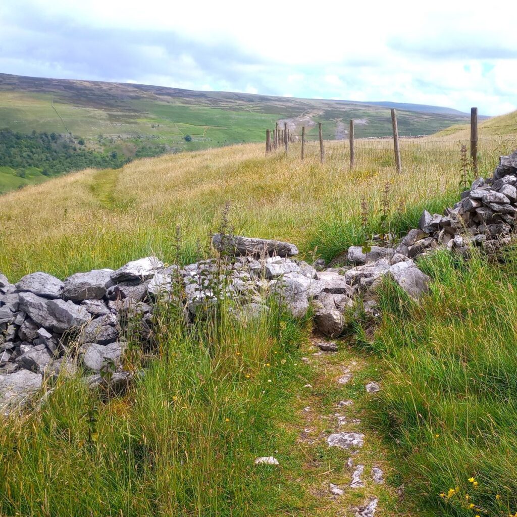
The Monks Road Path bears left and arrives at a gate into an area of rough pasture with prominent limestone pavement. After 100m or so there is a fork in the track – we need to keep right and follow the valley north toward an abandoned farm at Middle House.
The farm buildings have clearly hade no maintenance for decades and are now being reclaimed by nature. This has created a stunningly beautiful environment with the remaining roofs densely carpeted with mosses and wild flowers.
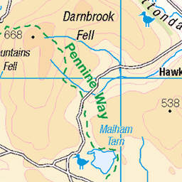
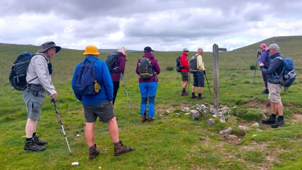
We continue past the farm and arrive at a fingerpost offering a choice of two paths. The one further to the left goes to Darnbrook – perhaps worth exploring another day, whilst our path more to the right goes on to Arncliffe.
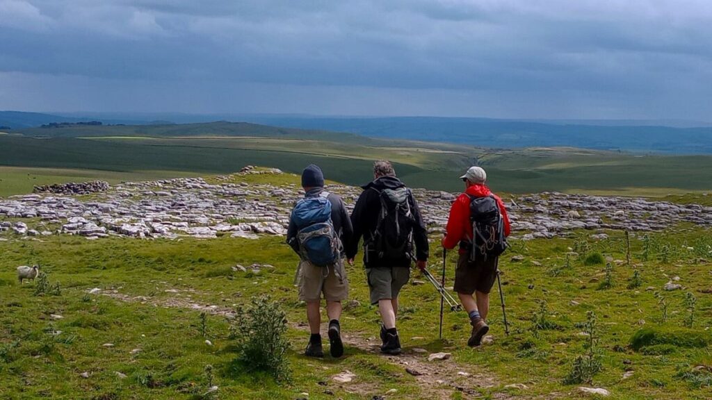
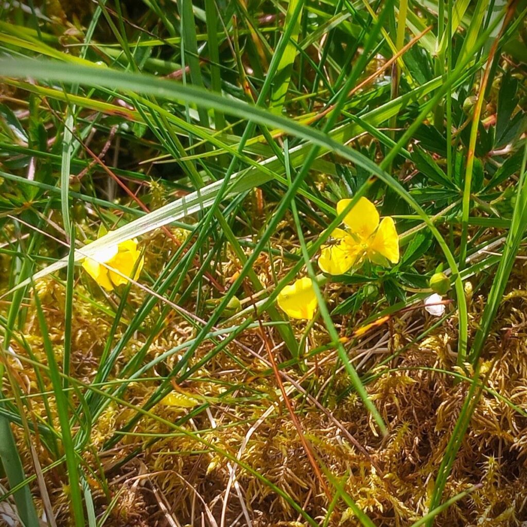
We follow the Monks Road for another 1000m or so and soon have an immense area of limestone pavement to our right. Growing in the Clints and Grikes are a wide variety of wildflowers. In fact, the walk as a whole offers a good selection of flora: We spotted Wild thyme, Tormentil, Germander speedwell, Birds-eye primrose, Common rock-rose, Scabious, Fragrant orchid, Broad-leaved marsh orchid and Cotton grass. At other times of the year or with more detailed knowledge you may find others.
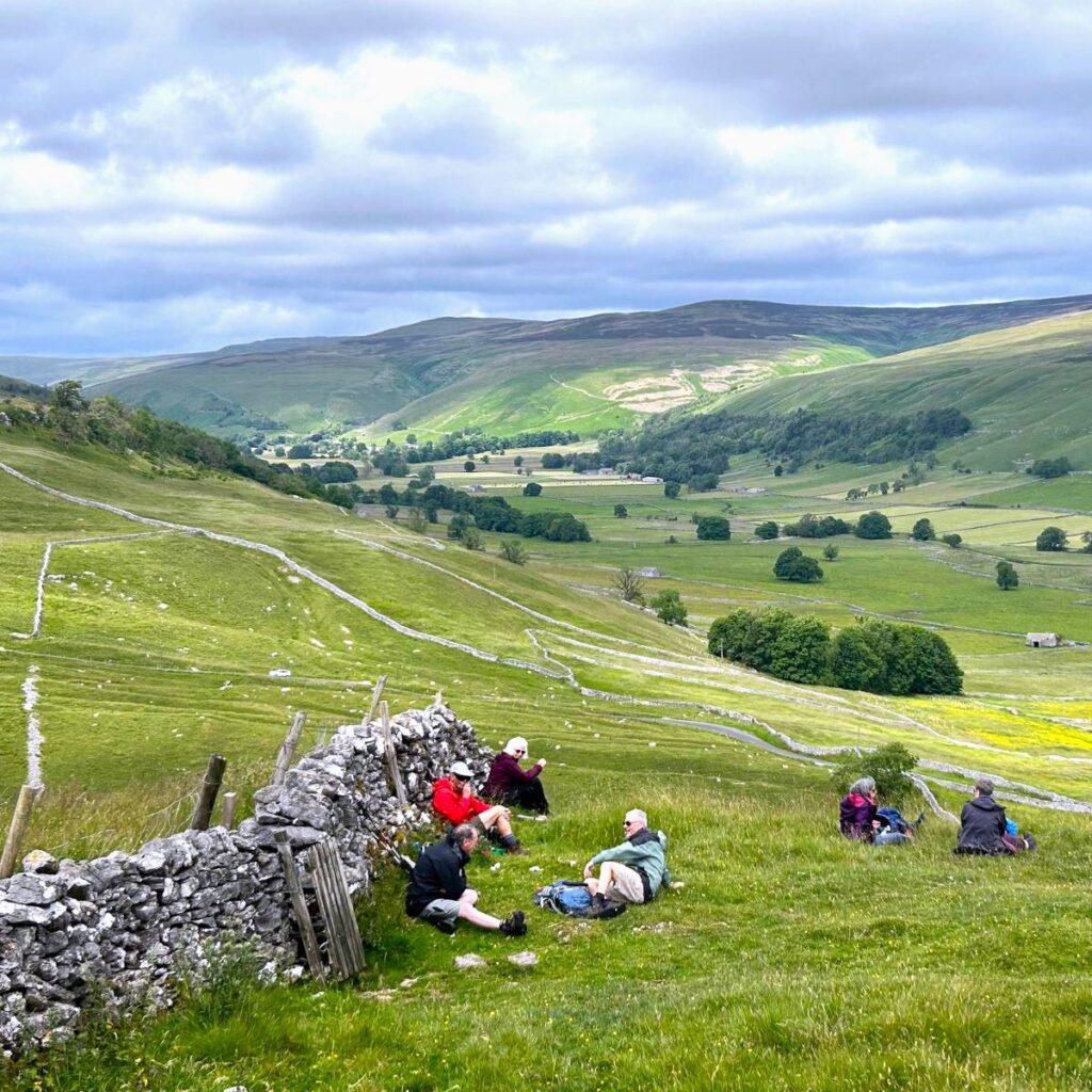
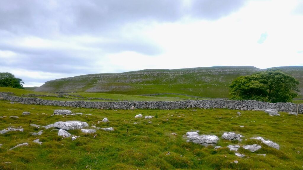
We continue with the Monk’s Road working our way closer to the edge of Yew Coger Scar as we go, and to the opposite side of the valley (the river at the bottom is Cowside Beck) we see Darnbrook Fell with Brootes Lane clinging to the side. We continue until we start to head downhill into Arncliffe – with a teasing view northwest up the Littondale Valley. If you want to know more about Yew Cogar and to see some particularly fine pictures, we recommend visiting thisexcellent site, or click hereto see a panorama video.
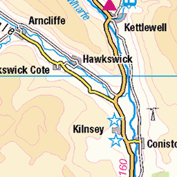
We don’t go as far as Arncliffe – simply because we needed to keep the walk length within reasonable limits. If you have time and feel fit, the Monks Road continues down into the village, arriving rather conveniently at the pub. Arncliffe by the way is a good base for walks as well as being worth exploring in its own right. To find out more about Arncliffe, click here.
Littondale was known in ancient times as Amerdale, and so when a name was needed for a fictional village in a Yorkshire farming soap opera initially filmed in Arncliffe, “Emmerdale” was born. The rest as they say is history. To find out more about Littondale, click here.
The views over Arncliffe to Littondale and Old Cote Moor are so good, that we took our lunch break here before setting off back the way we arrived.
In fact, we follow exactly the same route as far as the wooden step stile on the way down from Great Close Hill. We cross the stile and keep to the right of the field until we crest the ridge and have Malham Tarn in front of us.
We follow the path down to the track around the shore of the tarn, and when we arrive there, we head left. As we do so, take a moment to look right and you will notice dense woodland. Malham Tarn house is about 250m into that woodland, and on the shoreline round to our right we see a pair of boathouses. Click herefor a panorama video.
We follow the access road left for about 200m and as the road continues along the front of the impressive Great Close Scar, we find a fingerpost showing us a path across the fields and back to the car park (this is in fact part of the Pennine Way – so expect company).
Our walks are assigned a degree of difficulty largely based on distance – and (just) over 15km, this is a challenging walk. However, there are no particularly technical aspects, and much of the route is on the Monk’s Road where the going is relatively easy.