Jump to . . .Step by Step | OS Map | Downloads | Gallery | Fly through
In April 2023, Bentham Footpath Group enjoyed a great walk in Ravenstonedale and Smardale, where we explored a disused railway line and crossed the magnificent Smardale Gill viaduct. At the time, we made a mental note to come back and explore other parts of this line, and so when one of our group members suggested a walk at the poetry stones in Kirkby Stephen, we grasped the opportunity to combine the two. This walk visits the poetry stones on a route that includes parts of that disused railway line, and two more viaducts. We add interesting geology, a lovely riverside section, and Kirkby Stephen town centre – all crammed into a relatively short and easy walk.
- Total distance 11.1 km (6.9 miles)
- Total ascent 199 m
- Easy walk
Step-by-Step

We start in the town centre at Kirkby Stephen – there are a number of car parks to choose from, but the one we opted for is on Christian Head. This is easy to find: the main road through Kirkby Stephen is called North Road and right in the centre of the town there is a mini roundabout. Take the road to the left if you have approached from the south, right if coming from the north – this is Christian Head. The car park is just 100m away on the left. If you are using Satnav to get there then try CA17 4HA as a postcode, or if you prefer What-3-Words, the tag is ketchup.agenda.scrolled – Paper map users can use the OS grid reference is NY77310885.
Most of the walks we do are in reasonably remote locations, which usually restricts the opportunity to use public transport. Kirkby Stephen is served by railway and bus services – although the railway station is some way out of town. To find out more about timetables, click here or here
From the car park, we head back down to the town centre, passing a rather impressive house at the corner of Faraday Road. Once we arrive at North Road, we have the Parish Church ahead of us as we arrive at the mini roundabout, and here we have a choice: We will be leaving town via Lowmill bridge, and the quickest way to this to go left for 50m then bear right onto Hartley Lane. However, if you want to see a little more of the town centre and perhaps use the public toilets, then go right at the roundabout to head south on the main road for 50m before taking a left onto Stoneshot. The toilets are just 40m away on the right.

Opposite the toilets we find a track which leads up to the Parish Church. “Kirkby” in the name of towns generally indicates a Viking origin, meaning “church place”. And there is good evidence that there has been a church on this location for more than a thousand years, with the oldest written record dating to 1092. Unsurprisingly, relatively little of what you see today is that old. There have probably been three churches on this site. The first was built in Anglo-Saxon times, and part of a cross shaft bearing a relief of Loki, the Norse god, shown bound and chained, survives from this period, and is on display within the church. The Anglo-Saxon structure was replaced in 1170 by a Norman church, and some walls from this period survive in the north aisle.

That second building is believed to have fallen down, to be rebuilt again in 1230, but even that is not the structure we see today: The main thirteenth-century structures are the nave arcades, the north transept. The south aisle windows and south door were replaced in the fifteenth century, and the tower was built in the sixteenth century. The chancel, the chapels flanking it to north and south, and the south transept were rebuilt in 1847. Finally, the north wall of the north aisle and the south porch were rebuilt in 1871. The clerestory and south aisle windows were also renewed in the nineteenth century, and at the same time much of the internal stonework was reworked.
If you want to know more, click here for the church’s website with more history or here for a Wikipedia article.
It is tempting to assume that the parish church in Kirby Stephen would be dedicated to St Stephen. This is not actually the case: There is no factual basis to support a dedication to St Stephen or the rumoured previous dedication to St John.
We walk past the church, keeping it on our left as we walk round to the left and then bear right to pick up Hartley Road – where we go right and walk down to the road bridge over the river Eden. Just beyond the bridge we look to the left and see a fingerpost showing the route along the right bank of the Eden – this is part of the Pennine Journey path – so is well used. The Pennine Journey route was created to mark the contribution that Alfred Wainwright made to walking, and it follows a route he walked in 1938.

We follow the path upstream along the Eden for about 400m, initially passing the playing fields used by the football club. These are known locally as Parrots Park, and the curious name references a long standing colony of feral Macaws that have lived in Kirby since local John Strutt began to provide a refuge for unwanted parrots on his farm at nearby Eden Place. Click here to read more.

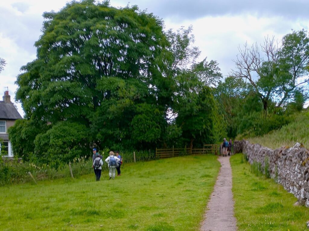
We soon arrive at a road – this is the A685, but fortunately there is a pavement, and we are on the road for just 100m, taking the first exit on the right to head up toward Winton on Kirkbank Lane. We pass a large house on our right and then note a path on the left – this is signed for Winton and takes us over a series of stiles to plot a course between the busy A-road and the quieter Kirkbank lane until we arrive at Winton.
To get there, we need to cross a stream called Mill Beck, using a small footbridge, before we arrive at Winton where we head right to walk through the village.
Winton is a delightful village. The name is Old English or Anglo-Saxon in origin, and records of “Wyntuna” meaning a pasture or farmstead were recorded in 1094, shortly after the Norman Conquest, during a period known as the ‘Harrying of the North’. In 1659, the village of Winton was at the centre of the Westmorland Witch trials, during which several women were hanged at Appleby General Sessions, having been found guilty of bewitching Margaret Bousefield – there are clear echoes of the earlier Pendle Witch trials here.
Click here or here to read more about Winton.
On the stroll up the village main street (Gap Lane) we notice the rather fine Winton Hall originally dating to 1665. The current facade was built 1726 and is Georgian looking but often described as mill-like in appearance. In the 1840’s the house saw life as a notorious Academy School until the Charles Dickens books illustrated the appalling conditions at these schools.


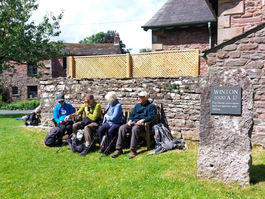
We soon arrive at the village green – a great place to pause for a break, and if you have children with you, they may want to use the excellent play facilities. Adults may be more drawn to the pub.
From here we continue east along the main street until we find the Winton United Church. Opposite this on the right is our path, signed for Mill Bridge, and we now go south crossing Mill Beck again, following a path that is clear on the ground although not exactly the same as the right of way indicated on the OS map. We soon arrive at a minor road – this is in fact Kirkbank Lane that we briefly walked earlier in the day.
We head left, away from Winton, and after just 30m on the road we meet a Y-shaped junction. The road to the right goes back to Kirkby, whilst to the left, we head to Hartley – we take the Hartley option and walk on the road for the next 1000m. The road is very quiet, and on our weekend walk we saw only one car – but still, please take extra care when walking on a road.
As we come into Hartley, we see a path on the right identified on the roundel as the John Strutt Walk. This is not part of our route today but might well be worth coming back to – for more details of this route, pick up a leaflet in the tourist information centre in Kirkby Stephen, or to read more about Strutt and his work, click here
We press on for another 250m until we see a permissive path, (also part of the John Strutt walk) on the left rising up to the rail bed of the disused railway line, where we head right. At first, it’s not particularly obvious that this was once the route of a railway – as we get further south, this changes.


We stay on the railway path for 200m or so, to arrive at what was once a railway bridge over a minor road – this has long since been demolished, so we now need to walk down to the road, cross and then climb back up to the railbed. From here onward, the route really does feel like a railway – especially when we come to Merrygill and Podgill viaducts. Both of these have paths down to lower level views – they were closed for repairs during our visit, but we know from past trips that they are well worth taking the time to explore.
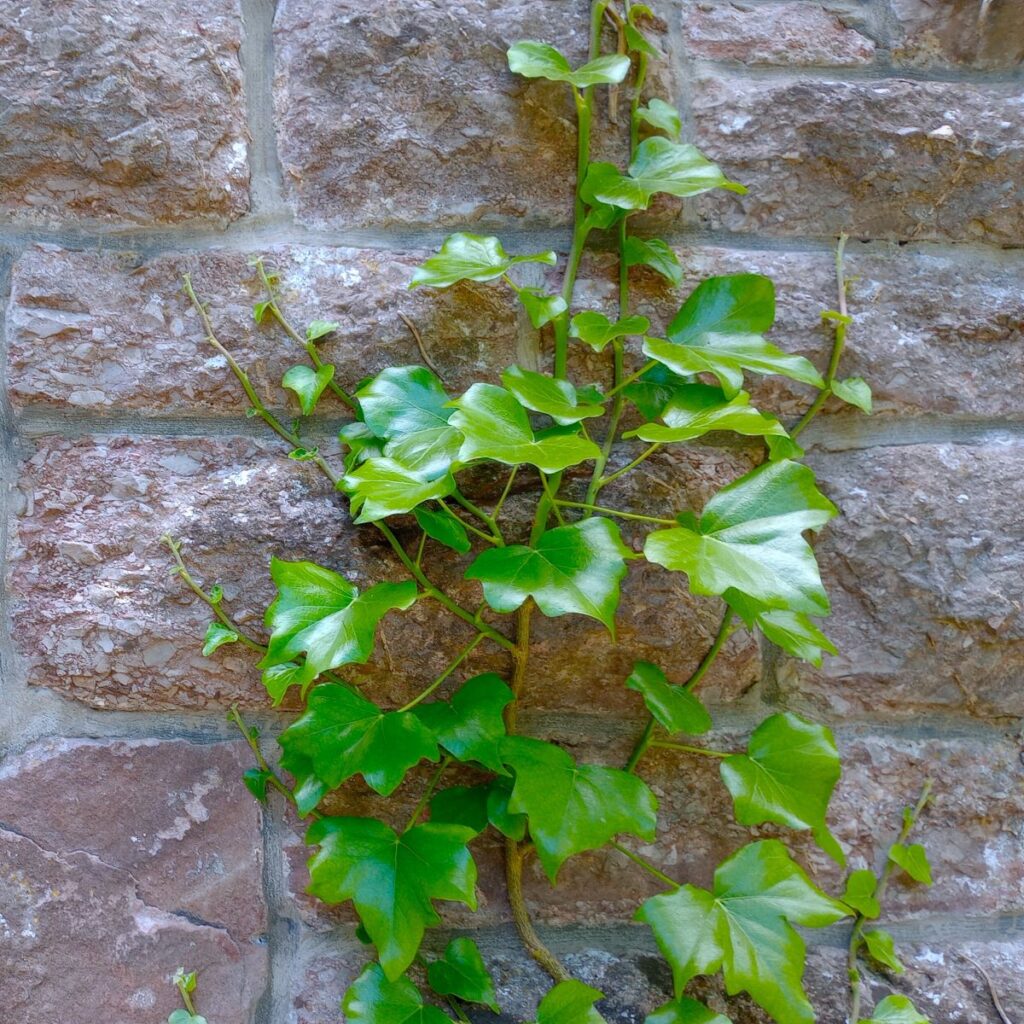
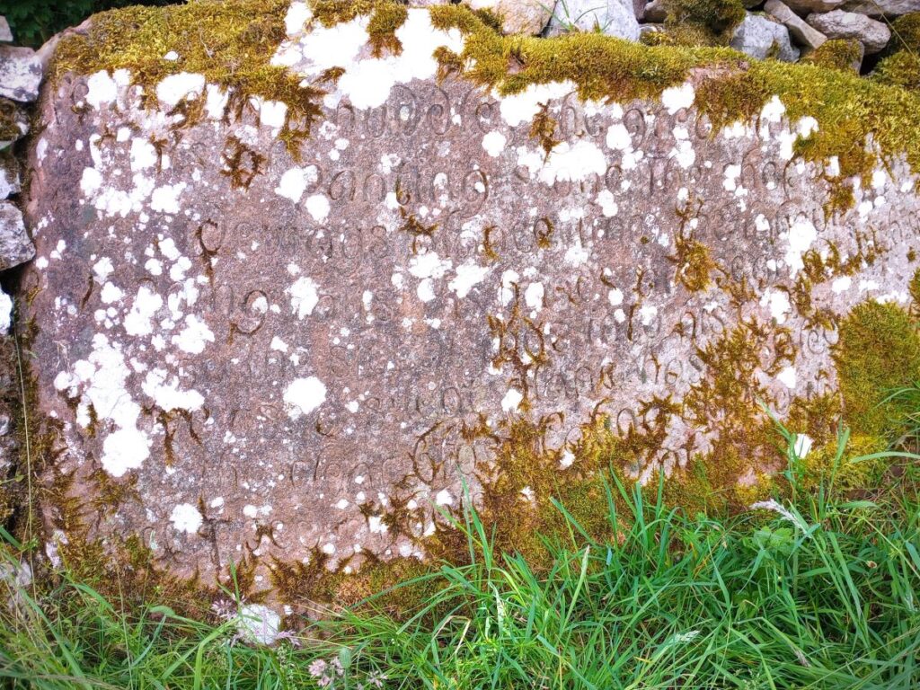
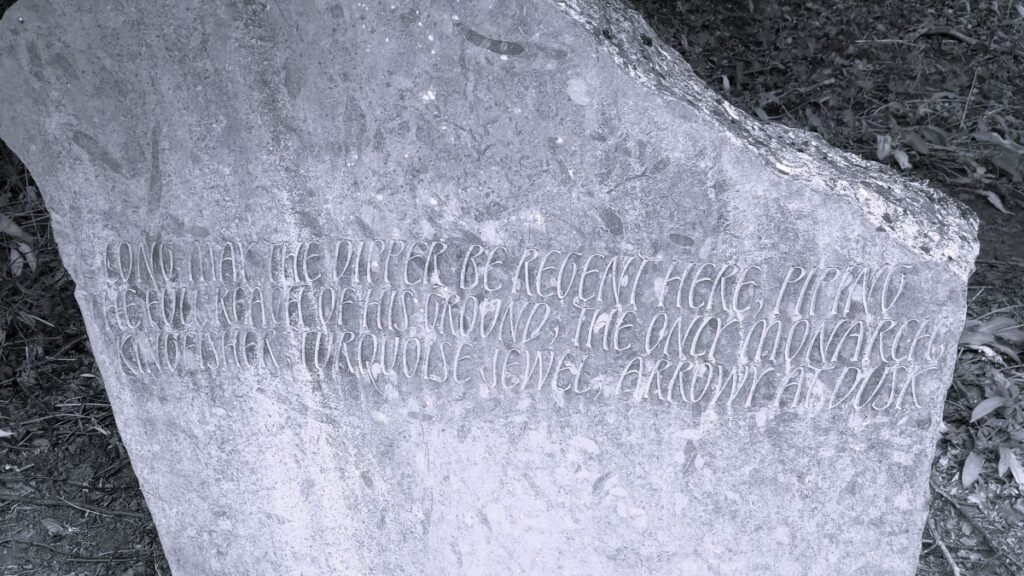
One hundred metres after the Podgill viaduct we go under a bridge, and then head sharp right to climb up to a path which heads away from the railway for 150m or so, to arrive at a junction where two paths cross. We go left here, back on the Pennine Journey path, to follow the river Eden south for a little while – note though that we soon arrive back at the disused railway line, so if you miss this turn, it’s not a problem. However, the reward for staying alert and finding this path is that it takes us to the poetry stones trail – a series of 12 stones, one for each month of the year, each with a poem inscribed.
Click here for a more detailed description of the poetry stones walk.
When we arrive back at the railway path, we head right for 100m until we arrive at a pedestrian bridge, where we cross the Eden, and then double back on ourselves now on the other side of the river heading upstream on a riverside path.


As we do so, it’s worth glancing at the riverbed below the bridge, where we see a curious effect caused by erosion of the Brockram rock under the force of the water and the abrasive action of small stones and rocks tumbling the current. This odd formation is known locally as the Devil’s griding mill.
The next 500m of the walk are along the bank of the river Eden – with the river to our right, and we find further poetry stones along this section – for a full description of all the stones, download the leaflet from our website.
We continue to a footbridge over the river – noting that there is a further poetry stone just to the left of the bridge, than after crossing, we bear right passing a rather attractive barn to arrive back at the crossing of paths that we met after leaving the railway path earlier. We head sharp left and follow a clear path upstream tracking the route of the Eden. Note though that we are not on the riverbank as such, until we get to the point where the Ladythwaite Beck (which we saw flow under the Podgill Viaduct) enters the Eden. Here we cross the beck at a footbridge and continue to follow the Eden upstream.
400m later we arrive at Franks Bridge where we cross the Eden for the last time and head back into the centre of Kirkby Stephen, where our walk ends.

This walk is just under 12km so we define it as “easy”. The use of disused railway lines and river banks also measn that there is little change in elevation: This is therefore an ideal easy walk for those wishing to get back into more active walking after a break.