Being able to take a walk on a balmy summer evening is one of life’s treats, and its one that the Bentham Footpath Group try to enjoy a few times each year.
The weather is beyond our control of course, as our August 2023 evening walk from the same starting location showed. This time we were lucky and got good light with excellent views.
The later starting time means that a shorter walk is appropriate, so this walk falls well into our easy category. Easy does not mean dull though -there’s plenty to see with hay meadows in full flower and some great views across the valley to Ingleborough.
We start from St Matthew’s Church in Keasden – where there is ample roadside parking. For those not familiar with St Matthew’s, and needing help with location, the grid reference is SD 7233 6660, and the what-3-words tag is pest.flitting.bangle. If you are using satnav to get there then the address is Reebys Lane Keasden, LA2 8EU.
Having parked on the roadside outside the church you may want to spend a few moments exploring the church and the grounds – it is generally open, and a donation would be welcome.
The church building is more recent than many in the area – it was opened and formally consecrated by the Lord Bishop of Ripon in 1873. Prior to this, church services in Keasden were held in a bobbin mill but, in order that people might have the advantage of a more suitable place of worship, James Farrer of Clapham provided a piece of land and ordered the construction of a ‘neat looking and substantial small church’.
The building is indeed neat and quite elegant: It can accommodate about 150 worshippers and was built in a fairly simple architectural style. The windows are single lancets with three windows grouped together to form an east window, and all are glazed with tinted rolled glass. Also noteworthy is the organ which was installed relatively recently having been rescued from Austwick Methodist Chapel after that was sold for conversion to a private dwelling – it dates from 1906.
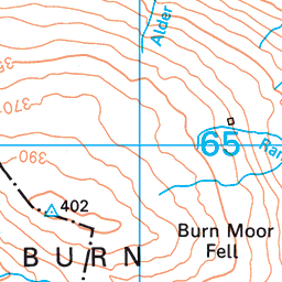
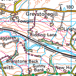
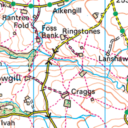
With our back facing the front door of the church we turn left and walk back along Reebys lane as if heading for Clapham station, then after just 60m of road walking take we the track on the right and follow the public footpath down to Keasden Beck and Turnerford Bridge. You may notice that there is a public footpath along the side of the Beck – but that’s not our route for today – try our Keasden Wanderroute to find out more about where that path leads.
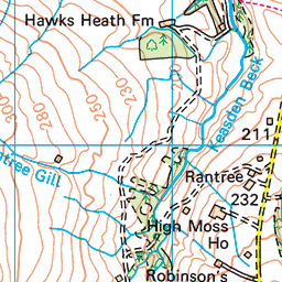
We go over Turnerford Bridge and then immediately right still on a rough track, following along the riverside for about 25m, before we find a lane on the left just past the outbuilding that takes us slightly uphill, and away from the river. We are heading southwest at this point through open fields, with Higher Turnerford Wood over to our right, and Hawksheath Wood to our left.
We pass a farm building then at the end of the track head right following the contour lines above the top edge of Higher Turnerford Wood. We walk through four fields and after no more than 400 arrive at a footbridge over a small stream – Heigh Head Gill. This is somewhat hidden in a dip so don’t expect to see it until you are just a few metres away.
Once over the bridge we cross a wall at a stile and almost immediately after, a fence at a wooden step stile, then continue west before curving slightly right around the small clump of trees rather optimistically identified on the OS map as Stony Wood. Once we are clear of the trees we see a cluster of farm buildings ahead of us, and we head straight toward them.
After crossing a broad flat field, we arrive at a farm access track, and notice that as well as the farm ahead, there is one to our left and slightly uphill – that’s Heigh Head, and not part of our route today, so we make sure we keep heading. right as we arrive at the track to walk toward The Heigh.
After about 100m on this track, we arrive at a T Junction – The Heigh is now just to our left, whilst to the right we have the farm access road which connects to the minor road that passes St Matthews. We head right here as if heading back to the road, and almost immediately we find a footpath on the left taking us away from the track and through fields again.
Our direction of travel is still broadly northwest as we head across the field and then down to a line of trees that grow along the banks of a small stream. We cross that stream at a small wooden footbridge and continue through two more fields. We now have another group of farm buildings in our sight – and we need to aim to arrive at the right hand end of these.
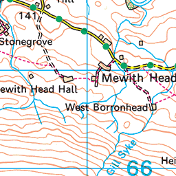
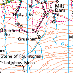
From here we see the farm access lane, and once we arrive at it, we find the path continuing opposite and heading west. Just 50m or so after we leave the farm access track, the footpath forks. We take the left hand option. The option to the right would take us over Cinder Hill and down to Mewith Lane which is part of our route soon, so if you take the wrong option here don’t worry.
However, if you want to be sure that you follow the recommended path, the advice is to head toward the farm buildings at West Borronhead. Here you will see the farmhouse to the left, and two large barns to the right. Our path goes between the two barns and then climbs up to the farm access road, where we take a sharp right turn.
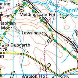
We stay on the access lane for abut 400m, heading north, until we arrive at Mewith Head. The road we are on now is called Mewith Lane and is a continuation of Reebys Lane that we started on. We turn right and walk along Mewith lane for about 600m. This is a quiet road, but there are no pavements, so take care.
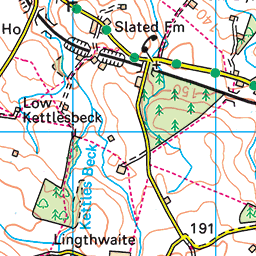
As an aside . . . you have an interest in historic buildings, it might be worth adding a short diversion to have a look at Mewith Head Hall. This impressive Grade II* listed building dating from 1708 is a private dwelling and is not open to the public but does have a public footpath adjacent to it. To find it head left on Mewith Lane and take the path on the left after 100m. The hall is 500m up that path.
Assuming we have gone right at Mewith Lane, then after just 200m you might notice a path on the right – that’s the footpath over Cinder Hill, so if you chose that option earlier (intentionally or otherwise), welcome back.
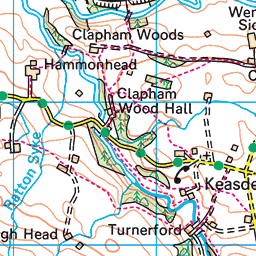
Our next landmark is a bridge over Bloe Beck – at this point Mewith Lane changes name to become Bloe Beck Lane, and 200m later we see a track on the left signed for Hammon Head Hall and Owl Barn. We take this track and head north for 100m to the farm buildings.
As we arrive, we notice two large houses on the right, and pass them before turning right and almost immediately left, into the farmyard. We pass the barns and then head right to walk behind the farm and onto an access lane.
We take the lane east for just 30m, then as it turns right, we head of diagonally left to head Northeast toward the tree line ahead. These trees are growing along the banks of Keasden Beck. When we arrive at the beck, we cross via a small concrete footbridge – somewhat hidden behind a drystone wall with a step stile. Take care on this bridge – it is somewhat mossy and so has the potential to be slippery when wet.
We now head east for 200m climbing gently as we head up the Wenning Valley – the river itself is over to our left and about 300m away.
There are a good number of paths in this area, so it would be relatively easy to be drawn onto one other than the route we are following. The best way to stay on track is to use our GPX file, but if that’s not possible, then be aware that as we approach the next farm building (Clapham Woods farmhouse) there is a path on our right.
We ignore that and carry on to a steel gate which gives us access to the farm track where we go right continuing east for a further 100m.
Another path crosses ours, and again we ignore that and press on for a further 200m until we see a distinctive stone step stile on our right. It looks quite difficult to scale, having lost the step-through at the top. But fortunately, there is a gate just to the left of it, which is rather more user-friendly: pick whichever you prefer and then take the path that turns back sharply to the right and heads up to a small patch of woodland.
There is a stone stile into the woodland, and when the path emerges on the far side, we head southwest through a very pretty wildflower meadow – please walk in single file here to minimise damage to the meadow.
At the opposite side of this field, our path intersects with another and forms a crossroads – we go left heading for Reeby’s Farm, where we walk through the farmyard and back onto Reebys Lane with St Matthews just to our left.
If you miss that last turn, don’t worry too much you will still arrive back at Reebys Lane and will still need to turn left to get back to the church – you will just be 400m further down the road.